landschaftsfotos.eu Linie landschaftsfotos.eu
Hello guest, you are not logged in. Log in | Create account 
Forum   Contact   Legal notice
German English 

Photos by Christopher Pätz
245 Photos
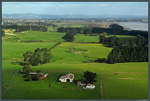
Farm near Auckland. (29.10.2016)
Christopher Pätz

Neuseeland / Nordinsel / Alles

448 1200x810 Px, 13.12.2016

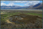
Swampland at the Rangitata River, near Mount Sunday. In the background, the New Zealand Alps. (28.10.2016)
Christopher Pätz

Neuseeland / S�sel / Canterbury

375 1200x809 Px, 12.12.2016

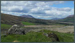
View from Mount Sunday of a tributary of the Rangitata River. (28.10.2016)
Christopher Pätz

Neuseeland / S�sel / Canterbury

346 1200x688 Px, 12.12.2016

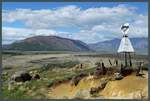
From the summit of Mount Sunday, there is a good view of the surrounding New Zealand Alps. The small hill served as a filming location for the movie  The Lord of the Rings.  (28.10.2016)
From the summit of Mount Sunday, there is a good view of the surrounding New Zealand Alps. The small hill served as a filming location for the movie "The Lord of the Rings." (28.10.2016)
Christopher Pätz

Neuseeland / S�sel / Canterbury

367 1200x809 Px, 12.12.2016

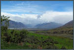
View of the valley around Mount Sunday and the surrounding New Zealand Alps. In the background, a rain shower is passing through. (28.10.2016)
Christopher Pätz

Neuseeland / S�sel / Canterbury

322 1200x809 Px, 12.12.2016

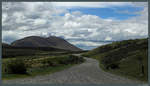
Gravel road in Hakatere Conservation Park. (28.10.2016)
Christopher Pätz

Neuseeland / S�sel / Canterbury

338 1200x688 Px, 12.12.2016

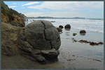
Several of the peculiar spheres of the Moeraki Boulders. In the foreground, a sphere broken down by the surf reveals the calcite located in the cracks. (Moeraki, 27.10.2016)
Christopher Pätz

Neuseeland / S�sel / Otago

325 1200x810 Px, 12.12.2016

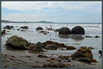
The Moeraki Boulders are a group of spherical stones on the coast near the town of Moeraki. (27.10.2016)
Christopher Pätz

Neuseeland / S�sel / Otago

311 1200x810 Px, 12.12.2016

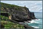
Taiaroa Head, the cape at the end of the approximately 30 km long Otago Peninsula, also marks the mouth of Otago Harbour. At the tip stands the lighthouse built in 1864. (27.10.2016)
Christopher Pätz

Neuseeland / S�sel / Otago

347 1200x809 Px, 12.12.2016

View from Taiaroa Head over the natural harbor Otago Harbour to the city of Dunedin. (27.10.2016)
Christopher Pätz

Neuseeland / S�sel / Otago

360 1200x497 Px, 11.12.2016

Monkey Island, a tiny island on the southwest coast of New Zealand's South Island, is also accessible on foot at low tide. The small islet was already used by the Maori as a lookout. (26.10.2016)
Christopher Pätz

Neuseeland / S�sel / Southland

385 1200x809 Px, 10.12.2016

Lake Hawea is the northernmost of the 5 large glacier lakes in New Zealand. (23.10.2016)
Christopher Pätz

Neuseeland / S�sel / Otago

428 1200x614 Px, 10.12.2016

The Fox Glacier extends over a length of 13 kilometers within the Westland National Park. Due to global warming, it has significantly retreated over the past 100 years. (23.10.2016)
Christopher Pätz

Neuseeland / S�sel / West Coast

388 1200x810 Px, 10.12.2016

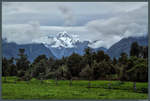
Mount Tasman, at 3,498 m, is the second highest mountain in New Zealand. On 23.10.2016, the clouds at Fox Glacier briefly reveal the view of the mountain, while Mount Cook – the highest mountain in New Zealand, located immediately to the right – hides behind a veil of clouds.
Christopher Pätz

Neuseeland / S�sel / West Coast

373 1200x810 Px, 10.12.2016

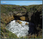
One of the pools in the Pancake Rocks. Through tubes carved into the rock by the surf, the waves splash into the pool. (22.10.2016)
Christopher Pätz

Neuseeland / S�sel / West Coast

379 1000x919 Px, 10.12.2016

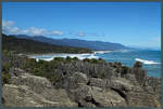
The Pancake Rocks are located directly on the west coast of New Zealand's South Island near the small town of Punakaiki. (22.10.2016)
Christopher Pätz

Neuseeland / S�sel / West Coast

435 1200x809 Px, 10.12.2016

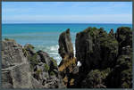
The Pancake Rocks at Punakaiki got their name due to the layered rock formations. Numerous tubes and holes, also known as blowholes, have formed in the rock due to the surf. (22.10.2016)
Christopher Pätz

Neuseeland / S�sel / West Coast

397 1200x809 Px, 10.12.2016

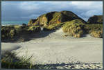
Dunes at Wharariki Beach. (20.10.2016)
Christopher Pätz

Neuseeland / S�sel / Tasman

402 1200x809 Px, 08.12.2016

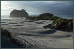
Wharariki Beach is one of the most beautiful beaches in New Zealand. (20.10.2016)
Christopher Pätz

Neuseeland / S�sel / Tasman

528  2 1200x809 Px, 08.12.2016

Wharariki Beach is located near Cape Farewell at the northernmost tip of New Zealand's South Island. (20.10.2016)
Christopher Pätz

Neuseeland / S�sel / Tasman

410 1200x810 Px, 08.12.2016

The Tory Channel, a strait in the Marlborough Sounds of New Zealand's South Island. (19.10.2016)
Christopher Pätz

Neuseeland / S�sel / Marlborough

438 1200x687 Px, 07.12.2016

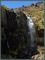
A small waterfall in Tongariro National Park. (18.10.2016)
Christopher Pätz

Neuseeland / Nordinsel / Alles

396 682x900 Px, 28.11.2016

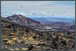
View from the edge of Mount Ngauruhoe towards Pukekaikiore. (18.10.2016)
Christopher Pätz

Neuseeland / Nordinsel / Alles

422 1200x810 Px, 28.11.2016

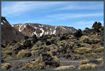
Dark volcanic rock at the edge of Mount Ngauruhoe. In the background, the Red Crater, another volcano of the Tongariro massif. (18.10.2016)
Christopher Pätz

Neuseeland / Nordinsel / Alles

403 1200x809 Px, 28.11.2016