

landschaftsfotos.eu Linie landschaftsfotos.eu
Hello guest, you are not logged in. Log in | Create account 
Forum   Contact   Legal notice
German English 

Photos by Christopher Pätz
246 Photos
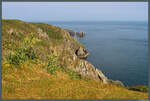
The south coast of Alderney drops steeply into the sea. (01.05.2026)
Christopher Pätz

United Kingdom / Channel Islands / Alderney

41 1500x1012 Px, 04.10.2026

Wintery Magdeburg Börde: The last rays of sunshine make the snow cover sparkle near Wellen on 11.01.2026.
Christopher Pätz

Frosty temperatures on 10.01.2026 cause ice drift on the Elbe River in Magdeburg. In the background, the Buckau district and the city park on the right can be seen.
Christopher Pätz

Cliff coast near Stonehaven in eastern Scotland. (16.05.2025)
Christopher Pätz

United Kingdom / Scotland / Central Lowlands

113 1400x945 Px, 04.09.2025

The Dane's Stone, also known as the Pitlochry Standing Stone, stands in a sheep pasture near Pitlochry. (13.05.2025)
Christopher Pätz

United Kingdom / Scotland / Highlands

122 1400x944 Px, 21.08.2025

From about 400 meters altitude, the path from Pitlochry to the mountain Ben Vrackie leads through the largely treeless Scottish Highlands. (13.05.2025)
Christopher Pätz

United Kingdom / Scotland / Highlands

120 1400x943 Px, 21.08.2025

Blair Castle also includes the Hercules Garden, a walled landscape garden with fruit trees and a pond. (Blair Atholl, 12.05.2025)
Christopher Pätz

United Kingdom / Scotland / Highlands

122 1400x945 Px, 20.08.2025

For a short moment, the wisps of clouds at the summit of Heaval, the highest mountain of Barra, on 10.05.2025 allow a view of the sea.
Christopher Pätz

United Kingdom / Scotland / Outer Hebrides

120 1400x888 Px, 12.08.2025

Beach on the west coast of Barra. (09.05.2025)
Christopher Pätz

United Kingdom / Scotland / Outer Hebrides

119 1400x887 Px, 09.08.2025

A lightly trafficked road connects Barra with the neighboring island of Vatersay (in the background). The small settlement of Caolas is located on the causeway  Vatersay Causeway.  (09.05.2025)
A lightly trafficked road connects Barra with the neighboring island of Vatersay (in the background). The small settlement of Caolas is located on the causeway "Vatersay Causeway." (09.05.2025)
Christopher Pätz

United Kingdom / Scotland / Outer Hebrides

123 1400x945 Px, 09.08.2025

In the west, the island of Barra meets the Atlantic Ocean. The stones in the foreground are the remains of the Iron Age watchtower Dun Ban. (Barra, 09.05.2025)
Christopher Pätz

United Kingdom / Scotland / Outer Hebrides

121 1600x721 Px, 08.08.2025

Cliff coast with sheep in the southwest of Barra. (09.05.2025)
Christopher Pätz

United Kingdom / Scotland / Outer Hebrides

114 1400x944 Px, 08.08.2025

A spotted orchid on the island of Barra. (09.05.2025)
Christopher Pätz

Insh Island is one of the uninhabited islands in the Firth of Lorn. (08.05.2025)
Christopher Pätz

United Kingdom / Scotland / Inner Hebrides

101 1400x944 Px, 06.08.2025

A Suillus mushroom rises from the grass in a park near Gulbene (Latvia). (01.09.2024)
Christopher Pätz

Galleries / Plants and fungi / Mushrooms

150 1400x887 Px, 16.12.2024

West of the dunes of the Curonian Spit, the Baltic Sea beach stretches along to the Memel estuary. (near Preila, 27.08.2024)
Christopher Pätz

Lithuania / District Klaipėda / Nida

144 1400x888 Px, 08.12.2024

The Curonian Spit is known for its dunes. The 57 m high Preila Dune near the village of the same name offers a beautiful view over the landscape. (Preila, 27.08.2024)
Christopher Pätz

Lithuania / District Klaipėda / Nida

135 1400x887 Px, 08.12.2024

The Curonian Spit stretches almost 100 km along the coast. On 25.08.2024, the beach near Klaipėda is only moderately visited.
Christopher Pätz

Lithuania / District Klaipėda / Klaipėda

158 1400x887 Px, 27.11.2024

View from the ferry of the Curonian Spit near Klaipeda (Memel). It stretches over a total of 98 km to Selenogradsk (Cranz). (24.08.2024)
Christopher Pätz

Lithuania / District Klaipėda / Klaipėda

147 1400x887 Px, 16.11.2024

A sand crocus is blooming near Bronte in Sicily. (27.02.2024)
Christopher Pätz

East of Bronte, the lava fields of Mount Etna stretch out, with the snow-covered volcano emerging from the haze in the background. (27.02.2024)
Christopher Pätz

Italy / Islands / Sicily

194 1400x887 Px, 11.06.2024

The summit of Mount Etna is often shrouded in clouds. On 26.02.2024, the summit craters of the 3357 m high volcano were clearly visible. On the left is the southeast crater formed in 1979, on the right the northeast crater from 1911, with the main crater between them. They are still covered with snow; the smoke plumes and discoloration of the snow around the summits indicate volcanic activity.
Christopher Pätz

Italy / Islands / Sicily

204 1400x887 Px, 10.06.2024

View from Lipari across to the island of Salina. (Quattropani, 22.02.2024)
Christopher Pätz

Italy / Islands / Lipari Islands

218 1400x944 Px, 02.06.2024

Olive tree near Quattropani. In the background, the islands of Panarea and Stromboli can be seen. (22.02.2024)
Christopher Pätz

Italy / Islands / Lipari Islands

207 1400x887 Px, 02.06.2024