landschaftsfotos.eu Linie landschaftsfotos.eu
Hello guest, you are not logged in. Log in | Create account 
Forum   Contact   Legal notice
German English 

Photos by Christopher Pätz

245 Photos
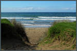
Sandy Bay near the small village of Matapouri. (11.10.2016)
Christopher Pätz

Neuseeland / Nordinsel / Alles

493 1200x809 Px, 18.11.2016

Sandy Bay is a bay popular with surfers on the east coast of the North Island. However, on 11.10.2016, only a single surfer ventured into the cool waters.
Christopher Pätz

Neuseeland / Nordinsel / Alles

470 1200x810 Px, 18.11.2016

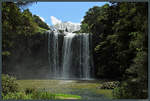
The 26-meter-high Whangarei Falls are located right on the outskirts of Whangarei, nestled within a small park. (11.10.2016)
Christopher Pätz

Neuseeland / Nordinsel / Alles

379 1200x810 Px, 18.11.2016

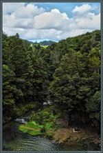
On the outskirts of Whangarei is the Whangarei Falls Scenic Reserve. (11.10.2016)
Christopher Pätz

Neuseeland / Nordinsel / Alles

371 609x900 Px, 18.11.2016

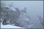
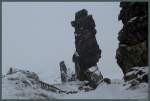
The Roßtrappe rises above the Bodetal near Thale. On the frosty 06.01.2016, the rocks are shrouded in fog, so the opposite Hexentanzplatz cannot be seen.
Christopher Pätz

The Teufelmauer near Weddersleben is one of the oldest nature reserves in Germany. In the center, the Königstein can be seen, with the continuation of the sandstone formation in the form of the Mittelsteine in the background. (06.01.2016)
Christopher Pätz

Deutschland / Sachsen-Anhalt / Harz

815  4 1200x809 Px, 08.01.2016

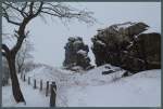
The Devil's Wall is a peculiar sandstone formation that stretches over 20 km from Ballenstedt to Blankenburg. According to legend, God and the Devil disputed the dominion over the Harz region. They agreed that the Devil would gain control over the Harz if he could build a wall around it overnight. However, the Devil failed to complete the wall, so he angrily tore it down again. The image shows the so-called Long Wall near Neinstedt, covered with snow on 06.01.2016.
Christopher Pätz

Deutschland / Sachsen-Anhalt / Harz

510 1200x809 Px, 08.01.2016

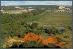
Between the cities of Rabat and Salé, the Bou Regreg River flows towards the Atlantic and has left a wide, green valley. (Rabat, 23.11.2015)
Christopher Pätz

Afrika / Marokko / Sonstige Landschaften

470 1200x810 Px, 24.12.2015

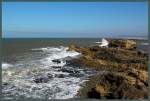
The Atlantic coast of Essaouira alternates between sandy beaches and sandstone cliffs. Here you can see the rocks in front of the city wall of Essaouira. (21.11.2015)
Christopher Pätz

Afrika / Marokko / Sonstige Landschaften

464 1200x809 Px, 15.12.2015

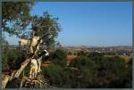
The hilly region between Marrakesh and Essaouira is predominantly agricultural. Argan trees grow here, from whose fruits argan oil is extracted (traditionally, women undertake this task). The argan fruits are also often eaten by goats, which climb onto the branches to reach them. (21.11.2015)
Christopher Pätz

Afrika / Marokko / Sonstige Landschaften

468 1200x810 Px, 11.12.2015

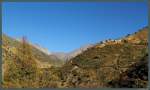
Many of the Berber settlements in the High Atlas are difficult to access. Here is a settlement in a side valley of the Ourika Valley at an altitude of about 1500 m. (19.11.2015)
Christopher Pätz

Afrika / Marokko / Hoher Atlas

552 1200x721 Px, 11.12.2015

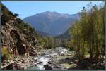
The Oued Ourika flows through the Ourika Valley in the High Atlas near Marrakech. The mountains in the background reach an elevation of about 3500 m. (19.11.2015)
Christopher Pätz

Afrika / Marokko / Hoher Atlas

580 1200x810 Px, 11.12.2015

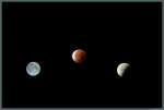
Phases of the lunar eclipse on 28.09.2015: On the left, the full moon is visible on the evening before. In the early morning, it entered the Earth's umbra. The middle image shows the total lunar eclipse, during which the moon turns blood red. The right image shows the partially covered moon at the end of the solar eclipse. (All photos were taken on the night of 27./28.09.2015 in Magdeburg)
Christopher Pätz

Galerien / Stimmungsbilder / Mond

512 1200x809 Px, 14.10.2015

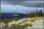
View from the Brocken towards Ilsenburg and the northern Harz foreland. (27.09.2015)
Christopher Pätz

Deutschland / Sachsen-Anhalt / Harz

583 1200x809 Px, 04.10.2015

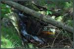
A stream babbles downhill in the Harz National Park near Schierke. (27.09.2015)
Christopher Pätz

Deutschland / Sachsen-Anhalt / Harz

497 1200x810 Px, 04.10.2015

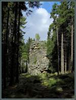
The Feuerstein Cliff is one of the landmarks of Schierke and also the namesake for the local herbal liqueur. (27.09.2015)
Christopher Pätz

Deutschland / Sachsen-Anhalt / Harz

565 682x900 Px, 03.10.2015

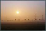
Slowly, on 21.08.2015, the morning fog dissipates as the rising sun ascends over the fields and wind turbines near Eilvese.
Christopher Pätz

View from the Galzig towards the impressive backdrop of the Lechtal Alps: In the center of the image is the 3036 m high Parseierspitze, the highest point of the Lechtal Alps. To the left are the 2889 m high Vorderseespitze and at the left edge of the image the Vallesinspitze (2768 m, just rising above the mountain in the foreground) and the 2757 m high Stanskogel immediately next to it. On the right in the image is the Hohe Riffler (3168 m). (09.08.2015)
Christopher Pätz

ֳterreich / Tirol / Lechtaler Alpen

394 1200x614 Px, 19.08.2015

View from the Galzig to the Lechtal Alps: On the left, the 2720 m high Trittkopf, on the right, the 2809 m high Valluga with the mountain station of the Vallugabahn. In the foreground, the lift to St. Christoph, which operates only in winter, can be seen. (09.08.2015)
<a href= http://www.landschaftsfotos.eu/bild/oesterreich~tirol~lechtaler-alpen/31240/die-lechtaler-alpen-sind-ein-beliebtes.html >To the right part of the panorama</a>
View from the Galzig to the Lechtal Alps: On the left, the 2720 m high Trittkopf, on the right, the 2809 m high Valluga with the mountain station of the Vallugabahn. In the foreground, the lift to St. Christoph, which operates only in winter, can be seen. (09.08.2015) To the right part of the panorama
Christopher Pätz

ֳterreich / Tirol / Lechtaler Alpen

523 1200x687 Px, 18.08.2015

The Lechtal Alps are a popular winter sports area. The 2184 m high Galzig is therefore served by several ski lifts. In the background, the Valluga massif can be seen. On the left is the Valluga (2809 m, recognizable by the mountain station), in the middle the Schindlerspitze (2648 m), and on the right Lorfekopf (2689 m) and Weißschrofenspitze (2752 m). (09.08.2015)  
<a href= http://www.landschaftsfotos.eu/bild/oesterreich~tirol~lechtaler-alpen/31241/blick-vom-galzig-auf-die-lechtaler.html >To the left part of the panorama</a>
The Lechtal Alps are a popular winter sports area. The 2184 m high Galzig is therefore served by several ski lifts. In the background, the Valluga massif can be seen. On the left is the Valluga (2809 m, recognizable by the mountain station), in the middle the Schindlerspitze (2648 m), and on the right Lorfekopf (2689 m) and Weißschrofenspitze (2752 m). (09.08.2015) To the left part of the panorama
Christopher Pätz

ֳterreich / Tirol / Lechtaler Alpen

520 1200x687 Px, 18.08.2015

Directly at the Arlberg Pass lies the 2185 m high Galzig, which offers a good view of the surrounding mountains. On the left are the foothills of the Verwall group, which flatten out towards the Arlberg Pass. On the right, the Lechquellen Mountains can be seen. In the background on the left are the Rätikon and the Klostertal. (09.08.2015)
Christopher Pätz

ֳterreich / Tirol / Lechtaler Alpen

387 1200x731 Px, 18.08.2015

The rapeseed blooms bright yellow on 02.05.2015 near the small town of Egeln.
Christopher Pätz

Deutschland / Sachsen-Anhalt / Unteres Saaletal

513 1200x809 Px, 03.05.2015

The weather station on the Brocken was built in 1939 and still serves as a weather station today. Despite the freezing temperatures, December 27, 2014, also offered good visibility of the eastern Harz (in the background). Most days of the year, the summit is shrouded in clouds.
Christopher Pätz

Deutschland / Sachsen-Anhalt / Harz

674 1200x809 Px, 28.12.2014

View from the Brocken towards Bad Harzburg (right), Goslar, and the northern Harz foothills. (27.12.2014)
Christopher Pätz