
landschaftsfotos.eu Linie landschaftsfotos.eu
Hello guest, you are not logged in. Log in | Create account 
Forum   Contact   Legal notice
German English 

Photos by Christopher Pätz
246 Photos
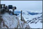
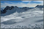
Approaching clouds lie just above the 2875 m high Schneefernerkopf, which, like the Zugspitze, is located on the German-Austrian border. (03.03.2018)
Christopher Pätz

Germany / Bavaria / Wetterstein Mountains

438 1200x809 Px, 18.03.2018

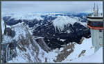
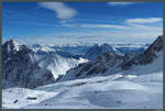
Visitor platform on the Zugspitze with a view of the Wetterstein Mountains. (03.03.2018)
Christopher Pätz

Germany / Bavaria / Wetterstein Mountains

404 1200x810 Px, 12.03.2018

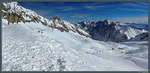
View from the Zugspitze over the Ehrwald Basin with the towns of Ehrwald and Lermoos as well as the Ammergau Alps. (03.03.2018)
Christopher Pätz

Germany / Bavaria / Wetterstein Mountains

387 1200x746 Px, 12.03.2018

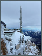
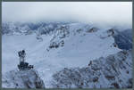
View from the German side of the Zugspitze towards the Austrian visitor platform and the Ammergau Alps. (03.03.2018)
Christopher Pätz

Germany / Bavaria / Wetterstein Mountains

360 683x900 Px, 12.03.2018

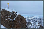
A gilded summit cross crowns the Zugspitze as Germany's highest mountain peak. (03.03.2018)
Christopher Pätz

Germany / Bavaria / Wetterstein Mountains

352 1200x809 Px, 12.03.2018

View from the Zugspitzplatt looking south towards Wetterwandeck, Plattspitze, and Gatterlkopf. (03.03.2018)
Christopher Pätz

The nearly cloudless sky on 03.03.2018 allows for a wide view of the Austrian Alps from the Zugspitzplatt. In the valley at the center of the image is the city of Innsbruck, to the right of it the Hohe Munde (2662 m). On the left, the Wetterstein Mountains can be seen.
Christopher Pätz

View from the Zugspitzplatt to the Hochblassen and the Wetterstein Mountains in beautiful winter weather. In the foreground, the Sonnenkar chairlift can be seen, which leads down into the Brunntal. (03.03.2018)
Christopher Pätz

View from the Kleine Bastei over the Elbe Valley towards the Zirkelstein and the Kaiserkrone near Schöna. (02.12.2017)
Christopher Pätz

Germany / Saxony / Saxon Switzerland

496 1200x809 Px, 18.12.2017

Ilz Valley near Kalteneck. (09.09.2017)
Christopher Pätz

Germany / Bavaria / Lower Bavaria

358 1200x809 Px, 24.09.2017

View over the IGA grounds in Berlin-Marzahn. (30.07.2017)
Christopher Pätz

Germany / Brandenburg, Berlin / City of Berlin

389 682x900 Px, 12.08.2017

View from the Torre de Iznaga over the huts of the eponymous village and the Valle de los Ingenios. (Iznaga, 27.03.2017)
Christopher Pätz

Cuba / Sancti Spíritus / various

416 1200x809 Px, 19.05.2017

Waterfall in Topes de Collantes National Park near Trinidad. (03/26/2017)
Christopher Pätz

Cuba / Sancti Spíritus / various

377 1200x809 Px, 10.05.2017

View from the Mirador del Caribe viewpoint over the foothills of the Escambray Mountains towards the city of Trinidad. (26.03.2017)
Christopher Pätz

Cuba / Sancti Spíritus / various

463 1200x761 Px, 10.05.2017

View from the Mirador des Caribe viewpoint to the Escambray Mountains. (near Trinidad, 26.03.2017)
Christopher Pätz

Cuba / Sancti Spíritus / various

399 1200x809 Px, 10.05.2017

Beach on the Península Ancón near the town of Trinidad. (25.03.2017)
Christopher Pätz

Cuba / Sancti Spíritus / various

391 1200x760 Px, 07.05.2017

Evening in the Viñales Valley. (22.03.2017)
Christopher Pätz

Cuba / Pinar del Río / Viñales Valley

350 1200x809 Px, 01.05.2017

The Mural de la Prehistoria is one of the most famous sights in the Viñales Valley. The 120 m high rock painting was created in 1961 by the Mexican artist Leovigildo González Morillo. (Viñales, 22.03.2017)
Christopher Pätz

Cuba / Pinar del Río / Viñales Valley

9695  2 1200x810 Px, 29.04.2017

Tobacco is one of the most important agricultural products in the Viñales Valley. The leaves are dried on the poles. (Viñales, 21.03.2017)
Christopher Pätz

Cuba / Pinar del Río / Viñales Valley

434 1200x810 Px, 25.04.2017

In the western area of the Viñales Valley is the Valle de dos Hermanas, recognizable by the narrow valley between two limestone hills (Mogotes). It is a popular tourist destination due to the rock painting Mural de la Prehistoria. (20.03.2017)
Christopher Pätz

Cuba / Pinar del Río / Viñales Valley

478 1200x809 Px, 24.04.2017

View from the mountains over the eastern part of the Viñales Valley. (20.03.2017)
Christopher Pätz

Cuba / Pinar del Río / Viñales Valley

438 1200x809 Px, 24.04.2017

View over the Viñales Valley with the distinctive mogotes (limestone hills). Since 1999, the valley has been part of the UNESCO World Heritage. (20.03.2017)
Christopher Pätz

Cuba / Pinar del Río / Viñales Valley

470 1200x809 Px, 22.04.2017

An underground river runs through the Cueva del Indio, part of which is navigable by motorboats. Shown is the northern entrance of the cave (Viñales, 20.03.2017)
Christopher Pätz

Cuba / Pinar del Río / Viñales Valley

456 682x900 Px, 22.04.2017

Stalactites in the karst cave Cueva del Indio near Viñales. (20.03.2017)
Christopher Pätz

Cuba / Pinar del Río / Viñales Valley

424 1200x810 Px, 22.04.2017