landschaftsfotos.eu Linie landschaftsfotos.eu
Hello guest, you are not logged in. Log in | Create account 
Forum   Contact   Legal notice
German English 

Photos by Günther Glauz†
87 Photos
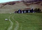
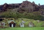
Museum farm Glaumbaer about 15 km south of Saudarkrokur in June 1997, detailed description at www.christianengl.de/norden.html.
Günther Glauz†

Iceland / Regions / Northwest Land - Norðurland vestra

925 800x543 Px, 25.02.2007

Youth Hostel Fljotsdalur in June 1997, the floor was extremely tilted due to an earthquake. The hostel is located 30 km south of the Hekla volcano, notorious for its strong earthquakes before eruptions and the release of toxic gas clouds; a certain radius around the mountain is uninhabited.
Günther Glauz†

Iceland / Regions / Southland - Suðurland

1219 800x568 Px, 24.02.2007

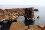
This natural rock arch gave the Dyrholaey peninsula (literally  door hole island ) its name, called an island because it only became a peninsula after a volcanic eruption. This coast is notorious for its storms; 100 years ago, many fishing boats sank here, with most fishermen losing their lives.
This natural rock arch gave the Dyrholaey peninsula (literally "door hole island") its name, called an island because it only became a peninsula after a volcanic eruption. This coast is notorious for its storms; 100 years ago, many fishing boats sank here, with most fishermen losing their lives.
Günther Glauz†

Iceland / Regions / Southland - Suðurland

1096 800x535 Px, 24.02.2007

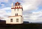
Lighthouse from 1910 on the Dyrholaey Peninsula in June 1997, 6 km west of Vik i Myrdal, the plateau is 120 m high, it drops vertically to the sea and is the southernmost point of Iceland.
Günther Glauz†

Iceland / Regions / Southland - Suðurland

1099 800x547 Px, 24.02.2007

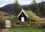
Old church next to the museum farm at Kalfafell in June 1997.
Günther Glauz†

Iceland / Regions / Southland - Suðurland

1140 800x561 Px, 24.02.2007

Museum farm near Kalfafell west of the Skeidararsandur in June 1997.
Günther Glauz†

Iceland / Regions / Southland - Suðurland

1068 800x541 Px, 24.02.2007

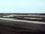
Temporary bridge over the glacier river Nupsvötn in the western Skeidararsandur in June 1997.
Günther Glauz†

Iceland / Regions / Southland - Suðurland

966 800x600 Px, 23.02.2007

Glacier river Nupsvötn in the western part of the Skeidararsandur in June 1997, behind it the Skeidararjökull (glacier), above it the Skaftafellstjöll (mountains). In this area, the 450 m high glacial lake must have broken through; on the satellite map, the glacier collapse up to the volcano Grimsvötn, 45 km away, can be seen quite clearly.
Günther Glauz†

Iceland / Regions / Southland - Suðurland

1003 800x569 Px, 23.02.2007

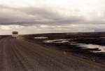
Ring Road through the Skeidararsandur in June 1997, there were often signs at the roadside warning that leaving the road was life-threatening due to sinking in the mud. The Polish bus was an  old acquaintance  from the ferry.
Ring Road through the Skeidararsandur in June 1997, there were often signs at the roadside warning that leaving the road was life-threatening due to sinking in the mud. The Polish bus was an "old acquaintance" from the ferry.
Günther Glauz†

Iceland / Regions / Southland - Suðurland

857 800x544 Px, 23.02.2007

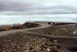
Access ramp to the destroyed part of the Sandur Bridge in July 1997, showing the junction of the temporary track, which was simply laid 30 km across the flat Skeidararsandur. The old road had been relocated onto a dam, which was no longer visible.
Günther Glauz†

Iceland / Regions / Southland - Suðurland

861 800x539 Px, 23.02.2007

Bridge over the glacier river Skeidarar in the 30 km wide eastern part of the Skeidararsandur in June 1997, the left part of the bridge was destroyed during the glacier outburst flood in November 1996, the flood wave is said to have been up to 40 m high, the coastal shore of the sandur was pushed up to 600 m further into the sea. The access ramp was rebuilt after the flood wave, the provisional ring road had only been passable here again for a few days.
Günther Glauz†

Iceland / Regions / Southland - Suðurland

1167 800x547 Px, 23.02.2007

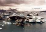
Jökulsarlon in June 1997
Günther Glauz†

Iceland / Regions / Southland - Suðurland

985 800x539 Px, 20.02.2007

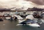
Jökulsarlon (engl. glacier lagoon) in Breidamerkursamdur on the south coast in June 1997, the icebergs calve directly from the Breidamerkurjokull into the lake and can be up to 15 m high, the lake is up to 150 m deep, between the sea and the lake there is a land bridge only 50 m wide, over which the Ring Road runs.
Günther Glauz†

Iceland / Regions / Southland - Suðurland

968 800x551 Px, 20.02.2007

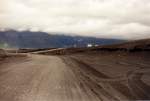
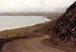
Ring Road about 65 km west of Höfn on the south coast, in June 1997 most of the Ring Road was still not paved but looked like this, today most of it is paved. The Ring Road has also become shorter; in 1996 it was just under 1500 km, today it is only 1336 km due to shortcuts, new bridges, and tunnels.
Günther Glauz†

Iceland / Regions / Southland - Suðurland

1193 800x550 Px, 20.02.2007

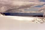
View over the Vatnajökull glacier to the east; continuing by jeep was not permitted in June 1997 for safety reasons. The Bardarbunga volcano beneath the glacier erupted on 02.10.1996, and the heat melted large amounts of ice into a 450 m high underground lake, which broke through the ice on the south coast on 04.11.1996. Parts of the ice cover have collapsed, but large cavities were still suspected, which could collapse at any time.
Günther Glauz†

Iceland / Regions / Southland - Suðurland

1246 800x537 Px, 20.02.2007

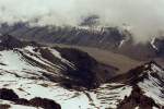
Kalfafellsdalur in June 1997, taken from the edge of the Vatnajökull glacier; unfortunately, the mountain peaks on the other side of the valley could not be seen, the mountains are about 1400 m high.
Günther Glauz†

Iceland / Regions / Southland - Suðurland

1115 800x538 Px, 20.02.2007

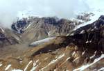
After about 15 km drive from the Berghotel Jöklasel over the Vatnajökull glacier, we arrived at the glacier edge at an altitude of 1200 m with a beautiful view to the west over and into the Kalfafellsdalur (valley), taken in June 1997.
Günther Glauz†

Iceland / Regions / Southland - Suðurland

1230 800x549 Px, 20.02.2007

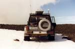
For the glacier ride, air was let out of the tires next to the Berghotel Jöklasel, and the jeep has a compressor at the front for reinflating. In addition to jeeps, there are also guided snowmobile tours. Vatnajökull is the second largest glacier in Europe with 8,100 km² and has a maximum ice thickness of 1,000 m.
Günther Glauz†

Iceland / Regions / Southland - Suðurland

989 800x532 Px, 19.02.2007

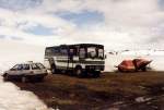
Off-road bus with high ground clearance next to the mountain hotel Jöhlasel in June 1997, a 16 km long dead-end road branches off from the ring road, the last 6 km are only allowed for off-road vehicles and this bus, cars actually have no business here.
Günther Glauz†

Iceland / Regions / Southland - Suðurland

1160 800x541 Px, 19.02.2007

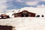
Mountain hotel Jöklasel at 840 m altitude on the edge of the Skalafellsjökull (Vatnajökull) 55 km west of Höfn on the south coast in June 1997.
Günther Glauz†

Iceland / Regions / Southland - Suðurland

1375 800x539 Px, 19.02.2007

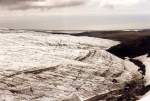
Skalafellsjökull, part of Vatnajökull, about 40 km west of Höfn on the south coast in June 1997.
Günther Glauz†

Iceland / Regions / Southland - Suðurland

1626 800x542 Px, 19.02.2007

Youth Hostel Vagnsstadir (right) with farm 50 km west of Höfn on the south coast in June 1997, this hostel manager and farmer has a third profession: excursion rides with the jeep on the Vatnajökull glacier.
Günther Glauz†

Iceland / Regions / Southland - Suðurland

1301 800x535 Px, 19.02.2007

Abandoned former American radar station on the south coast of Iceland in June 1997, only one thing the Americans forgot: to turn off the light, the street lighting was still on!
Günther Glauz†

Iceland / Regions / Southland - Suðurland

1134 800x543 Px, 18.02.2007

Bizarre rock on the north coast near the Osar youth hostel in June 1997, probably a remnant of a volcanic eruption, it will not withstand the Atlantic storms for much longer, maybe it can no longer be seen, as the photo was taken 10 years ago. The white spots on the rock are birds.
Günther Glauz†