
landschaftsfotos.eu Linie landschaftsfotos.eu
Hello guest, you are not logged in. Log in | Create account 
Forum   Contact   Legal notice
German English 

Photos by Günther Glauz†
87 Photos
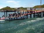
Disembarking passengers from the mainland with these motorboats at the landing pier on Helgoland on 16.05.2008
Günther Glauz†

Germany / Schleswig-Holstein / Heligoland Island

1255 800x600 Px, 27.05.2008

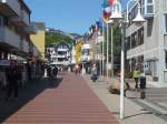
Lung Wai, the main street in the lowlands from the pier to the stairs and lift to the highlands on 16.05.2008
Günther Glauz†

Germany / Schleswig-Holstein / Heligoland Island

1549 800x600 Px, 27.05.2008

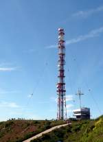
Transmission mast at the ascent to the Oberland, here begins the approximately three-kilometer circular trail over the Oberland, 16.05.2008
Günther Glauz†

Germany / Schleswig-Holstein / Heligoland Island

1041 433x600 Px, 27.05.2008

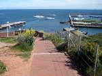
View from Oberland towards the landing pier (left), the excursion boats anchored offshore, and the marina (right) on 16.05.2008
Günther Glauz†

Germany / Schleswig-Holstein / Heligoland Island

1052 800x594 Px, 27.05.2008

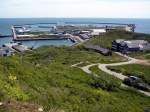
View from the Oberland over the Mittelland with the hospital to the South Harbor on 16.05.2008, here the catamaran ship  Helgoland  from Hamburg docks, visible on the right in front of the harbor exit.
View from the Oberland over the Mittelland with the hospital to the South Harbor on 16.05.2008, here the catamaran ship "Helgoland" from Hamburg docks, visible on the right in front of the harbor exit.
Günther Glauz†

Germany / Schleswig-Holstein / Heligoland Island

1595 800x600 Px, 27.05.2008

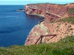
The approximately one-kilometer-long western cliff coast from  Bakenhorn  to  Lange Anna  on 16.05.2008
The approximately one-kilometer-long western cliff coast from "Bakenhorn" to "Lange Anna" on 16.05.2008
Günther Glauz†

Germany / Schleswig-Holstein / Heligoland Island

1233 800x600 Px, 27.05.2008

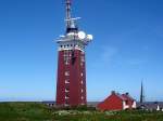
Former anti-aircraft tower, today the lighthouse of Helgoland Island, the only building that was not destroyed during the bombing raids on April 17 and 18, 1945 (18 days before the end of the war!), on 16.05.2008
Günther Glauz†

Germany / Schleswig-Holstein / Heligoland Island

2324 800x600 Px, 27.05.2008

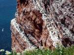
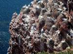
The  Lummenfelsen  on the northwest coast of Helgoland, where thousands of seabirds breed in May/June, photographed on 16.05.2008
The "Lummenfelsen" on the northwest coast of Helgoland, where thousands of seabirds breed in May/June, photographed on 16.05.2008
Günther Glauz†

Germany / Schleswig-Holstein / Heligoland Island

1318 800x600 Px, 26.05.2008

The  Puffin Cliffs  on the northwest coast of Helgoland, photographed on 16.05.2008
The "Puffin Cliffs" on the northwest coast of Helgoland, photographed on 16.05.2008
Günther Glauz†

Germany / Schleswig-Holstein / Heligoland Island

1315 800x600 Px, 26.05.2008

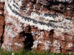
Breeding Northern Gannets at the  Lummenfelsen , 16.05.2008
Breeding Northern Gannets at the "Lummenfelsen", 16.05.2008
Günther Glauz†

Germany / Schleswig-Holstein / Heligoland Island

640 800x600 Px, 26.05.2008

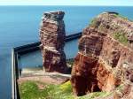
The  Lange Anna  at the northwest corner of Helgoland on 16.05.2008
The "Lange Anna" at the northwest corner of Helgoland on 16.05.2008
Günther Glauz†

Germany / Schleswig-Holstein / Heligoland Island

695 800x600 Px, 26.05.2008

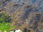
The rocky tidal flat  Schorre  at the northwest corner of Helgoland near the  Lange Anna,  here on 16.05.2008 covered with only a few centimeters of water.
The rocky tidal flat "Schorre" at the northwest corner of Helgoland near the "Lange Anna," here on 16.05.2008 covered with only a few centimeters of water.
Günther Glauz†

Germany / Schleswig-Holstein / Heligoland Island

854 800x600 Px, 26.05.2008

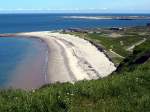
Sandy beach on the north coast of Helgoland, with the youth hostel in the middle, and the island  Düne  in the background, which was connected to Helgoland until 1723, photographed on 16.05.2008.
Sandy beach on the north coast of Helgoland, with the youth hostel in the middle, and the island "Düne" in the background, which was connected to Helgoland until 1723, photographed on 16.05.2008.
Günther Glauz†

Germany / Schleswig-Holstein / Heligoland Island

3290  1 800x600 Px, 26.05.2008

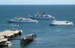
The fleet of excursion boats to Husum, Cuxhaven, and Glückstadt on 16.05.2008, the motorboats have already started boarding the tourists, I have to hurry to get from the upland to the pier.
Günther Glauz†

Germany / Schleswig-Holstein / Heligoland Island

1477  1 800x517 Px, 26.05.2008

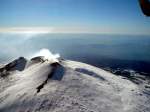
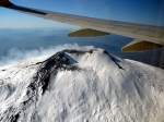
Only in this photo can you see that just behind the main crater there is another crater that is smoking, or rather  steaming,  because it looks more like water vapor from the snow. Take care, Etna, and stay peaceful, as you have caused quite a bit of trouble in the past.
Only in this photo can you see that just behind the main crater there is another crater that is smoking, or rather "steaming," because it looks more like water vapor from the snow. Take care, Etna, and stay peaceful, as you have caused quite a bit of trouble in the past.
Günther Glauz†

Italy / Islands / Sicily

723 800x600 Px, 29.01.2008

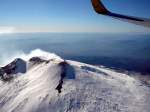
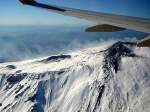
In this photo, you can see that there is a second crater to the left behind the main crater; it was the main crater until 1964, and the new one only formed that year during an eruption.
Günther Glauz†

Italy / Islands / Sicily

633 800x600 Px, 29.01.2008

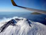
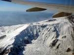
From a slightly higher perspective, the crater is more visible.
Günther Glauz†

Italy / Islands / Sicily

620 800x600 Px, 29.01.2008

The main crater and summit, 3323 m high
Günther Glauz†

Italy / Islands / Sicily

659 800x600 Px, 29.01.2008

The main summit is coming into view, this was probably the site of the last small eruption about a year ago, which is why no snow remains; the complete cooling of the lava takes up to five years.
Günther Glauz†

Italy / Islands / Sicily

663 800x600 Px, 29.01.2008

Flight on 28.01.2008 past Mount Etna from the southeast towards the northwest, on the far left the road to the tourist spot Etna-South is visible, a winter ski area with two lifts that have been destroyed several times by eruptions. Above the steep slope, smaller craters are visible, also on the far left, as can be found all over the Etna massif, most at around 1800 m altitude.
Günther Glauz†

Italy / Islands / Sicily

758 800x600 Px, 29.01.2008

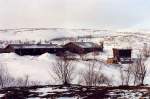
Fjell Youth Hostel near Lakselv, March 1992.
Günther Glauz†

Norway / Northern Norway / Finnmark

1244 800x532 Px, 22.06.2007

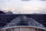
Farewell to Mageroya and Nordkapp, crossing from Honningsvag to Kafjord (mainland), March 1992.
Günther Glauz†

Norway / Northern Norway / Finnmark

1420 800x543 Px, 22.06.2007

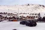
Waiting for the ferry to the mainland, in the background the largest town on the island of Mageroya, Honningsvag. This image is from the past; today a tunnel runs under the sea to the mainland, March 1992.
Günther Glauz†

Norway / Northern Norway / Finnmark

1336 800x541 Px, 22.06.2007

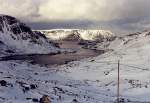
View from the E69 about 7 kilometers north of Honningsvag looking north over the island of Mageroya, March 1992.
Günther Glauz†

Norway / Northern Norway / Finnmark

1200 800x553 Px, 22.06.2007