landschaftsfotos.eu Linie landschaftsfotos.eu
Hello guest, you are not logged in. Log in | Create account 
Forum   Contact   Legal notice
German English 

Photos by Günther Glauz†
87 Photos
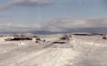
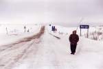
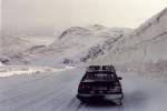
Road across the island of Mageroya from Honningsvag to the North Cape over the approximately 300-meter-high plateau, snowdrifts can be considerable in some places, the road is occasionally closed due to weather conditions, March 1992.
Günther Glauz†

Norway / Northern Norway / Finnmark

1538  2 800x534 Px, 22.06.2007

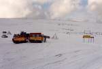
Junction of the North Cape Road before Skarsvag on the island of Mageroya, where two tracked vehicles with tracked trailers are waiting for a bus to transport tourists on the uncleared road to the North Cape, March 1992.
Günther Glauz†

Norway / Northern Norway / Finnmark

1722 800x543 Px, 22.06.2007

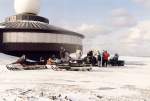
From Skarsvag, we rode snow scooters the 15 km to the North Cape, where hundreds of tourists gather in the summer; on March 22, 1992, we were the only ones there with our drivers. On the way back, we were allowed to drive ourselves on the plateau.
Günther Glauz†

Norway / Northern Norway / Finnmark

1178 800x544 Px, 21.06.2007

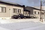
Tourist lodge in Skarsvag, we were the first guests of the year on March 21, 1992.
Günther Glauz†

Norway / Northern Norway / Finnmark

1022 800x535 Px, 21.06.2007

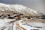
Europe's northernmost fishing village Skarsvag on the North Cape island Mageroya, about 15 km from the North Cape, in March 1992. In winter, the road is only cleared up to here; the North Cape is purely a tourist station and uninhabited in winter.
Günther Glauz†

Norway / Northern Norway / Finnmark

1476 800x544 Px, 21.06.2007

E6 on a plateau north of Alta in March 1992, the ascent from Alta was just barely manageable with a car without snow chains.
Günther Glauz†

Norway / Northern Norway / Finnmark

1236 800x496 Px, 21.06.2007

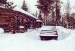
Log cabin on a peninsula at Lake Jerisjärvi, we had rented it for two weeks, March 1994.
Günther Glauz†

Finland / Northern Finland / Lapland

1463 800x543 Px, 21.06.2007

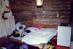
Interior design of the log cabin at Lake Jerisjärvi, here the living-bedroom, there was also a bedroom and of course a sauna.
Günther Glauz†

Finland / Northern Finland / Lapland

1618 800x539 Px, 21.06.2007

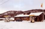
Rest area, gas station, and mini supermarket in the Finnish border town of Kilpisjärvi; from here, it is about 150 km to the next Finnish town, the nearest Norwegian one is somewhat closer, about 45 km, March 1994
Günther Glauz†

Finland / Northern Finland / Lapland

1822 800x524 Px, 21.06.2007

Border crossing Finland - Norway between Kilpisjärvi and Skibotn in the immediate vicinity of the tripoint Finland - Norway - Sweden, March 1994.
Günther Glauz†

Finland / Northern Finland / Lapland

2378 800x543 Px, 21.06.2007

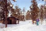
Juuva Shelter approx. 20 km from Muonio, March 1994.
Günther Glauz†

Finland / Northern Finland / Lapland

1296 800x547 Px, 21.06.2007

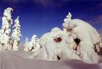
Bizarre snow formations on the cross-country ski trail between the Kuusimaa and Luuvanrova shelters near Muonio, the trail runs here at about 400 meters elevation over a mountain ridge, just below the tree line, March 1994.
Günther Glauz†

Finland / Northern Finland / Lapland

1600 800x541 Px, 21.06.2007

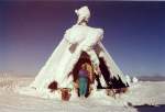
Shelter hut in the Särkitunturi near Lake Jerisjärvi, about 20 km from Muonio, with a cross-country ski trail passing by. This hut is modeled after a Lapp tent, but made of wood, with an open smoke vent at the top center, photographed in March 1994.
Günther Glauz†

Finland / Northern Finland / Lapland

1735 800x548 Px, 20.06.2007

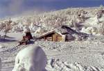
Nammalakuru shelter in the Palastunturi near Muonio on the Finnish-Swedish border in March 1994, a snowy winter in this area. A cross-country ski trail passes by the shelter, and there are about 1000 km of trails in the entire area, making it a beautiful region in such weather.
Günther Glauz†

Finland / Northern Finland / Lapland

2210 800x547 Px, 20.06.2007

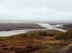
Bridge over the Jokulsa a Fjöllum River near Asbyrgi Road 85 Husavik - Kopasker in June 1997, the road partly runs along a scenic route on the north coast, below on the beach lie tree trunks that are washed ashore by the current from North America and processed by the Icelanders into construction timber.
Günther Glauz†

Iceland / Regions / Northeast Land - Norðurland eystra

1007 800x592 Px, 27.02.2007

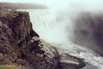
Dettifoss waterfall, 100 m wide, 45 m high, on the Jokulsa a Fjöllum river in June 1997. The 28 km long  road  from the Ring Road to the waterfall was the worst I have ever driven on with a car in 1997, a dirt and mud track with puddles up to 30 cm deep, I was glad I didn't get stuck. On the way back, I took a 150 km detour via Husavik to get back to the Ring Road.
Dettifoss waterfall, 100 m wide, 45 m high, on the Jokulsa a Fjöllum river in June 1997. The 28 km long "road" from the Ring Road to the waterfall was the worst I have ever driven on with a car in 1997, a dirt and mud track with puddles up to 30 cm deep, I was glad I didn't get stuck. On the way back, I took a 150 km detour via Husavik to get back to the Ring Road.
Günther Glauz†

Iceland / Regions / Northeast Land - Norðurland eystra

1020 800x543 Px, 26.02.2007

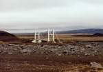
Bridge of the Ring Road at Grimstadir over the river Jokulsa a Fjöllum in June 1997.
Günther Glauz†

Iceland / Regions / Northeast Land - Norðurland eystra

1122 800x564 Px, 26.02.2007

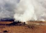
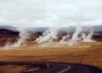
Steam plumes in the Namaskardi solfatara field in June 1997, someone was heating up strongly down there!
Günther Glauz†

Solfatara field Namaskardi 6 km east of Lake Myvatn on the Ring Road in June 1997, with mud pots, steam columns, and the smell of sulfur. Leaving the marked paths is dangerous; you can break through, and underneath it can be up to 200 degrees hot!
Günther Glauz†

Iceland / Regions / Northeast Land - Norðurland eystra

992 800x575 Px, 26.02.2007

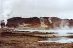
Lake with warm water and in the background solfatara fields with steam columns next to the diatomite factory (left) at Lake Myvatn in June 1997.
Günther Glauz†

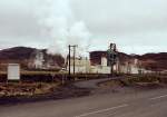
Northeast of Lake Myvatn, diatomaceous earth was mined and processed into diatomite at this plant, which is environmentally controversial. According to Wikipedia, the plant has since been closed and dismantled. Photographed in June 1997.
Günther Glauz†

Iceland / Regions / Northeast Land - Norðurland eystra

1000 800x563 Px, 25.02.2007

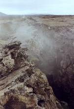
Fissure near Lake Myvatn, formed by the drifting apart of the North American and Eurasian tectonic plates, which can move up to 20 cm per year. The gap is filled with magma, which rarely reaches the Earth's surface, but water can penetrate and evaporate due to heating.
Günther Glauz†

Iceland / Regions / Northeast Land - Norðurland eystra

1232 409x600 Px, 25.02.2007

Myvatn Lake (German: Mückensee) in northeastern Iceland in June 1997, the lake does not freeze over in winter and is quite rich in fish, but also known for its abundance of midges in summer.
Günther Glauz†

Iceland / Regions / Northeast Land - Norðurland eystra

897 800x544 Px, 25.02.2007

Glaumbaer Museum Farm, side view
Günther Glauz†