landschaftsfotos.eu Linie landschaftsfotos.eu
Hello guest, you are not logged in. Log in | Create account 
Forum   Contact   Legal notice
German English 
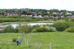
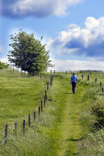
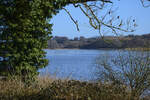
On the Gendarmen Path between Pattburg (Danish Padborg) and Krusau (Danish Kruså). The Gendarmstien was named after the Danish border gendarmerie (Grænsegendarmeriet). The Danish border gendarmes used the Gendarmstien for patrols, which they covered on foot in sections. Photo taken: May 28, 2023.
Hans Christian Davidsen

D䮥mark / J�nd / Sydjylland

265 1200x800 Px, 29.05.2023

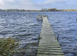
On the Gendarmen Path between Pattburg (Danish Padborg) and Krusau (Danish Kruså). The Gendarmstien was named after the Danish border gendarmerie (Grænsegendarmeriet). The Danish border gendarmes used the Gendarmstien for patrols, which they covered on foot in sections. Photo taken: May 28, 2023.
Hans Christian Davidsen

D䮥mark / J�nd / Sydjylland

261 800x1200 Px, 29.05.2023

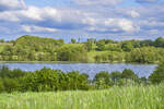
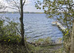
View of Niehuuser Lake. The landscape in the foreground belongs to Denmark. The landscape in the background belongs to Germany. Shot: May 28, 2023.
Hans Christian Davidsen

D䮥mark / J�nd / Sydjylland

277 1200x800 Px, 29.05.2023

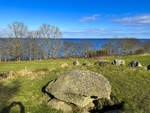
The burial mound  Baronens Høj  on the Danish island of Als. The burial mound is named after the former forester Baron Wedel-Wedelsborg, who lived on the island of Als during the 19th century.

The mound has a well-preserved burial chamber with a capstone and is surrounded by 30 kerbstones.

During an excavation in 1946, decorated shards of pottery were found, dated to around 3600 BC. Human bone remains and two beautiful flint knives, which originate from later burials, were also discovered.
Photo taken: March 4, 2023.
The burial mound "Baronens Høj" on the Danish island of Als. The burial mound is named after the former forester Baron Wedel-Wedelsborg, who lived on the island of Als during the 19th century. The mound has a well-preserved burial chamber with a capstone and is surrounded by 30 kerbstones. During an excavation in 1946, decorated shards of pottery were found, dated to around 3600 BC. Human bone remains and two beautiful flint knives, which originate from later burials, were also discovered. Photo taken: March 4, 2023.
Hans Christian Davidsen

D䮥mark / S�mark / Sonderborg

207 1200x900 Px, 05.03.2023

Brejning Beach on the Vejle Fjord. Shot: June 5, 2022.
Hans Christian Davidsen

D䮥mark / S�mark / Vejle

217 1200x900 Px, 07.06.2022

View of Vejle Fjord from Gauerslund Forest. Shot: June 5, 2022.
Hans Christian Davidsen

D䮥mark / S�mark / Vejle

187 1200x776 Px, 07.06.2022

Beach at Gauerslund Forest east of the town of Vejle. Shot: June 5, 2022.
Hans Christian Davidsen

D䮥mark / S�mark / Vejle

200 1200x796 Px, 07.06.2022

Cliff coast near Brejning on the Vejle Fjord. Photo taken: June 5, 2022.
Hans Christian Davidsen

D䮥mark / S�mark / Vejle

211 1200x800 Px, 06.06.2022

Cliff coast at Brejning Beach near Vejle Fjord. Shot: June 5, 2022.
Hans Christian Davidsen

D䮥mark / S�mark / Vejle

195 1200x779 Px, 06.06.2022

Cliff coast at Brejning Beach in East Jutland. Shot: June 5, 2022.
Hans Christian Davidsen

D䮥mark / S�mark / Vejle

179 1200x786 Px, 06.06.2022

Tree roots on the cliff coast near Brejning. Shot: June 5, 2022.
Hans Christian Davidsen

D䮥mark / S�mark / Sonderborg

188 1200x800 Px, 06.06.2022

View of Vejle Fjord from Brejning. Shot: June 5, 2022.
Hans Christian Davidsen

D䮥mark / S�mark / Sonderborg

177 1200x800 Px, 06.06.2022

View of Vejle Fjord from Gauerslund Forest. Shot: June 5, 2022.
Hans Christian Davidsen

D䮥mark / S�mark / Vejle

179 1200x796 Px, 06.06.2022

Brejning Beach - View of Vejle Fjord. Shot: June 5, 2022.
Hans Christian Davidsen

D䮥mark / S�mark / Vejle

200 1200x802 Px, 06.06.2022

Brejning Beach - View of Vejle Fjord. Shot: June 5, 2022.
Hans Christian Davidsen

D䮥mark / S�mark / Vejle

180 1200x806 Px, 06.06.2022

Brejning Beach - View from Dyrehaven (Deer Park) over Vejle Fjord. Photo taken on June 5, 2022.
Hans Christian Davidsen

D䮥mark / S�mark / Vejle

166 1200x792 Px, 06.06.2022

Brejning Beach - View from Dyrehaven (Deer Park) over Vejle Fjord. Photo taken: June 5, 2022.
Hans Christian Davidsen

D䮥mark / S�mark / Vejle

168 1200x789 Px, 06.06.2022

The Haderslev Dam (Danish Haderslev Dam) is a lake west of the old town of Haderslev (Danish Haderslev) in North Schleswig, Denmark. The lake, which is six kilometers long and up to one kilometer wide, is now divided into three parts, as both the western end (Hindemai/Hindemade) and the section near the town (Innerdamm) are separated by dams from the main body of water, which covers about 260 hectares. Photo taken on February 26, 2022.
Hans Christian Davidsen

D䮥mark / J�nd / Sydjylland

260 1200x800 Px, 27.02.2022

Haderslebener Damm (Danish Haderslev Dam) in Northern Schleswig (Sønderjylland). The dam stretches through the Haderslebener glacial valley, which also includes the narrow fjord. Photo taken: February 26, 2022.
Hans Christian Davidsen

D䮥mark / J�nd / Sydjylland

227 1200x800 Px, 27.02.2022

View of Haderslebener Damm (Danish Haderslev Dam) west of Haderslev (Danish Haderslev) in Northern Schleswig (Sønderjylland). Photo taken: February 26, 2022.
Hans Christian Davidsen

D䮥mark / J�nd / Sydjylland

206 1200x800 Px, 27.02.2022

Haderslebener Damm (Danish Haderslev Dam). While the western part of the lake, with its partly wooded and partly marshy surroundings, is partially under nature protection, the eastern part near the city is integrated into a park. Photo taken: February 26, 2022.
Hans Christian Davidsen

D䮥mark / J�nd / Sydjylland

215 1200x800 Px, 27.02.2022

Arnkil north of Sønderborg on the island of Als. Here, on June 29, 1864, the Battle of Als between the kingdoms of Denmark and Prussia began. Photo taken: October 27, 2021.
Hans Christian Davidsen

D䮥mark / S�mark / Sonderborg

278 1200x868 Px, 02.11.2021

Arnkil on Kær Hoved north of Sonderburg (Sønderborg) on the island of Als. On June 29 at 02:00, about 2500 Prussian soldiers began crossing the Als Sound in small boats. At 02:15, the first troops landed at Arnkil and were able to take the Danish positions under heavy bombardment. From here, a pontoon bridge could be constructed to allow more soldiers to cross. After a skirmish, Sonderburg and Kær were also captured shortly thereafter. Photo taken: October 27, 2021.
Hans Christian Davidsen

D䮥mark / S�mark / Sonderborg

241 1200x868 Px, 02.11.2021

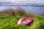
Höruphaff on the Gendarmen Path on the Danish island of Als (Northern Schleswig). Shot: May 20, 2021.
Hans Christian Davidsen

D䮥mark / S�mark / Sonderborg

225 1200x795 Px, 08.08.2021