landschaftsfotos.eu Linie landschaftsfotos.eu
Hello guest, you are not logged in. Log in | Create account 
Forum   Contact   Legal notice
German English 
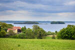
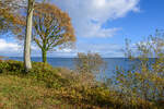
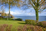
View of the Ox Islands in the Flensburg Fjord from Fjordvejen in Rønshoved. Photo taken: May 17, 2026.
Hans Christian Davidsen

D䮥mark / J�nd / Sydjylland

60 1200x800 Px, 17.05.2026

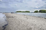
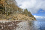
View of the Ox Islands from the beach at Sønderhav (German: Süderhaff). Photo taken on May 17, 2026.
Hans Christian Davidsen

D䮥mark / J�nd / Sydjylland

63 1200x800 Px, 17.05.2026

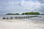
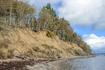
View of the Ox Islands from the beach at Sønderhav (German: Süderhaff). Photo taken: May 17, 2026
Hans Christian Davidsen

D䮥mark / J�nd / Sydjylland

47 1200x800 Px, 17.05.2026

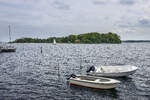
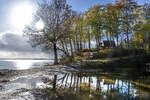
View of the Ox Islands from the beach at Sønderhav (German: Süderhaff). Photo taken: May 17, 2026.
Hans Christian Davidsen

D䮥mark / J�nd / Sydjylland

51 1200x800 Px, 17.05.2026

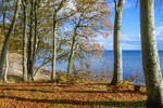
View over the Little Belt at the cliff coast near Tormaj south of Haderslev (German Hadersleben) in North Schleswig. Photo taken on October 30, 2025.
Hans Christian Davidsen

D䮥mark / J�nd / Sydjylland

115 1200x800 Px, 31.10.2025

The cliff coast at Tormaj south of Haderslev (German Hadersleben) in North Schleswig. Photo taken on October 30, 2025.
Hans Christian Davidsen

D䮥mark / J�nd / Sydjylland

95 1200x800 Px, 31.10.2025

The cliff coast at Tormaj south of Haderslev (German Hadersleben) in North Schleswig. Photo taken on October 30, 2025.
Hans Christian Davidsen

D䮥mark / J�nd / Sydjylland

92 1200x800 Px, 31.10.2025

Water on the parking lot at Tormaj Beach south of Haderslev (German Hadersleben) in Northern Schleswig. The water comes from the heights behind the coast, is dammed up, and is waiting to flow into the Little Belt through a narrow stream.  
Photo taken: October 30, 2025.
Water on the parking lot at Tormaj Beach south of Haderslev (German Hadersleben) in Northern Schleswig. The water comes from the heights behind the coast, is dammed up, and is waiting to flow into the Little Belt through a narrow stream. Photo taken: October 30, 2025.
Hans Christian Davidsen

D䮥mark / J�nd / Sydjylland

109 1200x800 Px, 31.10.2025

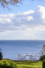
View over the Little Belt from the viewpoint at Tormaj Beach south of Haderslev (German Hadersleben)  
Photo taken: October 30, 2025.
View over the Little Belt from the viewpoint at Tormaj Beach south of Haderslev (German Hadersleben) Photo taken: October 30, 2025.
Hans Christian Davidsen

D䮥mark / J�nd / Sydjylland

98 1200x800 Px, 31.10.2025

View over the Little Belt from Tormajvej at Tormaj Beach south of Haderslev (German Hadersleben). Photo taken on October 30, 2025.
Hans Christian Davidsen

D䮥mark / J�nd / Sydjylland

92 800x1200 Px, 31.10.2025

View over the Little Belt from Tormajvej at Tormaj Beach south of Haderslev (German Hadersleben) in North Schleswig. Photo taken on October 30, 2025.
Hans Christian Davidsen

D䮥mark / J�nd / Sydjylland

97 1200x800 Px, 31.10.2025

Blue sky over the very wide sandy beach on the Danish Wadden Sea island of Rømø (German Röm). Photo taken: May 19, 2025.
Hans Christian Davidsen

D䮥mark / S�mark / Roemoe

160 1200x800 Px, 20.05.2025

On the Danish North Sea island of Rømø (Danish Rømø), it is permitted to drive cars on the very wide sandy beaches.  
Photo taken: May 19, 2025.
On the Danish North Sea island of Rømø (Danish Rømø), it is permitted to drive cars on the very wide sandy beaches. Photo taken: May 19, 2025.
Hans Christian Davidsen

D䮥mark / S�mark / Roemoe

163 1200x800 Px, 20.05.2025

Rapeseed field near Rømø Kirkeby on the Danish Wadden Sea island of Rømø (German Röm). Photo taken: May 19, 2025
Hans Christian Davidsen

D䮥mark / S�mark / Roemoe

179 1200x800 Px, 20.05.2025

View of the Alssund in Sønderborg in a northern direction. The bridge crossing the sound is called the Alssund Bridge and connects Sundewitt (Sundeved) with the island of Als. - Photo taken on May 17, 2025.
Hans Christian Davidsen

D䮥mark / S�mark / Sonderborg

176 1200x800 Px, 18.05.2025

The Königsaus as seen from the Frihedsbroen (German  Freedom Bridge ). The view is directed towards the west.
Shot: October 11, 2024:
The Königsaus as seen from the Frihedsbroen (German "Freedom Bridge"). The view is directed towards the west. Shot: October 11, 2024:
Hans Christian Davidsen

D䮥mark / J�nd / Sydjylland

180 1200x900 Px, 12.10.2024

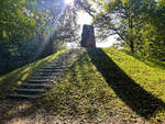
When Denmark had to cede North Schleswig to Prussia in 1864, the Königsau (Danish Kongeåen) became the state border. From Skibelund Krat, one could look south over the North Schleswig landscape. Especially farmers and schoolteachers made Skibelund Krat a national meeting place for Danish-minded people north and south of the border.  
Photo taken: October 11, 2024.
When Denmark had to cede North Schleswig to Prussia in 1864, the Königsau (Danish Kongeåen) became the state border. From Skibelund Krat, one could look south over the North Schleswig landscape. Especially farmers and schoolteachers made Skibelund Krat a national meeting place for Danish-minded people north and south of the border. Photo taken: October 11, 2024.
Hans Christian Davidsen

D䮥mark / J�nd / Sydjylland

159 1200x900 Px, 12.10.2024

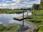
The Königsau at Foldingbro. Along the river course of the Kongeå, a hiking trail (Danish Kongeåstien) has been established. The Kongeå hiking trail is a simple footpath, but it is clearly marked with posts, so you cannot get lost. The hiking trail is a total of 67 kilometers long and equipped with information boards at interesting points. A total of 14 route sections are described in detail. Simple wooden shelters along the way can be used for overnight stays.  
Photo taken: October 11, 2024.
The Königsau at Foldingbro. Along the river course of the Kongeå, a hiking trail (Danish Kongeåstien) has been established. The Kongeå hiking trail is a simple footpath, but it is clearly marked with posts, so you cannot get lost. The hiking trail is a total of 67 kilometers long and equipped with information boards at interesting points. A total of 14 route sections are described in detail. Simple wooden shelters along the way can be used for overnight stays. Photo taken: October 11, 2024.
Hans Christian Davidsen

D䮥mark / J�nd / Sydjylland

168 1200x900 Px, 12.10.2024

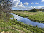
The Königsau near Foldingbro. The Au is a 65-kilometer-long watercourse that flows from east to west through South Jutland and forms the historical border between North Schleswig and the Kingdom of Denmark.  
Shot: October 11, 2024.
The Königsau near Foldingbro. The Au is a 65-kilometer-long watercourse that flows from east to west through South Jutland and forms the historical border between North Schleswig and the Kingdom of Denmark. Shot: October 11, 2024.
Hans Christian Davidsen

D䮥mark / J�nd / Sydjylland

188 1200x900 Px, 12.10.2024

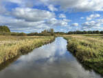
The Königsau photographed north of the village of Københoved. As early as the 13th century, the Kongeå together with the Kolding Å formed the border between the Duchy of Schleswig and the Kingdom of Denmark. From the 16th century until 1850, the Kongeå was a customs border between Schleswig and Denmark. Although both areas belonged to the Danish realm and were under the Danish king, customs had to be paid when crossing the border. After Denmark's defeat against Prussia and Austria in the German-Danish War of 1864 and due to the Treaty of Vienna of October 30, 1864, the Kongeå between Fårkrog and Villebøl formed a partial border between Denmark and Prussia, and from 1871 the German Empire.  
Shot: October 11, 2024.
The Königsau photographed north of the village of Københoved. As early as the 13th century, the Kongeå together with the Kolding Å formed the border between the Duchy of Schleswig and the Kingdom of Denmark. From the 16th century until 1850, the Kongeå was a customs border between Schleswig and Denmark. Although both areas belonged to the Danish realm and were under the Danish king, customs had to be paid when crossing the border. After Denmark's defeat against Prussia and Austria in the German-Danish War of 1864 and due to the Treaty of Vienna of October 30, 1864, the Kongeå between Fårkrog and Villebøl formed a partial border between Denmark and Prussia, and from 1871 the German Empire. Shot: October 11, 2024.
Hans Christian Davidsen

D䮥mark / J�nd / Sydjylland

162 1200x900 Px, 12.10.2024

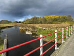
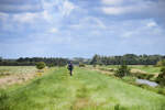
Hiking and cycling trail along the Vindtved Canal between Ellhöft in the Nordfriesland district and Lydersholm in Denmark. Photo taken on August 11, 2024.
Hans Christian Davidsen

D䮥mark / J�nd / Sydjylland

129 1200x800 Px, 18.08.2024

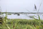
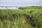
Rüttebüller Lake as seen from the Danish Ruttebüll (Rudbøl). Photo taken on August 3, 2024.
Hans Christian Davidsen

D䮥mark / J�nd / Sydjylland

211 1200x800 Px, 04.08.2024

Rüttebüller See as seen from the Danish Ruttebüll (Rudbøl). Photo taken on August 3, 2024.
Hans Christian Davidsen

D䮥mark / J�nd / Sydjylland

210 1200x800 Px, 04.08.2024

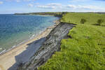
The cliff coast on the east coast of Broagerland (Northern Schleswig/Sønderjylland). Photo taken: April 22, 2024.
Hans Christian Davidsen

D䮥mark / S�mark / Sonderborg

244 1200x800 Px, 29.04.2024