
landschaftsfotos.eu Linie landschaftsfotos.eu
Hello guest, you are not logged in. Log in | Create account 
Forum   Contact   Legal notice
German English 

South Jutland photos

110 Photos
Die Galerie präsentiert Landschaftsaufnahmen aus Sydjylland (Südjütland) in Dänemark, mit Schwerpunkten auf den Regionen Mandø, Vojens und der Flensburger Förde. Die Fotos zeigen verschiedene Motive: Wattwürmer und Ebbewege im Wattenmeer bei Mandø, den Verlauf des Låningsvejen zwischen Festland und Insel sowie Küstenabschnitte der West- und Südküste von Mandø. Aufnahmen dokumentieren zudem den Zustand des Wattwegs bei unterschiedlichen Wasserständen und Situationen am Deich sowie am Strandweg westlich des Inseldorfs. Weitere Bilder stammen aus dem Fuglesøparken und rund um den Vogelsee (Fuglesøen) südlich von Vojens mit Details wie Butterblumen, Rasenflächen und Parkwegen. Die Flensburger Förde ist mit Ansichten bei Egernsund und Rendbjerg vertreten, darunter Pfosten im Wasser, Badebrücken, Angler und Segelboote. Mehrere Sonnenuntergänge an der Förde sowie ein Foto aus dem Waldgebiet Kollund Skov ergänzen die Galerie. Die Motive sind geografisch klar zuordenbar und zeigen typische Landschaftselemente der jeweiligen Orte. EU label: AI-generated content
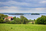
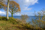
View of the Ox Islands in the Flensburg Fjord from Fjordvejen in Rønshoved. Photo taken: May 17, 2026.
Hans Christian Davidsen

Denmark / Jutland / South Jutland

75 1200x800 Px, 17.05.2026

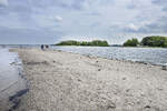
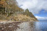
View of the Ox Islands from the beach at Sønderhav (German: Süderhaff). Photo taken on May 17, 2026.
Hans Christian Davidsen

Denmark / Jutland / South Jutland

79 1200x800 Px, 17.05.2026

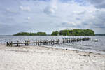
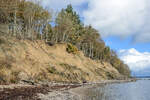
View of the Ox Islands from the beach at Sønderhav (German: Süderhaff). Photo taken: May 17, 2026
Hans Christian Davidsen

Denmark / Jutland / South Jutland

61 1200x800 Px, 17.05.2026

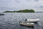
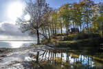
View of the Ox Islands from the beach at Sønderhav (German: Süderhaff). Photo taken: May 17, 2026.
Hans Christian Davidsen

Denmark / Jutland / South Jutland

65 1200x800 Px, 17.05.2026

View over the Little Belt at the cliff coast near Tormaj south of Haderslev (German Hadersleben) in North Schleswig. Photo taken on October 30, 2025.
Hans Christian Davidsen

Denmark / Jutland / South Jutland

129 1200x800 Px, 31.10.2025

The cliff coast at Tormaj south of Haderslev (German Hadersleben) in North Schleswig. Photo taken on October 30, 2025.
Hans Christian Davidsen

Denmark / Jutland / South Jutland

108 1200x800 Px, 31.10.2025

The cliff coast at Tormaj south of Haderslev (German Hadersleben) in North Schleswig. Photo taken on October 30, 2025.
Hans Christian Davidsen

Denmark / Jutland / South Jutland

110 1200x800 Px, 31.10.2025

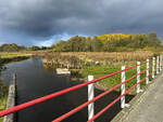
Water on the parking lot at Tormaj Beach south of Haderslev (German Hadersleben) in Northern Schleswig. The water comes from the heights behind the coast, is dammed up, and is waiting to flow into the Little Belt through a narrow stream.  
Photo taken: October 30, 2025.
Water on the parking lot at Tormaj Beach south of Haderslev (German Hadersleben) in Northern Schleswig. The water comes from the heights behind the coast, is dammed up, and is waiting to flow into the Little Belt through a narrow stream. Photo taken: October 30, 2025.
Hans Christian Davidsen

Denmark / Jutland / South Jutland

119 1200x800 Px, 31.10.2025

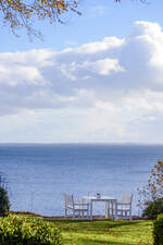
View over the Little Belt from the viewpoint at Tormaj Beach south of Haderslev (German Hadersleben)  
Photo taken: October 30, 2025.
View over the Little Belt from the viewpoint at Tormaj Beach south of Haderslev (German Hadersleben) Photo taken: October 30, 2025.
Hans Christian Davidsen

Denmark / Jutland / South Jutland

112 1200x800 Px, 31.10.2025

View over the Little Belt from Tormajvej at Tormaj Beach south of Haderslev (German Hadersleben). Photo taken on October 30, 2025.
Hans Christian Davidsen

Denmark / Jutland / South Jutland

103 800x1200 Px, 31.10.2025

View over the Little Belt from Tormajvej at Tormaj Beach south of Haderslev (German Hadersleben) in North Schleswig. Photo taken on October 30, 2025.
Hans Christian Davidsen

Denmark / Jutland / South Jutland

113 1200x800 Px, 31.10.2025

The Königsaus as seen from the Frihedsbroen (German  Freedom Bridge ). The view is directed towards the west.
Shot: October 11, 2024:
The Königsaus as seen from the Frihedsbroen (German "Freedom Bridge"). The view is directed towards the west. Shot: October 11, 2024:
Hans Christian Davidsen

Denmark / Jutland / South Jutland

196 1200x900 Px, 12.10.2024

When Denmark had to cede North Schleswig to Prussia in 1864, the Königsau (Danish Kongeåen) became the state border. From Skibelund Krat, one could look south over the North Schleswig landscape. Especially farmers and schoolteachers made Skibelund Krat a national meeting place for Danish-minded people north and south of the border.  
Photo taken: October 11, 2024.
When Denmark had to cede North Schleswig to Prussia in 1864, the Königsau (Danish Kongeåen) became the state border. From Skibelund Krat, one could look south over the North Schleswig landscape. Especially farmers and schoolteachers made Skibelund Krat a national meeting place for Danish-minded people north and south of the border. Photo taken: October 11, 2024.
Hans Christian Davidsen

Denmark / Jutland / South Jutland

177 1200x900 Px, 12.10.2024

The Königsau at Foldingbro. Along the river course of the Kongeå, a hiking trail (Danish Kongeåstien) has been established. The Kongeå hiking trail is a simple footpath, but it is clearly marked with posts, so you cannot get lost. The hiking trail is a total of 67 kilometers long and equipped with information boards at interesting points. A total of 14 route sections are described in detail. Simple wooden shelters along the way can be used for overnight stays.  
Photo taken: October 11, 2024.
The Königsau at Foldingbro. Along the river course of the Kongeå, a hiking trail (Danish Kongeåstien) has been established. The Kongeå hiking trail is a simple footpath, but it is clearly marked with posts, so you cannot get lost. The hiking trail is a total of 67 kilometers long and equipped with information boards at interesting points. A total of 14 route sections are described in detail. Simple wooden shelters along the way can be used for overnight stays. Photo taken: October 11, 2024.
Hans Christian Davidsen

Denmark / Jutland / South Jutland

183 1200x900 Px, 12.10.2024

The Königsau near Foldingbro. The Au is a 65-kilometer-long watercourse that flows from east to west through South Jutland and forms the historical border between North Schleswig and the Kingdom of Denmark.  
Shot: October 11, 2024.
The Königsau near Foldingbro. The Au is a 65-kilometer-long watercourse that flows from east to west through South Jutland and forms the historical border between North Schleswig and the Kingdom of Denmark. Shot: October 11, 2024.
Hans Christian Davidsen

Denmark / Jutland / South Jutland

199 1200x900 Px, 12.10.2024

The Königsau photographed north of the village of Københoved. As early as the 13th century, the Kongeå together with the Kolding Å formed the border between the Duchy of Schleswig and the Kingdom of Denmark. From the 16th century until 1850, the Kongeå was a customs border between Schleswig and Denmark. Although both areas belonged to the Danish realm and were under the Danish king, customs had to be paid when crossing the border. After Denmark's defeat against Prussia and Austria in the German-Danish War of 1864 and due to the Treaty of Vienna of October 30, 1864, the Kongeå between Fårkrog and Villebøl formed a partial border between Denmark and Prussia, and from 1871 the German Empire.  
Shot: October 11, 2024.
The Königsau photographed north of the village of Københoved. As early as the 13th century, the Kongeå together with the Kolding Å formed the border between the Duchy of Schleswig and the Kingdom of Denmark. From the 16th century until 1850, the Kongeå was a customs border between Schleswig and Denmark. Although both areas belonged to the Danish realm and were under the Danish king, customs had to be paid when crossing the border. After Denmark's defeat against Prussia and Austria in the German-Danish War of 1864 and due to the Treaty of Vienna of October 30, 1864, the Kongeå between Fårkrog and Villebøl formed a partial border between Denmark and Prussia, and from 1871 the German Empire. Shot: October 11, 2024.
Hans Christian Davidsen

Denmark / Jutland / South Jutland

173 1200x900 Px, 12.10.2024

Hiking and cycling trail along the Vindtved Canal between Ellhöft in the Nordfriesland district and Lydersholm in Denmark. Photo taken on August 11, 2024.
Hans Christian Davidsen

Denmark / Jutland / South Jutland

141 1200x800 Px, 18.08.2024

Rüttebüller Lake as seen from the Danish Ruttebüll (Rudbøl). Photo taken on August 3, 2024.
Hans Christian Davidsen

Denmark / Jutland / South Jutland

225 1200x800 Px, 04.08.2024

Rüttebüller See as seen from the Danish Ruttebüll (Rudbøl). Photo taken on August 3, 2024.
Hans Christian Davidsen

Denmark / Jutland / South Jutland

228 1200x800 Px, 04.08.2024

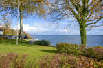
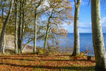
View of the Flensburg Fjord from Kollund Forest (Northern Schleswig/Sønderjylland). Photo taken on April 22, 2024.
Hans Christian Davidsen

Denmark / Jutland / South Jutland

180 1200x800 Px, 29.04.2024

Here stands  The Man at the Sea,  a sculpture group made of white concrete in Esbjerg, Denmark (Danish: Mennesket ved Havet). The image shows the landscape around the sculpture group. Seen on February 17, 2024.
Here stands "The Man at the Sea," a sculpture group made of white concrete in Esbjerg, Denmark (Danish: Mennesket ved Havet). The image shows the landscape around the sculpture group. Seen on February 17, 2024.
Klaus-P. Dietrich

Denmark / Jutland / South Jutland

173 1200x802 Px, 14.04.2024

On the Marsch path (Danish Marskstien) in the Tondern Marsh (Danish Tøndermarsken) in North Schleswig/Sønderjylland. Photo taken: April 2, 2024.
Hans Christian Davidsen

Denmark / Jutland / South Jutland

242 1200x900 Px, 04.04.2024

Right here, you cross the German-Danish border in the Frøslev-Jardelund Moor nature reserve. The photo was taken one and a half meters inside Denmark. Shot: July 30, 2023.
Hans Christian Davidsen

Denmark / Jutland / South Jutland

358 1200x800 Px, 31.07.2023

On the old Ellund Kirkevej, which was cut through during the construction of the highway border crossing between Schleswig-Holstein and Denmark. Photo taken: July 28, 2023.
Hans Christian Davidsen

Denmark / Jutland / South Jutland

241 1200x800 Px, 28.07.2023