landschaftsfotos.eu Linie landschaftsfotos.eu
Hello guest, you are not logged in. Log in | Create account 
Forum   Contact   Legal notice
German English 

Photos by Hans-Peter Kampmann
78 Photos
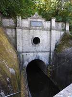
NAVIGATION TUNNEL WEILBURG/LAHN
It is quite a unique technical monument, the navigation tunnel inaugurated in 1847 and also the longest in Germany at 195 meters near WEILBURG/LAHN...
The Latin inscription above the north portal translates to:
 ADOLPH, DUKE OF NASSAU, PIERCED THROUGH THE BACK OF THE MOUNTAIN AND OPENED IT TO THE SHIPS... , here on 19.9.2018
NAVIGATION TUNNEL WEILBURG/LAHN It is quite a unique technical monument, the navigation tunnel inaugurated in 1847 and also the longest in Germany at 195 meters near WEILBURG/LAHN... The Latin inscription above the north portal translates to: "ADOLPH, DUKE OF NASSAU, PIERCED THROUGH THE BACK OF THE MOUNTAIN AND OPENED IT TO THE SHIPS...", here on 19.9.2018
Hans-Peter Kampmann

Deutschland / Hessen / Waldhessen

383 900x1200 Px, 19.09.2018

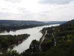
ROMANTIC MIDDLE RHINE VALLEY VIEW FROM THE ROLANDSBOGEN  
One of the most romantic viewpoints in the Middle Rhine Valley can be found at the  
ROLANDSBOGEN, high above ROLANDSECK, from where you can observe rail and ship traffic....on 28.8.2018...
ROMANTIC MIDDLE RHINE VALLEY VIEW FROM THE ROLANDSBOGEN One of the most romantic viewpoints in the Middle Rhine Valley can be found at the ROLANDSBOGEN, high above ROLANDSECK, from where you can observe rail and ship traffic....on 28.8.2018...
Hans-Peter Kampmann

Deutschland / Rheinland-Pfalz / Mittelrheintal

421 1200x900 Px, 30.08.2018

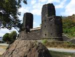
EAST PIER OF THE REMAGEN BRIDGE ON THE RHINE RIVER BANK NEAR ERPEL
The 335-meter-long  LUDENDORFF BRIDGE  over the RHINE at REMAGEN/ERPEL
was the last intact railway bridge at the end of World War II,
captured intact by the advancing American troops,
but collapsed a few days later due to overloading...
On the rock in the foreground, a memorial plaque commemorates these battles, but
also a reunion among friends in the 1990s... on 23.8.2018
EAST PIER OF THE REMAGEN BRIDGE ON THE RHINE RIVER BANK NEAR ERPEL The 335-meter-long "LUDENDORFF BRIDGE" over the RHINE at REMAGEN/ERPEL was the last intact railway bridge at the end of World War II, captured intact by the advancing American troops, but collapsed a few days later due to overloading... On the rock in the foreground, a memorial plaque commemorates these battles, but also a reunion among friends in the 1990s... on 23.8.2018
Hans-Peter Kampmann

Deutschland / Rheinland-Pfalz / Mittelrheintal

419 1200x900 Px, 26.08.2018

FASCINATION RHINE SIEBENGEBIRGE  
The NATURPARK SIEBENGEBIRGE near KÖNIGSWINTER/RHINE offers magnificent views,  
such as here the view from PETERSBERG to DRACHENFELS with DRACHENBURG and  
the Drachenfels ruins....on 21.8.2018 - No wonder that the famous English  
painter WILLIAM TURNER was fascinated by the grandeur of nature, the castle ruins, and the vine-covered slopes during his first Rhine trip in 1817....
FASCINATION RHINE SIEBENGEBIRGE The NATURPARK SIEBENGEBIRGE near KÖNIGSWINTER/RHINE offers magnificent views, such as here the view from PETERSBERG to DRACHENFELS with DRACHENBURG and the Drachenfels ruins....on 21.8.2018 - No wonder that the famous English painter WILLIAM TURNER was fascinated by the grandeur of nature, the castle ruins, and the vine-covered slopes during his first Rhine trip in 1817....
Hans-Peter Kampmann

Deutschland / Nordrhein-Westfalen / Region K�Bonn

508 1200x900 Px, 22.08.2018

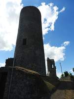
MERENBERG CASTLE RUINS /LIMBURG-WEILBURG DISTRICT/WESTERWALD
Mentioned in one of the earliest documents from 1129 as the possession of HARTRAD I., the eponymous town was even granted market rights in 1290... The ruins of a medieval hill castle above the small town dominate the landscape – from the keep, which can be climbed via a spiral staircase, there is a wonderful panoramic view over the Westerwald to the Lahn region... on 10.8.2018
MERENBERG CASTLE RUINS /LIMBURG-WEILBURG DISTRICT/WESTERWALD Mentioned in one of the earliest documents from 1129 as the possession of HARTRAD I., the eponymous town was even granted market rights in 1290... The ruins of a medieval hill castle above the small town dominate the landscape – from the keep, which can be climbed via a spiral staircase, there is a wonderful panoramic view over the Westerwald to the Lahn region... on 10.8.2018
Hans-Peter Kampmann

Deutschland / Hessen / Waldhessen

396 900x1200 Px, 10.08.2018

ON THE  KYRILL TRAIL  IN THE SIEGERLAND ROTHAAR MOUNTAINS  
Only a few minutes during the night of January 18 to 19, 2007, were enough for the hurricane KYRILL to transform a 100-year-old spruce stand with some beeches and Douglas firs in the SIEGEN-WITTGENSTEIN forestry district into a chaos of fallen trees, upturned root plates, and shattered trunks...  
In this forestry area alone, over 2.5 million trunks fell victim to the storm.  

It was decided to preserve the forest over an area of about 3 hectares exactly as the hurricane left it. Today, here on 12.7.2018, one can impressively experience and hike through how powerfully and vividly the development has progressed over 11 years solely through the force of nature... extremely impressive
ON THE "KYRILL TRAIL" IN THE SIEGERLAND ROTHAAR MOUNTAINS Only a few minutes during the night of January 18 to 19, 2007, were enough for the hurricane KYRILL to transform a 100-year-old spruce stand with some beeches and Douglas firs in the SIEGEN-WITTGENSTEIN forestry district into a chaos of fallen trees, upturned root plates, and shattered trunks... In this forestry area alone, over 2.5 million trunks fell victim to the storm. It was decided to preserve the forest over an area of about 3 hectares exactly as the hurricane left it. Today, here on 12.7.2018, one can impressively experience and hike through how powerfully and vividly the development has progressed over 11 years solely through the force of nature... extremely impressive
Hans-Peter Kampmann

Deutschland / Nordrhein-Westfalen / Siegerland

424 1200x900 Px, 13.07.2018

LAHN SOURCE IN THE SIEGERLAND ROTHAAR MOUNTAINS
Just as romantic as along its entire course until it flows into the RHINE at NIEDERLAHNSTEIN after 218 kilometers, the Lahn also reveals itself at its source in a spring pond in the Siegerland ROTHAAR MOUNTAINS, surrounded by pasturelands for grazing cattle...
only a few kilometers away are the sources of two other significant rivers, the SIEG and the EDER, here on 11.7.2018
LAHN SOURCE IN THE SIEGERLAND ROTHAAR MOUNTAINS Just as romantic as along its entire course until it flows into the RHINE at NIEDERLAHNSTEIN after 218 kilometers, the Lahn also reveals itself at its source in a spring pond in the Siegerland ROTHAAR MOUNTAINS, surrounded by pasturelands for grazing cattle... only a few kilometers away are the sources of two other significant rivers, the SIEG and the EDER, here on 11.7.2018
Hans-Peter Kampmann

Deutschland / Nordrhein-Westfalen / Siegerland

426 1200x900 Px, 11.07.2018

HIGH ABOVE THE SIEGTAL NEAR KIRCHEN - CITY OF THE YOUNG LOCOMOTIVES
On 10.7.2018, from the platform of the OTTOTURM, a newly built steel structure in 2010, 18.59 meters high, the view looks down into the Siegtal with KIRCHEN, the city of the JUNG LOCOMOTIVES exported worldwide...
Clearly visible are the workshop halls of the former locomotive forge, next to them the towers of the Catholic and Protestant churches with the mountain ranges of the Westerwald in the background....
HIGH ABOVE THE SIEGTAL NEAR KIRCHEN - CITY OF THE YOUNG LOCOMOTIVES On 10.7.2018, from the platform of the OTTOTURM, a newly built steel structure in 2010, 18.59 meters high, the view looks down into the Siegtal with KIRCHEN, the city of the JUNG LOCOMOTIVES exported worldwide... Clearly visible are the workshop halls of the former locomotive forge, next to them the towers of the Catholic and Protestant churches with the mountain ranges of the Westerwald in the background....
Hans-Peter Kampmann

Deutschland / Rheinland-Pfalz / Westerwald

416 1200x900 Px, 10.07.2018

AT THE BASALT CONE  DRUIDENSTEIN  IN THE WESTERWALD
At the basalt cone DRUIDENSTEIN, which solidified from LAVA about 20 million years ago,
near BETZDORF/KIRCHEN in the border area of Westerwald and Siegerland, 450 meters above
sea level and designated as a NATIONAL GEOTOP, there is a WAY OF THE CROSS with its
stations. The crucifixion group with Mary and John below the
basalt cone commemorates the biblical Passion story from 2000 years ago,
here on 23.6.2018...
AT THE BASALT CONE "DRUIDENSTEIN" IN THE WESTERWALD At the basalt cone DRUIDENSTEIN, which solidified from LAVA about 20 million years ago, near BETZDORF/KIRCHEN in the border area of Westerwald and Siegerland, 450 meters above sea level and designated as a NATIONAL GEOTOP, there is a WAY OF THE CROSS with its stations. The crucifixion group with Mary and John below the basalt cone commemorates the biblical Passion story from 2000 years ago, here on 23.6.2018...
Hans-Peter Kampmann

Deutschland / Rheinland-Pfalz / Westerwald

555 1200x900 Px, 02.07.2018

HIGH ABOVE THE SIEGTAL NEAR WINDECK-ROSBACH
High above the Siegtal near WINDECK-ROSBACH, the viewpoint  ALTER STUHL,  also a starting point for paragliders, offers a magnificent panoramic view over the SIEGTAL and the ridges of the WESTERWALD/BERGISCH LAND...
Down in the valley, the S-Bahn train COLOGNE-AU is just crossing the Sieg bridge - on 23.6.2018
HIGH ABOVE THE SIEGTAL NEAR WINDECK-ROSBACH High above the Siegtal near WINDECK-ROSBACH, the viewpoint "ALTER STUHL," also a starting point for paragliders, offers a magnificent panoramic view over the SIEGTAL and the ridges of the WESTERWALD/BERGISCH LAND... Down in the valley, the S-Bahn train COLOGNE-AU is just crossing the Sieg bridge - on 23.6.2018
Hans-Peter Kampmann

Deutschland / Nordrhein-Westfalen / Region K�Bonn

558 1200x900 Px, 29.06.2018

AT THE OBERNAU VALLEY DAM IN THE SIEGERLAND
Built from 1967-71, impounded from 1972... the dam, located on the southern foothills of the ROTHAAR MOUNTAINS near NETPHEN, primarily serves as the drinking water supply for an entire region.
From the hiking trail above, there are beautiful views, here on 23.5.2018
AT THE OBERNAU VALLEY DAM IN THE SIEGERLAND Built from 1967-71, impounded from 1972... the dam, located on the southern foothills of the ROTHAAR MOUNTAINS near NETPHEN, primarily serves as the drinking water supply for an entire region. From the hiking trail above, there are beautiful views, here on 23.5.2018
Hans-Peter Kampmann

Deutschland / Nordrhein-Westfalen / Siegerland

350 1200x900 Px, 23.05.2018

STORM ATMOSPHERE OVER THE FELDBERG/TAUNUS  
On the afternoon of May 20, 2018, there was a stormy atmosphere over the  Frankfurt local mountain,   
the Feldberg, which at 881 meters above sea level is the highest peak in the TAUNUS and one of the most distinctive  
mid-mountain summits in Germany....
STORM ATMOSPHERE OVER THE FELDBERG/TAUNUS On the afternoon of May 20, 2018, there was a stormy atmosphere over the "Frankfurt local mountain," the Feldberg, which at 881 meters above sea level is the highest peak in the TAUNUS and one of the most distinctive mid-mountain summits in Germany....
Hans-Peter Kampmann

Deutschland / Hessen / Frankfurt am Main

357 1200x900 Px, 20.05.2018

AT THE SOURCE OF THE SIEG IN THE ROTHAAR MOUNTAINS  
At this location in the SIEGERLÄNDER ROTHAAR MOUNTAINS above the village of WALPERSDORF  
lies the renatured source of the SIEG, restored in 2013, which flows for 155 km  
before emptying into the RHINE near MONDORF – just a few kilometers away is the  
source pond of the LAHN, the second significant river originating here...  
on 15.5.2018
AT THE SOURCE OF THE SIEG IN THE ROTHAAR MOUNTAINS At this location in the SIEGERLÄNDER ROTHAAR MOUNTAINS above the village of WALPERSDORF lies the renatured source of the SIEG, restored in 2013, which flows for 155 km before emptying into the RHINE near MONDORF – just a few kilometers away is the source pond of the LAHN, the second significant river originating here... on 15.5.2018
Hans-Peter Kampmann

Deutschland / Nordrhein-Westfalen / Siegerland

357 1200x900 Px, 17.05.2018

IN THE SIEGERLAND ROTHAAR MOUNTAINS - BETWEEN FOREST AND SKY
Dreamlike views unfold in the Siegerland ROTHAAR MOUNTAINS - here at the top lies
the source area of 3 significant rivers: SIEG-LAHN-EDER..
Down in the valley, in the small village of WALPERSDORF, the
CHARCOAL KILN still smokes, as it did centuries ago, to produce CHARCOAL....on 15.5.2018...
IN THE SIEGERLAND ROTHAAR MOUNTAINS - BETWEEN FOREST AND SKY Dreamlike views unfold in the Siegerland ROTHAAR MOUNTAINS - here at the top lies the source area of 3 significant rivers: SIEG-LAHN-EDER.. Down in the valley, in the small village of WALPERSDORF, the CHARCOAL KILN still smokes, as it did centuries ago, to produce CHARCOAL....on 15.5.2018...
Hans-Peter Kampmann

Deutschland / Nordrhein-Westfalen / Siegerland

335 1200x900 Px, 15.05.2018

UNDERPASS OF THE SIEG WITH A FERRY AT TROISDORF-BERGHEIM  
The Sieg has traveled almost 130 km from its source in the ROTHAAR MOUNTAINS until here at TROISDORF-BERGHEIM, just before its confluence with the RHINE, where it can actually be crossed by one of the last single-person ferries in Germany on a TOW-ROPE FERRY – the song by Chris de Burgh  Don’t pay the ferryman  really does not apply here, because with a river width of about 15 meters, the certainty of reaching the opposite riverbank is 100%... here on 3.5.2018
UNDERPASS OF THE SIEG WITH A FERRY AT TROISDORF-BERGHEIM The Sieg has traveled almost 130 km from its source in the ROTHAAR MOUNTAINS until here at TROISDORF-BERGHEIM, just before its confluence with the RHINE, where it can actually be crossed by one of the last single-person ferries in Germany on a TOW-ROPE FERRY – the song by Chris de Burgh "Don’t pay the ferryman" really does not apply here, because with a river width of about 15 meters, the certainty of reaching the opposite riverbank is 100%... here on 3.5.2018
Hans-Peter Kampmann

Deutschland / Nordrhein-Westfalen / Region K�Bonn

498 1200x900 Px, 03.05.2018

LAHN LANDSCAPE WITH WEIR AND MARBLE BRIDGE NEAR VILLMAR
Many dreamlike beautiful motifs can be found on the middle and lower course of the Lahn,
such as here the weir with the bridge built in 1893/94 from  LAHN MARBLE , polishable limestones...on 28.4.2018
LAHN LANDSCAPE WITH WEIR AND MARBLE BRIDGE NEAR VILLMAR Many dreamlike beautiful motifs can be found on the middle and lower course of the Lahn, such as here the weir with the bridge built in 1893/94 from "LAHN MARBLE", polishable limestones...on 28.4.2018
Hans-Peter Kampmann

Deutschland / Hessen / Waldhessen

395 1200x900 Px, 28.04.2018

SPRING IN THE SIEGTAL NEAR WINDECK/DATTENFELD (RHEIN-SIEG DISTRICT)
On a beautiful spring day, on April 15, 2018, the view from the ruins of the castle built in the 12th century and first destroyed during the Thirty Years' War,
WINDECK CASTLE, looks out over the Siegtal with the villages of WINDECK and DATTENFELD....
SPRING IN THE SIEGTAL NEAR WINDECK/DATTENFELD (RHEIN-SIEG DISTRICT) On a beautiful spring day, on April 15, 2018, the view from the ruins of the castle built in the 12th century and first destroyed during the Thirty Years' War, WINDECK CASTLE, looks out over the Siegtal with the villages of WINDECK and DATTENFELD....
Hans-Peter Kampmann

Deutschland / Nordrhein-Westfalen / Region K�Bonn

401 1200x900 Px, 15.04.2018

AT THE BREITENBACH DAM NEAR WAIGANDSHAIN/WW.  
With 11 ha, it is one of the smallest dams in the WESTERWALD, but its beautiful location between EMMERICHENHAIN and WAIGANDSHAIN, as well as its designation as a bird sanctuary with occurrences of ospreys, herons, mallards, coots, and great crested grebes, distinguish it... here on 30.3.2018....
AT THE BREITENBACH DAM NEAR WAIGANDSHAIN/WW. With 11 ha, it is one of the smallest dams in the WESTERWALD, but its beautiful location between EMMERICHENHAIN and WAIGANDSHAIN, as well as its designation as a bird sanctuary with occurrences of ospreys, herons, mallards, coots, and great crested grebes, distinguish it... here on 30.3.2018....
Hans-Peter Kampmann

Deutschland / Rheinland-Pfalz / Westerwald

438 1200x1200 Px, 31.03.2018

IN THE BASALT PARK NEAR BAD MARIENBERG/WESTERWALD
A visit to this decommissioned and recultivated quarry offers diverse insights into the volcanic activity of the region from 25 million years ago as well as basalt mining and its economic significance over the past centuries....
Numerous informative display panels along the circular trail highlight rare and protected animal and plant species such as KINGFISHER, COOT, PAINTED LADY, RED ADMIRAL, COLTSFOOT, or CORNFLOWER, to name just a few... a visit here on 30.3.2018 is truly impressive....
IN THE BASALT PARK NEAR BAD MARIENBERG/WESTERWALD A visit to this decommissioned and recultivated quarry offers diverse insights into the volcanic activity of the region from 25 million years ago as well as basalt mining and its economic significance over the past centuries.... Numerous informative display panels along the circular trail highlight rare and protected animal and plant species such as KINGFISHER, COOT, PAINTED LADY, RED ADMIRAL, COLTSFOOT, or CORNFLOWER, to name just a few... a visit here on 30.3.2018 is truly impressive....
Hans-Peter Kampmann

Deutschland / Rheinland-Pfalz / Westerwald

337 1200x1200 Px, 30.03.2018

IN THE HESSIAN MOUNTAIN REGION BETWEEN HERBORN AND WETZLAR WITH GREIFENSTEIN CASTLE RUINS
Between HERBORN and WETZLAR, on a ridge of the DILL-WESTERWALD,
lies the Greifenstein castle ruins, at 441 meters above sea level the highest
castle in the LAHN-DILL DISTRICT...on 19.3.2018
IN THE HESSIAN MOUNTAIN REGION BETWEEN HERBORN AND WETZLAR WITH GREIFENSTEIN CASTLE RUINS Between HERBORN and WETZLAR, on a ridge of the DILL-WESTERWALD, lies the Greifenstein castle ruins, at 441 meters above sea level the highest castle in the LAHN-DILL DISTRICT...on 19.3.2018
Hans-Peter Kampmann

Deutschland / Hessen / Marburg-Biedenkopf

381 1200x1177 Px, 19.03.2018

AT THE AARTAL RESERVOIR IN THE LAHN-DILL DISTRICT/HESSE
The Aartal Reservoir in the Hessian LAHN-DILL DISTRICT has been damming the AAR, a tributary of the DILL, in the GLADENBACH MOUNTAINS since 1991... here on 5.3.2018 the entire shoreline is still covered by a layer of ice......
AT THE AARTAL RESERVOIR IN THE LAHN-DILL DISTRICT/HESSE The Aartal Reservoir in the Hessian LAHN-DILL DISTRICT has been damming the AAR, a tributary of the DILL, in the GLADENBACH MOUNTAINS since 1991... here on 5.3.2018 the entire shoreline is still covered by a layer of ice......
Hans-Peter Kampmann

Deutschland / Hessen / Landkreis Gieߥn

396 1200x1200 Px, 05.03.2018

IN THE HIGH WESTERWALD
 ..over your heights the wind whistles so cold....  according to the motto of the old song
you can find numerous wind energy plants on the ridges of the WESTERWALD like
these near FRIEDEWALD, in fantastic photographic weather on 30.1.2018.....
IN THE HIGH WESTERWALD "..over your heights the wind whistles so cold...." according to the motto of the old song you can find numerous wind energy plants on the ridges of the WESTERWALD like these near FRIEDEWALD, in fantastic photographic weather on 30.1.2018.....
Hans-Peter Kampmann

Deutschland / Rheinland-Pfalz / Westerwald

437 1200x1200 Px, 30.01.2018

PANORAMIC VIEW OVER WESTERWALD/SIEGERLAND/BERGISCHES LAND FROM THE HEADFRAME TOWER
On a Westerwald high plateau near MALBERG/ALTENKIRCHEN DISTRICT stands the
former headframe tower of the lead-zinc ore mine in
BAD GRUND in the Harz, built here in 2013, now serving as an observation tower with beautiful panoramic views, on 7.1.2018
PANORAMIC VIEW OVER WESTERWALD/SIEGERLAND/BERGISCHES LAND FROM THE HEADFRAME TOWER On a Westerwald high plateau near MALBERG/ALTENKIRCHEN DISTRICT stands the former headframe tower of the lead-zinc ore mine in BAD GRUND in the Harz, built here in 2013, now serving as an observation tower with beautiful panoramic views, on 7.1.2018
Hans-Peter Kampmann

Deutschland / Rheinland-Pfalz / Westerwald

480 1200x1200 Px, 07.01.2018

VIEW OVER THE HIGH WESTERWALD
On November 14, 2017, the view from the observation tower on the GRÄBERSBERG near ALPENROD/HACHENBURG extends far into the HIGH WESTERWALD at 513 meters above sea level - the 73 m high tower has its viewing platform at 33 meters height - in clear weather, fantastic panoramic views are possible...
VIEW OVER THE HIGH WESTERWALD On November 14, 2017, the view from the observation tower on the GRÄBERSBERG near ALPENROD/HACHENBURG extends far into the HIGH WESTERWALD at 513 meters above sea level - the 73 m high tower has its viewing platform at 33 meters height - in clear weather, fantastic panoramic views are possible...
Hans-Peter Kampmann

Deutschland / Rheinland-Pfalz / Westerwald

420 1200x1200 Px, 14.11.2017