landschaftsfotos.eu Linie landschaftsfotos.eu
Hello guest, you are not logged in. Log in | Create account 
Forum   Contact   Legal notice
German English 

Landschaftsbilder, Landschaftsaufnahmen, Bilder von Landschaften from September 2016

Auf Landschaftsfotos.eu hochgeladene Bilder im September 2016:

2. September 2016 (2 Photos)

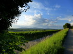
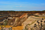
View from the Tuniberg to the Kaiserstuhl, Aug. 2016
rainer ullrich

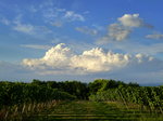
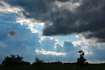
Thunderstorm clouds seen from Tuniberg, Aug. 2016
rainer ullrich

3. September 2016 (10 Photos)

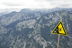
The Julian Alps as seen from Vogel in Slovenia. The mountains are not crooked, but the sign is. Photo taken on August 2, 2016.
Hans Christian Davidsen
Slowenien / Julischen Alpen / Gorenjska (Oberkrain)

486 1200x797 Px, 03.09.2016

Landscape at Mount Orlova Glava in Slovenia. Shot: August 2, 2016.
Hans Christian Davidsen

Slowenien / Julischen Alpen / Gorenjska (Oberkrain)

396 1200x797 Px, 03.09.2016

The mountain face of Studorski Orlić in Slovenia. Photo taken on August 2, 2016.
Hans Christian Davidsen

Slowenien / Julischen Alpen / Gorenjska (Oberkrain)

431 1200x797 Px, 03.09.2016

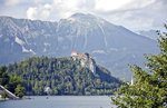
The mountains of Lake Bled (Slovene: Blejsko jezero) in Slovenia. Photo taken on August 1, 2016.
Hans Christian Davidsen
Slowenien / Julischen Alpen / Gorenjska (Oberkrain)

422 1200x780 Px, 03.09.2016

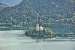
Lake Bled (Slovene: Blejsko jezero) near Bled. Photo taken on August 1, 2016.
Hans Christian Davidsen

Slowenien / Julischen Alpen / Gorenjska (Oberkrain)

410 1200x797 Px, 03.09.2016


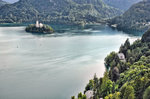
Lake Bled (Slovene: Blejsko jezero) as seen from the castle. Photo taken on August 1, 2016.
Hans Christian Davidsen

Slowenien / Julischen Alpen / Gorenjska (Oberkrain)

619 1200x799 Px, 03.09.2016

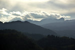
Clouds over the mountains near Bled in Slovenia. Photo taken on August 2, 2016.
Hans Christian Davidsen

Slowenien / Julischen Alpen / Gorenjska (Oberkrain)

379 1200x797 Px, 03.09.2016

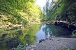
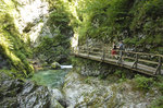
The Vintgar Gorge (Slovene: Blejski Vintgar) is located 4 kilometers northwest of Bled in Slovenia.
Hans Christian Davidsen

Slowenien / Julischen Alpen / Gorenjska (Oberkrain)

470 1200x797 Px, 03.09.2016

The Vintgar Gorge (Slovene: Blejski Vintgar) 4 kilometers northwest of Bled in Slovenia.
Hans Christian Davidsen

Slowenien / Julischen Alpen / Gorenjska (Oberkrain)

484 1200x797 Px, 03.09.2016

The Triglav massif in Slovenia as seen from Jasna. Photo taken on August 4, 2016.
Hans Christian Davidsen

Slowenien / Julischen Alpen / Gorenjska (Oberkrain)

443 1200x797 Px, 03.09.2016

4. September 2016 (10 Photos)

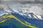
The mountains at the toll station of the Großglockner High Alpine Road north of Heiligenblut. Photo taken on August 5, 2016.
Hans Christian Davidsen
ֳterreich / K䲮ten / Drautal

406 1200x797 Px, 04.09.2016

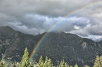
Rainbow and mountains at the Großglockner High Alpine Road north of Heiligenblut. Photo taken on August 5, 2016.
Hans Christian Davidsen
ֳterreich / K䲮ten / Drautal

386 1200x797 Px, 04.09.2016

Kreuzkopf and Ochenskopf north of Heiligenblut in Austria. Shot: August 5, 2016.
Hans Christian Davidsen

ֳterreich / K䲮ten / Drautal

404 1200x797 Px, 04.09.2016

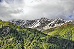
The Großglockner massif covered in clouds - viewed from the Großglockner High Alpine Road. Photo taken on August 5, 2016.
Hans Christian Davidsen
ֳterreich / K䲮ten / Drautal

404 1200x797 Px, 04.09.2016

Jöchlkopf and Hinterm Hap as seen from the Großglockner High Alpine Road. Photo taken on August 5, 2016.
Hans Christian Davidsen
ֳterreich / K䲮ten / Drautal

408 1200x797 Px, 04.09.2016

The Großglockner massif covered in clouds - viewed from the Großglockner High Alpine Road. Photo taken on August 5, 2016.
Hans Christian Davidsen
ֳterreich / K䲮ten / Drautal

380 1200x797 Px, 04.09.2016

View of Hofmannskees from Kaiser-Franz-Josef-Höhe north of Heiligenblut in Austria. Photo taken on August 5, 2016.
Hans Christian Davidsen
ֳterreich / K䲮ten / Drautal

371 1200x797 Px, 04.09.2016

View of the Pasterze from Kaiser-Franz-Josef-Höhe north of Heiligenblut in Austria. Photo taken on August 5, 2016.
Hans Christian Davidsen
ֳterreich / K䲮ten / Drautal

458 1200x797 Px, 04.09.2016

View of Glocknerkees from Kaiser-Franz-Josef-Höhe north of Heiligenblut in Austria. Photo taken on August 5, 2016.
Hans Christian Davidsen
ֳterreich / K䲮ten / Drautal

409 1200x797 Px, 04.09.2016

View of Kleinglocknerkees and Hofmannskees from Kaiser-Franz-Josef-Höhe north of Heiligenblut in Austria. Photo taken on August 5, 2016.
Hans Christian Davidsen

ֳterreich / K䲮ten / Drautal

408 1200x797 Px, 04.09.2016

5. September 2016 (20 Photos)

The landscape along the Großglockner High Alpine Road after a summer snowfall. Photo taken on August 5, 2016.
Hans Christian Davidsen
ֳterreich / K䲮ten / Drautal

437 1200x797 Px, 05.09.2016

Lipnica (2417 meters) in the Slovenian Triglav National Park as seen from the main road 201. Photo taken on August 4, 2016.
Hans Christian Davidsen
Slowenien / Julischen Alpen / Gorenjska (Oberkrain)

446 1200x797 Px, 05.09.2016

Johannisberg in the Hohe Tauern National Park in Austria. Photo taken on August 6, 2016.
Hans Christian Davidsen

ֳterreich / K䲮ten / Drautal

453 1200x797 Px, 05.09.2016

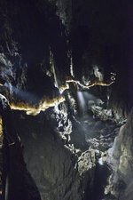
The Škocjan Caves represent a unique natural phenomenon created by the Reka River. The Reka originates at the foot of Snežnik and flows approximately 55 km above ground. When it reaches the Karst landscape of Kras, an area composed of limestone, it deepens its riverbed not only mechanically through erosion but also through corrosion by dissolving the limestone. The visitor path constructed for tourists leads through a part of the caves. Photo taken: July 28, 2016.
Hans Christian Davidsen
Slowenien / Divaca / Skocjan

553 1200x800 Px, 05.09.2016

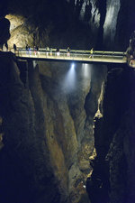
The Škocjan Caves are located in the Inner Carniola Karst region at an elevation of approximately 420 to 450 m. Rainwater and rivers dissolve the limestone. The largest chamber is the Martel Chamber, measuring 308 m in length, up to 146 m in height, and a maximum width of 123 m. It has a volume of 2.1 million m³. Photo taken: July 28, 2016.
Hans Christian Davidsen
Slowenien / Divaca / Skocjan

505 800x1200 Px, 05.09.2016

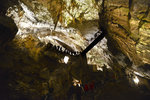
The Škocjan Caves are a cave system near the Slovenian town of Škocjan. In 1986, they were inscribed by UNESCO on the World Cultural and Natural Heritage list. Photo taken: August 28, 2016.
Hans Christian Davidsen
Slowenien / Divaca / Skocjan

821 800x1200 Px, 05.09.2016

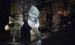
A complex of passages, galleries, and halls, a variety of karst phenomena, and easy access are the main reasons for the exceptional popularity and visitor numbers of the Postojna Cave, which has recorded 36 million visits in 200 years. Photo taken: July 27, 2016.
Hans Christian Davidsen
Slowenien / Primorsko-notranjska / Postojna

457 1200x800 Px, 05.09.2016

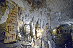
In the karst region of Postojna in Slovenia are the second largest show caves in the world accessible to tourists. The cave system of Postojna is the upper part of the karst-influenced catchment area of the Ljubljanica and has been formed by the Pivka, the main outflow of the Pivka basin, and its underground tributaries. Photo taken: July 27, 2016.
Hans Christian Davidsen
Slowenien / Primorsko-notranjska / Postojna

492 1200x733 Px, 05.09.2016

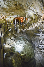
The Postojna Caves, Slovenian Postojnska jama (Italian Grotte di Postumia, German also Adelsberger Grotte), actually the entire Postojna Cave System (Postojnski jamski sistem), are located near the Slovenian town of Postojna. Dating of the sediments deposited in the cave system revealed an age of up to 0.9 million years<br>Photo taken: July 27, 2016.
The Postojna Caves, Slovenian Postojnska jama (Italian Grotte di Postumia, German also Adelsberger Grotte), actually the entire Postojna Cave System (Postojnski jamski sistem), are located near the Slovenian town of Postojna. Dating of the sediments deposited in the cave system revealed an age of up to 0.9 million years
Photo taken: July 27, 2016.

Hans Christian Davidsen
Slowenien / Primorsko-notranjska / Postojna

625 1200x800 Px, 05.09.2016

The Postojna cave system consists of three main levels – on the lowest one, the Pivka River still flows today. Connected to the Postojna Cave through the underground course of the Pivka are Pivka Jama, Otoska Jama, Magdalena Jama, Črna Jama, and Planinska Jama. Photo taken: July 27, 2016.
Hans Christian Davidsen
Slowenien / Primorsko-notranjska / Postojna

619 800x1200 Px, 05.09.2016

Piers in the harbor of Pataholm on Öland (06/13/2016)
Peter Reiser
Schweden / S�hweden (G�and) / ֬and

378 1200x900 Px, 05.09.2016

Lake near Alby on the island of Öland (13.06.2016)
Peter Reiser
Schweden / S�hweden (G�and) / ֬and

332 1200x900 Px, 05.09.2016

Meadows near Egby on Öland (06/13/2016)
Peter Reiser

Schweden / S�hweden (G�and) / ֬and

316 1200x900 Px, 05.09.2016

Meadows near Seby on Öland (06/13/2016)
Peter Reiser

Schweden / S�hweden (G�and) / ֬and

368 1200x900 Px, 05.09.2016

Barrow Cemetery at Gettlinge, Öland (13.06.2016)
Peter Reiser

Schweden / S�hweden (G�and) / ֬and

416 1200x900 Px, 05.09.2016

Lake by the road from Remyre to Katrineholm, Södermanland (14.06.2016)
Peter Reiser
Schweden / Mittelschweden (Svealand) / S�manland

323 1200x900 Px, 05.09.2016

Lake in the Eric's Castle Park, Södermanland (14.06.2016)
Peter Reiser
Schweden / Mittelschweden (Svealand) / S�manland

354 1200x900 Px, 05.09.2016

Lake at Ericsberg, Södermanland (14.06.2016)
Peter Reiser

Schweden / Mittelschweden (Svealand) / S�manland

340 1200x675 Px, 05.09.2016

Meadows near Floda, Södermanland (14.06.2016)
Peter Reiser

Schweden / Mittelschweden (Svealand) / S�manland

343 1200x900 Px, 05.09.2016

Rapeseed fields near Björsund, Södermanland (14.06.2016)
Peter Reiser

Schweden / Mittelschweden (Svealand) / S�manland

306 1200x900 Px, 05.09.2016

7. September 2016 (8 Photos)

View of the Eifel landscape southwest of Niederdürrenbach (district Ahrweiler) - 19.07.2016
Rolf Reinhardt
Deutschland / Rheinland-Pfalz / Landkreis Ahrweiler

417 1024x683 Px, 07.09.2016

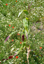
A single  stray  corn plant in a flower field near Euskirchen - 08/09/2016
A single "stray" corn plant in a flower field near Euskirchen - 08/09/2016
Rolf Reinhardt
Sun/cloud mix near Bad Münstereifel - 30.05.2016
Rolf Reinhardt

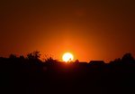
Sunset near Euskirchen - 16.08.2016
Rolf Reinhardt

Galerien / Stimmungsbilder / Sonnenunterg䮧e

460 1024x711 Px, 07.09.2016

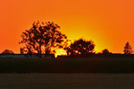
Sunset near Euskirchen - 16.08.2016
Rolf Reinhardt

Galerien / Stimmungsbilder / Sonnenunterg䮧e

489 1024x682 Px, 07.09.2016

Full moon over the Eifel on 16.08.2016
Rolf Reinhardt

Galerien / Stimmungsbilder / Mond

448 1024x710 Px, 07.09.2016

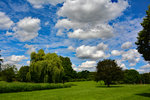
Summer clouds and trees in the Erft floodplain Euskirchen - 28.06.2016
Rolf Reinhardt

8. September 2016 (9 Photos)
The Škocjan Caves - The largest chamber is the Martel Chamber, measuring 308 m in length, up to 146 m in height, and a maximum width of 123 m. It has a volume of 2.1 million m³. Photo taken: July 28, 2016.
Hans Christian Davidsen
Slowenien / Divaca / Skocjan

717 1200x800 Px, 08.09.2016

The Škocjan Caves (Slovene: Škocjanske jame). The Škocjan Caves are located in the Inner Carniola Karst region at an elevation of about 420 to 450 m. Rainwater and rivers dissolve the limestone rock. This creates caves and sinkholes – large funnels in the landscape. Photo taken: July 28, 2016.
Hans Christian Davidsen
Slowenien / Divaca / Skocjan

941 1200x800 Px, 08.09.2016

In the Škocjan Caves (Slovene: Škocjanske jame). Photo taken: July 28, 2016.
Hans Christian Davidsen

Slowenien / Divaca / Skocjan

860 1200x800 Px, 08.09.2016

The Škocjan Caves were formed by the sinking river Reka in the limestone. In 1987, they were inscribed as a UNESCO World Natural Heritage site. The Škocjan Caves are considered the most beautiful underground caves in the Slovenian Karst. Photo taken: July 28, 2016.
Hans Christian Davidsen
Slowenien / Divaca / Skocjan

604 1200x800 Px, 08.09.2016

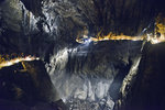
The Škocjan Caves - Due to their spacious chambers and the underground river gorge, the Škocjan Caves hold a very special place among the more than 8000 caves and grottos in Slovenia. Photo taken: July 28, 2016.
Hans Christian Davidsen
Slowenien / Divaca / Skocjan

635 1200x800 Px, 08.09.2016

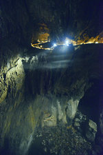
The Škocjan Caves in Slovenia - The Reka River flows through the canyon, turning northwest just before the Cerkvenik Bridge and continuing its course in the Hankek Channel. This is a 3.5 km long, 10–60 m wide, and over 140 m deep underground channel that was already explored at the end of the 19th century. Photo taken: July 28, 2016.
Hans Christian Davidsen
Slowenien / Divaca / Skocjan

961 1200x800 Px, 08.09.2016

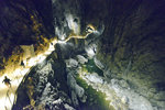
The Škocjan Caves in Slovenia - The Škocjan Caves represent a unique natural phenomenon created by the Reka River. The Reka originates at the foot of Snežnik and flows about 55 km above ground. When it reaches the Karst region Kras, an area composed of limestone, it deepens its riverbed not only mechanically through erosion but also through corrosion by dissolving the limestone. Photo taken: July 28, 2016.
Hans Christian Davidsen
Slowenien / Divaca / Skocjan

670 800x1200 Px, 08.09.2016

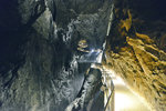
The Škocjan Caves in Slovenia - Archaeological research has proven that the caves and their surroundings have been inhabited since prehistoric times – from the Mesolithic, Neolithic, Bronze and Iron Ages through Antiquity and the Middle Ages – thus for over 5000 years. Photo taken: July 28, 2016.
Hans Christian Davidsen
Slowenien / Divaca / Skocjan

550 1200x800 Px, 08.09.2016

The Škocjan Caves in Slovenia are considered the most significant underground feature in the Kras karst landscape and among the most important caves in the world. The Reka River disappears beneath a rock face, above which lies the village of Škocjan, after which the caves (Škocjanske jame) are named. Photo taken: July 28, 2016.
Hans Christian Davidsen

Slowenien / Divaca / Skocjan

667 1200x800 Px, 08.09.2016

9. September 2016 (1 Image)

WESTERWALD LANDSCAPE NEAR GEMÜNDEN –  
located between RENNEROD and WESTERBURG with the Protestant collegiate church ST. SEVERUS.  
The small village has just 1200 inhabitants, but with the Protestant collegiate church  
St. Severus, the oldest church in the Westerwald, a jewel of a Romanesque  
pillar basilica, originally consecrated in 879 in the presence of King Ludwig III.,  
significant for the Christianization of the Westerwald, here on 9.9.2016...
WESTERWALD LANDSCAPE NEAR GEMÜNDEN – located between RENNEROD and WESTERBURG with the Protestant collegiate church ST. SEVERUS. The small village has just 1200 inhabitants, but with the Protestant collegiate church St. Severus, the oldest church in the Westerwald, a jewel of a Romanesque pillar basilica, originally consecrated in 879 in the presence of King Ludwig III., significant for the Christianization of the Westerwald, here on 9.9.2016...
Hans-Peter Kampmann

Deutschland / Rheinland-Pfalz / Westerwald

716 1200x900 Px, 09.09.2016

11. September 2016 (6 Photos)

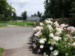
Meadows in the forest area Utrechtse Heuvelrug near Driebergen (20.08.2016)
Peter Reiser
Niederlande / Provinz Utrecht / Landschaften

373 1200x900 Px, 11.09.2016

Barneveld, Castle Park of Kasteel Jan van Schaffelaer (20.08.2016)
Peter Reiser

Niederlande / Gelderland / Landschaften

343 1200x900 Px, 11.09.2016

In the city park of Apeldoorn (20.08.2016)
Peter Reiser

Niederlande / Gelderland / Landschaften

336 1200x900 Px, 11.09.2016

On the Ijssel River in Olst-Wijhe (20.08.2016)
Peter Reiser

Niederlande / Overijssel / Landschaften

367 1200x900 Px, 11.09.2016

In the harbor of Huizen (21.08.2016)
Peter Reiser

Niederlande / Noord-Holland / Landschaften

398 1200x900 Px, 11.09.2016

Lake near Loosdrecht (21.08.2016)
Peter Reiser

Niederlande / Noord-Holland / Landschaften

398 1200x900 Px, 11.09.2016

12. September 2016 (2 Photos)

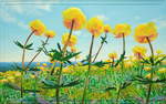
 Trollblumenweite , painting: oil on cotton + wood (no frame), 2016, 94 x 148 cm; view from the Feuerstein meadows near Schierke towards the eastern Harz mountain ranges...
"Trollblumenweite", painting: oil on cotton + wood (no frame), 2016, 94 x 148 cm; view from the Feuerstein meadows near Schierke towards the eastern Harz mountain ranges...
Fred Hahn

Galerien / Sonstiges / gemalte Bilder, Landschaftsmalerei

969 1200x759 Px, 12.09.2016

 Light Flower 4 (Blue Viper's Bugloss with Butterfly) , Painting: Oil on canvas, 2016, 80 x 120 cm;
"Light Flower 4 (Blue Viper's Bugloss with Butterfly)", Painting: Oil on canvas, 2016, 80 x 120 cm;
Fred Hahn

Galerien / Sonstiges / gemalte Bilder, Landschaftsmalerei

853 1200x801 Px, 12.09.2016

13. September 2016 (2 Photos)

Wave games, on July 22, 2016, at the beach of Dranske.
Mirko Schmidt
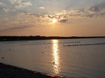
Sunset like in summer, on an official autumn day, on September 12, 2016, at the beach of Glowe.
Mirko Schmidt

16. September 2016 (5 Photos)

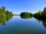
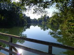
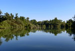
NSG Taubergießen on the Upper Rhine, Sept. 2016
rainer ullrich

NSG Taubergießen on the Upper Rhine, Sept. 2016
rainer ullrich

NSG Taubergießen on the Upper Rhine, Sept. 2016
rainer ullrich

NSG Taubergießen on the Upper Rhine, Sept. 2016
rainer ullrich

NSG Taubergießen on the Upper Rhine, Sept. 2016
rainer ullrich