
landschaftsfotos.eu Linie landschaftsfotos.eu
Hello guest, you are not logged in. Log in | Create account 
Forum   Contact   Legal notice
German English 

Graubünden/Grischun/Grigioni Landschaftsfotos (Landschaften, Natur und Ausblicke)
159 Photos
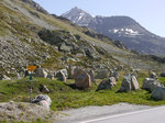
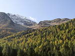
October 10, 2019, landscape along the railway line in the Bernina region.
Klaus-P. Dietrich

Switzerland / Canton of Graubünden / Bernina Region

335 1200x900 Px, 03.11.2019

Mountain landscape near Pontresina on October 10, 2019.
Klaus-P. Dietrich

Switzerland / Canton of Graubünden / Bernina Region

316 1200x900 Px, 03.11.2019

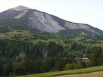
The landscape at Pontresina on October 10, 2019.
Klaus-P. Dietrich

Switzerland / Canton of Graubünden / Bernina Region

299 1200x900 Px, 03.11.2019

Snowfields at the Bernina Pass summit (22.06.2019)
Peter Reiser

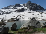
Ospizio Bernina and Lagh da la Cruseta at the Bernina Pass (22.06.2019)
Peter Reiser

Julier Pass (2284 m) with lake view towards Silvaplana; the European watershed runs along the pass summit: to the east the catchment area of Inn > Danube > Black Sea and to the west the catchment area of Geglia > Albula > Hinterrhein > Rhine > North Sea; Canton of Graubünden, Switzerland; 09.06.2014
Volkmar Döring

Tank barriers from around 1940 at the Julier Pass (2,284 m) between Bivio and Silvaplana; Canton of Graubünden, Switzerland; 09.06.2014
Volkmar Döring

Over the Julier Pass (2,284 m) runs the VEIA SURMIRANA (Oberhalbstein hiking trail); the stones come from the old tank barrier; Canton of Graubünden, Switzerland, 09.06.2014
Volkmar Döring

Julier Lake at the Julier Pass summit (2,284 m) between Bivio and Silvaplana; Canton of Graubünden, Switzerland, 09.06.2014
Volkmar Döring

Evening view over the Albula Valley towards Brienz/Brinzauls (northeast of Tiefencastel, Canton of Graubünden); This location is situated on the  Rutsch,  an old landslide area; 08.06.2014
Evening view over the Albula Valley towards Brienz/Brinzauls (northeast of Tiefencastel, Canton of Graubünden); This location is situated on the "Rutsch," an old landslide area; 08.06.2014
Volkmar Döring

Switzerland / Canton of Graubünden / Albula Region

506 1200x900 Px, 28.06.2016

View into the Albula Valley towards Filisur; Tiefencastel, 08.06.2014
Volkmar Döring

Switzerland / Canton of Graubünden / Albula Region

524 1200x900 Px, 27.06.2016

Tiefencastel in the Albula/Alvra region of the canton of Graubünden seen from the west; 08.06.2014
Volkmar Döring

Switzerland / Canton of Graubünden / Albula Region

642 1200x900 Px, 27.06.2016

Caumasee is located near Flims in the Swiss canton of Graubünden. The water is strikingly turquoise green - 02.09.2001
Olivier Monnet

The church of Davos Frauenkirch in May. (11.05.2014)
Hans-Gerd Seeliger

Switzerland / Canton of Graubünden / Region Davos

748 678x1024 Px, 26.05.2014

Bernina Group.

In the center of the image, brightly illuminated, you can see Piz Bernina (4049 m). The only 4000-meter peak in the Eastern Alps. Behind it, particularly dominant, you can see the slightly smaller Monte Disgrazia of the Bergell Alps in Italy.
Bernina Group. In the center of the image, brightly illuminated, you can see Piz Bernina (4049 m). The only 4000-meter peak in the Eastern Alps. Behind it, particularly dominant, you can see the slightly smaller Monte Disgrazia of the Bergell Alps in Italy.
Olli

Silvretta Massif.

The highest mountain Piz Linard (3411 m/peak in the shadow of clouds) is already located south of the glaciated watershed.
Silvretta Massif. The highest mountain Piz Linard (3411 m/peak in the shadow of clouds) is already located south of the glaciated watershed.
Olli

The Palü Glacier photographed from Alp Grüm on 02.07.12
Aaron Vollprecht

This path is closed due to  avalanche danger,  seen on a hike from Stugls to Latsch above Bergün. (13.03.2006)
This path is closed due to "avalanche danger," seen on a hike from Stugls to Latsch above Bergün. (13.03.2006)
Hans-Gerd Seeliger

Switzerland / Canton of Graubünden / Albula Region

854 1024x768 Px, 17.10.2012

Summer at the Bernina Pass, shortly before the summit. (Shot on 11.08.2012)
Hans-Gerd Seeliger

Switzerland / Canton of Graubünden / Bernina Region

885 1024x678 Px, 28.08.2012

Fantastic view shortly before the Bernina Pass summit. (Shot -from the train- on 11.08.2012)
Hans-Gerd Seeliger

Switzerland / Canton of Graubünden / Bernina Region

829 1024x678 Px, 26.08.2012

Along the hiking trail, a shady bench invites you to rest.  
(09/13/2011)
Along the hiking trail, a shady bench invites you to rest. (09/13/2011)
Christine Wohlfahrt

Switzerland / Canton of Graubünden / Engadin

765 1024x676 Px, 06.12.2011

Along the Inn River...  
(09/13/2011)
Along the Inn River... (09/13/2011)
Christine Wohlfahrt

Switzerland / Canton of Graubünden / Engadin

728 1024x686 Px, 06.12.2011

The Inn River in autumn mood near Susch.  
(13.09.2011)
The Inn River in autumn mood near Susch. (13.09.2011)
Christine Wohlfahrt

Switzerland / Canton of Graubünden / Engadin

779 1024x637 Px, 06.12.2011

A mountain stream among many in Graubünden.  
(11.09.2011)
A mountain stream among many in Graubünden. (11.09.2011)
Christine Wohlfahrt

Switzerland / Canton of Graubünden / Engadin

655 1024x774 Px, 07.11.2011