

landschaftsfotos.eu Linie landschaftsfotos.eu
Hello guest, you are not logged in. Log in | Create account 
Forum   Contact   Legal notice
German English 
Die Galerie zeigt Landschaftsaufnahmen aus dem Schweizer Kanton Graubünden mit Schwerpunkt auf das Engadin. Zu sehen sind Übersichten und Detailaufnahmen bekannter Orte wie St. Moritz sowie herbstliche Landschaften in Samnaun mit Blickrichtung Nordwesten. Mehrere Fotos dokumentieren die historische Eisenbrücke über den Inn bei Cinuos-chel-Brail aus dem Jahr 1897, einschließlich eines Gusschilds mit Herstellerangaben. Ein weiterer Fokus liegt auf Bahnreisen: Die Strecke der Albula Bahn von Thusis nach St. Moritz und die Bernina Bahn von St. Moritz nach Tirano werden mit verschiedenen Ansichten aus dem Zug gezeigt, darunter der Lago di Poschiavo, der Lago Bianco auf der Passhöhe, der Kehrviadukt und der Kreisviadukt bei Brusio. Es finden sich Motive aus dem Val Bregaglia bei Soglio mit Gletscherhorn, aus dem Münstertal bei Müstair und Lü, sowie aus dem Bergell Tal bei Promotogno. Weitere Aufnahmen zeigen das Engadin bei Zuoz, S-chanf mit alter Innbrücke, den Ofenpass, die Ofenpasshöhe, den Silser See mit Piz Fedoz, den Piz Kesch bei Celerina und den Piz Chapisun bei Lavin. EU label: AI-generated content
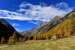
The Val Bever in the Engadin appeared especially beautiful on October 21, 2018, due to the autumnal coloration.
M. Schmid

Switzerland / Canton of Graubünden / Engadin

518 1200x810 Px, 31.03.2020

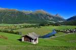
With the Inn River in the foreground, a photo was taken near Samedan in the Engadin on 03.09.2019.
M. Schmid

Switzerland / Canton of Graubünden / Engadin

305 1200x736 Px, 31.03.2020

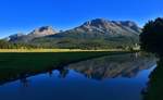
A clear summer day in the Engadin - view towards Pontresina and Bernina on 03.09.2019.
M. Schmid

Switzerland / Canton of Graubünden / Engadin

303 1200x790 Px, 30.03.2020

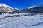
Celerina in the Engadin on 12.11.2016 - thanks to abundant fresh snow in the days before, the region showed its particularly beautiful side.
M. Schmid

Switzerland / Canton of Graubünden / Engadin

332 1200x781 Px, 30.03.2020

The Val Bever in the Engadin appeared especially beautiful on October 21, 2018, due to the autumnal coloration.
M. Schmid

Switzerland / Canton of Graubünden / Engadin

431 1200x800 Px, 30.03.2020

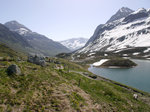
Julier Pass (2284 m) with lake view towards Silvaplana; the European watershed runs along the pass summit: to the east the catchment area of Inn > Danube > Black Sea and to the west the catchment area of Geglia > Albula > Hinterrhein > Rhine > North Sea; Canton of Graubünden, Switzerland; 09.06.2014
Volkmar Döring

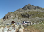
Tank barriers from around 1940 at the Julier Pass (2,284 m) between Bivio and Silvaplana; Canton of Graubünden, Switzerland; 09.06.2014
Volkmar Döring

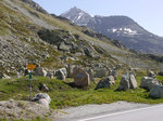
Over the Julier Pass (2,284 m) runs the VEIA SURMIRANA (Oberhalbstein hiking trail); the stones come from the old tank barrier; Canton of Graubünden, Switzerland, 09.06.2014
Volkmar Döring

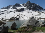
Julier Lake at the Julier Pass summit (2,284 m) between Bivio and Silvaplana; Canton of Graubünden, Switzerland, 09.06.2014
Volkmar Döring

Silvretta Massif.

The highest mountain Piz Linard (3411 m/peak in the shadow of clouds) is already located south of the glaciated watershed.
Silvretta Massif. The highest mountain Piz Linard (3411 m/peak in the shadow of clouds) is already located south of the glaciated watershed.
Olli

Along the hiking trail, a shady bench invites you to rest.  
(09/13/2011)
Along the hiking trail, a shady bench invites you to rest. (09/13/2011)
Christine Wohlfahrt

Switzerland / Canton of Graubünden / Engadin

762 1024x676 Px, 06.12.2011

Along the Inn River...  
(09/13/2011)
Along the Inn River... (09/13/2011)
Christine Wohlfahrt

Switzerland / Canton of Graubünden / Engadin

726 1024x686 Px, 06.12.2011

The Inn River in autumn mood near Susch.  
(13.09.2011)
The Inn River in autumn mood near Susch. (13.09.2011)
Christine Wohlfahrt

Switzerland / Canton of Graubünden / Engadin

777 1024x637 Px, 06.12.2011

A mountain stream among many in Graubünden.  
(11.09.2011)
A mountain stream among many in Graubünden. (11.09.2011)
Christine Wohlfahrt

Switzerland / Canton of Graubünden / Engadin

653 1024x774 Px, 07.11.2011

In Val Roseg during hike, October 12, 2010, 1:22 PM
Heinz Stoll

Switzerland / Canton of Graubünden / Engadin

1258  2 1024x683 Px, 04.08.2011

In Val Roseg during a hike, October 12, 2010, 2:44 PM
Heinz Stoll

Switzerland / Canton of Graubünden / Engadin

1140 1024x683 Px, 04.08.2011

At the beautiful Lake Staz, October 11, 2010, 1:25 PM
Heinz Stoll

Switzerland / Canton of Graubünden / Engadin

789 1024x780 Px, 04.08.2011

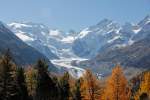
Morteratsch Glacier with Piz Palü and Piz Bernina. Shot from the moving train, shortly after the Montebello curve, October 15, 2010, 12:28
Heinz Stoll

Switzerland / Canton of Graubünden / Engadin

1374 1024x683 Px, 04.08.2011

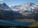
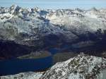
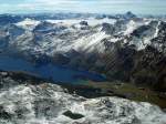
View of the freshly snow-covered mountain landscape. The village of Silvaplana is clearly visible. Shot from the cable car, October 15, 2009, 4:07 PM
Heinz Stoll

Switzerland / Canton of Graubünden / Engadin

936 1024x768 Px, 04.08.2011

View of the freshly snow-covered mountain landscape. The village of Silvaplana is clearly visible. Shot from Corvatsch, October 15, 2009, 3:45 PM
Heinz Stoll

Switzerland / Canton of Graubünden / Engadin

705 1024x768 Px, 04.08.2011

View of the freshly snow-covered mountain landscape. Corvatsch, Oct 15, 2009, 3:45 PM
Heinz Stoll

Switzerland / Canton of Graubünden / Engadin

947 1024x768 Px, 04.08.2011

Upper Engadin near La Punt (29.08.2010)
Peter Reiser

Switzerland / Canton of Graubünden / Engadin

804 1024x768 Px, 26.03.2011

Piz Chapisun 2931 m in the Upper Engadin near Lavin (22.08.2010)
Peter Reiser

Switzerland / Canton of Graubünden / Engadin

860 1024x768 Px, 26.03.2011

Engadin, Münstertal near LÜ (22.08.2010)
Peter Reiser

Switzerland / Canton of Graubünden / Engadin

1002 1024x768 Px, 26.03.2011