




Albula Landschaftsfotos (Landschaften, Natur und Ausblicke)
11 Photos
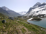
Julier Pass (2284 m) with lake view towards Silvaplana; the European watershed runs along the pass summit: to the east the catchment area of Inn > Danube > Black Sea and to the west the catchment area of Geglia > Albula > Hinterrhein > Rhine > North Sea; Canton of Graubünden, Switzerland; 09.06.2014
Volkmar Döring
Volkmar Döring
Switzerland / Canton of Graubünden / Engadin, Switzerland / Alpine passes / Julier Pass
609 1200x900 Px, 29.06.2016
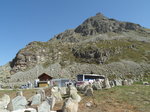
Tank barriers from around 1940 at the Julier Pass (2,284 m) between Bivio and Silvaplana; Canton of Graubünden, Switzerland; 09.06.2014
Volkmar Döring
Volkmar Döring
Switzerland / Canton of Graubünden / Engadin, Switzerland / Alpine passes / Julier Pass
637 1200x900 Px, 29.06.2016
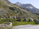
Over the Julier Pass (2,284 m) runs the VEIA SURMIRANA (Oberhalbstein hiking trail); the stones come from the old tank barrier; Canton of Graubünden, Switzerland, 09.06.2014
Volkmar Döring
Volkmar Döring
Switzerland / Canton of Graubünden / Engadin, Switzerland / Alpine passes / Julier Pass
650 1200x900 Px, 29.06.2016
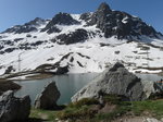
Julier Lake at the Julier Pass summit (2,284 m) between Bivio and Silvaplana; Canton of Graubünden, Switzerland, 09.06.2014
Volkmar Döring
Volkmar Döring
Switzerland / Canton of Graubünden / Engadin, Switzerland / Alpine passes / Julier Pass
661 1200x900 Px, 29.06.2016
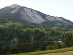
Evening view over the Albula Valley towards Brienz/Brinzauls (northeast of Tiefencastel, Canton of Graubünden); This location is situated on the "Rutsch," an old landslide area; 08.06.2014
Volkmar Döring
Volkmar Döring
Switzerland / Canton of Graubünden / Albula Region
506 1200x900 Px, 28.06.2016

Switzerland / Canton of Graubünden / Albula Region
524 1200x900 Px, 27.06.2016

Tiefencastel in the Albula/Alvra region of the canton of Graubünden seen from the west; 08.06.2014
Volkmar Döring
Volkmar Döring
Switzerland / Canton of Graubünden / Albula Region
640 1200x900 Px, 27.06.2016
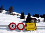
This path is closed due to "avalanche danger," seen on a hike from Stugls to Latsch above Bergün. (13.03.2006)
Hans-Gerd Seeliger
Hans-Gerd Seeliger
Switzerland / Canton of Graubünden / Albula Region
852 1024x768 Px, 17.10.2012