
landschaftsfotos.eu Linie landschaftsfotos.eu
Hello guest, you are not logged in. Log in | Create account 
Forum   Contact   Legal notice
German English 

Deutschland Landschaftsfotos (Landschaften, Natur und Ausblicke)
17170 Photos
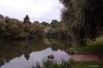
The Main River at Nedensdorf (ferry service to the opposite bank is still operated here) 02.09.2007
Thomas Fischer_Lif

Main view of the Trimeusel from Nedensdorf. 02.09.2007 (The main river's slip-off slope at the Trimensel is probably the most impressive Lias outcrop in northern Bavaria. Here, the thickest development of the Posidonia Shale in all of northern Bavaria can be found. Distinctive stratigraphic units are the Monotis bed and the THEODORIS dinosaur layer. The outcrop is known as a fossil site; however, collecting is prohibited according to the Bavarian Geological Survey.)
Thomas Fischer_Lif

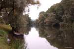
Main dock in Nedensdorf for the ferryman. (but he was resting today on Sunday) 02.09.2007
Thomas Fischer_Lif

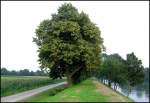
On the way along the Kolkerhofweg between Mülheim-Ruhr and Duisburg (view towards Mülheim, Raffelberg lock and power plant). On the right side of the image, the shipping canal can be seen, which is diverted from the Ruhr at the level of the Mülheim harbor area and reintroduced into the Ruhr at Werthacker (Duisburg). The river itself flows a bit further north in a curve.
Marina Frintrop

Germany / North Rhine-Westphalia / Ruhr area

1422  1 800x553 Px, 26.08.2007

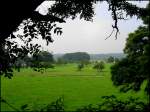
View of the Ruhr floodplains between Essen-Kettwig and Mülheim-Mintard (at the level of Hugenpoet Castle)
Marina Frintrop

Germany / North Rhine-Westphalia / Ruhr area

932 800x601 Px, 26.08.2007

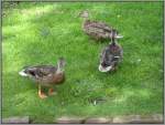
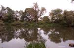
Ducks in Düsseldorf Ständehauspark. (07/08/2007)
Thomas Schmidt

Impressions from the Duisburg-Meiderich harbor area
Marina Frintrop

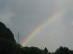
High-voltage pylons and rainbow.
Urban Stegmüller

Galleries / Weather phenomena / Rainbow

747 800x600 Px, 20.08.2007

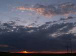
Around 8:30 PM in Grefrath. The sun is slowly setting and night is falling. The photo was taken on 17.08.2007.
Martin Kramer

Germany / North Rhine-Westphalia / Lower Rhine

1227 800x600 Px, 19.08.2007

View of Orsoy over this year's Rhine flood. The photo was taken on 14.08.2007.
Martin Kramer

Germany / North Rhine-Westphalia / Lower Rhine

1396 800x600 Px, 14.08.2007

View from Orsoy across the Rhine to Voerde. The building in the background is the coal-fired power plant in Voerde. The photo was taken on 13.08.2007.
Martin Kramer

Germany / North Rhine-Westphalia / Lower Rhine

1352 800x551 Px, 14.08.2007

Once again, a slightly different view of the Rhine.
Thomas Weicherding

View of the Loreley rock from Urbar.
Thomas Weicherding

A different perspective on the Rhine and a sandbank.
Thomas Weicherding

View of the Rhine Valley from the shore in St. Goar.
Thomas Weicherding

View towards St. Goarshausen.
Thomas Weicherding

View towards St. Goarshausen with castle.
Thomas Weicherding

As always, busy ship traffic in the Middle Rhine Valley near St. Goarshausen.
Thomas Weicherding

The Oybin in rather uninspiring weather, 11.08.07
Kai Gläßer

Germany / Saxony / Zittau Mountains

1235 800x600 Px, 13.08.2007

View of the Rhine Valley from the shore in Bararach. Summer 2005.
Thomas Weicherding

View of the Rhine Valley towards St. Goarshausen from a viewpoint opposite the Loreley. Summer 2005.
Thomas Weicherding

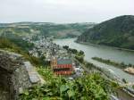
View over the Rhine Valley and the town of Oberwesel from a castle. Summer 2005.
Thomas Weicherding