
landschaftsfotos.eu Linie landschaftsfotos.eu
Hello guest, you are not logged in. Log in | Create account 
Forum   Contact   Legal notice
German English 

Photos by Volkmar Döring

195 Photos
This was the first act and the second... Here a beaver has worked successfully; on the Elbe near Geesthacht, 31.12.2019
Volkmar Döring

Lake Schaalsee between Seedorf and Salem-Dargow; view from the bridge over the Schaalsee Canal coming from Lake Phul; 23.08.2017
Volkmar Döring

Germany / Schleswig-Holstein / Duchy of Lauenburg

495 1200x675 Px, 02.09.2017

The Deutsche Bosel near Meißen as seen from the Elbe Cycle Route; 10.04.2017
Volkmar Döring

Germany / Saxony / Dresden Elbe Valley

639 1200x675 Px, 20.04.2017

Anyone who has not been there until now can no longer do so: This famous viewing platform in the Saxon Switzerland on the Bastei,  Saxony's Balcony , about 200 meters above the Elbe, remains permanently closed for safety reasons; a renovation of the rock nose is not possible. Discussions are already underway about the construction of a skywalk and a large observation tower; photo taken on 12.06.2009
Anyone who has not been there until now can no longer do so: This famous viewing platform in the Saxon Switzerland on the Bastei, "Saxony's Balcony", about 200 meters above the Elbe, remains permanently closed for safety reasons; a renovation of the rock nose is not possible. Discussions are already underway about the construction of a skywalk and a large observation tower; photo taken on 12.06.2009
Volkmar Döring

Germany / Saxony / Saxon Switzerland

534 1200x900 Px, 07.02.2017

There is no longer any way to get there. This famous viewing platform in the Saxon Switzerland on the Bastei,  Saxony's Balcony,  about 200 meters above the Elbe, remains permanently closed for safety reasons; renovation of the rock outcrop is not possible. Discussions are already underway about the construction of a skywalk and a large observation tower; photo taken on 12.06.2009
There is no longer any way to get there. This famous viewing platform in the Saxon Switzerland on the Bastei, "Saxony's Balcony," about 200 meters above the Elbe, remains permanently closed for safety reasons; renovation of the rock outcrop is not possible. Discussions are already underway about the construction of a skywalk and a large observation tower; photo taken on 12.06.2009
Volkmar Döring

Germany / Saxony / Saxon Switzerland

672  1 1200x900 Px, 07.02.2017

View of the market town of Rauris with Hochalmbahn; Salzburg region, Zell am See district; 21.07.2016
Volkmar Döring

Austria / Salzburg / Zell am See

644 1200x901 Px, 31.07.2016

Simplon Hospice of the Augustinian Canons of the Great St. Bernard on the Simplon Pass, the building was originally ordered by Napoleon Bonaparte in 1801 as a barracks; 10.06.2014
Volkmar Döring

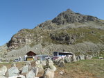
Mountain pass road Simplon Pass summit (2005 m) with hotel and restaurant MONTE LEONE; 10.06.2014
Volkmar Döring

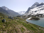
Mountain panorama at the Simplon Pass summit (2005 m); 10.06.2014
Volkmar Döring

Snow-covered peaks in the background and blooming spurred pansies / long-spurred violets (Viola calcarata) in the foreground; Simplon Pass summit; 10.06.2014
Volkmar Döring

Mountain panorama at the Simplon Pass summit (2005 m); 10.06.2014
Volkmar Döring

Mountain meadow with blooming spurred pansies / long-spurred violets (Viola calcarata) at the Simplon Pass summit (2,005 m) with snow-covered mountains in the background; 10.06.2014
Volkmar Döring

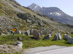
Simplon Pass with road signpost, left to Gondo and further to Domodossola (Italy), right to Brig (Switzerland); 10.06.2014
Volkmar Döring

Eagle made of stone as a monument to the Mountain Brigade 11 on the occasion of the border occupation during the Second World War (1939-1945) at the summit of the Simplon Pass in the canton of Valais / Wallis (Switzerland), pedestal inscription:  IN THE FREEDOM OF THE MOUNTAINS IT STANDS, A MASSIVE MONUMENT OF HARD GRANITE: A REMEMBRANCE OF FAITHFUL DUTY, A LASTING WARNING TO BE WILLING AND ALERT FOR OUR FREEDOM ; viewed from the pass road, 10.06.2014
Eagle made of stone as a monument to the Mountain Brigade 11 on the occasion of the border occupation during the Second World War (1939-1945) at the summit of the Simplon Pass in the canton of Valais / Wallis (Switzerland), pedestal inscription: "IN THE FREEDOM OF THE MOUNTAINS IT STANDS, A MASSIVE MONUMENT OF HARD GRANITE: A REMEMBRANCE OF FAITHFUL DUTY, A LASTING WARNING TO BE WILLING AND ALERT FOR OUR FREEDOM"; viewed from the pass road, 10.06.2014
Volkmar Döring

Valais Alps seen from the Simplon Pass road; 10.06.2014
Volkmar Döring

The road between Simplon Pass (2,005 m) and Brig (684 m) is secured with an avalanche gallery/avalanche protection structure; 10.06.2014
Volkmar Döring

Julier Pass (2284 m) with lake view towards Silvaplana; the European watershed runs along the pass summit: to the east the catchment area of Inn > Danube > Black Sea and to the west the catchment area of Geglia > Albula > Hinterrhein > Rhine > North Sea; Canton of Graubünden, Switzerland; 09.06.2014
Volkmar Döring

Tank barriers from around 1940 at the Julier Pass (2,284 m) between Bivio and Silvaplana; Canton of Graubünden, Switzerland; 09.06.2014
Volkmar Döring

Over the Julier Pass (2,284 m) runs the VEIA SURMIRANA (Oberhalbstein hiking trail); the stones come from the old tank barrier; Canton of Graubünden, Switzerland, 09.06.2014
Volkmar Döring

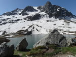
Julier Lake at the Julier Pass summit (2,284 m) between Bivio and Silvaplana; Canton of Graubünden, Switzerland, 09.06.2014
Volkmar Döring

Evening view over the Albula Valley towards Brienz/Brinzauls (northeast of Tiefencastel, Canton of Graubünden); This location is situated on the  Rutsch,  an old landslide area; 08.06.2014
Evening view over the Albula Valley towards Brienz/Brinzauls (northeast of Tiefencastel, Canton of Graubünden); This location is situated on the "Rutsch," an old landslide area; 08.06.2014
Volkmar Döring

Switzerland / Canton of Graubünden / Albula Region

508 1200x900 Px, 28.06.2016

View into the Albula Valley towards Filisur; Tiefencastel, 08.06.2014
Volkmar Döring

Switzerland / Canton of Graubünden / Albula Region

526 1200x900 Px, 27.06.2016

Tiefencastel in the Albula/Alvra region of the canton of Graubünden seen from the west; 08.06.2014
Volkmar Döring

Switzerland / Canton of Graubünden / Albula Region

643 1200x900 Px, 27.06.2016

View from the Bastei viewing platform, 194 m above the Elbe, (Saxon Switzerland) looking upstream over the spa town of Rathen towards the Bohemian Central Uplands; 01.04.2012
Volkmar Döring

Germany / Saxony / Saxon Switzerland

568 1200x900 Px, 25.06.2016