landschaftsfotos.eu Linie landschaftsfotos.eu
Hello guest, you are not logged in. Log in | Create account 
Forum   Contact   Legal notice
German English 

Photos by Hans Christian Davidsen
4155 Photos
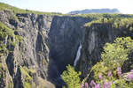
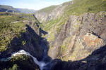
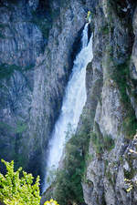
Vøringsfossen as seen from the main road Rv7. The waterfall is located on the western edge of the Hardangervidda in Eidfjord. The total drop is 183 meters, with the longest free-fall section of the water being 145 meters. Photo taken on July 7, 2018.
Hans Christian Davidsen

Norway / Westland / Hardanger

413 800x1200 Px, 25.07.2018

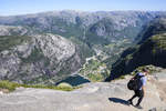
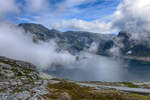
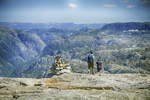
On the hiking trail to Kjeragbolten in the Norwegian municipality of Forsand (Rogaland County) at the Lysefjord. The village of Lysebotn can be seen in the mountain valley. Photo taken: July 3, 2018.
Hans Christian Davidsen

Norway / Southland / Rogaland

321 1200x800 Px, 25.07.2018

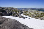
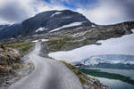
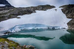
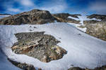
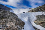
Snow in summer. Photo from the hiking trail to Kjeragbolten. Kjerag or Kiragg is a rock plateau in the Norwegian municipality of Forsand (Rogaland County) on the Lysefjord.  
Shot: July 3, 2018.
Snow in summer. Photo from the hiking trail to Kjeragbolten. Kjerag or Kiragg is a rock plateau in the Norwegian municipality of Forsand (Rogaland County) on the Lysefjord. Shot: July 3, 2018.
Hans Christian Davidsen

Norway / Southland / Rogaland

341 1200x800 Px, 25.07.2018

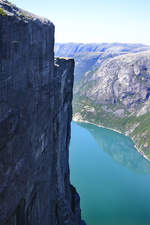
View from Kjeragbolten over the Lysefjord in the Norwegian municipality of Forsand (Rogaland County).  
Photo taken on July 3, 2018.
View from Kjeragbolten over the Lysefjord in the Norwegian municipality of Forsand (Rogaland County). Photo taken on July 3, 2018.
Hans Christian Davidsen

Norway / Southland / Rogaland

318 800x1200 Px, 25.07.2018

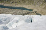
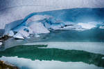
View of Jukladalsvatnet north of the Folgefonna glacier in Norway. Photo taken on July 6, 2018.
Hans Christian Davidsen

Norway / Westland / Hordaland

468 1200x800 Px, 25.07.2018

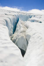
On the Folgefonna Glacier in Norway. The glacier is located in the high mountain region of the Folgefonna Peninsula between Sørfjord in the east, Åkrafjord in the south, and Hardangerfjord in the west.
Photo taken: July 6, 2018.
On the Folgefonna Glacier in Norway. The glacier is located in the high mountain region of the Folgefonna Peninsula between Sørfjord in the east, Åkrafjord in the south, and Hardangerfjord in the west. Photo taken: July 6, 2018.
Hans Christian Davidsen

Norway / Westland / Hordaland

422 800x1200 Px, 25.07.2018

On the Folgefonna Glacier in Norway. Since April 29, 2005, Folgefonna has been the 25th national park in Norway. Both the glacier and a large part of the surrounding landscape are now protected.
Photo taken: July 6, 2018.
On the Folgefonna Glacier in Norway. Since April 29, 2005, Folgefonna has been the 25th national park in Norway. Both the glacier and a large part of the surrounding landscape are now protected. Photo taken: July 6, 2018.
Hans Christian Davidsen

Norway / Westland / Hordaland

444 1200x800 Px, 25.07.2018

Vøringsfossen as seen from the main road Rv7. The waterfall is located on the western edge of the Hardangervidda in Eidfjord. The small river Bjoreio, along which Vøringsfossen lies, is dammed above the waterfall in the Sysendalen valley by the Sysen Dam and used for hydroelectric power production. The water volume is therefore limited, but for tourism reasons, it is increased in summer from June 1 to September 15 to about 12 m³ per second, which corresponds approximately to the natural flow rate.  
Shot: July 7, 2018.
Vøringsfossen as seen from the main road Rv7. The waterfall is located on the western edge of the Hardangervidda in Eidfjord. The small river Bjoreio, along which Vøringsfossen lies, is dammed above the waterfall in the Sysendalen valley by the Sysen Dam and used for hydroelectric power production. The water volume is therefore limited, but for tourism reasons, it is increased in summer from June 1 to September 15 to about 12 m³ per second, which corresponds approximately to the natural flow rate. Shot: July 7, 2018.
Hans Christian Davidsen

Norway / Westland / Hardanger

465 1200x800 Px, 25.07.2018

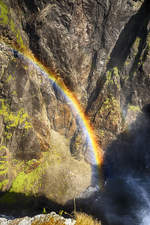
Rainbow at the Vøringsfossen waterfall in Norway's Hardanger region.  
Shot: July 7, 2018.
Rainbow at the Vøringsfossen waterfall in Norway's Hardanger region. Shot: July 7, 2018.
Hans Christian Davidsen

Norway / Westland / Hardanger

339 800x1200 Px, 25.07.2018

Vøringsfossen as seen from the parking lot at the Fossil Hotel. The water volume can exceed 150 cubic meters per second during the spring snowmelt. In 1980, the river was regulated for hydroelectric power generation, resulting in significant amounts of water no longer being visible.  
Shot: July 7
Vøringsfossen as seen from the parking lot at the Fossil Hotel. The water volume can exceed 150 cubic meters per second during the spring snowmelt. In 1980, the river was regulated for hydroelectric power generation, resulting in significant amounts of water no longer being visible. Shot: July 7
Hans Christian Davidsen

Norway / Westland / Hardanger

373 1200x800 Px, 25.07.2018

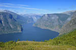
View of the Aurlandsfjord in Norway from the hiking trail to Prest. Photo taken on July 14, 2018.
Hans Christian Davidsen

Norway / Westland / Sogn and Fjordane

331 1200x800 Px, 24.07.2018

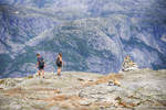
The challenging hiking route to Kjerag at the Norwegian Lysefjord crosses several mountain ridges. Photo taken on July 3, 2018.
Hans Christian Davidsen

Norway / Southland / Rogaland

315 1200x800 Px, 24.07.2018

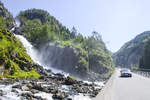
The twin waterfall Låtefoss (Oddadalen, Norway) with a drop of 165 meters is easily accessible from the RV 13 road. Photo taken: July 5, 2018.
Hans Christian Davidsen

Norway / Westland / Hordaland

425 1200x800 Px, 24.07.2018

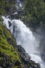
Låtefossen is a touristically significant twin waterfall with a total drop of 165 meters. It is located in the Norwegian province (Fylke) of Hordaland, about 20 kilometers south of Odda, directly on the main highway 13 opposite the slopes of the Folgefonna glacier. It forms a western outlet of the Hardangervidda. Photo taken: July 5, 2018.
Hans Christian Davidsen

Norway / Westland / Hordaland

382 800x1200 Px, 24.07.2018

Dravdalsvatnet in Folgefonni National Park in the Norwegian region of Hardanger. Photo taken on July 6, 2018.
Hans Christian Davidsen

Norway / Westland / Hordaland

375 1200x800 Px, 24.07.2018

Folgefonnavegen between Jondal and Folgefonna Ski Resort in the Norwegian region of Hardanger.  
Shot: July 6, 2018.
Folgefonnavegen between Jondal and Folgefonna Ski Resort in the Norwegian region of Hardanger. Shot: July 6, 2018.
Hans Christian Davidsen

Norway / Westland / Hordaland

435 1200x800 Px, 24.07.2018

The lower part of the Folgefonna glacier at Mosevatnet in the Norwegian region of Hardanger. July 6, 2018.
Hans Christian Davidsen

Norway / Westland / Hordaland

380 1200x800 Px, 24.07.2018

The Folgefonna (also Folgefonni) is, with a total area of around 214 km², the third largest glacier in Norway after the Jostedalsbreen and the Svartisen. The glacier is divided into the northern Folgefonna (25 km²), the middle Folgefonna (9 km²), and the southern Folgefonna (180 km²), with the highest point at 1,662 m above sea level and the lowest at 400 m above sea level. Photo taken: July 6, 2018.
Hans Christian Davidsen

Norway / Westland / Hordaland

362 1200x800 Px, 24.07.2018

The Folgefonna (also called Folgefonni) is the third largest mainland glacier in Norway (after Jostedalsbreen and Svartisen). The Summer Ski Center Fonna is located on the western part of the Folgefonna Glacier.  
Photo taken: July 6, 2018.
The Folgefonna (also called Folgefonni) is the third largest mainland glacier in Norway (after Jostedalsbreen and Svartisen). The Summer Ski Center Fonna is located on the western part of the Folgefonna Glacier. Photo taken: July 6, 2018.
Hans Christian Davidsen

Norway / Westland / Hordaland

572 1200x800 Px, 24.07.2018

The lower part of the Folgefonna glacier at Mosevatnet in the Norwegian region of Hardanger. July 6, 2018.
Hans Christian Davidsen

Norway / Westland / Hordaland

358 1200x800 Px, 24.07.2018

Kjerag or Kiragg is a rock plateau in the Norwegian municipality of Forsand (Rogaland County) on the Lysefjord. Along the route, in addition to the actual ascent, two mountains and two valleys must be crossed.  
Photo taken: July 3, 2018.
Kjerag or Kiragg is a rock plateau in the Norwegian municipality of Forsand (Rogaland County) on the Lysefjord. Along the route, in addition to the actual ascent, two mountains and two valleys must be crossed. Photo taken: July 3, 2018.
Hans Christian Davidsen

Norway / Southland / Rogaland

330 1200x800 Px, 23.07.2018

Kjerag or Kiragg is a rock plateau in the Norwegian municipality of Forsand (Rogaland County) on the Lysefjord. The highest point of the plateau is at approximately 1020 meters above sea level.  
Photo taken: July 3, 2018.
Kjerag or Kiragg is a rock plateau in the Norwegian municipality of Forsand (Rogaland County) on the Lysefjord. The highest point of the plateau is at approximately 1020 meters above sea level. Photo taken: July 3, 2018.
Hans Christian Davidsen

Norway / Southland / Rogaland

357 1200x800 Px, 23.07.2018

The hiking trail to Kjerag in Norway starts at Øygardstølen, a restaurant 640 m above Lysebotn. From there, the trail leads in about 2.5 hours through partly challenging terrain to Kjerag; the return route follows the same path and takes roughly the same amount of time. The trail is secured with iron chains in some sections.  
Photo taken: July 3, 2018.
The hiking trail to Kjerag in Norway starts at Øygardstølen, a restaurant 640 m above Lysebotn. From there, the trail leads in about 2.5 hours through partly challenging terrain to Kjerag; the return route follows the same path and takes roughly the same amount of time. The trail is secured with iron chains in some sections. Photo taken: July 3, 2018.
Hans Christian Davidsen

Norway / Southland / Rogaland

353 1200x800 Px, 23.07.2018

The challenging hiking route to Kjeragbolten crosses several mountain ridges. The route in southwestern Norway has an elevation difference of 460 meters.  
Shot: July 3, 2018.
The challenging hiking route to Kjeragbolten crosses several mountain ridges. The route in southwestern Norway has an elevation difference of 460 meters. Shot: July 3, 2018.
Hans Christian Davidsen

Norway / Southland / Rogaland

298 1200x800 Px, 23.07.2018