landschaftsfotos.eu Linie landschaftsfotos.eu
Hello guest, you are not logged in. Log in | Create account 
Forum   Contact   Legal notice
German English 

Photos by Hans Christian Davidsen
4155 Photos
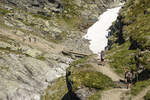
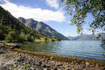
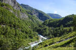
Landscape along the Flåm Railway (Norway). Shot: July 13, 2018.
Hans Christian Davidsen

Norway / Westland / Sogn and Fjordane

306 1200x800 Px, 28.07.2018

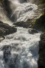
The Kjosfossen waterfall is a legendary waterfall in Norway. It belongs to the municipality of Aurland in the province of Sogn og Fjordane and is located directly on the Flåm Railway. In 1951, a stop was built near the waterfall so that travelers could leave the train to visit the waterfall. The stop is about four kilometers from the Myrdal station at an altitude of 670 meters above sea level.  
Shot: July 13, 2018.
The Kjosfossen waterfall is a legendary waterfall in Norway. It belongs to the municipality of Aurland in the province of Sogn og Fjordane and is located directly on the Flåm Railway. In 1951, a stop was built near the waterfall so that travelers could leave the train to visit the waterfall. The stop is about four kilometers from the Myrdal station at an altitude of 670 meters above sea level. Shot: July 13, 2018.
Hans Christian Davidsen

Norway / Westland / Sogn and Fjordane

410 800x1200 Px, 28.07.2018

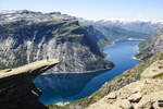
Trolltunga (Norwegian for  The Troll's Tongue ) is a horizontal rock formation in Norway, located about ten kilometers northeast of Odda on the Sørfjord. This rock is a roughly 10-meter-long ledge that tapers from a height of five meters at its base to just a few centimeters at the tip. The rock formation is situated approximately 700 meters above the lake Ringedalsvatnet.  
Photo taken: July 8, 2018.
Trolltunga (Norwegian for "The Troll's Tongue") is a horizontal rock formation in Norway, located about ten kilometers northeast of Odda on the Sørfjord. This rock is a roughly 10-meter-long ledge that tapers from a height of five meters at its base to just a few centimeters at the tip. The rock formation is situated approximately 700 meters above the lake Ringedalsvatnet. Photo taken: July 8, 2018.
Hans Christian Davidsen

Norway / Westland / Hardanger

615 1200x800 Px, 28.07.2018

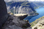
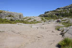
A rock outcrop on the high plateau in front of Trolltunga in Norway. Shot: July 8, 2018.
Hans Christian Davidsen

Norway / Westland / Sogn and Fjordane

507 1200x800 Px, 28.07.2018

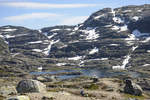
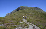
Mountains on the hiking trail to Trolltunga in Norderney. The hike to Trolltunga starts in Skjeggedal, passes through the high mountains, takes a total of 10 – 12 hours (28 kilometers round trip), and has an ascent of 1000 meters. Photo taken: July 8, 2018.
Hans Christian Davidsen

Norway / Westland / Hardanger

359 1200x800 Px, 28.07.2018

Normally, the hike to Trolltunga in Norway can be done from mid-June, depending on current snow conditions, until around mid-September. Photo taken: July 8, 2018.
Hans Christian Davidsen

Norway / Westland / Hardanger

352 1200x800 Px, 28.07.2018

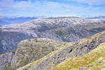
Norway - The mountains near Ausland as seen from Røyrgrind. Shot on July 16, 2018.
Hans Christian Davidsen

Norway / Westland / Sogn and Fjordane

351 1200x800 Px, 27.07.2018

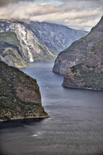
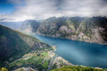
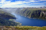
Norway - Aurlandsfjorden as seen from the Stegastein viewpoint. Photo taken: July 16, 2018.
Hans Christian Davidsen

Norway / Westland / Sogn and Fjordane

346 800x1200 Px, 27.07.2018

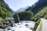
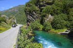
On the Flåmselv south of Flåm in the Norwegian province of Sogn og Fjordane. Shot: July 13, 2018.
Hans Christian Davidsen

Norway / Westland / Sogn and Fjordane

314 1200x800 Px, 27.07.2018

At the Flåmselv south of Flåm in the Norwegian province of Sogn og Fjordane. Shot on July 13, 2018.
Hans Christian Davidsen

Norway / Westland / Sogn and Fjordane

389 1200x800 Px, 27.07.2018

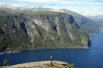
Norway - View of Urlandsfjorden from Hoden (947 meters). Photo taken: July 16, 2018.
Hans Christian Davidsen

Norway / Westland / Sogn and Fjordane

359 1200x800 Px, 27.07.2018

Norway - Aurlandsfjorden as seen from the Stegastein viewpoint. Photo taken: July 16, 2018.
Hans Christian Davidsen

Norway / Westland / Sogn and Fjordane

340 1200x800 Px, 27.07.2018

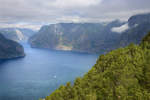
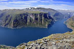
Norway - Aurlandsfjorden as seen from Røyrgrindkleivi. Photo taken on July 16, 2018.
Hans Christian Davidsen

Norway / Westland / Sogn and Fjordane

324 1200x800 Px, 27.07.2018

Norway - Aurlandsfjorden as seen from Røyrgrindkleivi. The village of Flåm is visible at the end of the fjord. Photo taken on July 16, 2018.
Hans Christian Davidsen

Norway / Westland / Sogn and Fjordane

334 1200x800 Px, 27.07.2018

View of Mount Røygrind (1365 meters) from Røyrgrindkleivi north of Ausland. From Røyrgrind, you have a beautiful view over the Aurlandsfjord. Photo taken: July 16, 2018.
Hans Christian Davidsen

Norway / Westland / Sogn and Fjordane

355 1200x773 Px, 27.07.2018

Norway - Aurlandsfjorden as seen from Røyrgrindkleivi. Photo taken on July 16, 2018.
Hans Christian Davidsen

Norway / Westland / Sogn and Fjordane

327 1200x800 Px, 27.07.2018

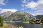
Eidfjord on the eponymous fjord, the easternmost arm of the Hardangerfjord in Norway. Photo taken: July 7, 2018.
Hans Christian Davidsen

Norway / Westland / Hardanger

457 1200x800 Px, 26.07.2018

At the Simadaslfjorden east of Eidfjord in Norway. Photo taken: July 7, 2018.
Hans Christian Davidsen

Norway / Westland / Hardanger

420 1200x800 Px, 26.07.2018

Norway - The landscape at Preikestolen is characterized by bright granite rock. Densely shaped and multicolored green valleys crowd the region of Rogaland. The mountains there reach heights of up to 843 meters. Photo taken: July 2, 2018.
Hans Christian Davidsen

Norway / Southland / Rogaland

428 1200x800 Px, 26.07.2018

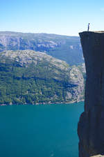
Preikestolen in Rogaland, Norway. The cliff edge drops 604 meters vertically into the nearly 40-kilometer-long Lysefjord.  
Photo taken on July 2, 2018.
Preikestolen in Rogaland, Norway. The cliff edge drops 604 meters vertically into the nearly 40-kilometer-long Lysefjord. Photo taken on July 2, 2018.
Hans Christian Davidsen

Norway / Southland / Rogaland

444 800x1200 Px, 26.07.2018

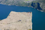
View of Preikestolen and Lysefjorden. The Preikestolen or Prekestolen (Norwegian for pulpit or literally preacher's chair) is a natural rock platform (rock pulpit) in Ryfylke in the Norwegian province (Fylke) of Rogaland and a tourist destination with wide views over the Lysefjord and surrounding mountains.
Photo taken: July 2, 2018.
View of Preikestolen and Lysefjorden. The Preikestolen or Prekestolen (Norwegian for pulpit or literally preacher's chair) is a natural rock platform (rock pulpit) in Ryfylke in the Norwegian province (Fylke) of Rogaland and a tourist destination with wide views over the Lysefjord and surrounding mountains. Photo taken: July 2, 2018.
Hans Christian Davidsen

Norway / Southland / Rogaland

419 1200x800 Px, 26.07.2018

View of Lysefjorden and Preikestolen in Norway. Shot: July 2, 2018.
Hans Christian Davidsen

Norway / Southland / Rogaland

414 1200x800 Px, 26.07.2018

Norway - Evening mood on the lake east of Stavanger. The photo was taken on the ferry from Tau to Stavanger. Shot: July 2, 2018.
Hans Christian Davidsen

Norway / Southland / Rogaland

326 1200x800 Px, 26.07.2018

On the hiking trail to Kjeragbolten in Norway. Kjerag or Kiragg is a rock plateau in the municipality of Forsand (Rogaland County) on the Lysefjord. Photo taken: July 3, 2018.
Hans Christian Davidsen

Norway / Southland / Rogaland

381 800x1200 Px, 26.07.2018