landschaftsfotos.eu Linie landschaftsfotos.eu
Hello guest, you are not logged in. Log in | Create account 
Forum   Contact   Legal notice
German English 

Photos by Erhard Pitzius
29 Photos
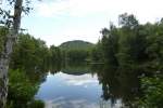
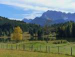
Our vacation in the region around Mittenwald started on the first day with great weather. Our two friends who prefer trains did not want to take on the effort of a hike. However, we were rewarded on our 10 km walk entirely on foot, without any means of transport, with fantastic views. View over Lake Gerold to the Karwendel Mountains. 05.10.2015  
Gerold, Municipality of Krün.
Our vacation in the region around Mittenwald started on the first day with great weather. Our two friends who prefer trains did not want to take on the effort of a hike. However, we were rewarded on our 10 km walk entirely on foot, without any means of transport, with fantastic views. View over Lake Gerold to the Karwendel Mountains. 05.10.2015 Gerold, Municipality of Krün.
Erhard Pitzius

Deutschland / Bayern / Oberbayern

459 1200x913 Px, 16.10.2015

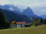
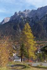
Our vacation in the region around Mittenwald started on the first day with great weather. Our two friends who prefer trains did not want to take on the effort of a hike. However, we were rewarded on our 10 km walk, entirely on foot without any means of transport, with stunning views. View over Gerold towards the Wetterstein Mountains and the Zugspitze. 05.10.2015
Erhard Pitzius

Deutschland / Bayern / Oberbayern

480 1200x900 Px, 16.10.2015

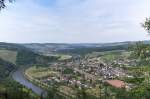
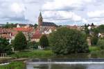
From the Honorary Cemetery and the hermitage in Kastel-Staadt, there is a great view into the Saar Valley. Serrig lies in the foreground, and part of Saarburg can be seen in the background. 28.06.2015
Erhard Pitzius

Deutschland / Rheinland-Pfalz / Saartal

606 1200x797 Px, 10.07.2015

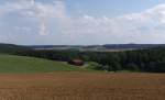
We are here in the Saxon Vogtland at the southwestern tip of Saxony, right on the border with Thuringia. The Vogtland extends over parts of Saxony, Thuringia, Bavaria (Upper Franconia), and Bohemia. View from Schönberg/Vogtland into the vastness of the Vogtland on 10.08.2013.
Erhard Pitzius

Deutschland / Sachsen / Vogtland

913 1024x622 Px, 05.11.2013

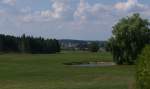
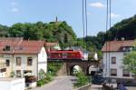
We are here in the Saxon Vogtland at the southwestern tip of Saxony, directly on the border with Thuringia. The Vogtland extends over parts of Saxony, Thuringia, Bavaria (Upper Franconia), and Bohemia. View from Schönberg/Vogtland towards Mühltroff. - 10.08.2013 -
Erhard Pitzius

Deutschland / Sachsen / Vogtland

859 1024x608 Px, 04.11.2013

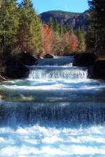
Cascades at Walchensee - 

The Rißbach is diverted into the Walchensee at Niedernach to generate electricity in the local power plant.

27.10.2005
Cascades at Walchensee - The Rißbach is diverted into the Walchensee at Niedernach to generate electricity in the local power plant. 27.10.2005
Erhard Pitzius

Deutschland / Bayern / Oberbayern

1317 666x1000 Px, 27.03.2013

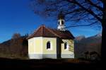
Chapel Maria Rast - 

It is located on the Buckelwiesen between Mittenwald and Krün.

27.10.2005
Chapel Maria Rast - It is located on the Buckelwiesen between Mittenwald and Krün. 27.10.2005
Erhard Pitzius

The hummocky meadows near Mittenwald on 11.02.2000.
Erhard Pitzius

Deutschland / Bayern / Oberbayern

825 1000x716 Px, 27.03.2013

The Schmalensee near Mittenwald on 24.10.2005 with a view of the Wetterstein Mountains.
Erhard Pitzius

View over Mittenwald to the Karwendel in the golden October 2005. (26.10.2005)
Erhard Pitzius

A summer day in August 2012 -  

The summer days in 2012 were few and far between, but on 04.08.2012 the sun had slowly gained the upper hand.

Until the reunification, no one could stand here and take photos, because the area around the border station Gutenfürst was well guarded.
Watchtowers, patrol paths, fences, patrols, and floodlight installations  protected  the GDR border.

At Gutenfürst with the Hof - Leipzig railway line.
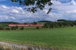
A summer day in August 2012 - The summer days in 2012 were few and far between, but on 04.08.2012 the sun had slowly gained the upper hand. Until the reunification, no one could stand here and take photos, because the area around the border station Gutenfürst was well guarded. Watchtowers, patrol paths, fences, patrols, and floodlight installations "protected" the GDR border. At Gutenfürst with the Hof - Leipzig railway line.
Erhard Pitzius

Deutschland / Sachsen / Vogtland

916 1000x664 Px, 11.03.2013

In the romantic Saar Valley - 

Or better in Lorraine  Dans la vallée de la Sarre. 

Picturesque villages can be found just beyond the German-French border. About 20 kilometers from Saarbrücken, you find yourself in another world.

The village of Sarreinsming (Saareinsmingen) was first mentioned in 1152.

Here is a view of the church of the Lorraine village.
06.07.2012
In the romantic Saar Valley - Or better in Lorraine "Dans la vallée de la Sarre." Picturesque villages can be found just beyond the German-French border. About 20 kilometers from Saarbrücken, you find yourself in another world. The village of Sarreinsming (Saareinsmingen) was first mentioned in 1152. Here is a view of the church of the Lorraine village. 06.07.2012
Erhard Pitzius

Frankreich / Regionen / Lorraine / D鰡rtement Moselle

691 1000x664 Px, 10.03.2013

The Saarland is worth a trip!

Of course, also by train. Outside the industrial centers, picturesque villages and small towns invite you to visit.

View from the pedestrian bridge over the Saar River towards Saarhölzbach.

04.08.2011
The Saarland is worth a trip! Of course, also by train. Outside the industrial centers, picturesque villages and small towns invite you to visit. View from the pedestrian bridge over the Saar River towards Saarhölzbach. 04.08.2011
Erhard Pitzius

Deutschland / Saarland / Kreis Merzig-Wadern

860 1000x662 Px, 10.03.2013

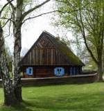
Open-Air Museum Olsztynek (Hohenstein) Masuria - 

The open-air museum displays several dozen original and reconstructed buildings from Warmia, Masuria, and Prussian Lithuania. It features timber-framed wooden houses, granaries, windmills, farm buildings, an inn, and a small church.

01.05.2010
Open-Air Museum Olsztynek (Hohenstein) Masuria - The open-air museum displays several dozen original and reconstructed buildings from Warmia, Masuria, and Prussian Lithuania. It features timber-framed wooden houses, granaries, windmills, farm buildings, an inn, and a small church. 01.05.2010
Erhard Pitzius

Polen / Polnische Seenplatten / Masurische Seenplatte

833 935x1000 Px, 10.03.2013

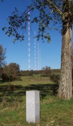
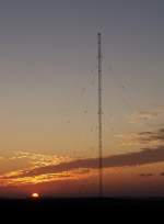
Broadcast mast Europe 1 at the France-Germany border on 06.10.2007 - 

The political status of Saarland in the 1950s made it possible to build and operate a French transmitter on Saarland territory (later FRG). The longwave transmission facility is one of the largest in the world. In the foreground is the border stone between Germany and France, accessible via the old border path from Berus. Here is the view from France (only 1 meter) into Germany. This view is no longer possible today because one of the transmission masts snapped in August 2012 and was completely demolished in November 2012.
Broadcast mast Europe 1 at the France-Germany border on 06.10.2007 - The political status of Saarland in the 1950s made it possible to build and operate a French transmitter on Saarland territory (later FRG). The longwave transmission facility is one of the largest in the world. In the foreground is the border stone between Germany and France, accessible via the old border path from Berus. Here is the view from France (only 1 meter) into Germany. This view is no longer possible today because one of the transmission masts snapped in August 2012 and was completely demolished in November 2012.
Erhard Pitzius

Saar old arm near Rehlingen with a view of the Oberlimberg -

Saar old arm and facility of the ASV Rehlingen. In the background, the Oberlimberg. Oskar Lafontaine resided there until 2011!
Saar old arm near Rehlingen with a view of the Oberlimberg - Saar old arm and facility of the ASV Rehlingen. In the background, the Oberlimberg. Oskar Lafontaine resided there until 2011!
Erhard Pitzius

Landscape near Plothen (Thuringia) - 

Taken during a walk at the  Plothener Teiche  on August 12, 2011
Landscape near Plothen (Thuringia) - Taken during a walk at the "Plothener Teiche" on August 12, 2011
Erhard Pitzius

Deutschland / Th�gen / Landkreis Saale-Orla

815 1000x558 Px, 09.03.2013

Sunset over the Saargau...

6 transmission masts of Europe 1, the French longwave transmitter (183 kHz), stand in Oberfelsberg. Here is one of the emergency masts (height 234 meters) at sunset.
12.09.2009 - Where the sun is just setting lies Thionville in Lorraine, and to the right on the horizon is the border with Luxembourg.
Sunset over the Saargau... 6 transmission masts of Europe 1, the French longwave transmitter (183 kHz), stand in Oberfelsberg. Here is one of the emergency masts (height 234 meters) at sunset. 12.09.2009 - Where the sun is just setting lies Thionville in Lorraine, and to the right on the horizon is the border with Luxembourg.
Erhard Pitzius

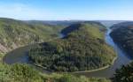
The Saarland - Worth a Visit!  
The Saar - Loop near Mettlach from the Cloef viewpoint in Orscholz.  
11.10.2010
The Saarland - Worth a Visit! The Saar - Loop near Mettlach from the Cloef viewpoint in Orscholz. 11.10.2010
Erhard Pitzius

500 meters from our house, this view was offered on 11.11.2012.  
30 minutes before sunset, the Bergenhalde in Ensdorf was still bathed in sunlight.  
View from Felsberg from the country road to Altforweiler towards Ensdorf.
500 meters from our house, this view was offered on 11.11.2012. 30 minutes before sunset, the Bergenhalde in Ensdorf was still bathed in sunlight. View from Felsberg from the country road to Altforweiler towards Ensdorf.
Erhard Pitzius

Homeland images.... Just a 5-minute walk from our house, this view of the power plant in Ensdorf is offered. The location is the connecting path from Unterfelsberg to Neuhof.  
11.11.2012
Homeland images.... Just a 5-minute walk from our house, this view of the power plant in Ensdorf is offered. The location is the connecting path from Unterfelsberg to Neuhof. 11.11.2012
Erhard Pitzius

Deutschland / Saarland / Landkreis Saarlouis

687 1024x801 Px, 17.02.2013

Wayside crosses can still be found in large numbers along the paths and roads in Saarland and neighboring Lorraine.  
This well-maintained and constantly decorated example stands on the old country road between Altforweiler and Felsberg in the Saarlouis district.  

23.09.2012
Wayside crosses can still be found in large numbers along the paths and roads in Saarland and neighboring Lorraine. This well-maintained and constantly decorated example stands on the old country road between Altforweiler and Felsberg in the Saarlouis district. 23.09.2012
Erhard Pitzius

Heimatbilder....

Nach 10 Minuten Fußmarsch von unserem Haus entfernt bietet sich dieser Blick auf einen Teil unseres Heimatortes.

Felsberg/Saar mit Kirche St. Nikolaus am 23.09.2012
Heimatbilder.... Nach 10 Minuten Fußmarsch von unserem Haus entfernt bietet sich dieser Blick auf einen Teil unseres Heimatortes. Felsberg/Saar mit Kirche St. Nikolaus am 23.09.2012
Erhard Pitzius

The Green Belt Bridge over the Saale was built in 2009, funded by the EU as well as the municipalities of Pottiga & Berg.

The ceremonial inauguration took place on November 8, 2009, almost exactly 20 years after the border opening, in the presence of many visitors and dignitaries.

From the bridge, you can reach the Blumenau Mill as well as the hiking trails on the Franconian side. This area was a restricted zone and the border between East and West Germany for over 30 years.
The Green Belt Bridge over the Saale was built in 2009, funded by the EU as well as the municipalities of Pottiga & Berg. The ceremonial inauguration took place on November 8, 2009, almost exactly 20 years after the border opening, in the presence of many visitors and dignitaries. From the bridge, you can reach the Blumenau Mill as well as the hiking trails on the Franconian side. This area was a restricted zone and the border between East and West Germany for over 30 years.
Erhard Pitzius

Deutschland / Bayern / Oberfranken

1017 1024x675 Px, 12.12.2012