landschaftsfotos.eu Linie landschaftsfotos.eu
Hello guest, you are not logged in. Log in | Create account 
Forum   Contact   Legal notice
German English 
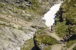
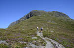
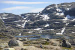
Mountains on the hiking trail to Trolltunga in Norderney. The hike to Trolltunga starts in Skjeggedal, passes through the high mountains, takes a total of 10 – 12 hours (28 kilometers round trip), and has an ascent of 1000 meters. Photo taken: July 8, 2018.
Hans Christian Davidsen

Norwegen / Westland / Hardanger

356 1200x800 Px, 28.07.2018

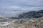
Normally, the hike to Trolltunga in Norway can be done from mid-June, depending on current snow conditions, until around mid-September. Photo taken: July 8, 2018.
Hans Christian Davidsen

Norwegen / Westland / Hardanger

350 1200x800 Px, 28.07.2018

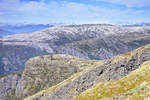
Norway - The mountains near Ausland as seen from Røyrgrind. Shot on July 16, 2018.
Hans Christian Davidsen

Norwegen / Westland / Sogn og Fjordane

349 1200x800 Px, 27.07.2018

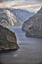
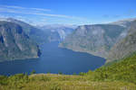
Norway - Aurlandsfjorden as seen from the Stegastein viewpoint. Photo taken: July 16, 2018.
Hans Christian Davidsen

Norwegen / Westland / Sogn og Fjordane

343 800x1200 Px, 27.07.2018

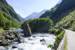
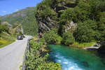
On the Flåmselv south of Flåm in the Norwegian province of Sogn og Fjordane. Shot: July 13, 2018.
Hans Christian Davidsen

Norwegen / Westland / Sogn og Fjordane

312 1200x800 Px, 27.07.2018

At the Flåmselv south of Flåm in the Norwegian province of Sogn og Fjordane. Shot on July 13, 2018.
Hans Christian Davidsen

Norwegen / Westland / Sogn og Fjordane

384 1200x800 Px, 27.07.2018

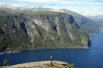
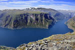
Norway - View of Urlandsfjorden from Hoden (947 meters). Photo taken: July 16, 2018.
Hans Christian Davidsen

Norwegen / Westland / Sogn og Fjordane

355 1200x800 Px, 27.07.2018

Norway - Aurlandsfjorden as seen from the Stegastein viewpoint. Photo taken: July 16, 2018.
Hans Christian Davidsen

Norwegen / Westland / Sogn og Fjordane

335 1200x800 Px, 27.07.2018

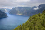
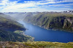
Norway - Aurlandsfjorden as seen from Røyrgrindkleivi. Photo taken on July 16, 2018.
Hans Christian Davidsen

Norwegen / Westland / Sogn og Fjordane

321 1200x800 Px, 27.07.2018

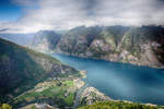
Norway - Aurlandsfjorden as seen from Røyrgrindkleivi. The village of Flåm is visible at the end of the fjord. Photo taken on July 16, 2018.
Hans Christian Davidsen

Norwegen / Westland / Sogn og Fjordane

332 1200x800 Px, 27.07.2018

View of Mount Røygrind (1365 meters) from Røyrgrindkleivi north of Ausland. From Røyrgrind, you have a beautiful view over the Aurlandsfjord. Photo taken: July 16, 2018.
Hans Christian Davidsen

Norwegen / Westland / Sogn og Fjordane

353 1200x773 Px, 27.07.2018

Norway - Aurlandsfjorden as seen from Røyrgrindkleivi. Photo taken on July 16, 2018.
Hans Christian Davidsen

Norwegen / Westland / Sogn og Fjordane

324 1200x800 Px, 27.07.2018

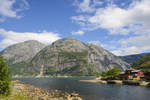
Eidfjord on the eponymous fjord, the easternmost arm of the Hardangerfjord in Norway. Photo taken: July 7, 2018.
Hans Christian Davidsen

Norwegen / Westland / Hardanger

455 1200x800 Px, 26.07.2018

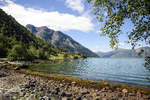
At the Simadaslfjorden east of Eidfjord in Norway. Photo taken: July 7, 2018.
Hans Christian Davidsen

Norwegen / Westland / Hardanger

418 1200x800 Px, 26.07.2018

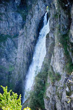
Vøringsfossen as seen from the main road Rv7. The waterfall is located on the western edge of the Hardangervidda in Eidfjord. The total drop is 183 meters, with the longest free-fall section of the water being 145 meters. Photo taken on July 7, 2018.
Hans Christian Davidsen

Norwegen / Westland / Hardanger

411 800x1200 Px, 25.07.2018

View of Jukladalsvatnet north of the Folgefonna glacier in Norway. Photo taken on July 6, 2018.
Hans Christian Davidsen

Norwegen / Westland / Hordaland

466 1200x800 Px, 25.07.2018

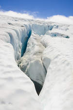
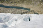
On the Folgefonna Glacier in Norway. The glacier is located in the high mountain region of the Folgefonna Peninsula between Sørfjord in the east, Åkrafjord in the south, and Hardangerfjord in the west.
Photo taken: July 6, 2018.
On the Folgefonna Glacier in Norway. The glacier is located in the high mountain region of the Folgefonna Peninsula between Sørfjord in the east, Åkrafjord in the south, and Hardangerfjord in the west. Photo taken: July 6, 2018.
Hans Christian Davidsen

Norwegen / Westland / Hordaland

420 800x1200 Px, 25.07.2018

On the Folgefonna Glacier in Norway. Since April 29, 2005, Folgefonna has been the 25th national park in Norway. Both the glacier and a large part of the surrounding landscape are now protected.
Photo taken: July 6, 2018.
On the Folgefonna Glacier in Norway. Since April 29, 2005, Folgefonna has been the 25th national park in Norway. Both the glacier and a large part of the surrounding landscape are now protected. Photo taken: July 6, 2018.
Hans Christian Davidsen

Norwegen / Westland / Hordaland

438 1200x800 Px, 25.07.2018

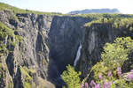
Vøringsfossen as seen from the main road Rv7. The waterfall is located on the western edge of the Hardangervidda in Eidfjord. The small river Bjoreio, along which Vøringsfossen lies, is dammed above the waterfall in the Sysendalen valley by the Sysen Dam and used for hydroelectric power production. The water volume is therefore limited, but for tourism reasons, it is increased in summer from June 1 to September 15 to about 12 m³ per second, which corresponds approximately to the natural flow rate.  
Shot: July 7, 2018.
Vøringsfossen as seen from the main road Rv7. The waterfall is located on the western edge of the Hardangervidda in Eidfjord. The small river Bjoreio, along which Vøringsfossen lies, is dammed above the waterfall in the Sysendalen valley by the Sysen Dam and used for hydroelectric power production. The water volume is therefore limited, but for tourism reasons, it is increased in summer from June 1 to September 15 to about 12 m³ per second, which corresponds approximately to the natural flow rate. Shot: July 7, 2018.
Hans Christian Davidsen

Norwegen / Westland / Hardanger

459 1200x800 Px, 25.07.2018

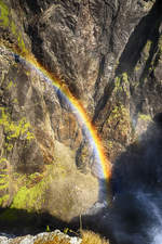
Rainbow at the Vøringsfossen waterfall in Norway's Hardanger region.  
Shot: July 7, 2018.
Rainbow at the Vøringsfossen waterfall in Norway's Hardanger region. Shot: July 7, 2018.
Hans Christian Davidsen

Norwegen / Westland / Hardanger

338 800x1200 Px, 25.07.2018

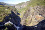
Vøringsfossen as seen from the parking lot at the Fossil Hotel. The water volume can exceed 150 cubic meters per second during the spring snowmelt. In 1980, the river was regulated for hydroelectric power generation, resulting in significant amounts of water no longer being visible.  
Shot: July 7
Vøringsfossen as seen from the parking lot at the Fossil Hotel. The water volume can exceed 150 cubic meters per second during the spring snowmelt. In 1980, the river was regulated for hydroelectric power generation, resulting in significant amounts of water no longer being visible. Shot: July 7
Hans Christian Davidsen

Norwegen / Westland / Hardanger

371 1200x800 Px, 25.07.2018

View of the Aurlandsfjord in Norway from the hiking trail to Prest. Photo taken on July 14, 2018.
Hans Christian Davidsen

Norwegen / Westland / Sogn og Fjordane

327 1200x800 Px, 24.07.2018

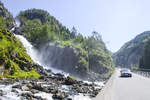
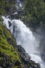
The twin waterfall Låtefoss (Oddadalen, Norway) with a drop of 165 meters is easily accessible from the RV 13 road. Photo taken: July 5, 2018.
Hans Christian Davidsen

Norwegen / Westland / Hordaland

422 1200x800 Px, 24.07.2018

Låtefossen is a touristically significant twin waterfall with a total drop of 165 meters. It is located in the Norwegian province (Fylke) of Hordaland, about 20 kilometers south of Odda, directly on the main highway 13 opposite the slopes of the Folgefonna glacier. It forms a western outlet of the Hardangervidda. Photo taken: July 5, 2018.
Hans Christian Davidsen

Norwegen / Westland / Hordaland

379 800x1200 Px, 24.07.2018