landschaftsfotos.eu Linie landschaftsfotos.eu
Hello guest, you are not logged in. Log in | Create account 
Forum   Contact   Legal notice
German English 
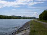
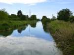
the Hüningen Canal (Canal de Huningue) in southern Alsace crosses a large nature reserve, May 2013
rainer ullrich

Frankreich / Regionen / Elsass / Oberelsass (Haut-Rhin)

702 1024x768 Px, 03.06.2013

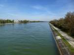
View over the Rhine side canal at Ottmarsheim towards the Markgräflerland, May 2013
rainer ullrich

Frankreich / Regionen / Elsass / Oberelsass (Haut-Rhin)

708 1024x768 Px, 03.06.2013

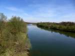
View from the bridge at Neuenburg over the Rhine side channel, April 2013
rainer ullrich

Frankreich / Regionen / Elsass / Oberelsass (Haut-Rhin)

693 1024x768 Px, 05.05.2013

View from the bridge at Neuenburg over the old Rhine downstream, April 2013
rainer ullrich

Deutschland / Baden-W�emberg / Rheinebene

769 1024x768 Px, 05.05.2013

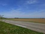
near Bantzenheim in southern Alsace, here you can clearly see why the Rhine Plain bears this name, April 2013
rainer ullrich

Frankreich / Regionen / Elsass / Oberelsass (Haut-Rhin)

690 1024x768 Px, 01.05.2013

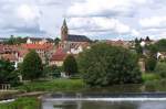
In the romantic Saar Valley - 

Or better in Lorraine  Dans la vallée de la Sarre. 

Picturesque villages can be found just beyond the German-French border. About 20 kilometers from Saarbrücken, you find yourself in another world.

The village of Sarreinsming (Saareinsmingen) was first mentioned in 1152.

Here is a view of the church of the Lorraine village.
06.07.2012
In the romantic Saar Valley - Or better in Lorraine "Dans la vallée de la Sarre." Picturesque villages can be found just beyond the German-French border. About 20 kilometers from Saarbrücken, you find yourself in another world. The village of Sarreinsming (Saareinsmingen) was first mentioned in 1152. Here is a view of the church of the Lorraine village. 06.07.2012
Erhard Pitzius

Frankreich / Regionen / Lorraine / D鰡rtement Moselle

691 1000x664 Px, 10.03.2013

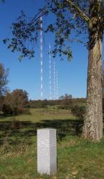
Broadcast mast Europe 1 at the France-Germany border on 06.10.2007 - 

The political status of Saarland in the 1950s made it possible to build and operate a French transmitter on Saarland territory (later FRG). The longwave transmission facility is one of the largest in the world. In the foreground is the border stone between Germany and France, accessible via the old border path from Berus. Here is the view from France (only 1 meter) into Germany. This view is no longer possible today because one of the transmission masts snapped in August 2012 and was completely demolished in November 2012.
Broadcast mast Europe 1 at the France-Germany border on 06.10.2007 - The political status of Saarland in the 1950s made it possible to build and operate a French transmitter on Saarland territory (later FRG). The longwave transmission facility is one of the largest in the world. In the foreground is the border stone between Germany and France, accessible via the old border path from Berus. Here is the view from France (only 1 meter) into Germany. This view is no longer possible today because one of the transmission masts snapped in August 2012 and was completely demolished in November 2012.
Erhard Pitzius

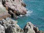
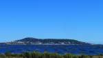
France, Languedoc-Roussillon, Hérault, Sète, the Mediterranean Sea as seen from the Promenade Maréchal Leclerc, 22.07.2010
Jean-Claude Delagardelle

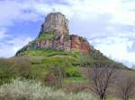
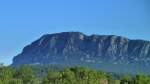
France, Burgundy, Saône-et-Loire, Roche de Solutré near Solutré-Pouilly, 06.04.2005
Jean-Claude Delagardelle

Frankreich / Regionen / Burgund Sonstiges

800 1024x768 Px, 19.12.2012

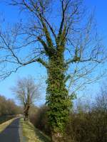
France, Lorraine, near Diane-Capelle on the Saar Canal in front of the first lock, tree covered with ivy
Jean-Claude Delagardelle

Frankreich / Regionen / Lorraine / D鰡rtement Moselle

662 768x1024 Px, 18.12.2012

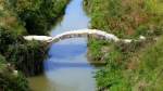
France, Languedoc-Roussillon, Gard, old bridge over the Rhôny, between Calvisson and Saint-Dionizy on the Voie Verte de la Vaunage
Jean-Claude Delagardelle

Frankreich / Regionen / Languedoc-Roussillon / Dept. Gard

1009 1024x576 Px, 12.12.2012

France, Languedoc and Tarn, Voie verte du Haut-Languedoc from Mazamet (Tarn) to Mons-la-Trivalle (Languedoc), near Olargues, 28.08.2011
Jean-Claude Delagardelle

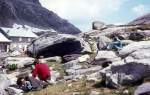
Department Alpes-Maritimes on July 2, 1972: Refuge des Merveilles.
Kurt Rasmussen

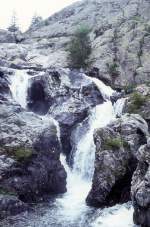
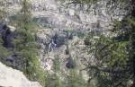
Alpes-Maritimes department on July 2, 1972: Waterfall near the Refuge des Merveilles.
Kurt Rasmussen

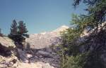
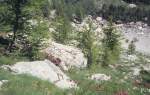
Alpes-Maritimes Department on July 2, 1972: The landscape near the Refuge des Marveilles.
Kurt Rasmussen

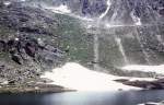
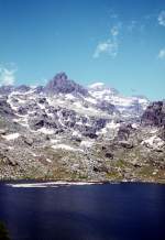
Alpes-Maritimes Department on July 2, 1972: Lac Long Supérieur (Refuge des Merveilles).
Kurt Rasmussen

Alpes-Maritimes Department on July 2, 1972: Lac Long Supérieur (Refuge des Merveilles).
Kurt Rasmussen

Department Alpes-Maritimes on July 2, 1972: In the Vallon de la Minière between St-Dalmas-de-Tende and the Refuge des Merveilles (Vallée des Merveilles).
Kurt Rasmussen

Alpes-Maritimes Department on July 2, 1972: Vallon de la Minière.
Kurt Rasmussen

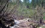
Alpes-Maritimes Department on July 2, 1972: Vallon de la Minière.
Kurt Rasmussen

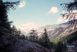
Department Alpes-Maritimes on July 2, 1972: The landscape in the Vallon de la Minière between Saint-Dalmas-de-Tende (a town located on the railway line Cuneo (Italy) - Breil-sur-Roya (France) - Ventimiglia (Italy) / Nice) and the Refuge des Merveilles (Vallée des Merveilles).
Kurt Rasmussen

Frankreich, Languedoc-Roussillon, Hérault, der Étang de Thau mit seinen Austernbänken und im Hintergrund mit Sète am Fusse des Mont Saint Clair, von  Bouzigues aus gesehen, 09.09.2011
Frankreich, Languedoc-Roussillon, Hérault, der Étang de Thau mit seinen Austernbänken und im Hintergrund mit Sète am Fusse des Mont Saint Clair, von Bouzigues aus gesehen, 09.09.2011
Jean-Claude Delagardelle

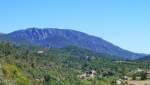
Frankreich, Languedoc-Roussillon, Hérault, Pic Saint Loup, 658m, von Notre Dame de Londres (nordwestlich vom Pic Saint Loup) aus gesehen, 19.08.2011
Jean-Claude Delagardelle

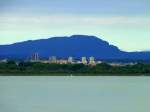
Frankreich, Languedoc-Roussillon, Hérault, Étang du Méjean, Montpellier, Pic Saint Loup, 658m, 20km nördlich von Montpellier, von Palavas aus gesehen, 07.08.2011
Jean-Claude Delagardelle