
landschaftsfotos.eu Linie landschaftsfotos.eu
Hello guest, you are not logged in. Log in | Create account 
Forum   Contact   Legal notice
German English 

Deutschland Landschaftsfotos (Landschaften, Natur und Ausblicke)
17170 Photos
View from Garmisch to the 1985m high Kramerspitz, the highest peak of the Ammergau Alps, Sept. 2014
rainer ullrich

Germany / Bavaria / Upper Bavaria

690 1200x854 Px, 04.11.2014

Autumn forest in the Tyrolean Lower Inn Valley on November 2, 2014, near Breitenbach am Inn.
bilderfan

Germany, Rhineland-Palatinate, Bernkastel-Wittlich district, rising ground fog over a meadow on the Mosel cycle path near Kues on the Mosel River
Jean-Claude Delagardelle

Germany, Rhineland-Palatinate, Wehlen on the Moselle. The Wehlener Sundial. 31.10.2014
Jean-Claude Delagardelle

Germany / Rhineland-Palatinate / Moselle Valley

859 768x1024 Px, 01.11.2014

Broad bean, the herbaceous plant up to 1m high is often grown as green manure in the Rhine plain, Oct. 2014
rainer ullrich

View into the Glottertal/Black Forest at sunset, Oct. 2014
rainer ullrich

Low water in the old Rhine near Grißheim, Oct. 2014
rainer ullrich

Germany / Baden-Württemberg / Rhine Plain

644 1200x900 Px, 30.10.2014

The moon is in the sky at Kohlscheid-Bank on the evening of 28.10.2014.
Stefan Hochstetter

The Schluchsee is a reservoir in the municipality of Schluchsee near St. Blasien in the district of Breisgau-Hochschwarzwald in Baden-Württemberg. It is located southeast of the Titisee and is the largest lake in the Black Forest.03.09.2014.
Valerij Rein

Germany / Baden-Württemberg / Black Forest

704 1200x695 Px, 28.10.2014

Sunrise at Fichtelberg in Oberwiesenthal. While the fog drifts northward in the valley, the first rays of sunlight reach the summit, 04.10.2014
Kay Baldauf

Germany / Saxony / Ore Mountains

844  2 1200x800 Px, 28.10.2014

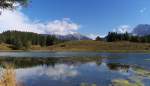
Hike to Wildensee - On 06.10.2014, we went up to Wildensee near Mittenwald.  
In Klais/Mittenwald Am Quicken, a path leads up to the lake through the training area of the Mittenwald mountain infantry. Outside of training times, the area may be entered, but there are no signposts and you have to plan your hike in advance. The lake is located at 1136 meters below the Kranzberg, with the starting point in Klais at about 930 meters. The lake has an area of approximately 2.3 hectares. Here is the view of the Soiern group of the Karwendel mountains.  
Along the way, you reach an altitude of about 1200 meters. After two hours of almost continuous uphill, this view makes the effort worthwhile. 06.10.2014
Hike to Wildensee - On 06.10.2014, we went up to Wildensee near Mittenwald. In Klais/Mittenwald Am Quicken, a path leads up to the lake through the training area of the Mittenwald mountain infantry. Outside of training times, the area may be entered, but there are no signposts and you have to plan your hike in advance. The lake is located at 1136 meters below the Kranzberg, with the starting point in Klais at about 930 meters. The lake has an area of approximately 2.3 hectares. Here is the view of the Soiern group of the Karwendel mountains. Along the way, you reach an altitude of about 1200 meters. After two hours of almost continuous uphill, this view makes the effort worthwhile. 06.10.2014
Ivonne Pitzius

Germany / Bavaria / Upper Bavaria

740  1 1200x689 Px, 28.10.2014

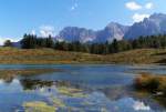
Hike to Wildensee - On 06.10.2014, we went up to Wildensee near Mittenwald.  
In Klais/Mittenwald Am Quicken, a path leads up to the lake through the training area of the Mittenwald mountain infantry. Outside of training times, the area may be entered, but there are no signposts and you need to plan your hike in advance. The lake is located at 1136 meters below the Kranzberg, with the starting point in Klais at about 930 meters. The lake has an area of approximately 2.3 hectares. Here is the view of the Karwendel peaks near Mittenwald. Along the way, you reach an altitude of about 1200 meters. After two hours of almost continuous uphill hiking, this view makes the effort worthwhile. 06.10.2014
Hike to Wildensee - On 06.10.2014, we went up to Wildensee near Mittenwald. In Klais/Mittenwald Am Quicken, a path leads up to the lake through the training area of the Mittenwald mountain infantry. Outside of training times, the area may be entered, but there are no signposts and you need to plan your hike in advance. The lake is located at 1136 meters below the Kranzberg, with the starting point in Klais at about 930 meters. The lake has an area of approximately 2.3 hectares. Here is the view of the Karwendel peaks near Mittenwald. Along the way, you reach an altitude of about 1200 meters. After two hours of almost continuous uphill hiking, this view makes the effort worthwhile. 06.10.2014
Ivonne Pitzius

Germany / Bavaria / Upper Bavaria

654 1200x813 Px, 28.10.2014

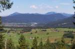
View from the Mountain Infantry Memorial near Mittenwald over the Buckelwiesen and into the Isar Valley near Krün. 06.10.2014
Ivonne Pitzius

Germany / Bavaria / Upper Bavaria

611 1200x797 Px, 28.10.2014

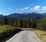
Downwards....After our hike to Wildensee and the Mountain Infantry Memorial near Mittenwald, we slowly made our way back towards Klais and Am Quicken.  
We had been on the trail for 4 hours so far and started the  descent  again with a great view of the Estergebirge. 06.10.2014
Downwards....After our hike to Wildensee and the Mountain Infantry Memorial near Mittenwald, we slowly made our way back towards Klais and Am Quicken. We had been on the trail for 4 hours so far and started the "descent" again with a great view of the Estergebirge. 06.10.2014
Ivonne Pitzius

Germany / Bavaria / Upper Bavaria

626 1024x946 Px, 28.10.2014

In the evening mood in Kohlscheid-Bank on the evening of 26.10.2014.
Stefan Hochstetter

View from the Rhine Plain near Bötzingen towards the Kaiserstuhl with the 557m high Totenkopf, Oct. 2014
rainer ullrich

Germany / Baden-Württemberg / Kaiserstuhl

695 1200x900 Px, 24.10.2014

Autumn morning at March Hill in the Rhine Plain, Oct. 2014
rainer ullrich

autumnal landscape at March Hill in the Rhine Plain, Oct. 2014
rainer ullrich

Wayside cross on March Hill in the Rhine Plain, Oct. 2014
rainer ullrich

View from the Rhine Plain near Neuershausen to the 1241m high Kandel in the central Black Forest, Oct. 2014
rainer ullrich

View over Buchheim in the Rhine Plain towards the Black Forest, Oct. 2014
rainer ullrich

Germany / Baden-Württemberg / Rhine Plain

637 1200x900 Px, 24.10.2014

View of Diesenbach in the Upper Allgäu (12.10.2014)
Peter Reiser

Germany / Bavaria / Upper Allgäu

519 1200x900 Px, 22.10.2014

At the Riedberg Pass near Wäldle, Oberallgäu (12.10.2014)
Peter Reiser

Germany / Bavaria / Upper Allgäu

525 1200x900 Px, 22.10.2014

At the Sigiswang Golf Course, Oberallgäu (12.10.2014)
Peter Reiser

Germany / Bavaria / Upper Allgäu

531 1200x900 Px, 22.10.2014