landschaftsfotos.eu Linie landschaftsfotos.eu
Hello guest, you are not logged in. Log in | Create account 
Forum   Contact   Legal notice
German English 
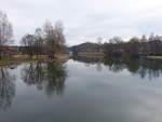
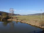
On the Altmühl near Grögling in the district of Neumarkt (12.03.2017)
Peter Reiser

Deutschland / Bayern / Oberpfalz

296 1200x900 Px, 28.03.2018

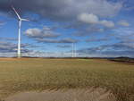
Wind turbines near Pelchenhofen on the western edge of the Franconian Jura (03/05/2017)
Peter Reiser

Deutschland / Bayern / Oberpfalz

321 1200x900 Px, 28.03.2018

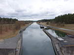
Main-Danube Canal near Eckersmühlen in the district of Roth (03/05/2017)
Peter Reiser

Deutschland / Bayern / Mittelfranken

392 1200x900 Px, 28.03.2018

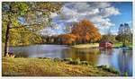
Alz River near Truchtlaching in the Alz Valley, Traunstein District (26.02.2017)
Peter Reiser

Deutschland / Bayern / Oberbayern

421 1200x900 Px, 28.03.2018

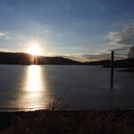
View over the Brunausee near Bispingen/Behringen. The body of water is the dammed Brunau, a small stream that originates in the heath below the Tütsberg and Wulfsberg, Lüneburg Heath, late October 2017.
Reiner Spangemacher

Deutschland / Niedersachsen / L�urger Heide und Wendland

611  1 1200x702 Px, 26.03.2018

View from Schwanberg over the village of Rödelsee, Kitzingen district (11.03.2018)
Peter Reiser

Deutschland / Bayern / Unterfranken

487 1200x675 Px, 21.03.2018

IN THE HESSIAN MOUNTAIN REGION BETWEEN HERBORN AND WETZLAR WITH GREIFENSTEIN CASTLE RUINS
Between HERBORN and WETZLAR, on a ridge of the DILL-WESTERWALD,
lies the Greifenstein castle ruins, at 441 meters above sea level the highest
castle in the LAHN-DILL DISTRICT...on 19.3.2018
IN THE HESSIAN MOUNTAIN REGION BETWEEN HERBORN AND WETZLAR WITH GREIFENSTEIN CASTLE RUINS Between HERBORN and WETZLAR, on a ridge of the DILL-WESTERWALD, lies the Greifenstein castle ruins, at 441 meters above sea level the highest castle in the LAHN-DILL DISTRICT...on 19.3.2018
Hans-Peter Kampmann

Deutschland / Hessen / Marburg-Biedenkopf

384 1200x1177 Px, 19.03.2018

Approaching clouds lie just above the 2875 m high Schneefernerkopf, which, like the Zugspitze, is located on the German-Austrian border. (03.03.2018)
Christopher Pätz

Deutschland / Bayern / Wettersteingebirge

428 1200x809 Px, 18.03.2018

 Brockentagpfauenauge (...but I need nature II) , Painting: Oil, oil pastel on cotton + wood (-frame), 2018, 92 x 126 cm; late afternoon mid-July on the Brocken, a peacock butterfly on resin fleabane flowers, in the background view over the Southwest Harz over 100 km far to the Kassel Mountains in the center of the image on the horizon...
"Brockentagpfauenauge (...but I need nature II)", Painting: Oil, oil pastel on cotton + wood (-frame), 2018, 92 x 126 cm; late afternoon mid-July on the Brocken, a peacock butterfly on resin fleabane flowers, in the background view over the Southwest Harz over 100 km far to the Kassel Mountains in the center of the image on the horizon...
Fred Hahn

Galerien / Sonstiges / gemalte Bilder, Landschaftsmalerei

914 1200x876 Px, 16.03.2018

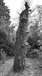
The remains of a dead tree, seen in April 2017 on the Bürgerwiese in Dresden.
Christian Bremer

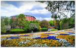
The photo was taken at the foot of the  Mühle am Wall  in Bremen city center, looking over the sea of flowers and the Wallgraben, which provided protection for the old Hanseatic city in the Middle Ages. May 2017.
The photo was taken at the foot of the "Mühle am Wall" in Bremen city center, looking over the sea of flowers and the Wallgraben, which provided protection for the old Hanseatic city in the Middle Ages. May 2017.
Reiner Spangemacher

Deutschland / Stadtstaaten / Bremen - Bremerhaven

422 1200x767 Px, 13.03.2018

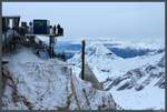
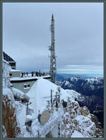
Visitor platform on the Zugspitze with a view of the Wetterstein Mountains. (03.03.2018)
Christopher Pätz

Deutschland / Bayern / Wettersteingebirge

393 1200x810 Px, 12.03.2018

View from the Zugspitze over the Ehrwald Basin with the towns of Ehrwald and Lermoos as well as the Ammergau Alps. (03.03.2018)
Christopher Pätz

Deutschland / Bayern / Wettersteingebirge

377 1200x746 Px, 12.03.2018

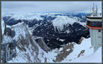
View from the German side of the Zugspitze towards the Austrian visitor platform and the Ammergau Alps. (03.03.2018)
Christopher Pätz

Deutschland / Bayern / Wettersteingebirge

347 683x900 Px, 12.03.2018

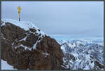
A gilded summit cross crowns the Zugspitze as Germany's highest mountain peak. (03.03.2018)
Christopher Pätz

Deutschland / Bayern / Wettersteingebirge

341 1200x809 Px, 12.03.2018

The Belvedere in Neubrandenburg photographed from the Tollensesee on 11.03.2018
Felix B.

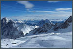
View from the Zugspitzplatt looking south towards Wetterwandeck, Plattspitze, and Gatterlkopf. (03.03.2018)
Christopher Pätz

The nearly cloudless sky on 03.03.2018 allows for a wide view of the Austrian Alps from the Zugspitzplatt. In the valley at the center of the image is the city of Innsbruck, to the right of it the Hohe Munde (2662 m). On the left, the Wetterstein Mountains can be seen.
Christopher Pätz

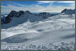
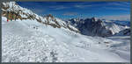
View from the Zugspitzplatt to the Hochblassen and the Wetterstein Mountains in beautiful winter weather. In the foreground, the Sonnenkar chairlift can be seen, which leads down into the Brunntal. (03.03.2018)
Christopher Pätz

AT THE AARTAL RESERVOIR IN THE LAHN-DILL DISTRICT/HESSE
The Aartal Reservoir in the Hessian LAHN-DILL DISTRICT has been damming the AAR, a tributary of the DILL, in the GLADENBACH MOUNTAINS since 1991... here on 5.3.2018 the entire shoreline is still covered by a layer of ice......
AT THE AARTAL RESERVOIR IN THE LAHN-DILL DISTRICT/HESSE The Aartal Reservoir in the Hessian LAHN-DILL DISTRICT has been damming the AAR, a tributary of the DILL, in the GLADENBACH MOUNTAINS since 1991... here on 5.3.2018 the entire shoreline is still covered by a layer of ice......
Hans-Peter Kampmann

Deutschland / Hessen / Landkreis Gieߥn

397 1200x1200 Px, 05.03.2018

View from the new Erfurt–Leipzig/Halle railway line towards the village of Dieskau (municipality of Kabelsketal) in nice weather. [4.2.2018 | 13:37]
Clemens Kral

View of a field in beautiful sunshine towards Zwintschöna (municipality of Kabelsketal). [4.2.2018 | 11:59 AM]
Clemens Kral

Hinter dem Acker und der Neubaustrecke Erfurt–Leipzig/Halle bei Benndorf (Gemeinde Kabelsketal) erkennt man imposante Silhouetten. Es handelt sich um Gebäude der Stadt Halle (Saale).
V.l.n.r.: Pauluskirche, Wasserturm Nord, Pylon der Berliner Brücke. [4.2.2018 | 11:05 Uhr]
Hinter dem Acker und der Neubaustrecke Erfurt–Leipzig/Halle bei Benndorf (Gemeinde Kabelsketal) erkennt man imposante Silhouetten. Es handelt sich um Gebäude der Stadt Halle (Saale). V.l.n.r.: Pauluskirche, Wasserturm Nord, Pylon der Berliner Brücke. [4.2.2018 | 11:05 Uhr]
Clemens Kral

Blick auf die leicht verschneiten Felder zwischen Bruckdorf (Stadt Halle (Saale)) und Zwintschöna (Gemeinde Kabelsketal). [4.2.2018 | 10:05 Uhr]
Clemens Kral