landschaftsfotos.eu Linie landschaftsfotos.eu
Hello guest, you are not logged in. Log in | Create account 
Forum   Contact   Legal notice
German English 
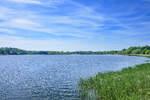
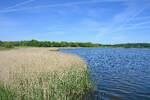
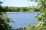
View of the Haddebyer Noor from the hiking trail near Loopstedt south of the Schlei. Photo taken: May 24, 2026.
Hans Christian Davidsen

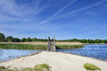
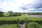
This wooden bridge is located at the point where the Haddebyer Noor south of the Schlei meets the Selker Noor. Photo taken: May 24, 2026.
Hans Christian Davidsen

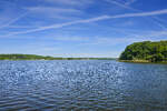
View of the Haddebyer Noor from the wooden bridge at Selker Noor south of the Schlei. Photo taken: May 24, 2026.
Hans Christian Davidsen

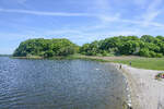
View of the sandy beach at the southern end of Haddebyer Noor, seen from the wooden bridge that crosses the Noor south of the Schlei. Photo taken on May 24, 2026.
Hans Christian Davidsen

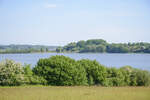
View over Selker Noor south of the Schlei. It is connected in the north via a 10-meter-wide narrow passage to the Haddebyer Noor and thus indirectly to the Schlei. Photo taken: May 24, 2026.
Hans Christian Davidsen

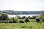
The Noor is connected to the Schlei – a fjord of the Baltic Sea – through two outlets in the north. To the south, the Selker Noor adjoins. Photo taken: May 24, 2026.
Hans Christian Davidsen

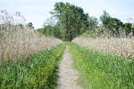
The path through the reed area between Haddebyer Noor and Selker Noor south of the Schlei. Photo taken: May 24, 2026.
Hans Christian Davidsen

View over the Haddebyer Noor from the ring fort of the former Viking town of Haithabu. Photo taken: May 24, 2026
Hans Christian Davidsen

View over the Haddebyer Noor from the ring fort of the former Viking town Haithabu. Photo taken: May 24, 2026.
Hans Christian Davidsen

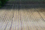
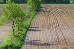
Fields of Margarethenwall seen west of Dannewerk. Shot: May 27, 2019.
Hans Christian Davidsen

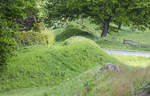
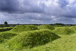
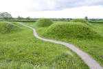
The Danevirke at the village of Danewerk east of Schleswig. Archaeology divides the construction history into a pre-Viking Age, a Viking Age, and a medieval phase. The main focus of the expansion activity lies in the pre-Viking Age. The Danevirke is therefore not a purely Viking Age monument.  
Photo taken: May 27, 2019.
The Danevirke at the village of Danewerk east of Schleswig. Archaeology divides the construction history into a pre-Viking Age, a Viking Age, and a medieval phase. The main focus of the expansion activity lies in the pre-Viking Age. The Danevirke is therefore not a purely Viking Age monument. Photo taken: May 27, 2019.
Hans Christian Davidsen

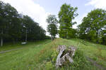
On the main rampart of Danewerk west of Schleswig. View westward towards Schanze 14. Photo taken: May 27, 2019.
Hans Christian Davidsen

The main rampart area in the Archaeological Park Danewerk west of Schleswig. The oldest parts of the Danewerk are two so far undated earthen ramparts. Around 700, a first major expansion followed, and an even stronger expansion in the year 737. During the Viking Age, the 7.5-kilometer-long Kograben and the connecting rampart were constructed, both related to the trading settlement Haithabu. The medieval works include the Waldemarsmauer, a castle from the Waldemar period, and the Thyraburg.  
Photo taken: May 27, 2019.
The main rampart area in the Archaeological Park Danewerk west of Schleswig. The oldest parts of the Danewerk are two so far undated earthen ramparts. Around 700, a first major expansion followed, and an even stronger expansion in the year 737. During the Viking Age, the 7.5-kilometer-long Kograben and the connecting rampart were constructed, both related to the trading settlement Haithabu. The medieval works include the Waldemarsmauer, a castle from the Waldemar period, and the Thyraburg. Photo taken: May 27, 2019.
Hans Christian Davidsen

The Danevirke at the Danevirke Museum. The Danevirke is a linear fortification from the early and high Middle Ages in northern Schleswig-Holstein. It consists of earthen ramparts with defensive ditches, a brick wall, two medieval motte-and-bailey castles, and a lake barrier. The Danevirke is considered the largest archaeological monument in Northern Europe and was designated a UNESCO World Heritage Site in 2018.
Photo taken: May 27, 2019.
The Danevirke at the Danevirke Museum. The Danevirke is a linear fortification from the early and high Middle Ages in northern Schleswig-Holstein. It consists of earthen ramparts with defensive ditches, a brick wall, two medieval motte-and-bailey castles, and a lake barrier. The Danevirke is considered the largest archaeological monument in Northern Europe and was designated a UNESCO World Heritage Site in 2018. Photo taken: May 27, 2019.
Hans Christian Davidsen

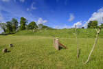
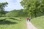
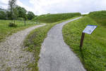
Hiking trail at Schanze 14 near Dannewerk west of Schleswig. The reconstructed fortification is a remnant from the German-Danish War of 1864. Photo taken: May 27, 2019.
Hans Christian Davidsen

Path to Redoubt 14 at the Danewerk west of Schleswig. Redoubt 14 is a redoubt of the Danewerk rebuilt in 2001, located not far from the Danewerk Museum and the Waldemarsmauer. Originally built between 1861 and 1863, Redoubt 14 was one of a total of 29 redoubts in the Danewerk defense system. Photo taken: May 27, 2019.
Hans Christian Davidsen

Hiking trails at Schanze 14 near Danewerk west of Schleswig. Schanze 14 is one of a total of 29 redoubts in the Danewerk defense system. Like the other redoubts, it was dismantled by Austrian troops after they took over the Danewerk without a fight in the first days of February 1864 (following the retreat of the Danish army to positions at the Düppeler Schanzen in North Schleswig).  
Photo taken: May 27, 2019.
Hiking trails at Schanze 14 near Danewerk west of Schleswig. Schanze 14 is one of a total of 29 redoubts in the Danewerk defense system. Like the other redoubts, it was dismantled by Austrian troops after they took over the Danewerk without a fight in the first days of February 1864 (following the retreat of the Danish army to positions at the Düppeler Schanzen in North Schleswig). Photo taken: May 27, 2019.
Hans Christian Davidsen

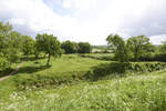
View of the landscape near Danewerk as seen from Schanze 14. The Danewerk (sometimes also Dannewerk) refers to a system of ramparts totaling 30 kilometers in length, built to protect the Danish Kingdom from attacks from the Frankish (later the German) Empire.  
Shot: May 27, 2019.
View of the landscape near Danewerk as seen from Schanze 14. The Danewerk (sometimes also Dannewerk) refers to a system of ramparts totaling 30 kilometers in length, built to protect the Danish Kingdom from attacks from the Frankish (later the German) Empire. Shot: May 27, 2019.
Hans Christian Davidsen

Schanze 14 near Danewerk, the largest archaeological monument in Northern Europe. During the German-Danish War of 1864, the Danewerk, besieged by Austrian troops, was abandoned in the first days of February due to catastrophic weather conditions (snowstorms at temperatures of minus 20 degrees), and the Danish troops withdrew to better defensible positions at the Düppeler Schanzen in North Schleswig.  
Photo taken: May 27, 2019.
Schanze 14 near Danewerk, the largest archaeological monument in Northern Europe. During the German-Danish War of 1864, the Danewerk, besieged by Austrian troops, was abandoned in the first days of February due to catastrophic weather conditions (snowstorms at temperatures of minus 20 degrees), and the Danish troops withdrew to better defensible positions at the Düppeler Schanzen in North Schleswig. Photo taken: May 27, 2019.
Hans Christian Davidsen

Dannewerk west of Schleswig - At the redoubt 14 from 1864, which was reconstructed in a German-Danish collaboration in 2001. Photo: May 27, 2019.
Hans Christian Davidsen

The landscape south of Danewerk as seen from Redoubt 14. Photo taken on May 27, 2019.
Hans Christian Davidsen

Fields of Margarethenwall seen west of Dannewerk. Photo taken: May 27, 2019.
Hans Christian Davidsen

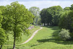
Hiking trail at the Waldemarsmauer near Dannewerk. Photo taken: May 27, 2019.
Hans Christian Davidsen