




Landkreis Göttingen Landschaftsfotos (Landschaften, Natur und Ausblicke)
60 Photos
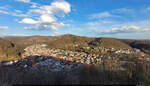
View of the Harz from the Hausberg in Bad Lauterberg on a clear late spring afternoon.
🕓 24.3.2023 | 5:10 PM
Clemens Kral
Clemens Kral
Germany / Lower Saxony / Harz
316 1600x915 Px, 29.06.2023
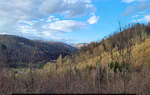
During a hike on the local mountain in Bad Lauterberg, the gaze wanders across the landscape of the Harz, here specifically towards the Großer Knollen.
🕓 24.3.2023 | 17:01 Uhr
Clemens Kral
Clemens Kral
Germany / Lower Saxony / Harz, Galleries / special topics / Forest
290 1600x1015 Px, 29.06.2023
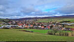
On the western edge of the Harz Mountains and near the former inner-German border lies Barbis, a district of the town Bad Lauterberg.
Captured during a walk on the Röhlberg.
🕓 19.2.2023 | 11:53 AM
Clemens Kral
Clemens Kral
Germany / Lower Saxony / Harz
210 1600x915 Px, 28.06.2023
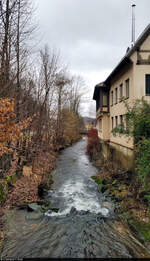
The Lutter flows into the Oder in Bad Lauterberg and is only 2.2 kilometers long. The image shows the tributary at the eponymous Lutterstraße at the height of Am Heibeek.
🕓 18.2.2023 | 13:08 Uhr
Clemens Kral
Clemens Kral
Germany / Lower Saxony / Harz, Galleries / special topics / Bodies of water
209 581x1012 Px, 28.06.2023
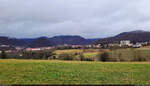
Changing visibility conditions (3/3):
A few minutes later, the entire town of Bad Lauterberg in the Harz and its surroundings can be seen again from the Brocken viewpoint. However, it is not enough to see all the way to the 1141-meter-high mountain.
🕓 18.2.2023 | 12:08 PM
Clemens Kral
Clemens Kral
Germany / Lower Saxony / Harz, Galleries / Weather phenomena / Clouds, Galleries / Seasons / Winter
270 1600x915 Px, 27.06.2023
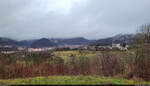
Changing visibility conditions (2/3):
After the shower over Bad Lauterberg has passed and the last rain clouds are moving away, you can see the town much better from Brockenblick.
🕓 18.2.2023 | 11:59 AM
Clemens Kral
After the shower over Bad Lauterberg has passed and the last rain clouds are moving away, you can see the town much better from Brockenblick.
🕓 18.2.2023 | 11:59 AM
Clemens Kral
Germany / Lower Saxony / Harz, Galleries / Weather phenomena / Clouds, Galleries / Seasons / Winter
245 1600x915 Px, 27.06.2023
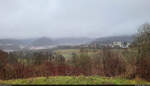
Changing Visibility Conditions (1/3):
The following images show how quickly the weather can change the view of the landscape within minutes. On a rainy winter day, we went to the Brocken viewpoint near Bad Lauterberg in the Harz. However, little could be seen from the location, let alone the famous mountain.
🕓 18.2.2023 | 11:55 AM
Clemens Kral
Germany / Lower Saxony / Harz, Galleries / Weather phenomena / Clouds, Galleries / Seasons / Winter
260 1600x915 Px, 27.06.2023
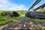
A so-called "wet storage" is located below the Werratal bridges between Hann. Münden and Hedemünden. Here, unused logs are sprayed with water around the clock to keep them fresh.
🕓 15.8.2022 | 4:30 PM
Clemens Kral
Clemens Kral
Germany / Lower Saxony / Göttingen, Galleries / special topics / Forest
234 1500x1015 Px, 29.12.2022
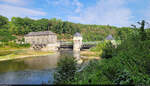
The magnificent weir and lock system "Letzter Heller" on the Werra near Hann. Münden was built until 1924 and is a protected monument.
🕓 15.8.2022 | 16:25 Uhr
Clemens Kral
Clemens Kral
Germany / Lower Saxony / Göttingen, Galleries / special topics / Bodies of water
248 1600x915 Px, 29.12.2022
Germany / Lower Saxony / Göttingen
245 1200x900 Px, 19.09.2021

"Ackerbergfalter", painting: oil on cotton, 2008, 85 x 120 cm; painted after a shot on the Reitstieg hiking trail on the Ackerkamm: Two pearl-bordered fritillaries on blossoms of ragwort...
Fred Hahn
Fred Hahn
Galleries / Miscellaneous / painted pictures
1412 1200x844 Px, 17.08.2014
Germany / Lower Saxony / Region Hannover, Germany / Lower Saxony / Harz
1553 800x535 Px, 13.09.2009