
landschaftsfotos.eu Linie landschaftsfotos.eu
Hello guest, you are not logged in. Log in | Create account 
Forum   Contact   Legal notice
German English 

Regierungsbezirk Freiburg Landschaftsfotos (Landschaften, Natur und Ausblicke)
1590 Photos
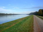
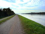
on the Rhine embankment with light early morning fog, north of Breisach, Oct. 2008
rainer ullrich

on the Rhine embankment with light early morning fog, north of Breisach, Oct. 2008
rainer ullrich

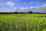
View from March Hill in the Rhine Plain over blooming field mustard fields to the Kaiserstuhl, Oct. 2018
rainer ullrich

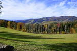
View from Lindenberg near St. Peter looking west over the autumnal Black Forest, Nov. 2018
rainer ullrich

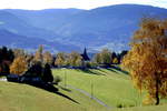
View of the pilgrimage church on the Lindenberg near St. Peter in the Black Forest, Nov. 2018
rainer ullrich

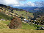
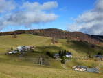
View of Hofsgrund on the southern slope of the 1284m high Schauinsland in the Black Forest, Nov.2015
rainer ullrich

View over the village of Hofsgrund to the southern slope of the Schauinsland, Nov. 2018
rainer ullrich

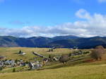
View over the village of Hofsgrund to the High Black Forest with the Feldberg, Nov. 2015
rainer ullrich

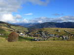
View of Hofsgrund, a district of Oberried in the Black Forest, Nov. 2015
rainer ullrich

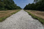
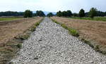
the dried-up riverbed of the Dreisam, west of Freiburg in Aug. 2018
rainer ullrich

the dried-up riverbed of the Dreisam, west of Freiburg in August 2018
rainer ullrich

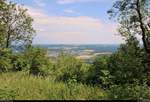
View from Hohenhewen (844 m above sea level) in Hegau towards the northeast and the town of Engen, a few hours before a thunderstorm.  
[15.7.2018 | 12:50 PM]
View from Hohenhewen (844 m above sea level) in Hegau towards the northeast and the town of Engen, a few hours before a thunderstorm. [15.7.2018 | 12:50 PM]
Clemens Kral

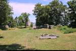
View of parts of the castle ruins on the Hohenhewen (844 m above sea level) in the Hegau. There are also seating areas and a fire pit here.  
[15.7.2018 | 12:41 PM]
View of parts of the castle ruins on the Hohenhewen (844 m above sea level) in the Hegau. There are also seating areas and a fire pit here. [15.7.2018 | 12:41 PM]
Clemens Kral

View from Hohenhewen (844 m above sea level) in Hegau towards the east, a few hours before a thunderstorm.  
[15.7.2018 | 12:39 PM]
View from Hohenhewen (844 m above sea level) in Hegau towards the east, a few hours before a thunderstorm. [15.7.2018 | 12:39 PM]
Clemens Kral

View from Hohenhewen (844 m above sea level) in Hegau towards the southeast or towards Welschingen, a district of Engen, a few hours before a thunderstorm.  
[15.7.2018 | 12:37 PM]
View from Hohenhewen (844 m above sea level) in Hegau towards the southeast or towards Welschingen, a district of Engen, a few hours before a thunderstorm. [15.7.2018 | 12:37 PM]
Clemens Kral

View from Hohenhewen (844 m above sea level) in the Hegau region towards the southwest, a few hours before a thunderstorm.  
[15.7.2018 | 12:22 PM]
View from Hohenhewen (844 m above sea level) in the Hegau region towards the southwest, a few hours before a thunderstorm. [15.7.2018 | 12:22 PM]
Clemens Kral

View from Hohenhewen (844 m above sea level) in the Hegau region towards the northeast and the town of Engen, a few hours before a thunderstorm.  
[15.7.2018 | 12:20 PM]
View from Hohenhewen (844 m above sea level) in the Hegau region towards the northeast and the town of Engen, a few hours before a thunderstorm. [15.7.2018 | 12:20 PM]
Clemens Kral

View from Hohenhewen (844 m above sea level) in the Hegau region towards the northwest, a few hours before a thunderstorm.  
[15.7.2018 | 12:20 PM]
View from Hohenhewen (844 m above sea level) in the Hegau region towards the northwest, a few hours before a thunderstorm. [15.7.2018 | 12:20 PM]
Clemens Kral

View towards Hohenstoffeln (842 m above sea level) during a hike to Hohenhewen (844 m above sea level) in the Hegau.  
[15.7.2018 | 11:05 AM]
View towards Hohenstoffeln (842 m above sea level) during a hike to Hohenhewen (844 m above sea level) in the Hegau. [15.7.2018 | 11:05 AM]
Clemens Kral

View towards Hohenstoffeln (842 m above sea level) during a hike on the Hohenhewen (844 m above sea level) in the Hegau.  
[15.7.2018 | 10:42 AM]
View towards Hohenstoffeln (842 m above sea level) during a hike on the Hohenhewen (844 m above sea level) in the Hegau. [15.7.2018 | 10:42 AM]
Clemens Kral

View from Engen-Welschingen to the Hohenhewen (843.7 m above sea level), the local mountain of the town of Engen in the Hegau region.  
[15.7.2018 | 10:30 AM]
View from Engen-Welschingen to the Hohenhewen (843.7 m above sea level), the local mountain of the town of Engen in the Hegau region. [15.7.2018 | 10:30 AM]
Clemens Kral

View from the Old Rhine Bridge in Konstanz over Lake Constance.  
[12.7.2018 | 17:09]
View from the Old Rhine Bridge in Konstanz over Lake Constance. [12.7.2018 | 17:09]
Clemens Kral

View from Seestraße in Konstanz overlooking Lake Constance.  
[12.7.2018 | 4:45 PM]
View from Seestraße in Konstanz overlooking Lake Constance. [12.7.2018 | 4:45 PM]
Clemens Kral

View from Seeburgpark in Kreuzlingen (CH) over Lake Constance towards Konstanz.  
[12.7.2018 | 14:34]
View from Seeburgpark in Kreuzlingen (CH) over Lake Constance towards Konstanz. [12.7.2018 | 14:34]
Clemens Kral