




Hegau photos

rainer ullrich
151 1200x867 Px, 21.04.2025
Jörg Reuter
281 1200x900 Px, 14.02.2021
Jörg Reuter
322 1200x900 Px, 14.02.2021
269 1200x900 Px, 16.03.2020
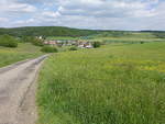
250 1200x900 Px, 16.03.2020
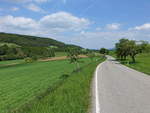
251 1200x900 Px, 16.03.2020
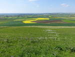
239 1200x900 Px, 16.03.2020
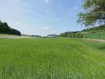
267 1200x900 Px, 16.03.2020
![View from Hohenhewen (844 m above sea level) in Hegau towards the northeast and the town of Engen, a few hours before a thunderstorm.
[15.7.2018 | 12:50 PM]](/bilder/thumbs/deutschland--baden-wuerttemberg--hegau-38995.jpg "View from Hohenhewen (844 m above sea level) in Hegau towards the northeast and the town of Engen, a few hours before a thunderstorm.
[15.7.2018 | 12:50 PM]")
Clemens Kral
376 1200x815 Px, 11.10.2018
![View of parts of the castle ruins on the Hohenhewen (844 m above sea level) in the Hegau. There are also seating areas and a fire pit here.
[15.7.2018 | 12:41 PM]](/bilder/thumbs/deutschland--baden-wuerttemberg--hegau-38994.jpg "View of parts of the castle ruins on the Hohenhewen (844 m above sea level) in the Hegau. There are also seating areas and a fire pit here.
[15.7.2018 | 12:41 PM]")
Clemens Kral
359 1200x815 Px, 11.10.2018
![View from Hohenhewen (844 m above sea level) in Hegau towards the east, a few hours before a thunderstorm.
[15.7.2018 | 12:39 PM]](/bilder/thumbs/deutschland--baden-wuerttemberg--hegau-38993.jpg "View from Hohenhewen (844 m above sea level) in Hegau towards the east, a few hours before a thunderstorm.
[15.7.2018 | 12:39 PM]")
Clemens Kral
397 1200x815 Px, 11.10.2018
![View from Hohenhewen (844 m above sea level) in Hegau towards the southeast or towards Welschingen, a district of Engen, a few hours before a thunderstorm.
[15.7.2018 | 12:37 PM]](/bilder/thumbs/deutschland--baden-wuerttemberg--hegau-38992.jpg "View from Hohenhewen (844 m above sea level) in Hegau towards the southeast or towards Welschingen, a district of Engen, a few hours before a thunderstorm.
[15.7.2018 | 12:37 PM]")
Clemens Kral
358 1200x815 Px, 11.10.2018
![View from Hohenhewen (844 m above sea level) in the Hegau region towards the southwest, a few hours before a thunderstorm.
[15.7.2018 | 12:22 PM]](/bilder/thumbs/deutschland--baden-wuerttemberg--hegau-38991.jpg "View from Hohenhewen (844 m above sea level) in the Hegau region towards the southwest, a few hours before a thunderstorm.
[15.7.2018 | 12:22 PM]")
Clemens Kral
336 1200x815 Px, 11.10.2018
![View from Hohenhewen (844 m above sea level) in the Hegau region towards the northeast and the town of Engen, a few hours before a thunderstorm.
[15.7.2018 | 12:20 PM]](/bilder/thumbs/deutschland--baden-wuerttemberg--hegau-38990.jpg "View from Hohenhewen (844 m above sea level) in the Hegau region towards the northeast and the town of Engen, a few hours before a thunderstorm.
[15.7.2018 | 12:20 PM]")
Clemens Kral
368 1200x815 Px, 11.10.2018
![View from Hohenhewen (844 m above sea level) in the Hegau region towards the northwest, a few hours before a thunderstorm.
[15.7.2018 | 12:20 PM]](/bilder/thumbs/deutschland--baden-wuerttemberg--hegau-38989.jpg "View from Hohenhewen (844 m above sea level) in the Hegau region towards the northwest, a few hours before a thunderstorm.
[15.7.2018 | 12:20 PM]")
Clemens Kral
326 1200x815 Px, 11.10.2018
![View towards Hohenstoffeln (842 m above sea level) during a hike to Hohenhewen (844 m above sea level) in the Hegau.
[15.7.2018 | 11:05 AM]](/bilder/thumbs/deutschland--baden-wuerttemberg--hegau-38988.jpg "View towards Hohenstoffeln (842 m above sea level) during a hike to Hohenhewen (844 m above sea level) in the Hegau.
[15.7.2018 | 11:05 AM]")
Clemens Kral
365 1200x815 Px, 11.10.2018
![View towards Hohenstoffeln (842 m above sea level) during a hike on the Hohenhewen (844 m above sea level) in the Hegau.
[15.7.2018 | 10:42 AM]](/bilder/thumbs/deutschland--baden-wuerttemberg--hegau-38986.jpg "View towards Hohenstoffeln (842 m above sea level) during a hike on the Hohenhewen (844 m above sea level) in the Hegau.
[15.7.2018 | 10:42 AM]")
Clemens Kral
421 1200x815 Px, 11.10.2018
![View from Engen-Welschingen to the Hohenhewen (843.7 m above sea level), the local mountain of the town of Engen in the Hegau region.
[15.7.2018 | 10:30 AM]](/bilder/thumbs/deutschland--baden-wuerttemberg--hegau-38985.jpg "View from Engen-Welschingen to the Hohenhewen (843.7 m above sea level), the local mountain of the town of Engen in the Hegau region.
[15.7.2018 | 10:30 AM]")
Clemens Kral
493 1200x815 Px, 10.10.2018
750 1200x772 Px, 07.02.2014
rainer ullrich
947 1024x690 Px, 01.04.2013
rainer ullrich
1090 1024x681 Px, 07.09.2012
813 1024x575 Px, 02.02.2010

942 4 535x800 Px, 31.08.2009