landschaftsfotos.eu Linie landschaftsfotos.eu
Hello guest, you are not logged in. Log in | Create account 
Forum   Contact   Legal notice
German English 
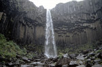
Svartifoss in Skaftafell in Vatnajökull National Park in Iceland. Slide image. Shot: August 1995.
Hans Christian Davidsen

Island / Regionen / Ostland - Austurland

627 1200x795 Px, 31.05.2016

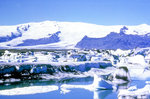
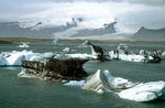
The Jokulsárlón lagoon at Vatnajökull in Iceland. Slide image. Shot: August 1995.
Hans Christian Davidsen

Island / Regionen / Ostland - Austurland

419 1200x792 Px, 31.05.2016

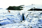
On the Vatnajökull glacier. Slide image. Shot: August 1995.
Hans Christian Davidsen

Island / Regionen / Ostland - Austurland

426 1200x799 Px, 31.05.2016

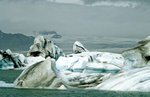
The Jokulsárlón lagoon at Vatnajökull in Iceland. Slide image. Shot: August 1995.
Hans Christian Davidsen

Island / Regionen / Ostland - Austurland

394 1200x782 Px, 31.05.2016

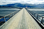
Bridge over Reyðará on the Ring Road 1 between Höfn and Egilsstaðir. Slide image. Shot: August 1995.
Hans Christian Davidsen

Island / Regionen / Ostland - Austurland

400 1200x783 Px, 31.05.2016

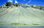
Volcanic mountain on the Ring Road 1 in Iceland. Slide image. Shot: August 1995.
Hans Christian Davidsen

Island / Regionen / Ostland - Austurland

415 1200x778 Px, 31.05.2016

The Jokulsárlón lagoon at Vatnajökull in Iceland. Slide image. Shot: July 1995.
Hans Christian Davidsen

Island / Regionen / Ostland - Austurland

381 1200x785 Px, 30.05.2016

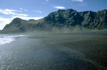
Black lava beach in Austurland - Iceland. Slide image. Shot: July 1995.
Hans Christian Davidsen

Island / Regionen / Ostland - Austurland

385 1200x788 Px, 30.05.2016

In Iceland, there is a main road, Road Number 1. This ring road circles around the entire island. The photo shows the coastal road in Austurland. Image from a slide. Taken: July 1995.
Hans Christian Davidsen

Island / Regionen / Ostland - Austurland

332 1200x801 Px, 30.05.2016

Bridge over the glacier river Skeidarar in the 30 km wide eastern part of the Skeidararsandur in June 1997, the left part of the bridge was destroyed during the glacier outburst flood in November 1996, the flood wave is said to have been up to 40 m high, the coastal shore of the sandur was pushed up to 600 m further into the sea. The access ramp was rebuilt after the flood wave, the provisional ring road had only been passable here again for a few days.
Günther Glauz

Island / Regionen / S�nd - Su𵲬and

1159 800x547 Px, 23.02.2007

Jökulsarlon in June 1997
Günther Glauz

Island / Regionen / S�nd - Su𵲬and

980 800x539 Px, 20.02.2007

Ring Road about 65 km west of Höfn on the south coast, in June 1997 most of the Ring Road was still not paved but looked like this, today most of it is paved. The Ring Road has also become shorter; in 1996 it was just under 1500 km, today it is only 1336 km due to shortcuts, new bridges, and tunnels.
Günther Glauz

Island / Regionen / S�nd - Su𵲬and

1183 800x550 Px, 20.02.2007

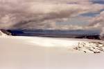
View over the Vatnajökull glacier to the east; continuing by jeep was not permitted in June 1997 for safety reasons. The Bardarbunga volcano beneath the glacier erupted on 02.10.1996, and the heat melted large amounts of ice into a 450 m high underground water lake, which broke through the ice on the south coast on 04.11.1996. Parts of the ice cover have collapsed, but large cavities were still suspected, which could collapse at any time.
Günther Glauz

Island / Regionen / S�nd - Su𵲬and

1242 800x537 Px, 20.02.2007

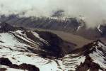
Kalfafellsdalur in June 1997, taken from the edge of the Vatnajökull glacier; unfortunately, the mountain peaks on the other side of the valley were not visible. The mountains are approximately 1400 m high.
Günther Glauz

Island / Regionen / S�nd - Su𵲬and

1108 800x538 Px, 20.02.2007

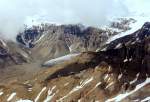
After about 15 km drive from the Berghotel Jöklasel over the Vatnajökull glacier, we arrived at the glacier edge at an altitude of 1200 m with a beautiful view to the west over and into the Kalfafellsdalur (valley), taken in June 1997.
Günther Glauz

Island / Regionen / S�nd - Su𵲬and

1222 800x549 Px, 20.02.2007

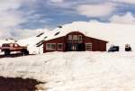
Mountain hotel Jöklasel at 840 m altitude on the edge of the Skalafellsjökull (Vatnajökull) 55 km west of Höfn on the south coast in June 1997.
Günther Glauz

Island / Regionen / S�nd - Su𵲬and

1369 800x539 Px, 19.02.2007

Skalafellsjökull, part of Vatnajökull, about 40 km west of Höfn on the south coast in June 1997.
Günther Glauz

Island / Regionen / S�nd - Su𵲬and

1619 800x542 Px, 19.02.2007

Youth Hostel Vagnsstadir (right) with farm 50 km west of Höfn on the south coast in June 1997, this hostel manager and farmer has a third profession: excursion rides with the jeep on the Vatnajökull glacier.
Günther Glauz

Island / Regionen / S�nd - Su𵲬and

1295 800x535 Px, 19.02.2007

Abandoned former American radar station on the south coast of Iceland in June 1997, only one thing the Americans forgot: to turn off the light, the street lighting was still on!
Günther Glauz

Island / Regionen / S�nd - Su𵲬and

1128 800x543 Px, 18.02.2007