landschaftsfotos.eu Linie landschaftsfotos.eu
Hello guest, you are not logged in. Log in | Create account 
Forum   Contact   Legal notice
German English 

Photos by Hans Christian Davidsen

4155 Photos
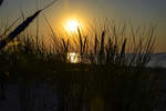
Sunset on the beach in front of Czołpino and the Slowinski National Park in Hinterpommern. Photo taken on August 16, 2020.
Hans Christian Davidsen

Poland / Baltic Sea coast with hinterland / Pomerania

408 1200x790 Px, 06.09.2020

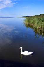
The Jezioro Łebsko (German Lebasee) in the Słowiński National Park on the Polish Baltic Sea coast. Shot: August 17, 2020.
Hans Christian Davidsen

Poland / Baltic Sea coast with hinterland / Pomerania

216 800x1200 Px, 06.09.2020

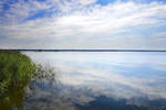
With an area of 75 square kilometers, Lake Leba (Jezioro Łebsko) is the largest of the Pomeranian coastal lakes. It is now part of the Słowiński National Park. Photo taken: August 17, 2020.
Hans Christian Davidsen

Poland / Baltic Sea coast with hinterland / Pomerania

268 1200x800 Px, 06.09.2020

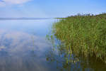
The Jezioro Łebsko (German Lebasee). The lake was the subject of a failed project starting in 1776. The goal was to lower the water level of Lake Leba and thereby facilitate the drainage of the surrounding swamps. For this purpose, the Prussian authorities had a canal dug from Lake Leba to the Baltic Sea, approximately in the middle of the spit.<br>The canal was used as a seaport for shipping from 1777. However, it soon became apparent that during storms, water from the Baltic Sea was pushed into the canal and thus into Lake Leba, causing the water level of Lake Leba to rise and resulting in flooding.<br>During a storm in 1779, the canal structure was destroyed, and there was a risk that the breach would widen and that Lake Leba could become a bay of the Baltic Sea. Therefore, the canal was closed again in 1783, and the old outflow of the Leba from Lake Leba was cleaned and restored.<br>Photo taken: August 17, 2020.
The Jezioro Łebsko (German Lebasee). The lake was the subject of a failed project starting in 1776. The goal was to lower the water level of Lake Leba and thereby facilitate the drainage of the surrounding swamps. For this purpose, the Prussian authorities had a canal dug from Lake Leba to the Baltic Sea, approximately in the middle of the spit.
The canal was used as a seaport for shipping from 1777. However, it soon became apparent that during storms, water from the Baltic Sea was pushed into the canal and thus into Lake Leba, causing the water level of Lake Leba to rise and resulting in flooding.
During a storm in 1779, the canal structure was destroyed, and there was a risk that the breach would widen and that Lake Leba could become a bay of the Baltic Sea. Therefore, the canal was closed again in 1783, and the old outflow of the Leba from Lake Leba was cleaned and restored.
Photo taken: August 17, 2020.

Hans Christian Davidsen

Poland / Baltic Sea coast with hinterland / Pomerania

237 1200x800 Px, 06.09.2020

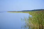
The Jezioro Łebsko (German Lebasee) is a coastal lake in the Polish Pomeranian Voivodeship. The Lebasee is separated from the Baltic Sea by a spit that is 800 meters to 2.5 kilometers wide and 17 kilometers long. Photo taken: August 17, 2020.
Hans Christian Davidsen

Poland / Baltic Sea coast with hinterland / Pomerania

248 1200x800 Px, 06.09.2020

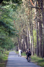
On the bike path between Leba and the wandering dune Wydma Łącka (Lontzko Dune). Photo taken: August 17, 2020.
Hans Christian Davidsen

Poland / Baltic Sea coast with hinterland / Pomerania

229 800x1200 Px, 06.09.2020

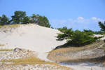
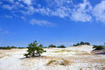
Dunes in the Słowiński National Park east of the former missile launch pads near Rąbka. Photo taken on August 17, 2020.
Hans Christian Davidsen

Poland / Baltic Sea coast with hinterland / Pomerania

221 1200x800 Px, 06.09.2020

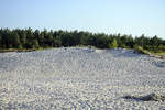
Dunes in the Słowiński National Park east of the former missile launch pads near Rąbka. Photo taken: August 17, 2020.
Hans Christian Davidsen

Poland / Baltic Sea coast with hinterland / Pomerania

229 1200x800 Px, 06.09.2020

Sunset on the beach in front of Czołpino in Słowiński National Park in Farther Pomerania. Shot: August 16, 2020.
Hans Christian Davidsen

Poland / Baltic Sea coast with hinterland / Pomerania

246 1200x800 Px, 06.09.2020

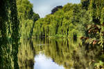
In the Park Książąt Pomorskich (Park of the Pomeranian Dukes) in Koszalin/Köslin. Photo taken on August 16, 2020.
Hans Christian Davidsen

In the Park Książąt Pomorskich (Park of the Pomeranian Dukes) in Koszalin/Köslin. Over two kilometers of green areas lie along the Dzierzecinka River around the city center of Koszalin. Photo taken: August 16, 2020.
Hans Christian Davidsen

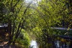
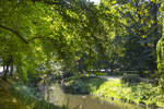
The listed park of the Pomeranian Dukes in Koszalin/Köslin. The oldest part of the park, the so-called  Old Promenade,  was established in 1817 at the foot of the defensive wall. The work on creating the park avenues, regulating the river, as well as the construction of the fountain and the pond lasted until 1838. Photo taken: August 16, 2020.
The listed park of the Pomeranian Dukes in Koszalin/Köslin. The oldest part of the park, the so-called "Old Promenade," was established in 1817 at the foot of the defensive wall. The work on creating the park avenues, regulating the river, as well as the construction of the fountain and the pond lasted until 1838. Photo taken: August 16, 2020.
Hans Christian Davidsen

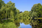
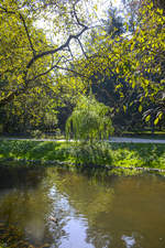
The listed park of the Pomeranian Dukes in Koszalin/Köslin. In the years 1933/34, the pond was enlarged and the Swan Island was created. Photo: August 16, 2020.
Hans Christian Davidsen

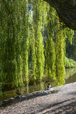
In the Książąt Pomorskich Park (Park of the Pomeranian Dukes) in Koszalin/Köslin. Over two kilometers of green areas stretch along the Dzierzecinka River around the city center of Koszalin. Photo taken: August 16, 2020.
Hans Christian Davidsen

Poland / Baltic Sea coast with hinterland / Pomerania

231 800x1200 Px, 05.09.2020

In the Książąt Pomorskich Park (Park of the Pomeranian Dukes) in Koszalin/Köslin. Over two kilometers of green spaces stretch along the Dzierzecinka River around the city center of Koszalin. Photo taken: August 16, 2020.
Hans Christian Davidsen

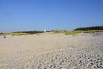
On the beach in front of Leba in Farther Pomerania. Shot: August 16, 2020.
Hans Christian Davidsen

Poland / Baltic Sea coast with hinterland / Pomerania

233 1200x800 Px, 05.09.2020

At the beautiful beach in front of Leba in Pomerania. Shot: August 16, 2020.
Hans Christian Davidsen

Poland / Baltic Sea coast with hinterland / Pomerania

246 1200x800 Px, 05.09.2020

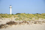
Dunes on the east beach of Leba on the Polish Baltic Sea. Photo taken on August 16, 2020.
Hans Christian Davidsen

Poland / Baltic Sea coast with hinterland / Pomerania

224 1200x800 Px, 05.09.2020

Landscape at the Flensburg Outer Fjord near Westerholz. Date: July 25, 2020.
Hans Christian Davidsen

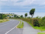
View of the Flensburg Outer Fjord from Haffstraße in Westerholz near Langballigau. Photo taken on July 25, 2020.
Hans Christian Davidsen

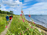
The Gendarmen Path from the Danish Padborg/Pattburg to the Danish Høruphav/Höruphaff is considered one of the most beautiful hiking trails in Denmark and can be explored over its 74 km by bike or on foot. Lovely landscapes, gentle hills, and sandy beaches accompany the former patrol route (here near Egernsund/Ekensund) of the gendarmes along the Flensburg Fjord. Photo taken: July 12, 2020.
Hans Christian Davidsen

Denmark / South Denmark / Sonderborg

403 1200x900 Px, 13.07.2020

The Lower Elbe between Glückstadt in Schleswig-Holstein and Wischhafen in Lower Saxony. Photo taken on June 26, 2020.
Hans Christian Davidsen

Germany / Schleswig-Holstein / Steinburg District

266 1200x900 Px, 29.06.2020

The Lower Elbe between Glückstadt in Schleswig-Holstein and Wischhafen in Lower Saxony. Shot: June 26, 2020.
Hans Christian Davidsen

Germany / Schleswig-Holstein / Steinburg District

256 1200x900 Px, 29.06.2020

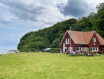
On the beach in front of Sandwig (Glücksburg). Shot: June 3, 2020.
Hans Christian Davidsen