landschaftsfotos.eu Linie landschaftsfotos.eu
Hello guest, you are not logged in. Log in | Create account 
Forum   Contact   Legal notice
German English 

Photos by Hans Christian Davidsen
4155 Photos
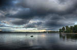
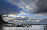
The sky over Helgasjön north of the town of Växjö in Swedish Småland. The municipality of Växjö consists of about 13% lakes and rivers. Even the name Växjö suggests this, as it probably means  road by the lake.  Photo taken on July 19, 2017.
The sky over Helgasjön north of the town of Växjö in Swedish Småland. The municipality of Växjö consists of about 13% lakes and rivers. Even the name Växjö suggests this, as it probably means "road by the lake." Photo taken on July 19, 2017.
Hans Christian Davidsen

Sweden / Southern Sweden (Götaland) / Smaaland

399 1200x778 Px, 05.08.2017

Evedal is a large recreational area on the shore of Helgasjön, north of Växjö. Here you will find beautiful bathing beaches, a small marina with rentals, a mini-golf course, restaurants, playgrounds, fishing opportunities, and many hiking trails. Photo taken: July 17, 2017.
Hans Christian Davidsen

Sweden / Southern Sweden (Götaland) / Smaaland

480 1200x797 Px, 05.08.2017

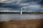
The diving tower at the beach of »Evedalsbadet« on Lake Helgasjön in Växjö. Evedal is a large recreational area on the shore of Helgasjön, north of Växjö. Here you will find beautiful swimming beaches, a small marina with rentals, a mini-golf course, restaurants, playgrounds, fishing opportunities, and many hiking trails.

Photo taken: July 17, 2017.
The diving tower at the beach of »Evedalsbadet« on Lake Helgasjön in Växjö. Evedal is a large recreational area on the shore of Helgasjön, north of Växjö. Here you will find beautiful swimming beaches, a small marina with rentals, a mini-golf course, restaurants, playgrounds, fishing opportunities, and many hiking trails. Photo taken: July 17, 2017.
Hans Christian Davidsen

Sweden / Southern Sweden (Götaland) / Smaaland

825 1200x797 Px, 05.08.2017

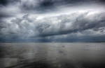
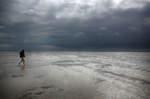
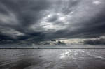
Rain clouds over the North Frisian Wadden Sea between the island of Föhr and the Hallig Oland. The photo was taken during a mudflat hiking tour. Shot: June 25, 2017.
Hans Christian Davidsen

Germany / Schleswig-Holstein / North Frisia

444 1200x780 Px, 29.06.2017

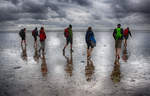
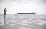
Mudflat hiking between the North Frisian mainland and the Hallig Oland.

Mudflat hiking refers to a walk in the mudflats. This can be undertaken under the guidance of an experienced mudflat guide who is familiar with the particular dangers of the mudflats. There are mudflat hiking trails to or between some islands, which are sometimes marked with bush stakes and offer protection with rescue beacons in case hikers are caught by the tide.
Photo taken: June 25, 2017.
Mudflat hiking between the North Frisian mainland and the Hallig Oland. Mudflat hiking refers to a walk in the mudflats. This can be undertaken under the guidance of an experienced mudflat guide who is familiar with the particular dangers of the mudflats. There are mudflat hiking trails to or between some islands, which are sometimes marked with bush stakes and offer protection with rescue beacons in case hikers are caught by the tide. Photo taken: June 25, 2017.
Hans Christian Davidsen

Germany / Schleswig-Holstein / North Frisia

492 1200x770 Px, 29.06.2017

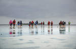
Mudflat hiking in the North Frisian Wadden Sea. As part of an organized mudflat tour, you can receive information about the Wadden Sea natural area, the organisms in the mudflat soil, and the effects of the tides on the Wadden Sea. Guided mudflat hikes are offered by most tourist offices and nature conservation organizations such as the Wadden Sea Conservation Station.

Photo taken: June 25, 2017.
Mudflat hiking in the North Frisian Wadden Sea. As part of an organized mudflat tour, you can receive information about the Wadden Sea natural area, the organisms in the mudflat soil, and the effects of the tides on the Wadden Sea. Guided mudflat hikes are offered by most tourist offices and nature conservation organizations such as the Wadden Sea Conservation Station. Photo taken: June 25, 2017.
Hans Christian Davidsen

Germany / Schleswig-Holstein / North Frisia

405 1200x796 Px, 29.06.2017

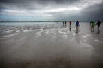
Mudflat hiking in the North Frisian Wadden Sea. A mudflat hike away from the coast should only be undertaken by the inexperienced in the company of a mudflat guide, as the tidal channels are flooded first during high tide, potentially cutting off the return route. Mudflat guides are informed about the daily changing tides and the shifting course of the tidal channels and plan the hike accordingly.

Another danger is sea fog, which can suddenly appear and make orientation difficult or even impossible.

Photo taken: June 25, 2017.
Mudflat hiking in the North Frisian Wadden Sea. A mudflat hike away from the coast should only be undertaken by the inexperienced in the company of a mudflat guide, as the tidal channels are flooded first during high tide, potentially cutting off the return route. Mudflat guides are informed about the daily changing tides and the shifting course of the tidal channels and plan the hike accordingly. Another danger is sea fog, which can suddenly appear and make orientation difficult or even impossible. Photo taken: June 25, 2017.
Hans Christian Davidsen

Germany / Schleswig-Holstein / North Frisia

382 1200x785 Px, 29.06.2017

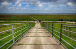
On the dike of the Hallig Land in the North Frisian Wadden Sea. The Halligen rise only a few meters above sea level, which is why they are flooded during a strong tide except for the Warften, artificially raised mounds on which the houses stand (»Landunter«).

Shot: June 25, 2017.
On the dike of the Hallig Land in the North Frisian Wadden Sea. The Halligen rise only a few meters above sea level, which is why they are flooded during a strong tide except for the Warften, artificially raised mounds on which the houses stand (»Landunter«). Shot: June 25, 2017.
Hans Christian Davidsen

Germany / Schleswig-Holstein / North Frisia

425 1200x780 Px, 29.06.2017

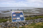
End of the mudflat hiking route between Dagebüll and the Hallig Land in North Frisia. The Schleswig-Holstein Wadden Sea National Park extends from the German-Danish maritime border in the north to the Elbe estuary in the south. In the North Frisian part, it includes the mudflats around the geest core and marsh islands and Halligen.  
Photo taken: June 25, 2017.
End of the mudflat hiking route between Dagebüll and the Hallig Land in North Frisia. The Schleswig-Holstein Wadden Sea National Park extends from the German-Danish maritime border in the north to the Elbe estuary in the south. In the North Frisian part, it includes the mudflats around the geest core and marsh islands and Halligen. Photo taken: June 25, 2017.
Hans Christian Davidsen

Germany / Schleswig-Holstein / North Frisia

419 1200x796 Px, 29.06.2017

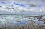
Low tide in the Wadden Sea of the North Sea between the mainland and the island of Föhr - North Frisia. Shot: June 25, 2017.
Hans Christian Davidsen

Germany / Schleswig-Holstein / North Frisia

407 1200x798 Px, 29.06.2017

View of the Hallig Oland from the Wadden Sea in front of Dagebüll (North Frisia). Vast areas of the Wadden Sea regularly dry out twice daily during low tide and are flooded during high tide. The areas that dry out at low tide are called mudflats. 

Photo taken: June 25, 2017.
View of the Hallig Oland from the Wadden Sea in front of Dagebüll (North Frisia). Vast areas of the Wadden Sea regularly dry out twice daily during low tide and are flooded during high tide. The areas that dry out at low tide are called mudflats. Photo taken: June 25, 2017.
Hans Christian Davidsen

Germany / Schleswig-Holstein / North Frisia

430 1200x769 Px, 29.06.2017

The Wadden Sea south of Der Hallig Land in North Frisia. Shot: June 25, 2017.
Hans Christian Davidsen

Germany / Schleswig-Holstein / North Frisia

406 1200x797 Px, 25.06.2017

Low tide in the Wadden Sea north of Hallig Land in North Frisia. Photo taken: June 25, 2017.
Hans Christian Davidsen

Germany / Schleswig-Holstein / North Frisia

1071 1200x783 Px, 25.06.2017

The Hallig land seen from the Wadden Sea. The Halligen are small, unprotected or only slightly protected marsh islands off the coasts, which can be flooded during storm surges. They are located in the North Frisian Wadden Sea on the North Sea coast of Schleswig-Holstein. Photo taken: June 25, 2017.
Hans Christian Davidsen

Germany / Schleswig-Holstein / Halligen

406 1200x789 Px, 25.06.2017

The Wadden Sea at low tide between Dagebüll and the Hallig Land. Photo taken on June 25, 2017.
Hans Christian Davidsen

Germany / Schleswig-Holstein / North Frisia

374 1200x782 Px, 25.06.2017

The Wadden Sea at low tide between Dagebüll and the Hallig Land. Photo taken on June 25, 2017.
Hans Christian Davidsen

Germany / Schleswig-Holstein / North Frisia

483 1200x797 Px, 25.06.2017

The Wadden Sea at low tide between Dagebüll and the Hallig Land. Photo taken on June 25, 2017.
Hans Christian Davidsen

Germany / Schleswig-Holstein / North Frisia

379 1200x797 Px, 25.06.2017

The Wadden Sea at low tide between Dagebüll and the Hallig Land. Photo taken on June 25, 2017.
Hans Christian Davidsen

Germany / Schleswig-Holstein / North Frisia

385 1200x797 Px, 25.06.2017

The Wadden Sea at low tide between Dagebüll and the Hallig Land. Photo taken on June 25, 2017.
Hans Christian Davidsen

Germany / Schleswig-Holstein / North Frisia

550 1200x790 Px, 25.06.2017

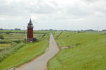
The dike along the riverside path south of Dagebüll in North Frisia. The Old Lighthouse can be seen on the left side of the image. Photo taken: June 25, 2017.
Hans Christian Davidsen

Germany / Schleswig-Holstein / North Frisia

402 1200x797 Px, 25.06.2017

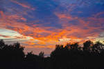
Sunset over the Schäferhaus Foundation Land nature reserve near Flensburg. Photo taken: June 15, 2017.
Hans Christian Davidsen

 Tumlepladsen  (in German:  Tobe-Platz ) in the Riis Skov of Aarhus. Photo taken on June 5, 2017.
"Tumlepladsen" (in German: "Tobe-Platz") in the Riis Skov of Aarhus. Photo taken on June 5, 2017.
Hans Christian Davidsen

Denmark / Jutland / Central Jutland

408 1200x788 Px, 05.06.2017

View of the Kattegat from Riis Skov near Aarhus. Date of capture: June 5, 2017.
Hans Christian Davidsen

Denmark / Jutland / Central Jutland

360 1200x793 Px, 05.06.2017

At the lake »Baggelhuizer Plas« east of the city of Assen in Drenthe, Holland/Netherlands. Photo taken: May 25, 2017.
Hans Christian Davidsen

Netherlands / Drenthe / Central Drenthe

431 1200x787 Px, 28.05.2017