landschaftsfotos.eu Linie landschaftsfotos.eu
Hello guest, you are not logged in. Log in | Create account 
Forum   Contact   Legal notice
German English 

Photos by André Breutel
744 Photos
In the Drava Valley; 09.01.2012
André Breutel

ֳterreich / K䲮ten / Karawanken

472 800x533 Px, 01.04.2012

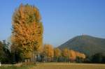
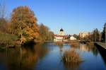
I don't think Napoleon ever dreamed of how beautiful his avenues look in autumn. A poplar avenue with the Holandsboug in the background. Alsace; 23.10.2011
André Breutel

Frankreich / Regionen / Elsass / Eberbach - Seltz

435 800x533 Px, 17.11.2011

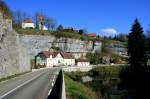
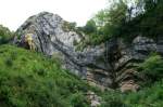
One of the most fantastic loops is formed by the Doubs at the limestone cliffs near Morteau; 22.10.2011
André Breutel

Frankreich / Fl� / Doubs

551 800x533 Px, 17.11.2011

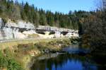
One of the most fantastic loops is formed by the Doubs at the limestone cliffs near Morteau; 22.10.2011
André Breutel

Frankreich / Fl� / Doubs

579 800x533 Px, 17.11.2011

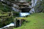
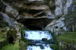
The Source of the Loue; 22.10.2011
André Breutel

Frankreich / Regionen / Jura / Haut-Jura

577 800x533 Px, 17.11.2011

The Source of the Loue; 22.10.2011
André Breutel

Frankreich / Regionen / Jura / Haut-Jura

524 800x533 Px, 17.11.2011

On the Doubs near Pontarlier; 22.10.2011
André Breutel

Autumn in the French Jura; 22.10.2011
André Breutel

Frankreich / Regionen / Jura / Haut-Jura

585 533x800 Px, 17.11.2011

One of the most spectacular mountain faults is the  Capeau de Gendarme  near Saint Claude; 03.09.2011
One of the most spectacular mountain faults is the "Capeau de Gendarme" near Saint Claude; 03.09.2011
André Breutel

Frankreich / Regionen / Jura / Haut-Jura

549 800x533 Px, 17.11.2011

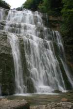
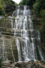
Cascades du Hérisson; 17.09.2011
André Breutel

Frankreich / Regionen / Jura / Haut-Jura

505 533x800 Px, 05.11.2011

Cascades du Hérisson; 17.09.2011
André Breutel

Frankreich / Regionen / Jura / Haut-Jura

484 533x800 Px, 05.11.2011

Eine Wanderung durch die Aareschlucht, 21.08.2011
André Breutel

Schweiz / Kanton Bern / Aareschlucht

455 800x533 Px, 05.11.2011

Die Aare hat sich ihr Flußbett unter einer schmalen Feslspalte gefressen; 21.08.2011
André Breutel

Schweiz / Kanton Bern / Aareschlucht

439 533x800 Px, 05.11.2011

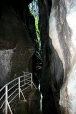
In einer schmalen Felsspalte unter die sich die Aare gefressen hat; 21.08.2011
André Breutel

Schweiz / Kanton Bern / Aareschlucht

427 533x800 Px, 05.11.2011

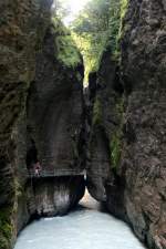
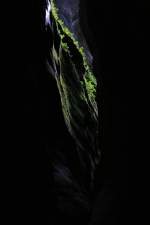
Sparse daylight falls into a narrow rock crevice of the Aare Gorge; 21.08.2011
André Breutel

Schweiz / Kanton Bern / Aareschlucht

585  2 533x800 Px, 05.11.2011

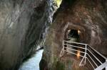
Zum Teil mussten Stollen durch den Fels gehauen werden um die Aareschlucht passierbar zu machen. Der Weg war im 19. Jh. aber nicht für die Touristen von heute geplant; 21.08.2011
André Breutel

Schweiz / Kanton Bern / Aareschlucht

498 800x533 Px, 05.11.2011

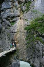
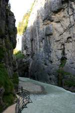
The path through the Aare Gorge runs along narrow walkways beside the rock face. The path through the gorge was completed in 1888. 21.08.2011
André Breutel

Schweiz / Kanton Bern / Aareschlucht

496 533x800 Px, 05.11.2011

The Aare Gorge is 1400m long. The rock walls rise up to 1400m vertically above the riverbed; 21.08.2011
André Breutel

Schweiz / Kanton Bern / Aareschlucht

455 533x800 Px, 05.11.2011

View from the Aare Gorge over the upper Aare Valley towards Lake Grimsel; 21.08.2011
André Breutel

Schweiz / Kanton Bern / Aareschlucht

545 800x533 Px, 05.11.2011

In the karst region of the French Jura, a river originates that breathtakingly makes its way through the Jura. It is the Doubs, for me one of the most beautiful rivers in Europe. Over its 453 km length from Mouthe to Verdun-sur-le-Doubs, it initially winds eastward, flowing through beautiful valleys, several lakes, and plunging 27 meters deep. At Saint-Ursanne, it changes direction and flows northwest towards Belfort, the largest city on its banks. There it turns westward and then flows into the Saône. Source la Doubs on 27.08.2011
André Breutel

Frankreich / Fl� / Doubs

780 800x533 Px, 18.09.2011

The Doubs originates in an impressive way. As a karst river, it leaves its source cave near Mouthe as a fairly large river. Near Pontarlier, large amounts of its water seep away and reemerge at the karst spring of the Loun. Although the Doubs is 453 km long, due to its M-shaped course, the source and mouth are only 90 km apart. Source de Doubs on 17.08.2011
André Breutel

Frankreich / Fl� / Doubs

795 800x533 Px, 18.09.2011

A typical karst landscape with bizarrely shaped rocks is traversed by the Doubs along wide parts of its upper course. The Val de Doubs near Pontarlier; 22.04.2011
André Breutel

Frankreich / Fl� / Doubs

686 800x533 Px, 18.09.2011

On its course through the Jura, the Doubs flows through several lakes. For example, the well-known Lac des Brenets near Le Locle with its rock formations; 18.09.2010
André Breutel

Frankreich / Fl� / Doubs

593 800x534 Px, 18.09.2011

Rock formations at Lac des Brenets; 18.09.2010
André Breutel

Frankreich / Fl� / Doubs

577 800x533 Px, 18.09.2011