landschaftsfotos.eu Linie landschaftsfotos.eu
Hello guest, you are not logged in. Log in | Create account 
Forum   Contact   Legal notice
German English 

Photos by Ivonne Pitzius
37 Photos
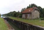
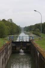
On 24.08.2013, we traveled with the museum railway from Attigny to Challerange. The railway line runs for many kilometers parallel to the river L'Aisne and the Canal de Vouziers. Here is a view of the lock at Voncq.
Ivonne Pitzius

Frankreich / Fl� / Canal de Vouziers

488 680x1024 Px, 06.09.2013

On 24.08.2013 we traveled with the museum railway from Attigny to Challerange. The railway line runs for many kilometers parallel to the river L'Aisne and the Canal de Vouziers. Here is a view of the lock at Voncq.
Ivonne Pitzius

Frankreich / Fl� / Canal de Vouziers

490 1200x821 Px, 06.09.2013

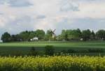
View from the Syrau train stop of the village windmill in the Vogtland near Plauen. The mill was built in 1887 in the style of a tower Dutch mill.  
28.05.2013
View from the Syrau train stop of the village windmill in the Vogtland near Plauen. The mill was built in 1887 in the style of a tower Dutch mill. 28.05.2013
Ivonne Pitzius

Deutschland / Sachsen / Vogtland

843 1024x698 Px, 25.06.2013

View from the Saargau near Felsberg/Saar over the Saar Valley and the Saarlouis Basin - 23.09.2012
Ivonne Pitzius

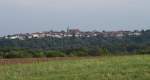
View of Berus.

The old town center is located on a spur of the Saargau overlooking the vast lowlands of the Saar, directly on the border with Lorraine (France).

Worth seeing is the historic town center with the tithe barn and Scharfeneck gatehouse.

Also noteworthy are the Oranna Chapel and the Europe Monument as well as the longwave transmission facility of Europe I.

23.09.2012
View of Berus. The old town center is located on a spur of the Saargau overlooking the vast lowlands of the Saar, directly on the border with Lorraine (France). Worth seeing is the historic town center with the tithe barn and Scharfeneck gatehouse. Also noteworthy are the Oranna Chapel and the Europe Monument as well as the longwave transmission facility of Europe I. 23.09.2012
Ivonne Pitzius

Nature and Industry.

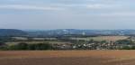
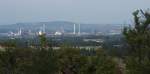
After an 8-minute walk from our house, this view of the Saar Valley opens up.

The view extends from the orchard meadows of Sauberg near Felsberg across the Saar Valley with Dillinger Hütte and the central coking plant to the Litermont, a hill near Nalbach. The Litermont has an elevation of 414 meters.

Felsberg/Saar on 23.09.2012
Nature and Industry. After an 8-minute walk from our house, this view of the Saar Valley opens up. The view extends from the orchard meadows of Sauberg near Felsberg across the Saar Valley with Dillinger Hütte and the central coking plant to the Litermont, a hill near Nalbach. The Litermont has an elevation of 414 meters. Felsberg/Saar on 23.09.2012
Ivonne Pitzius

Deutschland / Saarland / Landkreis Saarlouis

654 1024x506 Px, 09.02.2013

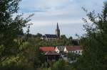
Just a 5-minute walk from our house, this view offers a glimpse of part of our hometown in the Saargau region.

Felsberg/Saar with St. Nicholas Church on 23.09.2012
Just a 5-minute walk from our house, this view offers a glimpse of part of our hometown in the Saargau region. Felsberg/Saar with St. Nicholas Church on 23.09.2012
Ivonne Pitzius

Interesting in the Saar Valley.  
Winery Schloss Saarstein near Serrig.  
29.09.2012
Interesting in the Saar Valley. Winery Schloss Saarstein near Serrig. 29.09.2012
Ivonne Pitzius

Deutschland / Rheinland-Pfalz / Saartal

1059 1024x727 Px, 15.01.2013

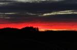
Breathtaking sunset in the Vogtland.  
At 4:41 PM on December 29, 2012, this stunning evening sky appeared at Kornbach in the Vogtland.
Breathtaking sunset in the Vogtland. At 4:41 PM on December 29, 2012, this stunning evening sky appeared at Kornbach in the Vogtland.
Ivonne Pitzius

Deutschland / Sachsen / Vogtland

802 1024x680 Px, 10.01.2013

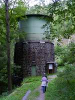
Hydroelectric Power Plant Höllental/Upper Franconia - Water Tower. To harness the hydropower of the Selbitz River in the Franconian Höllental, a strong gradient is needed. The valley of the small river does not provide this. Therefore, almost 2 kilometers upstream from the power plant, the water is dammed at a weir and channeled through pipelines to the power plant. There, it is temporarily stored in a water tower and then fed to the turbine from a height of just over 30 meters. 13.08.2012
Ivonne Pitzius

Deutschland / Bayern / Oberfranken

1393 768x1024 Px, 08.12.2012

To harness the hydropower of the Selbitz in the Franconian Höllental, a steep gradient is required. The valley of the small river does not provide this. Therefore, almost 2 kilometers before the power plant, the water is dammed at a weir and channeled through pipes to the power plant. There it is temporarily stored in a water tower and then fed to the turbine from a height of just over 30 meters.

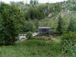
Behind the building at the weir runs the route of the former Höllental railway.
13.08.2012
To harness the hydropower of the Selbitz in the Franconian Höllental, a steep gradient is required. The valley of the small river does not provide this. Therefore, almost 2 kilometers before the power plant, the water is dammed at a weir and channeled through pipes to the power plant. There it is temporarily stored in a water tower and then fed to the turbine from a height of just over 30 meters. Behind the building at the weir runs the route of the former Höllental railway. 13.08.2012
Ivonne Pitzius

Deutschland / Bayern / Oberfranken

750 1024x768 Px, 07.12.2012

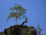
The Hirschsprung is not only found in the Black Forest in the Höllental but also in the  Franconian  Höllental. The Höllental in Upper Franconia stretches from the village of Hölle to Blechschmidtenhammer (Lichtenberg) in the valley of the Selbitz.

The actual landmark of the Höllental is the Hirschsprung, the wooden carved depiction of a jumping stag. The life-sized sculpture is located on a rock ledge 80 meters above the valley floor.

The  Franconian Höllentalbahn  once ran through the valley from Marxgrün to Blankenstein (Thuringia).
13.08.2012
The Hirschsprung is not only found in the Black Forest in the Höllental but also in the "Franconian" Höllental. The Höllental in Upper Franconia stretches from the village of Hölle to Blechschmidtenhammer (Lichtenberg) in the valley of the Selbitz. The actual landmark of the Höllental is the Hirschsprung, the wooden carved depiction of a jumping stag. The life-sized sculpture is located on a rock ledge 80 meters above the valley floor. The "Franconian Höllentalbahn" once ran through the valley from Marxgrün to Blankenstein (Thuringia). 13.08.2012
Ivonne Pitzius

Deutschland / Bayern / Oberfranken

1234 1024x768 Px, 07.12.2012

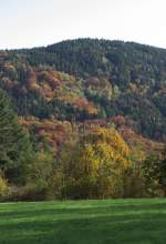
Landscape on the Saar near Taben-Rodt - 21.10.2012
Ivonne Pitzius

Deutschland / Rheinland-Pfalz / Saartal

787 698x1024 Px, 16.11.2012