landschaftsfotos.eu Linie landschaftsfotos.eu
Hello guest, you are not logged in. Log in | Create account 
Forum   Contact   Legal notice
German English 

Landschaftsbilder, Landschaftsaufnahmen, Bilder von Landschaften from Juni 2017

Auf Landschaftsfotos.eu hochgeladene Bilder im Juni 2017:

2. Juni 2017 (8 Photos)

Beautiful  flower arrangement  - 13.05.2017
Beautiful "flower arrangement" - 13.05.2017
Rolf Reinhardt

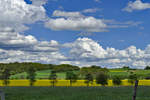
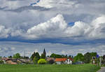
Eifel landscape near Bad Münstereifel (clouds-fields-forest-trees) - 13.05.2017
Rolf Reinhardt
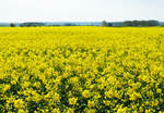
Rapeseed Blossom Field near Rheinbach - 20.04.2017
Rolf Reinhardt

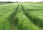
Deep tire tracks right through the grain field near Euskirchen - 12.05.2017
Rolf Reinhardt

Galerien / Pflanzen und Pilze / Nutzpflanzen

339 1024x725 Px, 02.06.2017

Full moon with clearly visible  impact craters  on the underside - 09.04.2017
Full moon with clearly visible "impact craters" on the underside - 09.04.2017
Rolf Reinhardt

Wind turbines in the cornfield near Odendorf....in the background fittingly the high-voltage power line - 26.05.2017
Rolf Reinhardt
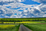
Gloomy clouds over Eu-Wißkirchen - 10.05.2017
Rolf Reinhardt

Clouds - Forest - Fields near  Billiger Wald  close to Euskirchen - 12.05.2017
Clouds - Forest - Fields near "Billiger Wald" close to Euskirchen - 12.05.2017
Rolf Reinhardt

5. Juni 2017 (13 Photos)
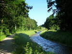
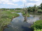
The small river Neumagen, coming from the Black Forest, flows through the Rhine plain, here between Bad Krozingen and Biengen, May 2017
rainer ullrich
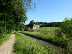
the small Black Forest river Neumagen between Bad Krozingen and Biengen, May 2017
rainer ullrich
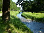
the small Black Forest river Neumagen between Bad Krozingen and Biengen, May 2017
rainer ullrich
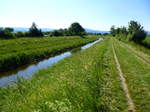
the channelized section of the Black Forest footbridge Möhlin in the Rhine plain near Hausen a.M., with the Black Forest in the background, May 2017
rainer ullrich
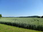
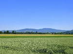
View from the village of Hausen an der Möhlin over the Rhine Plain towards the north, on the right the southern tip of the Tuniberg, further left on the horizon the Kaiserstuhl, May 2017
rainer ullrich

Deutschland / Baden-W�emberg / Rheinebene

469 1200x900 Px, 05.06.2017

18.04.2017 Another onset of winter at Fuchseck / Albtrauf
Claus Seifert
Deutschland / Baden-W�emberg / Landkreis G�ngen

354 1024x682 Px, 05.06.2017

18.04.2017 Another onset of winter at Fuchseck / Albtrauf
Claus Seifert

Deutschland / Baden-W�emberg / Landkreis G�ngen

379 1024x682 Px, 05.06.2017

07.04.2017 The Fuchseck in the evening light
Claus Seifert

Deutschland / Baden-W�emberg / Landkreis G�ngen

400 1024x682 Px, 05.06.2017

05.05.2017 Sunset between Hattenhofen and Sparwiesen
Claus Seifert

Deutschland / Baden-W�emberg / Landkreis G�ngen

372 1024x682 Px, 05.06.2017

27.05.2017 ... and a few minutes later, the chimneys belong to the Altbach power plant.
Claus Seifert

27.05.2017 View into the Neckar Valley after sunset above Rosswälden ...
Claus Seifert
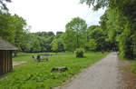
View of the Kattegat from Riis Skov near Aarhus. Date of capture: June 5, 2017.
Hans Christian Davidsen

D䮥mark / J�nd / Midtjylland

353 1200x793 Px, 05.06.2017

 Tumlepladsen  (in German:  Tobe-Platz ) in the Riis Skov of Aarhus. Photo taken on June 5, 2017.
"Tumlepladsen" (in German: "Tobe-Platz") in the Riis Skov of Aarhus. Photo taken on June 5, 2017.
Hans Christian Davidsen

D䮥mark / J�nd / Midtjylland

404 1200x788 Px, 05.06.2017

10. Juni 2017 (10 Photos)

In the Danube floodplains near Aholfing, Straubing district (02.06.2017)
Peter Reiser
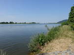
Deutschland / Bayern / Niederbayern

356 1200x900 Px, 10.06.2017

On the Danube near Frengkofen, Lower Bavaria (02.06.2017)
Peter Reiser
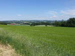
Deutschland / Bayern / Niederbayern

374 1200x900 Px, 10.06.2017

View of the front Bavarian Forest near Kürn (02.06.2017)
Peter Reiser
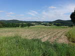
Deutschland / Bayern / Bayerischer Wald

374 1200x900 Px, 10.06.2017

Fields near Maiershof in the district of Cham (02.06.2017)
Peter Reiser
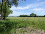
Deutschland / Bayern / Bayerischer Wald

405 1200x900 Px, 10.06.2017

Vast plain between the Main River and Staigerwald near Alitzheim, Lower Franconia (28.05.2017)
Peter Reiser

Deutschland / Bayern / Unterfranken

337 1200x900 Px, 10.06.2017

Wind turbines near Frankenwinheim in Lower Franconia (28.05.2017)
Peter Reiser
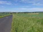
Deutschland / Bayern / Unterfranken

367 1200x900 Px, 10.06.2017

View of the village of Kützberg in the Main-Rhön region in Lower Franconia (28.05.2017)
Peter Reiser
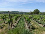
Deutschland / Bayern / Unterfranken

353 1200x900 Px, 10.06.2017

Vineyards near Lindach in Lower Franconia (28.05.2017)
Peter Reiser
Deutschland / Bayern / Unterfranken

356 1200x900 Px, 10.06.2017

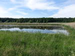
Small lake near Obervolkach in the district of Kitzingen in Lower Franconia (28.05.2017)
Peter Reiser
Deutschland / Bayern / Unterfranken

382 1200x900 Px, 10.06.2017

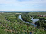
View of the Main River from the Vogelsberg, Lower Franconia (28.05.2017)
Peter Reiser

Deutschland / Bayern / Unterfranken

404 1200x900 Px, 10.06.2017

12. Juni 2017 (2 Photos)

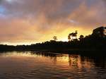
Dawn at the Taponahony River near Palumeu in Suriname, 28.5.2017
Mario Ulbricht
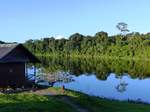
The Taponahony River near Palumeu in Suriname on 27.5.2017
Mario Ulbricht

S�erika / Suriname / Distrikt Sipaliwini

389 1200x900 Px, 12.06.2017

16. Juni 2017 (2 Photos)

During a Himalayan sightseeing flight on the morning of 15.10.2012 in Nepal, we saw, among others, Mount Everest (8848m) and Lhotse (8516m)
Mario Ulbricht

Asien / China / Gebierge

420 1200x900 Px, 16.06.2017

On a Himalayan sightseeing flight on the morning of 15.10.2012, we saw Mt. Everest (8848m), Lhotse (8516m), and Makalu (8481m).
Mario Ulbricht

Asien / China / Gebierge

408 1200x900 Px, 16.06.2017

21. Juni 2017 (5 Photos)

View from Hausen an der Möhlin over the Rhine Plain to the southern Kaiserstuhl, May 2017
rainer ullrich
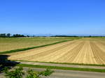
View from Biengen OT Dottinghofen looking west over the Rhine Plain towards the Vosges, May 2017
rainer ullrich
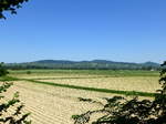
Deutschland / Baden-W�emberg / Rheinebene

416 1200x900 Px, 21.06.2017

View from the western Tuniberg near Merdingen towards the Kaiserstuhl, May 2017
rainer ullrich
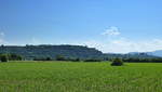
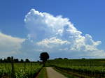
View from the Rhine plain near Hausen a.M. towards the southern foothills of the Tuniberg, with the Black Forest in the background on the right, May 2017
rainer ullrich
Deutschland / Baden-W�emberg / Rheinebene

496 1200x684 Px, 21.06.2017

Thunderstorm clouds over the Black Forest, seen from the Tuniberg, May 2017
rainer ullrich

22. Juni 2017 (8 Photos)
Elderberry bush in full bloom - 02.06.2017
Rolf Reinhardt

Galerien / Pflanzen und Pilze / Str䵣her

400 694x1024 Px, 22.06.2017

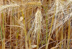
Wheat ears, not yet fully ripe near Euskirchen - 17.06.2017
Rolf Reinhardt

Poppy at the field edge near Bad Münstereifel - 17.06.2017
Rolf Reinhardt
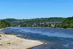
Rhine view over Wallen, Linz to Burg Ockenfels (all on the right bank of the Rhine). 27.05.2017
Rolf Reinhardt
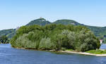
Rhine island Nonnenwerth, in the background the Siebengebirge with Drachenfels and castle ruins, as well as further to the left the Drachenburg castle - 27.05.2017
Rolf Reinhardt
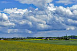
Leaning Birch Avenue near Euskirchen - 26.05.25017
Rolf Reinhardt

Clouds, forest, and fields in spring in the Voreifel. On the right side of the image, between the chimney and the high-voltage mast, a bit of the Siebengebirge can be seen at a distance of 35 km. 12.05.2017
Rolf Reinhardt
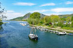
Marina on the Rhine in Bad Honnef with a view up to the Drachenfels - 30.04.2017
Rolf Reinhardt

25. Juni 2017 (10 Photos)

Sunset over the Stiftungsland Schäferhaus nature reserve near Flensburg. Photo taken: June 15, 2017.
Hans Christian Davidsen
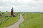
The dike along the riverside path south of Dagebüll in North Frisia. The Old Lighthouse can be seen on the left side of the image. Photo taken: June 25, 2017.
Hans Christian Davidsen
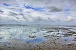
Deutschland / Schleswig-Holstein / Nordfriesland

397 1200x797 Px, 25.06.2017

The Wadden Sea at low tide between Dagebüll and the Hallig Land. Photo taken on June 25, 2017.
Hans Christian Davidsen
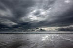
Deutschland / Schleswig-Holstein / Nordfriesland

545 1200x790 Px, 25.06.2017

The Wadden Sea at low tide between Dagebüll and the Hallig Land. Photo taken on June 25, 2017.
Hans Christian Davidsen
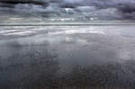
Deutschland / Schleswig-Holstein / Nordfriesland

382 1200x797 Px, 25.06.2017

The Wadden Sea at low tide between Dagebüll and the Hallig Land. Photo taken on June 25, 2017.
Hans Christian Davidsen
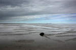
Deutschland / Schleswig-Holstein / Nordfriesland

376 1200x797 Px, 25.06.2017

The Wadden Sea at low tide between Dagebüll and the Hallig Land. Photo taken on June 25, 2017.
Hans Christian Davidsen
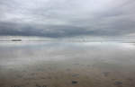
Deutschland / Schleswig-Holstein / Nordfriesland

480 1200x797 Px, 25.06.2017

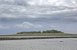
The Wadden Sea at low tide between Dagebüll and the Hallig Land. Photo taken on June 25, 2017.
Hans Christian Davidsen
Deutschland / Schleswig-Holstein / Nordfriesland

370 1200x782 Px, 25.06.2017

The Hallig land seen from the Wadden Sea. The Halligen are small, unprotected or only slightly protected marsh islands off the coasts, which can be flooded during storm surges. They are located in the North Frisian Wadden Sea on the North Sea coast of Schleswig-Holstein. Photo taken: June 25, 2017.
Hans Christian Davidsen

Deutschland / Schleswig-Holstein / Halligen

402 1200x789 Px, 25.06.2017

Low tide in the Wadden Sea north of Hallig Land in North Frisia. Photo taken: June 25, 2017.
Hans Christian Davidsen

Deutschland / Schleswig-Holstein / Nordfriesland

1067 1200x783 Px, 25.06.2017

The Wadden Sea south of Der Hallig Land in North Frisia. Shot: June 25, 2017.
Hans Christian Davidsen

Deutschland / Schleswig-Holstein / Nordfriesland

403 1200x797 Px, 25.06.2017

29. Juni 2017 (8 Photos)

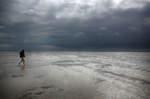
View of the Hallig Oland from the Wadden Sea in front of Dagebüll (North Frisia). Vast areas of the Wadden Sea regularly dry out twice daily during low tide and are flooded during high tide. The areas that dry out at low tide are called mudflats. 

Photo taken: June 25, 2017.
View of the Hallig Oland from the Wadden Sea in front of Dagebüll (North Frisia). Vast areas of the Wadden Sea regularly dry out twice daily during low tide and are flooded during high tide. The areas that dry out at low tide are called mudflats. Photo taken: June 25, 2017.
Hans Christian Davidsen
Deutschland / Schleswig-Holstein / Nordfriesland

427 1200x769 Px, 29.06.2017

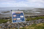
Low tide in the Wadden Sea of the North Sea between the mainland and the island of Föhr - North Frisia. Shot: June 25, 2017.
Hans Christian Davidsen
Deutschland / Schleswig-Holstein / Nordfriesland

401 1200x798 Px, 29.06.2017

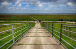
End of the mudflat hiking route between Dagebüll and the Hallig Land in North Frisia. The Schleswig-Holstein Wadden Sea National Park extends from the German-Danish maritime border in the north to the Elbe estuary in the south. In the North Frisian part, it includes the mudflats around the geest core and marsh islands and Halligen.  
Photo taken: June 25, 2017.
End of the mudflat hiking route between Dagebüll and the Hallig Land in North Frisia. The Schleswig-Holstein Wadden Sea National Park extends from the German-Danish maritime border in the north to the Elbe estuary in the south. In the North Frisian part, it includes the mudflats around the geest core and marsh islands and Halligen. Photo taken: June 25, 2017.
Hans Christian Davidsen
Deutschland / Schleswig-Holstein / Nordfriesland

413 1200x796 Px, 29.06.2017

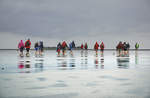
On the dike of the Hallig Land in the North Frisian Wadden Sea. The Halligen rise only a few meters above sea level, which is why they are flooded during a strong tide except for the Warften, artificially raised mounds on which the houses stand (»Landunter«).

Shot: June 25, 2017.
On the dike of the Hallig Land in the North Frisian Wadden Sea. The Halligen rise only a few meters above sea level, which is why they are flooded during a strong tide except for the Warften, artificially raised mounds on which the houses stand (»Landunter«). Shot: June 25, 2017.
Hans Christian Davidsen
Deutschland / Schleswig-Holstein / Nordfriesland

423 1200x780 Px, 29.06.2017

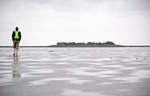
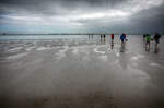
Mudflat hiking in the North Frisian Wadden Sea. A mudflat hike away from the coast should only be undertaken by the inexperienced in the company of a mudflat guide, as the tidal channels are flooded first during high tide, potentially cutting off the return route. Mudflat guides are informed about the daily changing tides and the shifting course of the tidal channels and plan the hike accordingly.

Another danger is sea fog, which can suddenly appear and make orientation difficult or even impossible.

Photo taken: June 25, 2017.
Mudflat hiking in the North Frisian Wadden Sea. A mudflat hike away from the coast should only be undertaken by the inexperienced in the company of a mudflat guide, as the tidal channels are flooded first during high tide, potentially cutting off the return route. Mudflat guides are informed about the daily changing tides and the shifting course of the tidal channels and plan the hike accordingly. Another danger is sea fog, which can suddenly appear and make orientation difficult or even impossible. Photo taken: June 25, 2017.
Hans Christian Davidsen
Deutschland / Schleswig-Holstein / Nordfriesland

377 1200x785 Px, 29.06.2017

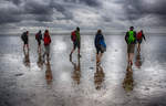
Mudflat hiking in the North Frisian Wadden Sea. As part of an organized mudflat tour, you can receive information about the Wadden Sea natural area, the organisms in the mudflat soil, and the effects of the tides on the Wadden Sea. Guided mudflat hikes are offered by most tourist offices and nature conservation organizations such as the Wadden Sea Conservation Station.

Photo taken: June 25, 2017.
Mudflat hiking in the North Frisian Wadden Sea. As part of an organized mudflat tour, you can receive information about the Wadden Sea natural area, the organisms in the mudflat soil, and the effects of the tides on the Wadden Sea. Guided mudflat hikes are offered by most tourist offices and nature conservation organizations such as the Wadden Sea Conservation Station. Photo taken: June 25, 2017.
Hans Christian Davidsen
Deutschland / Schleswig-Holstein / Nordfriesland

399 1200x796 Px, 29.06.2017

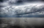
Mudflat hiking between the North Frisian mainland and the Hallig Oland.

Mudflat hiking refers to a walk in the mudflats. This can be undertaken under the guidance of an experienced mudflat guide who is familiar with the particular dangers of the mudflats. There are mudflat hiking trails to or between some islands, which are sometimes marked with bush stakes and offer protection with rescue beacons in case hikers are caught by the tide.
Photo taken: June 25, 2017.
Mudflat hiking between the North Frisian mainland and the Hallig Oland. Mudflat hiking refers to a walk in the mudflats. This can be undertaken under the guidance of an experienced mudflat guide who is familiar with the particular dangers of the mudflats. There are mudflat hiking trails to or between some islands, which are sometimes marked with bush stakes and offer protection with rescue beacons in case hikers are caught by the tide. Photo taken: June 25, 2017.
Hans Christian Davidsen
Deutschland / Schleswig-Holstein / Nordfriesland

487 1200x770 Px, 29.06.2017

Rain clouds over the North Frisian Wadden Sea between the island of Föhr and the Hallig Oland. The photo was taken during a mudflat hiking tour. Shot: June 25, 2017.
Hans Christian Davidsen


Deutschland / Schleswig-Holstein / Nordfriesland

439 1200x780 Px, 29.06.2017