Auf Landschaftsfotos.eu hochgeladene Bilder im Juli 2012:
![]()
1. Juli 2012 (3 Photos)
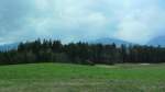
A meadow in the beautiful Tyrolean village of Gnadenwald on 14.4.2012.
Markus
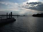
View of the Elbe River at the Teufelsbrück ferry terminal in Hamburg-Nienstedten. Taken in June 2012.
Michael Lembke
2. Juli 2012 (6 Photos)
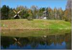
Windmills from bygone times in the Rocca al Mare open-air museum.
(08.05.2012)
Christine Wohlfahrt
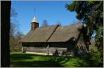
The old chapel from the 19th century used to stand on one of the islands of Estonia, and was brought from there to the Rocca al Mare Open-Air Museum to preserve it.
(08.05.2012)
Christine Wohlfahrt
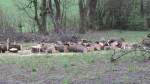
This maple tree, felled due to storm damage, was dismantled into its individual parts near Brixlegg. (15.4.2012)
Markus
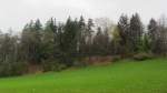
Lush spring field near Brixlegg. (15.4.2012)
Markus
3. Juli 2012 (7 Photos)
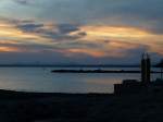
Mallorca, evening mood, seen from Colonia de Sant Jordi, May 2012
rainer ullrich
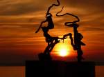
Mallorca, sunset observed through an artwork on the beach of Colonia de Sant Jordi, May 2012
rainer ullrich
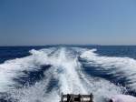
Mallorca, speedboat ride, the island of Cabrera (Goat Island) on the horizon, May 2012
rainer ullrich
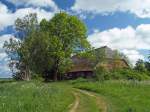
On Ummanz (18.05.2008), you can wonderfully get around on foot or by bike, but there are no tourist highlights there. However, you have an abundance of nature, a fairly attractive surfing area, and in autumn and spring, a resting place for migrating cranes.
Thomas Scherf
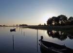
Evening mood on 18.05.2008 on the Baltic Sea island of Ummanz, a beautiful spot of nature off the beaten tourist paths located between Rügen and Hiddensee. A small bridge from Rügen leads onto the island, so you can easily arrive by car, park it, and simply enjoy the tranquility. I initially considered using the category Rügen-Hiddensee, but that wouldn't be entirely accurate.
Thomas Scherf
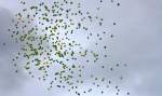
Balloons in the Brazilian colors fly into the summer sky.
Taken at the opening ceremony of the CHIO 2012 in Aachen on 3.7.2012.
Stefan Hochstetter
4. Juli 2012 (12 Photos)
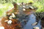
A mountain stream near the Oderteich in the Harz National Park; shot in the afternoon of 30.06.2012 from the "Fairy Tale Trail" between Torfhaus and the Oderteich.
Fred Hahn
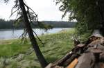
The Oderteich in the Harz National Park; shot in the afternoon of 30.06.2012 from the circular hiking trail on the eastern shore of the reservoir.
Fred Hahn
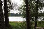
Deciduous trees on the shore of the Oderteich in Harz National Park; photo taken in the afternoon of 30.06.2012 from the circular hiking trail on the eastern shore of the lake.
Fred Hahn
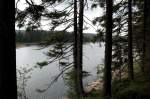
The Oderteich in the Harz National Park; dark clouds have moved in front of the sun; shot in the late afternoon of June 30, 2012, from the circular hiking trail on the steep east shore down to the water surface of the lake.
Fred Hahn
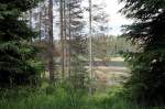
The Oderteich amidst the emerging primeval forest in the Harz National Park; view in the late afternoon of 30.06.2012 from the circular hiking trail on the west shore of the reservoir.
Fred Hahn
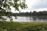
The Oderteich in the Harz National Park; view in the late afternoon of 30.06.2012 from the circular hiking trail on the east shore across the sparkling water surface to the other side.
Fred Hahn
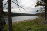
Dark clouds over the Oderteich in the Harz National Park; shot in the late afternoon of 30.06.2012 from the circular hiking trail on the eastern shore of the reservoir.
Fred Hahn
The Oderteich in the Harz National Park; view in the late afternoon of 30.06.2012 from the circular hiking trail on the steep eastern shore down to the lake.
Fred Hahn
The Oderteich in the Harz National Park; view in the late afternoon of 30.06.2012 from the circular hiking trail on the steep eastern shore down to the water surface.
Fred Hahn
From 1959 to 1990, the island of Vilm - located south of Rügen - was not accessible. The Council of Ministers of the GDR chose the idyllic islet and naturally wanted to vacation there largely undisturbed by the workers and peasants. Today, the bungalows are used by an environmental protection organization and are therefore also inhabited. However, on 21.08.2008, none of this was noticeable.
Thomas Scherf
For almost 500 years, no major logging has been carried out on Vilm, leaving the forest on the island largely to itself. On 21.08.2008, many witnesses of this renaturation were visible during an explanatory guided tour.
Thomas Scherf
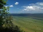
On August 21, 2008, the weather was wonderful on the East German Baltic Sea coast and thus also over the small island of Vilm, which has been under nature protection since 1936. Since 1990, it has been a biosphere reserve and is accessible again through authorized guided tours. Visitors are taken from Lauterbach by a small boat to the northern pier of the island. Prior reservation is recommended, as the number of people is limited.
Thomas Scherf
6. Juli 2012 (2 Photos)
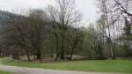
A pond in Matzen Park near Brixlegg. (15.4.2012)
Markus
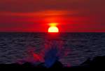
Kühlungsborn sunset with "exploding" wave at the pier. - 04.07.2012
Gerd Wiese
7. Juli 2012 (17 Photos)
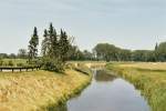
Landscape photos in the Seestermüher Marsh in the Pinneberg district. Photography from June 2011.
Michael Lembke
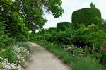
Country house Ettenbühl, a remarkable private park and garden estate in the Markgräflerland, Leyland cypresses line the main path, June 2012
rainer ullrich
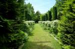
Country House Ettenbühl, the private, approximately 6-hectare estate in English style is open to visitors, June 2012
rainer ullrich
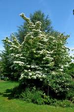
Country House Ettenbühl, Asian flowering dogwood in full splendor, June 2012
rainer ullrich
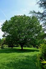
Country house Ettenbühl, tall ornamental cherry tree, June 2012
rainer ullrich
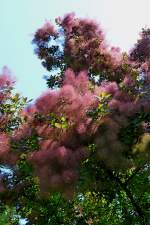
Country house Ettenbühl, smoke bush with red flower clusters, June 2012
rainer ullrich
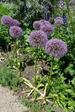
Country house Ettenbühl, bulbous leek in full bloom, June 2012
rainer ullrich
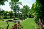
Country house Ettenbühl, a beautiful part of the estate to relax is the pond garden with pergola and koi basin, June 2012
rainer ullrich
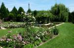
Country House Ettenbühl, View of the Water Garden, June 2012
rainer ullrich
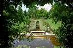
Country House Ettenbühl, View of the Water Garden, June 2012
rainer ullrich
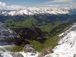
The snow that fell overnight above approximately 2000 m could be seen on 16.05.2007 from the Säntis as an interesting contrast to the green nature below.
Thomas Scherf
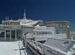
On the night of May 16, 2007, there was heavy snowfall in the Alpstein area above 2000 m, and in the morning the sky was clear again, so that on the Säntis the sun could slowly start to reduce the snow cover again.
Thomas Scherf
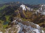
The Seealpsee from the Säntis on 16.05.2007, here too the snow that fell overnight creates an interesting contrast.
Thomas Scherf
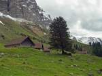
By noon on 16.05.2007, the beautiful weather at Säntis was already over again; in the mountains, that happens quickly. But from Schwägalp, it no longer looks so threatening....
Thomas Scherf
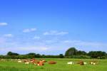
Summery idyll on Föhr along the bike path between Nieblum and Lembecksburg on 22.06.2012.
Ekkehard Sallmann
8. Juli 2012 (15 Photos)
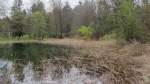
A small reed belt adorns the shore of a small pond near Brixlegg. The photo was taken on 15.4.2012.
Markus
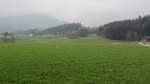
A cloud-covered field between Brixlegg and Reith in the Alpbachtal on 15.4.2012.
Markus
![Northwest Mecklenburg; View towards Wedendorf Castle (Hotel), located on L 02 Grevesmühlen - Rehna, Wedendorf [22.04.2011]](/bilder/thumbs/deutschland--mecklenburg-vorpommern--nordwestmecklenburg-22955.jpg "Northwest Mecklenburg; View towards Wedendorf Castle (Hotel), located on L 02 Grevesmühlen - Rehna, Wedendorf [22.04.2011]")
Northwest Mecklenburg; View towards Wedendorf Castle (Hotel), located on L 02 Grevesmühlen - Rehna, Wedendorf [22.04.2011]
Manfred Hellmann
![Parchim district; Mecklenburg landscape near Sukow, PCH [02.08.2009]](/bilder/thumbs/deutschland--mecklenburg-vorpommern--landkreis-ludwigslust-parchim-22957.jpg "Parchim district; Mecklenburg landscape near Sukow, PCH [02.08.2009]")
Parchim district; Mecklenburg landscape near Sukow, PCH [02.08.2009]
Manfred Hellmann
![Northwest Mecklenburg; Sports facility in the Bürgerwiese, Grevesmühlen [30.03.2010]](/bilder/thumbs/deutschland--mecklenburg-vorpommern--nordwestmecklenburg-22958.jpg "Northwest Mecklenburg; Sports facility in the Bürgerwiese, Grevesmühlen [30.03.2010]")
Northwest Mecklenburg; Sports facility in the Bürgerwiese, Grevesmühlen [30.03.2010]
Manfred Hellmann
![Northwest Mecklenburg; landscape at St. Nicolai Church, Grevesmühlen [30.04.2009]](/bilder/thumbs/deutschland--mecklenburg-vorpommern--nordwestmecklenburg-22960.jpg "Northwest Mecklenburg; landscape at St. Nicolai Church, Grevesmühlen [30.04.2009]")
Northwest Mecklenburg; landscape at St. Nicolai Church, Grevesmühlen [30.04.2009]
Manfred Hellmann
![Northwest Mecklenburg; Morning atmosphere at Kiebitzmoor, Grevesmühlen [02.11.2008]](/bilder/thumbs/deutschland--mecklenburg-vorpommern--nordwestmecklenburg-22961.jpg "Northwest Mecklenburg; Morning atmosphere at Kiebitzmoor, Grevesmühlen [02.11.2008]")
Northwest Mecklenburg; Morning atmosphere at Kiebitzmoor, Grevesmühlen [02.11.2008]
Manfred Hellmann
![Northwest Mecklenburg; View towards Groß Schwansee on the Bay of Lübeck, NWM [08.05.2008]](/bilder/thumbs/deutschland--mecklenburg-vorpommern--nordwestmecklenburg-22962.jpg "Northwest Mecklenburg; View towards Groß Schwansee on the Bay of Lübeck, NWM [08.05.2008]")
Northwest Mecklenburg; View towards Groß Schwansee on the Bay of Lübeck, NWM [08.05.2008]
Manfred Hellmann
![Northwest Mecklenburg; weather image from the Moltow-Dorf Mecklenburg road, west of Kietzin, NWM [04.04.2010]](/bilder/thumbs/deutschland--mecklenburg-vorpommern--nordwestmecklenburg-22963.jpg "Northwest Mecklenburg; weather image from the Moltow-Dorf Mecklenburg road, west of Kietzin, NWM [04.04.2010]")
Northwest Mecklenburg; weather image from the Moltow-Dorf Mecklenburg road, west of Kietzin, NWM [04.04.2010]
Manfred Hellmann
![Northwest Mecklenburg; weather image from the village road Mecklenburg-Beidendorf, near Grapen Stieten, NWM [04.04.2010]](/bilder/thumbs/deutschland--mecklenburg-vorpommern--nordwestmecklenburg-22964.jpg "Northwest Mecklenburg; weather image from the village road Mecklenburg-Beidendorf, near Grapen Stieten, NWM [04.04.2010]")
Northwest Mecklenburg; weather image from the village road Mecklenburg-Beidendorf, near Grapen Stieten, NWM [04.04.2010]
Manfred Hellmann
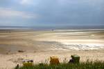
The beach of Goting on the island of Föhr in the early evening of 30.06.2012
Ekkehard Sallmann
9. Juli 2012 (5 Photos)
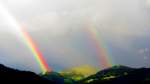
Rainbow over the Wiedersberger Horn in Alpbach on 7.7.2012. The primary and secondary rainbows are clearly visible.
Markus
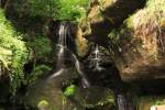
The Lichtenhainer Waterfall near Bad Schandau, photographed on 23.06.2012. The image shows it in its normal state, shortly before the half-hour "show flooding." By the way, this is also the final stop of the popular "Kirnitzschtalbahn"! Unfortunately, the final stop is currently out of service due to flood-related construction work, so the tram only runs up to the preceding stop "Beuthenfall"! A full reopening of the entire route is expected in autumn 2012.
Michael Edelmann
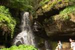
The Lichtenhainer Waterfall during the "show flooding," which is carried out every 30 minutes. The photo was taken on 23.06.2012.
Michael Edelmann
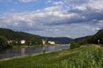
View on 23.06.2012 into the Elbe Valley near Bad Schandau. The shot was taken upstream towards Schmilka/Czech border.
Michael Edelmann
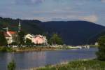
View over the town of Bad Schandau into the Elbe Valley, upstream into the Saxon Switzerland/Czech border. Below the mountains visible in the background are the well-known "Schrammsteine". At the "Bad Schandau" landing stage, the Elbe steamer "Kurort Rathen" can be seen. This zoom shot was taken on 23.06.2012 from Bad Schandau station.
Michael Edelmann
10. Juli 2012 (7 Photos)
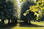
Photograph of a park area in the Seestermüher Marsch in the district of Pinneberg. I took this photo in June 2011.
Michael Lembke
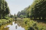
Landscape view in the Seetermüher Marsh in the district of Pinneberg. The photo was taken in June 2011.
Michael Lembke
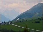
View from the Matterhorn Gotthard Railway into the Obergoms (upper Rhône valley) near Münster VB. 23.05.2012 (Jeanny)
De Rond Hans und Jeanny
View of the Säntis, fog in the foreground (28.10.2011)
mathias





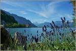
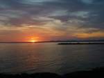
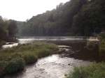
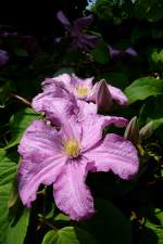
![Saale-Orla District; Thuringian Landscape, SOK [22.05.2009]](/bilder/thumbs/deutschland--thueringen--ostthueringen-22959.jpg "Saale-Orla District; Thuringian Landscape, SOK [22.05.2009]")