landschaftsfotos.eu Linie landschaftsfotos.eu
Hello guest, you are not logged in. Log in | Create account 
Forum   Contact   Legal notice
German English 
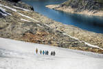
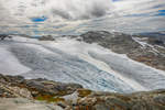
View of Juklavatnet from the Folgefonna Glacier in the Norwegian region of Hardanger.
Shot: July 6, 2018.
View of Juklavatnet from the Folgefonna Glacier in the Norwegian region of Hardanger. Shot: July 6, 2018.
Hans Christian Davidsen

Norwegen / Westland / Hardanger

354 1200x800 Px, 22.07.2018

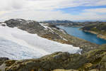
Shot of the Folgefonna Glacier in the Norwegian region of Hardanger. Folgefonna National Park was established in 2005 to protect the unique glacier landscape with its great biodiversity and diverse ecosystems.  
Date: July 6, 2018.
Shot of the Folgefonna Glacier in the Norwegian region of Hardanger. Folgefonna National Park was established in 2005 to protect the unique glacier landscape with its great biodiversity and diverse ecosystems. Date: July 6, 2018.
Hans Christian Davidsen

Norwegen / Westland / Hordaland

317 1200x800 Px, 22.07.2018

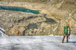
Folgefonna (also called Folgefonni) is the name of a glacier in the Norwegian region of Hardanger. The glacier covers parts of the municipalities of Jondal, Ullensvang, Odda, Etne, and Kvinnherad, all of which belong to Hordaland County. Photo taken: July 6, 2018.
Hans Christian Davidsen

Norwegen / Westland / Hordaland

364 1200x800 Px, 22.07.2018

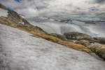
Folgefonna is Norway's southernmost glacier. The area on and around the Folgefonna glacier, the third largest glacier on the Norwegian mainland, has been a national park since 2005. The ice on the peninsula covers an area of about 270 km2, spread across five municipalities in Sunnhordland and Hardanger: Kvinnherad, Jondal, Ullensvang, Odda, and Etne.  
Photo taken: July 6, 2018.
Folgefonna is Norway's southernmost glacier. The area on and around the Folgefonna glacier, the third largest glacier on the Norwegian mainland, has been a national park since 2005. The ice on the peninsula covers an area of about 270 km2, spread across five municipalities in Sunnhordland and Hardanger: Kvinnherad, Jondal, Ullensvang, Odda, and Etne. Photo taken: July 6, 2018.
Hans Christian Davidsen

Norwegen / Westland / Hordaland

398 1200x800 Px, 22.07.2018

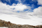
The area on and around the Folgefonna glacier, the third largest glacier on the Norwegian mainland, has been a national park since 2005. Photo taken: July 6, 2018.
Hans Christian Davidsen

Norwegen / Westland / Hordaland

312 1200x800 Px, 22.07.2018

The Folgefonna National Park is covered by 168 square kilometers of ice, which is up to 400 meters thick. The Folgefonna Glacier is approximately 90 kilometers from the Norwegian city of Bergen.  
Shot: July 6, 2018.
The Folgefonna National Park is covered by 168 square kilometers of ice, which is up to 400 meters thick. The Folgefonna Glacier is approximately 90 kilometers from the Norwegian city of Bergen. Shot: July 6, 2018.
Hans Christian Davidsen

Norwegen / Westland / Hordaland

401 1200x800 Px, 22.07.2018

The Folgefonna Glacier (Location: Hordaland - Norway) is not a remnant of the Ice Age. After the end of the last Ice Age, the ice retreated rapidly and the ice in the surrounding area completely melted away. It was only about 2,500 years ago that the northern part of the glacier (Nordre Folgefonna) reformed during a period of low temperatures and increased precipitation. With periodic variations, it had approximately the same extent as the current glacier. The other parts of the glacier have a parallel history.<br>Photo taken: July 6, 2018.
The Folgefonna Glacier (Location: Hordaland - Norway) is not a remnant of the Ice Age. After the end of the last Ice Age, the ice retreated rapidly and the ice in the surrounding area completely melted away. It was only about 2,500 years ago that the northern part of the glacier (Nordre Folgefonna) reformed during a period of low temperatures and increased precipitation. With periodic variations, it had approximately the same extent as the current glacier. The other parts of the glacier have a parallel history.
Photo taken: July 6, 2018.

Hans Christian Davidsen

Norwegen / Westland / Hordaland

343 1200x800 Px, 22.07.2018

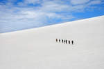
Photo of a glacier hike on the Folgefonna Glacier in Hordaland, Norway. Shot on July 6, 2018.
Hans Christian Davidsen

Norwegen / Westland / Hordaland

328 1200x800 Px, 22.07.2018

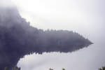
Revsvatnet at Preikestolen Fjellhytta in the morning mist. Photo taken: July 2, 2018.
Hans Christian Davidsen

Norwegen / S�nd / Rogaland

335 1200x800 Px, 21.07.2018

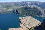
The rock formation Preikestolen was formed by frost weathering about 10,000 years ago, when the edges of the glacier extended above the rock. The size of the rock plateau is approximately 25 by 25 meters. The cliff edge drops 604 meters vertically into the nearly 40-kilometer-long fjord.  
Photo taken: July 2, 2018.
The rock formation Preikestolen was formed by frost weathering about 10,000 years ago, when the edges of the glacier extended above the rock. The size of the rock plateau is approximately 25 by 25 meters. The cliff edge drops 604 meters vertically into the nearly 40-kilometer-long fjord. Photo taken: July 2, 2018.
Hans Christian Davidsen

Norwegen / S�nd / Rogaland

377 1200x800 Px, 21.07.2018

The rock formation Preikestolen in Norway was formed by frost weathering about 10,000 years ago, when the edges of the glacier extended above the rock. Water froze in the rock crevices and broke off large, angular blocks, which the glacier then carried along. This is the reason for the angular shape of the plateau. A deep crack still runs along the plateau today. However, the geologists of the region confirm the safety of the plateau.  
Shot: July 2, 2018.
The rock formation Preikestolen in Norway was formed by frost weathering about 10,000 years ago, when the edges of the glacier extended above the rock. Water froze in the rock crevices and broke off large, angular blocks, which the glacier then carried along. This is the reason for the angular shape of the plateau. A deep crack still runs along the plateau today. However, the geologists of the region confirm the safety of the plateau. Shot: July 2, 2018.
Hans Christian Davidsen

Norwegen / S�nd / Rogaland

370 1200x800 Px, 21.07.2018

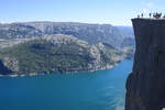
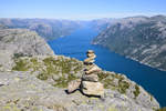
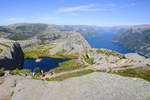
View over Lysefjorden at Preikestolen in Norway. The landscape at Preikestolen is characterized by bright granite rock. Densely shaped and multicolored green valleys crowd the region of Rogaland.  
Shot: July 2, 2018.
View over Lysefjorden at Preikestolen in Norway. The landscape at Preikestolen is characterized by bright granite rock. Densely shaped and multicolored green valleys crowd the region of Rogaland. Shot: July 2, 2018.
Hans Christian Davidsen

Norwegen / S�nd / Rogaland

384 1200x800 Px, 21.07.2018

Preikestolen (The Pulpit), the most famous tourist attraction in the Norwegian province of Ryfylke, rises 604 meters above the Lysefjord. This roughly 25 x 25 meter rock plateau probably formed about 10,000 years ago through frost weathering. Water freezing in rock cracks and crevices caused large angular rock blocks to break off, which were carried away by the glacier.  
Photo taken: July 2, 2018.
Preikestolen (The Pulpit), the most famous tourist attraction in the Norwegian province of Ryfylke, rises 604 meters above the Lysefjord. This roughly 25 x 25 meter rock plateau probably formed about 10,000 years ago through frost weathering. Water freezing in rock cracks and crevices caused large angular rock blocks to break off, which were carried away by the glacier. Photo taken: July 2, 2018.
Hans Christian Davidsen

Norwegen / S�nd / Rogaland

420 800x1200 Px, 21.07.2018

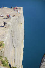
On the plateau above Lysefjorden (Roland, Norway). Shot: July 2, 2018.
Hans Christian Davidsen

Norwegen / S�nd / Rogaland

389 1200x800 Px, 21.07.2018

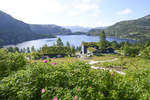
Below the Preikestolhytta in Rogaland, Norway, lies Lake Refsvatn.  
Shot: July 2, 2018.
Below the Preikestolhytta in Rogaland, Norway, lies Lake Refsvatn. Shot: July 2, 2018.
Hans Christian Davidsen

Norwegen / S�nd / Rogaland

317 1200x800 Px, 21.07.2018

View over Revsvatnet from Preikestolhytta (Rogaland, Norway). Photo taken on July 2, 2018.
Hans Christian Davidsen

Norwegen / S�nd / Rogaland

357 1200x800 Px, 21.07.2018

View over Lysefjorden from the Preikestolen hiking trail (Roland, Norway). Photo taken on July 2, 2018.
Hans Christian Davidsen

Norwegen / S�nd / Rogaland

395 1200x800 Px, 21.07.2018

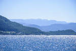
View of the islands Idee and Idsal from the Tau-Stavanger ferry (Roland, Norway). Photo: July 3, 2018.
Hans Christian Davidsen

Norwegen / S�nd / Rogaland

318 1200x800 Px, 21.07.2018

The hike to Preikestolen in Norway takes a total of four hours. The entire route is eight kilometers long. On the tour, you overcome an elevation difference of around 500 meters.
Photo taken: July 2, 2018.
The hike to Preikestolen in Norway takes a total of four hours. The entire route is eight kilometers long. On the tour, you overcome an elevation difference of around 500 meters. Photo taken: July 2, 2018.
Hans Christian Davidsen

Norwegen / S�nd / Rogaland

419 1200x800 Px, 20.07.2018

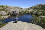
Mountain lake on the ascent to Preikestolen in Norway. Some sections of the hike are steep. The hike is of moderate difficulty. Photo taken: July 2, 2018.
Hans Christian Davidsen

Norwegen / S�nd / Rogaland

395 1200x800 Px, 20.07.2018

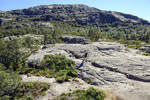
The trail to Preikestolen in Norway is steep and ascends over rocks. After some time, you reach flat terrain again and cross some marshy sections. Shortly thereafter, the main ascent of this hike begins. The path leads steeply uphill over boulders through a gully filled with scree.  
Shot: July 2, 2018.
The trail to Preikestolen in Norway is steep and ascends over rocks. After some time, you reach flat terrain again and cross some marshy sections. Shortly thereafter, the main ascent of this hike begins. The path leads steeply uphill over boulders through a gully filled with scree. Shot: July 2, 2018.
Hans Christian Davidsen

Norwegen / S�nd / Rogaland

425 1200x800 Px, 20.07.2018

For those traveling in southwestern Norway, a visit to the Preikestolen is almost a must. The rocky path leads hikers to these cliffs. Photo taken: July 2, 2018.
Hans Christian Davidsen

Norwegen / S�nd / Rogaland

412 1200x800 Px, 20.07.2018

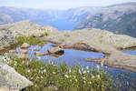
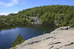
Small lake at the edge of the hiking trail near Preikestolen in Norway. The trail to the Preikestolen rock plateau leads over granite slabs. Photo taken: July 2, 2018.
Hans Christian Davidsen

Norwegen / S�nd / Rogaland

443 1200x800 Px, 20.07.2018

The hike to Preikestolen – in German: Pulpit Rock – is a highlight of many people's trip to Norway. The trail is very well marked, so you cannot get lost, and you don't need a hiking guide.  
Photo taken: July 2, 2018.
The hike to Preikestolen – in German: Pulpit Rock – is a highlight of many people's trip to Norway. The trail is very well marked, so you cannot get lost, and you don't need a hiking guide. Photo taken: July 2, 2018.
Hans Christian Davidsen

Norwegen / S�nd / Rogaland

490 1200x800 Px, 20.07.2018