




Eidfjord photos
33 Photos
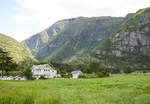
View of the mountains south of Øvre Eidford (Hardanger - Norway). Photo taken on July 8, 2018.
Hans Christian Davidsen
Hans Christian Davidsen
Norwegen / Westland / Hardanger
437 1200x833 Px, 04.08.2018
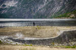
Eidfjorsvatnet as seen from Øvre Eidfjord (Hardanger - Norway). Photo taken on July 9, 2018.
Hans Christian Davidsen
Hans Christian Davidsen
Norwegen / Westland / Hardanger
408 1200x800 Px, 04.08.2018
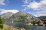
Eidfjord on the eponymous fjord, the easternmost arm of the Hardangerfjord in Norway. Photo taken: July 7, 2018.
Hans Christian Davidsen
Hans Christian Davidsen
Norwegen / Westland / Hardanger
453 1200x800 Px, 26.07.2018
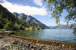
At the Simadaslfjorden east of Eidfjord in Norway. Photo taken: July 7, 2018.
Hans Christian Davidsen
Hans Christian Davidsen
Norwegen / Westland / Hardanger
416 1200x800 Px, 26.07.2018
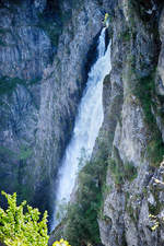
Vøringsfossen as seen from the main road Rv7. The waterfall is located on the western edge of the Hardangervidda in Eidfjord. The total drop is 183 meters, with the longest free-fall section of the water being 145 meters. Photo taken on July 7, 2018.
Hans Christian Davidsen
Hans Christian Davidsen
Norwegen / Westland / Hardanger
409 800x1200 Px, 25.07.2018
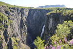
Vøringsfossen as seen from the main road Rv7. The waterfall is located on the western edge of the Hardangervidda in Eidfjord. The small river Bjoreio, along which Vøringsfossen lies, is dammed above the waterfall in the Sysendalen valley by the Sysen Dam and used for hydroelectric power production. The water volume is therefore limited, but for tourism reasons, it is increased in summer from June 1 to September 15 to about 12 m³ per second, which corresponds approximately to the natural flow rate.
Shot: July 7, 2018.
Hans Christian Davidsen
Hans Christian Davidsen
Norwegen / Westland / Hardanger
459 1200x800 Px, 25.07.2018
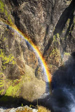
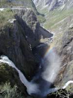
Rainbow at the Vøringsfossen waterfall in Norway's Hardanger region.
Shot: July 7, 2018.
Hans Christian Davidsen
Hans Christian Davidsen
Norwegen / Westland / Hardanger
337 800x1200 Px, 25.07.2018
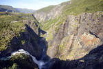
Vøringsfossen as seen from the parking lot at the Fossil Hotel. The water volume can exceed 150 cubic meters per second during the spring snowmelt. In 1980, the river was regulated for hydroelectric power generation, resulting in significant amounts of water no longer being visible.
Shot: July 7
Hans Christian Davidsen
Hans Christian Davidsen
Norwegen / Westland / Hardanger
368 1200x800 Px, 25.07.2018
Norwegen / Westland / Hordaland
633 480x640 Px, 27.12.2007