landschaftsfotos.eu Linie landschaftsfotos.eu
Hello guest, you are not logged in. Log in | Create account 
Forum   Contact   Legal notice
German English 
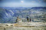
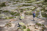
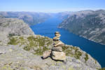
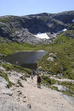
On the hiking trail to Kjeragbolten in Norway. Kjerag or Kiragg is a rock plateau in the municipality of Forsand (Rogaland County) on the Lysefjord. Photo taken: July 3, 2018.
Hans Christian Davidsen

Norwegen / S�nd / Rogaland

379 800x1200 Px, 26.07.2018

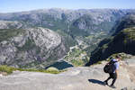
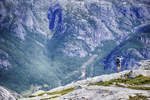
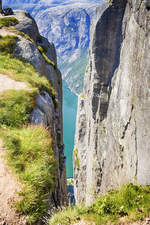
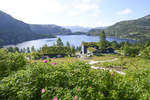
On the hiking trail to Kjeragbolten in the Norwegian municipality of Forsand (Rogaland County) at the Lysefjord. The village of Lysebotn can be seen in the mountain valley. Photo taken: July 3, 2018.
Hans Christian Davidsen

Norwegen / S�nd / Rogaland

319 1200x800 Px, 25.07.2018

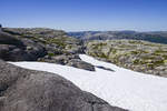
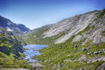
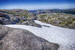
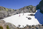
Snow in summer. Photo from the hiking trail to Kjeragbolten. Kjerag or Kiragg is a rock plateau in the Norwegian municipality of Forsand (Rogaland County) on the Lysefjord.  
Shot: July 3, 2018.
Snow in summer. Photo from the hiking trail to Kjeragbolten. Kjerag or Kiragg is a rock plateau in the Norwegian municipality of Forsand (Rogaland County) on the Lysefjord. Shot: July 3, 2018.
Hans Christian Davidsen

Norwegen / S�nd / Rogaland

340 1200x800 Px, 25.07.2018

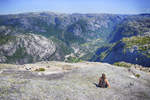
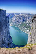
View from Kjeragbolten over the Lysefjord in the Norwegian municipality of Forsand (Rogaland County).  
Photo taken on July 3, 2018.
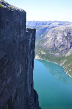
View from Kjeragbolten over the Lysefjord in the Norwegian municipality of Forsand (Rogaland County). Photo taken on July 3, 2018.
Hans Christian Davidsen

Norwegen / S�nd / Rogaland

314 800x1200 Px, 25.07.2018

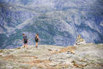
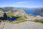
The challenging hiking route to Kjerag at the Norwegian Lysefjord crosses several mountain ridges. Photo taken on July 3, 2018.
Hans Christian Davidsen

Norwegen / S�nd / Rogaland

313 1200x800 Px, 24.07.2018

Kjerag or Kiragg is a rock plateau in the Norwegian municipality of Forsand (Rogaland County) on the Lysefjord. Along the route, in addition to the actual ascent, two mountains and two valleys must be crossed.  
Photo taken: July 3, 2018.
Kjerag or Kiragg is a rock plateau in the Norwegian municipality of Forsand (Rogaland County) on the Lysefjord. Along the route, in addition to the actual ascent, two mountains and two valleys must be crossed. Photo taken: July 3, 2018.
Hans Christian Davidsen

Norwegen / S�nd / Rogaland

328 1200x800 Px, 23.07.2018

Kjerag or Kiragg is a rock plateau in the Norwegian municipality of Forsand (Rogaland County) on the Lysefjord. The highest point of the plateau is at approximately 1020 meters above sea level.  
Photo taken: July 3, 2018.
Kjerag or Kiragg is a rock plateau in the Norwegian municipality of Forsand (Rogaland County) on the Lysefjord. The highest point of the plateau is at approximately 1020 meters above sea level. Photo taken: July 3, 2018.
Hans Christian Davidsen

Norwegen / S�nd / Rogaland

356 1200x800 Px, 23.07.2018

The hiking trail to Kjerag in Norway starts at Øygardstølen, a restaurant 640 m above Lysebotn. From there, the trail leads in about 2.5 hours through partly challenging terrain to Kjerag; the return route follows the same path and takes roughly the same amount of time. The trail is secured with iron chains in some sections.  
Photo taken: July 3, 2018.
The hiking trail to Kjerag in Norway starts at Øygardstølen, a restaurant 640 m above Lysebotn. From there, the trail leads in about 2.5 hours through partly challenging terrain to Kjerag; the return route follows the same path and takes roughly the same amount of time. The trail is secured with iron chains in some sections. Photo taken: July 3, 2018.
Hans Christian Davidsen

Norwegen / S�nd / Rogaland

352 1200x800 Px, 23.07.2018

The challenging hiking route to Kjeragbolten crosses several mountain ridges. The route in southwestern Norway has an elevation difference of 460 meters.  
Shot: July 3, 2018.
The challenging hiking route to Kjeragbolten crosses several mountain ridges. The route in southwestern Norway has an elevation difference of 460 meters. Shot: July 3, 2018.
Hans Christian Davidsen

Norwegen / S�nd / Rogaland

296 1200x800 Px, 23.07.2018

Roland, Norway - When there is snow, the hike to Kjeragbolten is only recommended, if at all, when accompanied by a nature guide. In any case, sturdy shoes, preferably hiking boots, are recommended.  
Photo taken: July 3, 2018.
Roland, Norway - When there is snow, the hike to Kjeragbolten is only recommended, if at all, when accompanied by a nature guide. In any case, sturdy shoes, preferably hiking boots, are recommended. Photo taken: July 3, 2018.
Hans Christian Davidsen

Norwegen / S�nd / Rogaland

316 1200x800 Px, 23.07.2018

Snow on Kjeragbolten in the Norwegian region of Rogaland. Photo taken: July 3, 2018.
Hans Christian Davidsen

Norwegen / S�nd / Rogaland

306 1200x800 Px, 23.07.2018

View from Kjeragbolten over the Lysefjord in southwestern Norway (Rogaland). Photo taken on July 3, 2018.
Hans Christian Davidsen

Norwegen / S�nd / Rogaland

308 800x1200 Px, 23.07.2018

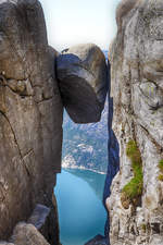
In the western part of the Kjerag plateau lies the Kjeragbolten, a monolith of about five cubic meters, wedged in a rock crevice 1000 meters above the Lysefjord. Photo taken: July 3, 2018.
Hans Christian Davidsen

Norwegen / S�nd / Rogaland

350 800x1200 Px, 23.07.2018

View from Kjeragbolten over the Lysefjord (Rogaland, Norway). Photo taken on July 3, 2018.
Hans Christian Davidsen

Norwegen / S�nd / Rogaland

340 800x1200 Px, 23.07.2018

On the hiking trail to Kjeragbolten in the Ryfylke region of southwestern Norway. Shot: July 3, 2018.
Hans Christian Davidsen

Norwegen / S�nd / Rogaland

307 1200x800 Px, 23.07.2018

Revsvatnet at Preikestolen Fjellhytta in the morning mist. Photo taken: July 2, 2018.
Hans Christian Davidsen

Norwegen / S�nd / Rogaland

335 1200x800 Px, 21.07.2018

The rock formation Preikestolen was formed by frost weathering about 10,000 years ago, when the edges of the glacier extended above the rock. The size of the rock plateau is approximately 25 by 25 meters. The cliff edge drops 604 meters vertically into the nearly 40-kilometer-long fjord.  
Photo taken: July 2, 2018.
The rock formation Preikestolen was formed by frost weathering about 10,000 years ago, when the edges of the glacier extended above the rock. The size of the rock plateau is approximately 25 by 25 meters. The cliff edge drops 604 meters vertically into the nearly 40-kilometer-long fjord. Photo taken: July 2, 2018.
Hans Christian Davidsen

Norwegen / S�nd / Rogaland

377 1200x800 Px, 21.07.2018

The rock formation Preikestolen in Norway was formed by frost weathering about 10,000 years ago, when the edges of the glacier extended above the rock. Water froze in the rock crevices and broke off large, angular blocks, which the glacier then carried along. This is the reason for the angular shape of the plateau. A deep crack still runs along the plateau today. However, the geologists of the region confirm the safety of the plateau.  
Shot: July 2, 2018.
The rock formation Preikestolen in Norway was formed by frost weathering about 10,000 years ago, when the edges of the glacier extended above the rock. Water froze in the rock crevices and broke off large, angular blocks, which the glacier then carried along. This is the reason for the angular shape of the plateau. A deep crack still runs along the plateau today. However, the geologists of the region confirm the safety of the plateau. Shot: July 2, 2018.
Hans Christian Davidsen

Norwegen / S�nd / Rogaland

370 1200x800 Px, 21.07.2018

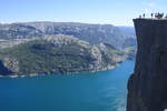
View over Lysefjorden at Preikestolen in Norway. The landscape at Preikestolen is characterized by bright granite rock. Densely shaped and multicolored green valleys crowd the region of Rogaland.  
Shot: July 2, 2018.
View over Lysefjorden at Preikestolen in Norway. The landscape at Preikestolen is characterized by bright granite rock. Densely shaped and multicolored green valleys crowd the region of Rogaland. Shot: July 2, 2018.
Hans Christian Davidsen

Norwegen / S�nd / Rogaland

384 1200x800 Px, 21.07.2018

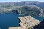
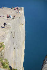
Preikestolen (The Pulpit), the most famous tourist attraction in the Norwegian province of Ryfylke, rises 604 meters above the Lysefjord. This roughly 25 x 25 meter rock plateau probably formed about 10,000 years ago through frost weathering. Water freezing in rock cracks and crevices caused large angular rock blocks to break off, which were carried away by the glacier.  
Photo taken: July 2, 2018.
Preikestolen (The Pulpit), the most famous tourist attraction in the Norwegian province of Ryfylke, rises 604 meters above the Lysefjord. This roughly 25 x 25 meter rock plateau probably formed about 10,000 years ago through frost weathering. Water freezing in rock cracks and crevices caused large angular rock blocks to break off, which were carried away by the glacier. Photo taken: July 2, 2018.
Hans Christian Davidsen

Norwegen / S�nd / Rogaland

420 800x1200 Px, 21.07.2018

On the plateau above Lysefjorden (Roland, Norway). Shot: July 2, 2018.
Hans Christian Davidsen

Norwegen / S�nd / Rogaland

389 1200x800 Px, 21.07.2018

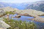
Below the Preikestolhytta in Rogaland, Norway, lies Lake Refsvatn.  
Shot: July 2, 2018.
Below the Preikestolhytta in Rogaland, Norway, lies Lake Refsvatn. Shot: July 2, 2018.
Hans Christian Davidsen

Norwegen / S�nd / Rogaland

317 1200x800 Px, 21.07.2018

View over Revsvatnet from Preikestolhytta (Rogaland, Norway). Photo taken on July 2, 2018.
Hans Christian Davidsen

Norwegen / S�nd / Rogaland

357 1200x800 Px, 21.07.2018

View over Lysefjorden from the Preikestolen hiking trail (Roland, Norway). Photo taken on July 2, 2018.
Hans Christian Davidsen

Norwegen / S�nd / Rogaland

395 1200x800 Px, 21.07.2018