landschaftsfotos.eu Linie landschaftsfotos.eu
Hello guest, you are not logged in. Log in | Create account 
Forum   Contact   Legal notice
German English 
Passing by a burial mound, an educational trail leads through forest and fields. Lovingly created at a forest edge near Ostervesede in the district of Rotenburg/Wümme, Heiderand area. March 2021.
Reiner Spangemacher

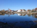
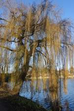
At the Stadtgraben Pond in Wolframs-Eschenbach (07.03.2021)
Peter Reiser

Deutschland / Bayern / Mittelfranken

274 1200x900 Px, 16.03.2021

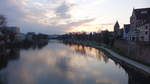
On the evening Danube near Ulm (07.03.2021)
Peter Reiser

Deutschland / Baden-W�emberg / Donautal

307 1200x675 Px, 16.03.2021

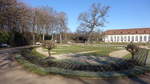
Ansbach, flower beds in the courtyard garden (07.03.2021)
Peter Reiser

Deutschland / Bayern / Mittelfranken

253 1200x675 Px, 16.03.2021

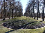
Ansbach, flower bed in the main avenue of the Hofgarten (07.03.2021)
Peter Reiser

Deutschland / Bayern / Mittelfranken

249 1200x900 Px, 16.03.2021

Fountain in the Court Garden at the Residence in Würzburg (21.02.2021)
Peter Reiser

Deutschland / Bayern / Mittelfranken

263 1200x900 Px, 16.03.2021

Park at the Imperial Castle in Rothenburg ob der Tauber (21.02.2021)
Peter Reiser

Deutschland / Bayern / Mittelfranken

246 1200x900 Px, 16.03.2021

At Lake Constance near Lindau with a view of the Bregenz Forest (20.02.2021)
Peter Reiser

Deutschland / Bayern / Oberallg䵀

253 1200x900 Px, 16.03.2021

RHINELAND WESTERWALD WITH SIEBENGEBIRGE

Lush green meadows, gentle hills, behind them the range of the SIEBENGEBIRGE...
It can be so beautiful in the Rhineland Westerwald, as here near UCKERATH on 2.5.20...
RHINELAND WESTERWALD WITH SIEBENGEBIRGE Lush green meadows, gentle hills, behind them the range of the SIEBENGEBIRGE... It can be so beautiful in the Rhineland Westerwald, as here near UCKERATH on 2.5.20...
Hans-Peter Kampmann

Deutschland / Nordrhein-Westfalen / Region K�Bonn

299 1200x889 Px, 16.03.2021

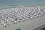
Order must be maintained! Beach chairs in Sellin on the island of Rügen on 09/04/2010.
Axel Hofmeister

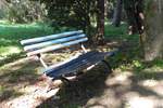
Bench on Rügen, on the footpath from Cape Arkona to Vitt, on 21.09.2020.
Axel Hofmeister

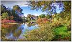
Lauenbrück, Rotenburg (Wümme) district. The Fintau Lake on the eponymous river, a local recreational area right in the town. Right next to it, a campsite (Löweninsel), also with a view of this lake. October 2013.
Reiner Spangemacher

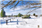
Wilseder Berg in its winter coat. A very rare sight, white winters are scarce in northern Germany. When it does snow and the sun shines, you have to hurry, because then a footpath of at least 3 km lies ahead of us. Motor vehicles are not allowed in the Lüneburg Heath Nature Reserve. The nearest parking lots are located in  Einem,   Niederhaverbeck,  and  Oberhaverbeck.  February 2021.
Wilseder Berg in its winter coat. A very rare sight, white winters are scarce in northern Germany. When it does snow and the sun shines, you have to hurry, because then a footpath of at least 3 km lies ahead of us. Motor vehicles are not allowed in the Lüneburg Heath Nature Reserve. The nearest parking lots are located in "Einem," "Niederhaverbeck," and "Oberhaverbeck." February 2021.
Reiner Spangemacher

Hamburg on 19.12.2020: the first sign of spring at the northern end of the Außenalster, with the Krugkoppel Bridge in the background /
Harald Schmidt

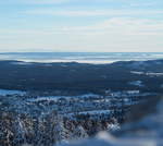
View from the Wurmberg in the early evening of 14.02.2021 towards the Großer Inselsberg, the best-known peak of the Thuringian Forest, on the left at the horizon; to the right next to the last mountains of the Thuringian Forest in the NW, you can faintly see at the horizon the much more distant parts of the Hessian Rhön. A broad hump in the left third of this area towers above everything else there – that could be the Wasserkuppe, although I am not one hundred percent sure. In any case, these mountains are up to 150 km away. Below that, the elongated arc of the Dün, below that in the middle row the distinctive humps of the Bleicheröder Mountains, below that mountains of the South Harz and Braunlage in the valley...
Fred Hahn

Deutschland / Niedersachsen / Harz

310 1200x1074 Px, 21.02.2021

View from the Wurmberg on the evening of 14.02.2021 towards the Kassel Mountains: In the right third of the image on the horizon under the dark cloud side by side: on the left the elongated ridge of the Hoher Habichtswald, on the right next to the edge of the image the distinctive cone of the Hoher Dörnberg, both more than 100 km away. Directly to the left of the elongated Hoher Habichtswald, a mountain is faintly visible on the horizon, which is significantly further away. That should be the Kellerwald with its highest peak, just under 700 m high and about 140 km away (!!!). There is no other mountain this high in this area and direction. To the left of the Kellerwald, you can clearly see a long mountain range extending to the left edge of the image - this is the Kaufunger Wald low mountain range with its highest peak in the middle, the Hirschberg with its rounded hump, about 75 km away...
Fred Hahn

Deutschland / Niedersachsen / Harz

326 1200x691 Px, 21.02.2021

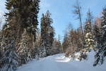
Out and about on the afternoon of 14.02.2021 in the forest along Große Bodestraße towards the Wurmberg summit...
Fred Hahn

Deutschland / Niedersachsen / Harz

289 1200x800 Px, 19.02.2021

A spruce forest section on Große Bodestraße glows in the afternoon sun of 14.02.2021...
Fred Hahn

Deutschland / Niedersachsen / Harz

313 1200x909 Px, 19.02.2021

The forest thins out and the view can wander southward into the distance. On the late afternoon of 14.02.2021, out on the Große Bodestraße...
Fred Hahn

Deutschland / Niedersachsen / Harz

310 1200x800 Px, 19.02.2021

Arriving at the summit ridge of the Wurmberg, I stand at the edge of the artificially created pond, which is supposed to supply the snow cannons for the ski slopes. It is frozen over and covered by a thick layer of snow. Above it on the horizon, you can faintly see the entire Thuringian Forest mountain range, about 100 to 150 km away...
Fred Hahn

Deutschland / Niedersachsen / Harz

314 1199x803 Px, 19.02.2021

The actual summit of the Wurmberg with the new red observation tower and the terminal station of the Wurmberg cable car. Late afternoon of 14.02.2021...
Fred Hahn

Deutschland / Niedersachsen / Harz

305 1200x779 Px, 19.02.2021

In the distance, you can see from the Wurmberg to the Kassel area, here slightly right of center on the horizon the broad ridge of the basalt table mountain Hoher Meißner in Hesse, about 80 km away; Sun., 14.02.2021 in the late afternoon...
Fred Hahn

Deutschland / Niedersachsen / Harz

424  3 1200x788 Px, 19.02.2021

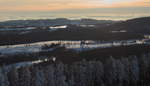
In the distance, the entire Thuringian Forest mountain range on the horizon and in the valley in front, against the backdrop of the South Harz, Braunlage; slightly right of center on the horizon, the distinctive shape of the Großer Inselsberg, over 100 km away; Sun, 14.02.2021 in the early evening...
Fred Hahn

Deutschland / Niedersachsen / Harz

324 1200x800 Px, 19.02.2021

View from the Wurmberg towards the Brocken in the early evening of 14.02.2021; on the left you can see the huge Telekom antenna tower, to the right of it the tower of the  Brockenherberge  hotel, next to it the weather station, all three buildings still from GDR times, when the entire summit area was closed to visitors...
View from the Wurmberg towards the Brocken in the early evening of 14.02.2021; on the left you can see the huge Telekom antenna tower, to the right of it the tower of the "Brockenherberge" hotel, next to it the weather station, all three buildings still from GDR times, when the entire summit area was closed to visitors...
Fred Hahn

Deutschland / Niedersachsen / Harz

347 1200x800 Px, 19.02.2021