landschaftsfotos.eu Linie landschaftsfotos.eu
Hello guest, you are not logged in. Log in | Create account 
Forum   Contact   Legal notice
German English 
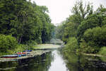
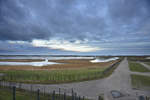
The Eider Canal (originally  Schleswig-Holstein Canal  also  Old Eider Canal ) was a waterway built between 1778 and 1785, which connected the Kiel Fjord with the Lower Eider near Rendsburg. The canal itself was 34 kilometers long and, with its connection to the Eider, which flows into the North Sea near Tönning, enabled for the first time a short shipping route between the Baltic and the North Sea. Photo taken: June 29, 2021.
The Eider Canal (originally "Schleswig-Holstein Canal" also "Old Eider Canal") was a waterway built between 1778 and 1785, which connected the Kiel Fjord with the Lower Eider near Rendsburg. The canal itself was 34 kilometers long and, with its connection to the Eider, which flows into the North Sea near Tönning, enabled for the first time a short shipping route between the Baltic and the North Sea. Photo taken: June 29, 2021.
Hans Christian Davidsen

Deutschland / Schleswig-Holstein / Rendsburg-Eckernf�

268 1200x800 Px, 10.08.2021

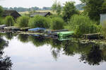
Recreational boats on the Eider Canal south of Sehestedt. Photo taken on June 29, 2021.
Hans Christian Davidsen

Deutschland / Schleswig-Holstein / Rendsburg-Eckernf�

220 1200x795 Px, 10.08.2021

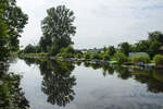
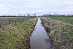
The Eider Canal south of the Kiel Canal near Klein Königsförde. Photo taken on June 29, 2021.
Hans Christian Davidsen

Deutschland / Schleswig-Holstein / Rendsburg-Eckernf�

218 1200x800 Px, 10.08.2021

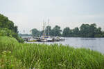
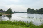
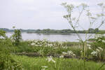
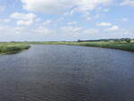
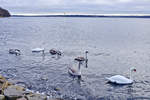
The Eider near Süderstapel (Schleswig-Flensburg district). Photo taken: June 29, 2021.
Hans Christian Davidsen

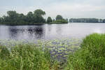
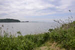
Near Süderstapel in the district of Schleswig-Flensburg, the Eider River makes a sharp bend. Photo taken on May 29, 2021.
Hans Christian Davidsen

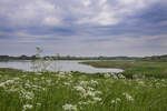
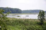
The Eider south of Süderstapel. From 811 to 1864, the river marked the southern border of Denmark with two brief interruptions. Photo taken: May 29, 2021.
Hans Christian Davidsen

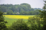
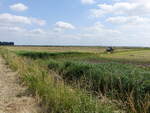
Landscape between Oersberg and Gulde in Angeln (Schleswig-Flensburg district).
Hans Christian Davidsen

View of the Geltinger Birk nature reserve in North Anglia. June 7, 2021.
Hans Christian Davidsen

Geltinger Bay as seen from the Geltinger Birk Nature Reserve. Photo taken on June 7, 2021.
Hans Christian Davidsen

The Geltinger Birk has been a nature reserve on the Schleswig-Holstein Baltic Sea since 1986. It is located – northeast of Gelting – mostly within the municipality of Nieby on the Geltinger Bay at the mouth of the Flensburg Fjord. Photo taken: June 7, 2021.
Hans Christian Davidsen

With an area of around 773 hectares, the nature reserve located in the Gelting Bay and on a peninsula is the largest in the Schleswig-Flensburg district. The area belongs to the Schleswig-Holstein Nature Conservation Foundation. Photo taken: June 7, 2021.
Hans Christian Davidsen

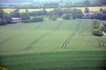
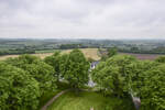
Fields in northern Angeln as seen from the Bismarck Tower near Quern. Photo taken on June 7, 2021.
Hans Christian Davidsen

View from the Bismarck Tower in northern Angeln (Schleswig-Flensburg district). Photo taken: June 7, 2021.
Hans Christian Davidsen

Fields in northern Angeln as seen from the Bismarck Tower near Quern. Photo taken on June 7, 2021.
Hans Christian Davidsen

Fields in northern Angeln as seen from the Bismarck Tower near Quern. Photo taken on June 7, 2021.
Hans Christian Davidsen

Landscape near Quern in North Angeln (Schleswig-Flensburg district). View from the Bismarck Tower looking south. Photo taken on June 7, 2021.
Hans Christian Davidsen

View from the Bismarck Tower near Quern in North Anglia. Photo taken on June 7, 2021.
Hans Christian Davidsen

Katinger Watt near Wesselburen, North Frisia (24.07.2021)
Peter Reiser

Deutschland / Schleswig-Holstein / Nordfriesland

244 1200x900 Px, 02.08.2021

Treene River near Friedrichstadt, North Frisia (24.07.2021)
Peter Reiser

Deutschland / Schleswig-Holstein / Nordfriesland

227 1200x900 Px, 02.08.2021

Rickelsbüller Koog is the northernmost polder on the northwest coast of Schleswig-Holstein. Photo taken on January 4, 2021.
Hans Christian Davidsen

Deutschland / Schleswig-Holstein / Nordfriesland

197 1200x800 Px, 06.01.2021

The controversial Danish wild boar fence along the border with Germany. On the left in the image is the Danish Margrethekog, on the right in the image is the Rickelsbüller Koog in Germany. Photo: January 4, 2021.
Hans Christian Davidsen

Deutschland / Schleswig-Holstein / Nordfriesland

212 1200x800 Px, 06.01.2021

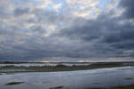
The sky over the Wadden Sea National Park west of Rodenäs in South Tønder. Shot: January 4, 2021.
Hans Christian Davidsen

Deutschland / Schleswig-Holstein / Nordfriesland

194 1200x800 Px, 06.01.2021

The Alte Au forms the border between Denmark (left) and Germany (right) - here at Neupebersmark in the district of Nordfriesland. Photo taken on January 4, 2021.
Hans Christian Davidsen

Deutschland / Schleswig-Holstein / Nordfriesland

227 1200x800 Px, 06.01.2021

View of Flensburg Fjord from the dam path near Wassersleben (municipality of Harrislee). Photo taken on January 4, 2021.
Hans Christian Davidsen