




Langeneß photos
9 Photos
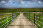
On the dike of the Hallig Land in the North Frisian Wadden Sea. The Halligen rise only a few meters above sea level, which is why they are flooded during a strong tide except for the Warften, artificially raised mounds on which the houses stand (»Landunter«).
Shot: June 25, 2017.
Hans Christian Davidsen
Hans Christian Davidsen
Deutschland / Schleswig-Holstein / Nordfriesland
423 1200x780 Px, 29.06.2017
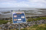
End of the mudflat hiking route between Dagebüll and the Hallig Land in North Frisia. The Schleswig-Holstein Wadden Sea National Park extends from the German-Danish maritime border in the north to the Elbe estuary in the south. In the North Frisian part, it includes the mudflats around the geest core and marsh islands and Halligen.
Photo taken: June 25, 2017.
Hans Christian Davidsen
Hans Christian Davidsen
Deutschland / Schleswig-Holstein / Nordfriesland
413 1200x796 Px, 29.06.2017
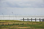
The Wadden Sea south of Der Hallig Land in North Frisia. Shot: June 25, 2017.
Hans Christian Davidsen
Hans Christian Davidsen
Deutschland / Schleswig-Holstein / Nordfriesland
403 1200x797 Px, 25.06.2017