landschaftsfotos.eu Linie landschaftsfotos.eu
Hello guest, you are not logged in. Log in | Create account 
Forum   Contact   Legal notice
German English 
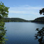
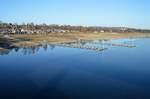
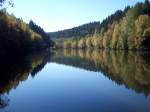
AT THE LISTERTAL DAM/MÄRKISCHER KREIS  
What almost looks like a western extension of the BIGGESEE is actually a 79-hectare, 4.5 km long reservoir near ATTENDORN,  
built between 1909-12 and one of the oldest dams in the Sauerland region—  
in the background the dam wall, on 23.8.2017...
AT THE LISTERTAL DAM/MÄRKISCHER KREIS What almost looks like a western extension of the BIGGESEE is actually a 79-hectare, 4.5 km long reservoir near ATTENDORN, built between 1909-12 and one of the oldest dams in the Sauerland region— in the background the dam wall, on 23.8.2017...
Hans-Peter Kampmann

Deutschland / Nordrhein-Westfalen / Sauerland

376 1200x1200 Px, 23.08.2017

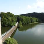
AT BIGGE RESERVOIR – WATER, FOREST, AND SKY,  
and additionally the HLB LINT railcar, which as RB 92  Biggesee Express  is traveling from ATTENDORN to OLPE and crossing a bay of the reservoir,  
on 22.8.2017....
AT BIGGE RESERVOIR – WATER, FOREST, AND SKY, and additionally the HLB LINT railcar, which as RB 92 "Biggesee Express" is traveling from ATTENDORN to OLPE and crossing a bay of the reservoir, on 22.8.2017....
Hans-Peter Kampmann

Deutschland / Nordrhein-Westfalen / Sauerland

463 1200x1200 Px, 22.08.2017

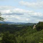
SAUERLAND LANDSCAPE NEAR ATTENDORN
Typical SAUERLAND landscape near ATTENDORN with forested green mountain ridges
and Schnellenberg Castle/Fortress on the right...on 21.8.2017...
SAUERLAND LANDSCAPE NEAR ATTENDORN Typical SAUERLAND landscape near ATTENDORN with forested green mountain ridges and Schnellenberg Castle/Fortress on the right...on 21.8.2017...
Hans-Peter Kampmann

Deutschland / Nordrhein-Westfalen / Sauerland

330 1200x1200 Px, 21.08.2017

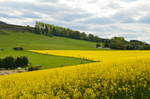
Rapeseed bloom in May 2017 in the Sauerland near Grevenstein
Wolfgang Schielasko

Deutschland / Nordrhein-Westfalen / Sauerland

423 1200x797 Px, 20.05.2017

Low water level in the Möhnesee near Körbecke on 15.02.2017
Wolfgang Schielasko

Deutschland / Nordrhein-Westfalen / Sauerland

504 1200x797 Px, 23.02.2017

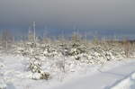
Atmospheric scene in the snow on the  Hellefelder Höhe  (502 m) near Arnsberg.
Atmospheric scene in the snow on the "Hellefelder Höhe" (502 m) near Arnsberg.
Wolfgang Schielasko

Deutschland / Nordrhein-Westfalen / Sauerland

479 1200x797 Px, 16.01.2017

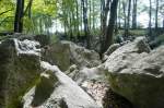
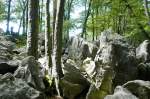
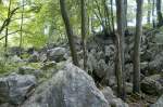
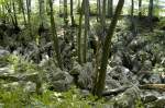
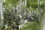
The sea of rocks in Hemer, Sauerland. Shot: July 2007.
Hans Christian Davidsen

Deutschland / Nordrhein-Westfalen / Sauerland

559 1200x797 Px, 11.01.2016

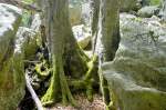
Close-up of the sea of rocks in the Sauerland region of Heer. Photo taken: July 2007.
Hans Christian Davidsen

Deutschland / Nordrhein-Westfalen / Sauerland

459 1200x797 Px, 11.01.2016

Close-up of the sea of rocks in the Sauerland region of Heer. Photo taken: July 2007.
Hans Christian Davidsen

Deutschland / Nordrhein-Westfalen / Sauerland

472 1200x797 Px, 11.01.2016

Close-up of the sea of rocks in the Sauerland region of Heer. Photo taken: July 2007.
Hans Christian Davidsen

Deutschland / Nordrhein-Westfalen / Sauerland

481 1200x797 Px, 09.01.2016

View of the mountains from Altena Castle. Shot: July 2007.
Hans Christian Davidsen

The sea of rocks near Hemer is a remnant from the Ice Age, one of the most significant geotopes in Germany, and not, as often assumed, a body of water. Photo taken: July 2007.
Hans Christian Davidsen

Deutschland / Nordrhein-Westfalen / Sauerland

559 1200x797 Px, 29.09.2015

The sea of rocks near Hemer. The bizarre rocky landscape of the sea of rocks is located between the Hemer districts of Sundwig and Deilinghofen. Photo taken: July 2007.
Hans Christian Davidsen

Deutschland / Nordrhein-Westfalen / Sauerland

516 1200x797 Px, 29.09.2015

The sea of rocks near Hemer. The wildly rugged rocky landscape is one of the 70 most significant geotopes in Germany. The oldest underground mining of iron ore in all of North Rhine-Westphalia has been documented here. Photo: July 2007.
Hans Christian Davidsen

Deutschland / Nordrhein-Westfalen / Sauerland

497 1200x797 Px, 29.09.2015

The Hemer Rock Sea is accessible around the clock. Leaving the marked paths is prohibited and very dangerous, as rock crevices are often hidden under leaves and branches. This has already led to several fatalities. Photo: July 2007.
Hans Christian Davidsen

Deutschland / Nordrhein-Westfalen / Sauerland

498 1200x797 Px, 29.09.2015

The Felsenmeer in Hemer, Sauerland, has been a protected natural area since 1968. Its rugged terrain geologically dates back to the Tertiary period. The Felsenmeer area is approximately 600 meters long, 200 meters wide, and situated 45 meters above the valley floor. Photo taken: July 2007.
Hans Christian Davidsen

Deutschland / Nordrhein-Westfalen / Sauerland

471 1200x797 Px, 29.09.2015

The old bakehouse (Backes) at the parish pond in Freudenberg-Oberholzklau, Siegen-Wittgenstein district, on 16.11.2013.
Armin Schwarz

Deutschland / Nordrhein-Westfalen / Siegerland

1454  2 1180x779 Px, 17.11.2013

Fly agaric in the forest
Jan Schneider

Deutschland / Nordrhein-Westfalen / Sauerland

645 1024x768 Px, 10.02.2012

Zinse 2011
Zinse 2011
Jan Schneider

Deutschland / Nordrhein-Westfalen / Sauerland

985 1024x768 Px, 10.02.2012

Brilon Heights in the High Sauerland near Madfeld (01.08.2011)
Peter Reiser

Deutschland / Nordrhein-Westfalen / Sauerland

803 680x1024 Px, 06.08.2011

High Sauerland near Nuttlar (01.08.2011)
Peter Reiser

Deutschland / Nordrhein-Westfalen / Sauerland

721 1024x680 Px, 05.08.2011

Ruhr near Nuttlar, Hochsauerland district (01.08.2011)
Peter Reiser

Deutschland / Nordrhein-Westfalen / Sauerland

837 1024x680 Px, 05.08.2011

Möhne Reservoir near Soest (01.08.2011)
Peter Reiser

Deutschland / Nordrhein-Westfalen / Sauerland

789 1024x680 Px, 05.08.2011

Dam of the Sorpetalsperre Reservoir near Langscheid, Hochsauerland District (01.08.2011)
Peter Reiser

Deutschland / Nordrhein-Westfalen / Sauerland

950 1024x680 Px, 05.08.2011