
landschaftsfotos.eu Linie landschaftsfotos.eu
Hello guest, you are not logged in. Log in | Create account 
Forum   Contact   Legal notice
German English 

Märkischer Kreis Landschaftsfotos (Landschaften, Natur und Ausblicke)

18 Photos
The almost dried-up waterbed near the Glörtalsperre. (Breckerfeld, February 2018)
Christian Bremer

The two pillars of the Glörtal Dam. (Breckerfeld, February 2018)
Christian Bremer

Germany / North Rhine-Westphalia / Ruhr area

460 800x1200 Px, 06.02.2018

The 168-meter-long and 32-meter-high dam wall of the Glörtalsperre. (Breckerfeld, February 2018)
Christian Bremer

Germany / North Rhine-Westphalia / Ruhr area

563 800x1200 Px, 06.02.2018

The 168-meter-long and 32-meter-high dam wall of the Glörtalsperre. (Breckerfeld, February 2018)
Christian Bremer

Germany / North Rhine-Westphalia / Ruhr area

580 1200x800 Px, 06.02.2018

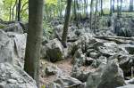
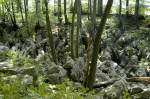
The sea of rocks in Hemer, Sauerland. Shot: July 2007.
Hans Christian Davidsen

Germany / North Rhine-Westphalia / Sauerland

576 1200x797 Px, 11.01.2016

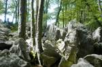
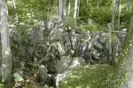
Close-up of the sea of rocks in the Sauerland region of Heer. Photo taken: July 2007.
Hans Christian Davidsen

Germany / North Rhine-Westphalia / Sauerland

468 1200x797 Px, 11.01.2016

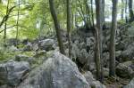
Close-up of the sea of rocks in the Sauerland region of Heer. Photo taken: July 2007.
Hans Christian Davidsen

Germany / North Rhine-Westphalia / Sauerland

483 1200x797 Px, 11.01.2016

Close-up of the sea of rocks in the Sauerland region of Heer. Photo taken: July 2007.
Hans Christian Davidsen

Germany / North Rhine-Westphalia / Sauerland

496 1200x797 Px, 09.01.2016

View of the mountains from Altena Castle. Shot: July 2007.
Hans Christian Davidsen

The sea of rocks near Hemer is a remnant from the Ice Age, one of the most significant geotopes in Germany, and not, as often assumed, a body of water. Photo taken: July 2007.
Hans Christian Davidsen

Germany / North Rhine-Westphalia / Sauerland

584 1200x797 Px, 29.09.2015

The sea of rocks near Hemer. The bizarre rocky landscape of the sea of rocks is located between the Hemer districts of Sundwig and Deilinghofen. Photo taken: July 2007.
Hans Christian Davidsen

Germany / North Rhine-Westphalia / Sauerland

532 1200x797 Px, 29.09.2015

The sea of rocks near Hemer. The wildly rugged rocky landscape is one of the 70 most significant geotopes in Germany. The oldest underground mining of iron ore in all of North Rhine-Westphalia has been documented here. Photo: July 2007.
Hans Christian Davidsen

Germany / North Rhine-Westphalia / Sauerland

510 1200x797 Px, 29.09.2015

The Hemer Rock Sea is accessible around the clock. Leaving the marked paths is prohibited and very dangerous, as rock crevices are often hidden under leaves and branches. This has already led to several fatalities. Photo: July 2007.
Hans Christian Davidsen

Germany / North Rhine-Westphalia / Sauerland

511 1200x797 Px, 29.09.2015

The Felsenmeer in Hemer, Sauerland, has been a protected natural area since 1968. Its rugged terrain geologically dates back to the Tertiary period. The Felsenmeer area is approximately 600 meters long, 200 meters wide, and situated 45 meters above the valley floor. Photo taken: July 2007.
Hans Christian Davidsen

Germany / North Rhine-Westphalia / Sauerland

485 1200x797 Px, 29.09.2015

Sea of rocks in Hemer
Michael Grotegut

Germany / North Rhine-Westphalia / Sauerland

2259 1024x680 Px, 03.10.2010

Winter forest area near Neuenrade before the Kyrill hurricane, taken on 26.12.2006
Jens

Hardly any forest left to see, Kyrill did a thorough job here almost a year ago. Photo taken on 26.12.2007 near Neuenrade
Jens

Where there was dense forest less than a year ago, this remained after Hurricane Kyrill. Photo taken on 26.12.2007 near Neuenrade
Jens