landschaftsfotos.eu Linie landschaftsfotos.eu
Hello guest, you are not logged in. Log in | Create account 
Forum   Contact   Legal notice
German English 
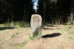
The Three-Country Stone at Jägerfleck. Where Lower Saxony, Saxony-Anhalt, and Thuringia meet today, there has always been a border. This stone separated the Duchy of Brunswick, the Kingdom of Prussia (until 1866 the Kingdom of Hanover), and the County of Schwarzburg-Sondershausen. The change after 1866 is clearly visible. AB stands for the Hanoverian Amt Benneckenstein. Later, it was changed to KP - Kingdom of Prussia. The inner-German border also ran through this point.
André Breutel

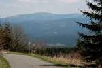
View of the Brocken from the Schalker Tower near Zellerfeld.
André Breutel

Germany / Lower Saxony / Harz

716 700x467 Px, 06.06.2008

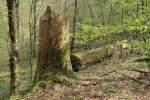
 Thick Firs  is the name of a primeval forest-like area near Hohegeiß. From the 18th century onwards, the forest was left to itself here. The tallest spruces in the Harz grow here and, after their life, undergo natural decay. This is how I imagine a primeval forest. The ridiculous national park is still very far from this...
"Thick Firs" is the name of a primeval forest-like area near Hohegeiß. From the 18th century onwards, the forest was left to itself here. The tallest spruces in the Harz grow here and, after their life, undergo natural decay. This is how I imagine a primeval forest. The ridiculous national park is still very far from this...
André Breutel

Germany / Lower Saxony / Harz

668 700x467 Px, 06.06.2008

 Dicke Tannen  is the name of a primeval forest-like woodland area near Hohegeiß. From the 18th century onwards, the forest here was left to itself. The tallest spruces in the Harz grow here and, after their life, undergo natural decay. This is how I imagine a primeval forest. The ridiculous national park is still very far from this...
"Dicke Tannen" is the name of a primeval forest-like woodland area near Hohegeiß. From the 18th century onwards, the forest here was left to itself. The tallest spruces in the Harz grow here and, after their life, undergo natural decay. This is how I imagine a primeval forest. The ridiculous national park is still very far from this...
André Breutel

Germany / Lower Saxony / Harz

639 700x467 Px, 06.06.2008

Upper Harz Water Regale - The Sperberhaier Dam Aqueduct was constructed between 1732 and 1734. Over the 16m high and 940m long dam, the dam ditch was guided on its course from Torfhaus to the Burgstädt district across the valley closure of the Söse.
André Breutel

Germany / Lower Saxony / Harz

722 700x467 Px, 06.06.2008

Upper Harz Water Regale - The Oderteich was constructed between 1715 and 1722. It is considered the oldest reservoir in Germany. Its capacity is 1.7 million m³. Through the Rehberger Graben, which branches off here, the St. Andreasberg mining district was supplied with water.
André Breutel

Germany / Lower Saxony / Harz

811 700x467 Px, 06.06.2008

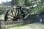
Upper Harz Water Management System - During the period from the 16th to the 19th century, mining in the Harz region experienced its heyday. The mining towns were granted their  mining freedom  or were founded, and many groundbreaking inventions originated here. These include the water pump, the railway rail, the wire rope, and the patented explosive. Water wheels and overshot wheels were used as engines for almost all tasks to be performed. The invention of the steam engine did not change this. It was only the introduction of electric motors in the 20th century that replaced the water wheels. Enormous amounts of water were needed as driving power, which ran low during the dry months. In the picture: Water art at the Maaßener Gaipel near Lautental.
Upper Harz Water Management System - During the period from the 16th to the 19th century, mining in the Harz region experienced its heyday. The mining towns were granted their "mining freedom" or were founded, and many groundbreaking inventions originated here. These include the water pump, the railway rail, the wire rope, and the patented explosive. Water wheels and overshot wheels were used as engines for almost all tasks to be performed. The invention of the steam engine did not change this. It was only the introduction of electric motors in the 20th century that replaced the water wheels. Enormous amounts of water were needed as driving power, which ran low during the dry months. In the picture: Water art at the Maaßener Gaipel near Lautental.
André Breutel

Germany / Lower Saxony / Harz

1661 700x467 Px, 05.06.2008

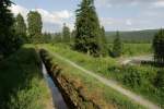
Upper Harz Water Management System - To quench the insatiable  thirst  of the water-powered mining machines, a gigantic system of water ditches, channels, dam aqueducts, and artificial ponds was created over decades in the Harz Mountains, which is now listed as a UNESCO World Heritage Site - the Upper Harz Water Management System. In the picture: the Rehberger Ditch just before the Rehberger Ditch House.
Upper Harz Water Management System - To quench the insatiable "thirst" of the water-powered mining machines, a gigantic system of water ditches, channels, dam aqueducts, and artificial ponds was created over decades in the Harz Mountains, which is now listed as a UNESCO World Heritage Site - the Upper Harz Water Management System. In the picture: the Rehberger Ditch just before the Rehberger Ditch House.
André Breutel

Germany / Lower Saxony / Harz

651 700x467 Px, 05.06.2008

Upper Harz Water Regale - The largest structure is the Dammgraben. Over a length of 25 km, it channels water from the high-precipitation areas around Torfhaus to the mining districts of Clausthal. In doing so, it crosses the Sösetal valley with the Sperberhaier Dam aqueduct, which is 16 meters high and 940 meters long. 500 miners built it between 1731 and 1734.
André Breutel

Germany / Lower Saxony / Harz

1049 700x467 Px, 05.06.2008

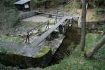
Upper Harz Water Regale - Not a drop of water was wasted. Every stream, every trickle was directed into the dam ditch at these weirs.
André Breutel

Germany / Lower Saxony / Harz

715 700x467 Px, 05.06.2008

Upper Harz Water Regale - The Great Weir at the Morgenbrodtshütte. Here, the water of the Söse was diverted. Through the Morgenbrodtstaler Ditch, built between 1715-1718, the water was led to Clausthal. Later, it flowed into the Dammgraben.
André Breutel

Germany / Lower Saxony / Harz

1236 700x467 Px, 05.06.2008

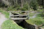
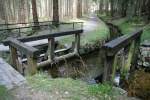
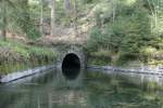
Upper Harz Water Regale - Initially, the ditches were adapted to a gentle slope of the topography and led on long routes around the mountains. Later, the mountains were pierced, and the water was directed through underground watercourses. The advantage here was that the water was slightly warmed in winter and did not freeze. In the picture: the Huttaler Wiederwaage.
André Breutel

Germany / Lower Saxony / Harz

748 700x467 Px, 05.06.2008

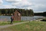
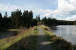
Upper Harz Water Regale - To have endless water reserves for the dry seasons, over 500 artificial ponds were built. The largest is the Oderteich. It is considered the first German dam. Here in the picture: Bärenbrucher Teich near Clausthal-Zellerfeld.
André Breutel

Germany / Lower Saxony / Harz

648 700x467 Px, 05.06.2008

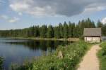
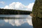
Upper Harz Water Regale - To have endless water reserves for the dry seasons, over 500 artificial ponds were built. The highest rule was,  First use the flowing water, then resort to the standing water!  Here in the picture: Nassenwieser Pond near Clausthal-Zellerfeld.
Upper Harz Water Regale - To have endless water reserves for the dry seasons, over 500 artificial ponds were built. The highest rule was, "First use the flowing water, then resort to the standing water!" Here in the picture: Nassenwieser Pond near Clausthal-Zellerfeld.
André Breutel

Germany / Lower Saxony / Harz

732  1 700x467 Px, 05.06.2008

Upper Harz Water Management System - Using the example of the Bärenbruch Pond and Ziegenberger Pond, the name  Water Management System  becomes clear. Like a shelf, the structures were arranged one above the other. The water was collected even after use and supplied to the next machine. This way, many installations above and below ground could be operated with the same water. Which energy carrier can be used so efficiently?
Upper Harz Water Management System - Using the example of the Bärenbruch Pond and Ziegenberger Pond, the name "Water Management System" becomes clear. Like a shelf, the structures were arranged one above the other. The water was collected even after use and supplied to the next machine. This way, many installations above and below ground could be operated with the same water. Which energy carrier can be used so efficiently?
André Breutel

Germany / Lower Saxony / Harz

561 700x467 Px, 05.06.2008

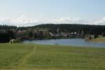
Upper Harz Water Regale - View over the Ziegenberger Pond to the Sumpfteich near Buntenbock.
André Breutel

Germany / Lower Saxony / Harz

666 700x467 Px, 05.06.2008

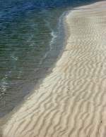
Incoming tide on Spiekeroog's Robbenplate on 22.05.2008
Jens

Beach near the Westend campsite on Spiekeroog on 22.05.2008
Jens

Spiekeroog's seaside on 22.05.2008
Jens

Photo from the Lower Saxony Wadden Sea National Park, here in front of Spiekeroog on 22.05.2008
Jens

The North Beach with the seal flat on Spiekeroog on 22.05.2008
Jens

At the Timmeler Meer. 11.05.2008
Jens

Last rays of sunshine on 10.05.2008 in Großefehn-Timmel
Jens

End of the day on 11.05.2008 in Großefehn-Timmel (Aurich district)
Jens