
landschaftsfotos.eu Linie landschaftsfotos.eu
Hello guest, you are not logged in. Log in | Create account 
Forum   Contact   Legal notice
German English 

Landkreis Goslar Landschaftsfotos (Landschaften, Natur und Ausblicke)

572 Photos
Dam, High Harz, digital slide from 1993
ERHARD BEYER

Germany / Lower Saxony / Harz

601 800x533 Px, 17.10.2008

As you can already see, there are many hiking trips at the Oderteich :) I took the photo on 06.06.2006. The Oderteich is a beautiful excursion destination in the High Harz!
Christoph Mehl

Germany / Lower Saxony / Harz

868  1 800x598 Px, 11.08.2008

View of the mountain town Altenau.
André Breutel

Germany / Lower Saxony / Harz

668 700x467 Px, 15.06.2008

View of Wieda from the Old Guardhouse.
André Breutel

Germany / Lower Saxony / Harz

1134 700x467 Px, 13.06.2008

In the Lutter Valley near Bad Lauterberg.
André Breutel

Germany / Lower Saxony / Harz

603 700x467 Px, 13.06.2008

A storm is brewing over the northern Harz foothills. The thermals of the mountain edge catapult the moist air up to an altitude of 10,000m. At this height, intense hail formation occurred, which then fell over the Magdeburg Börde area and caused damage.
André Breutel

View of the mountain town Wildemann.
André Breutel

Germany / Lower Saxony / Harz

711 700x467 Px, 11.06.2008

A blooming summer meadow above Wildemann.
André Breutel

Germany / Lower Saxony / Harz

645 700x467 Px, 11.06.2008

View of Wildemann.
View of Wildemann.
André Breutel

Germany / Lower Saxony / Harz

905 700x467 Px, 11.06.2008

View of the mountain town Lautenthal.
André Breutel

Germany / Lower Saxony / Harz

668 700x467 Px, 11.06.2008

Rhododendrons in front of a log cabin at the Altar Cliff.
André Breutel

Germany / Lower Saxony / Harz

547 700x467 Px, 11.06.2008

The Ecker Reservoir near Bad Harzburg. The inner-German border ran over its dam.
André Breutel

View over Wolfshagen in the Harz.
André Breutel

Germany / Lower Saxony / Harz

754 700x467 Px, 06.06.2008

The Granestausee near Goslar was constructed between 1966 and 1969. Its capacity is 64.4 million cubic meters.
André Breutel

Germany / Lower Saxony / Harz

1101 700x467 Px, 06.06.2008

The Granestausee near Goslar was constructed between 1966 and 1969. Its capacity is 64.4 million cubic meters.
André Breutel

Germany / Lower Saxony / Harz

777 700x467 Px, 06.06.2008

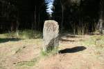
The Three-Country Stone at Jägerfleck. Where Lower Saxony, Saxony-Anhalt, and Thuringia meet today, there has always been a border. This stone separated the Duchy of Brunswick, the Kingdom of Prussia (until 1866 the Kingdom of Hanover), and the County of Schwarzburg-Sondershausen. The change after 1866 is clearly visible. AB stands for the Hanoverian Amt Benneckenstein. Later, it was changed to KP - Kingdom of Prussia. The inner-German border also ran through this point.
André Breutel

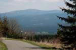
View of the Brocken from the Schalker Tower near Zellerfeld.
André Breutel

Germany / Lower Saxony / Harz

732 700x467 Px, 06.06.2008

 Thick Firs  is the name of a primeval forest-like area near Hohegeiß. From the 18th century onwards, the forest was left to itself here. The tallest spruces in the Harz grow here and, after their life, undergo natural decay. This is how I imagine a primeval forest. The ridiculous national park is still very far from this...
"Thick Firs" is the name of a primeval forest-like area near Hohegeiß. From the 18th century onwards, the forest was left to itself here. The tallest spruces in the Harz grow here and, after their life, undergo natural decay. This is how I imagine a primeval forest. The ridiculous national park is still very far from this...
André Breutel

Germany / Lower Saxony / Harz

683 700x467 Px, 06.06.2008

 Dicke Tannen  is the name of a primeval forest-like woodland area near Hohegeiß. From the 18th century onwards, the forest here was left to itself. The tallest spruces in the Harz grow here and, after their life, undergo natural decay. This is how I imagine a primeval forest. The ridiculous national park is still very far from this...
"Dicke Tannen" is the name of a primeval forest-like woodland area near Hohegeiß. From the 18th century onwards, the forest here was left to itself. The tallest spruces in the Harz grow here and, after their life, undergo natural decay. This is how I imagine a primeval forest. The ridiculous national park is still very far from this...
André Breutel

Germany / Lower Saxony / Harz

655 700x467 Px, 06.06.2008

Upper Harz Water Regale - The Sperberhaier Dam Aqueduct was constructed between 1732 and 1734. Over the 16m high and 940m long dam, the dam ditch was guided on its course from Torfhaus to the Burgstädt district across the valley closure of the Söse.
André Breutel

Germany / Lower Saxony / Harz

734 700x467 Px, 06.06.2008

Upper Harz Water Regale - The Oderteich was constructed between 1715 and 1722. It is considered the oldest reservoir in Germany. Its capacity is 1.7 million m³. Through the Rehberger Graben, which branches off here, the St. Andreasberg mining district was supplied with water.
André Breutel

Germany / Lower Saxony / Harz

822 700x467 Px, 06.06.2008

Upper Harz Water Management System - During the period from the 16th to the 19th century, mining in the Harz region experienced its heyday. The mining towns were granted their  mining freedom  or were founded, and many groundbreaking inventions originated here. These include the water pump, the railway rail, the wire rope, and the patented explosive. Water wheels and overshot wheels were used as engines for almost all tasks to be performed. The invention of the steam engine did not change this. It was only the introduction of electric motors in the 20th century that replaced the water wheels. Enormous amounts of water were needed as driving power, which ran low during the dry months. In the picture: Water art at the Maaßener Gaipel near Lautental.
Upper Harz Water Management System - During the period from the 16th to the 19th century, mining in the Harz region experienced its heyday. The mining towns were granted their "mining freedom" or were founded, and many groundbreaking inventions originated here. These include the water pump, the railway rail, the wire rope, and the patented explosive. Water wheels and overshot wheels were used as engines for almost all tasks to be performed. The invention of the steam engine did not change this. It was only the introduction of electric motors in the 20th century that replaced the water wheels. Enormous amounts of water were needed as driving power, which ran low during the dry months. In the picture: Water art at the Maaßener Gaipel near Lautental.
André Breutel

Germany / Lower Saxony / Harz

1682 700x467 Px, 05.06.2008

Upper Harz Water Management System - To quench the insatiable  thirst  of the water-powered mining machines, a gigantic system of water ditches, channels, dam aqueducts, and artificial ponds was created over decades in the Harz Mountains, which is now listed as a UNESCO World Heritage Site - the Upper Harz Water Management System. In the picture: the Rehberger Ditch just before the Rehberger Ditch House.
Upper Harz Water Management System - To quench the insatiable "thirst" of the water-powered mining machines, a gigantic system of water ditches, channels, dam aqueducts, and artificial ponds was created over decades in the Harz Mountains, which is now listed as a UNESCO World Heritage Site - the Upper Harz Water Management System. In the picture: the Rehberger Ditch just before the Rehberger Ditch House.
André Breutel

Germany / Lower Saxony / Harz

666 700x467 Px, 05.06.2008

Upper Harz Water Regale - The largest structure is the Dammgraben. Over a length of 25 km, it channels water from the high-precipitation areas around Torfhaus to the mining districts of Clausthal. In doing so, it crosses the Sösetal valley with the Sperberhaier Dam aqueduct, which is 16 meters high and 940 meters long. 500 miners built it between 1731 and 1734.
André Breutel

Germany / Lower Saxony / Harz

1067 700x467 Px, 05.06.2008