landschaftsfotos.eu Linie landschaftsfotos.eu
Hello guest, you are not logged in. Log in | Create account 
Forum   Contact   Legal notice
German English 
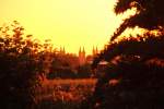
Sunset in Bamberg on 22.06.2013.
Markus K.

Deutschland / Bayern / Oberfranken

965  4 1024x682 Px, 29.06.2013

Altmühl Valley near Unterasbach (15.06.2013)
Peter Reiser

Deutschland / Bayern / Mittelfranken

598 1024x768 Px, 17.06.2013

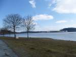
The water is still half frozen, but fortunately the sun is shining. At Untreusee, there is, among other things, a climbing park and a labyrinth. The photo was taken on 07.04.13.
L.K.

Deutschland / Bayern / Oberfranken

656 1024x768 Px, 13.04.2013

The water is still half frozen, but fortunately the sun is shining. At Untreusee, there is, among other things, a climbing park and a labyrinth. The photo was taken on 07.04.13.
L.K.

Deutschland / Bayern / Oberfranken

624 1024x768 Px, 13.04.2013

Here once again the view of Untreusee in Hof. At Untreusee, there is a pedal boat rental, a restaurant, and a playground. The photo was taken on a rather dull April 7, 2013.
L.K.

Deutschland / Bayern / Oberfranken

637 1024x768 Px, 13.04.2013

Here is the view of Untreusee in Hof. At Untreusee, there is a pedal boat rental, a restaurant, and a playground. The photo was taken on a rather dull April 7, 2013.
L.K.

Deutschland / Bayern / Oberfranken

635 1024x768 Px, 13.04.2013

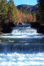
Cascades at Walchensee - 

The Rißbach is diverted into the Walchensee at Niedernach to generate electricity in the local power plant.

27.10.2005
Cascades at Walchensee - The Rißbach is diverted into the Walchensee at Niedernach to generate electricity in the local power plant. 27.10.2005
Erhard Pitzius

Deutschland / Bayern / Oberbayern

1317  1 666x1000 Px, 27.03.2013

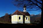
Chapel Maria Rast - 

It is located on the Buckelwiesen between Mittenwald and Krün.

27.10.2005
Chapel Maria Rast - It is located on the Buckelwiesen between Mittenwald and Krün. 27.10.2005
Erhard Pitzius

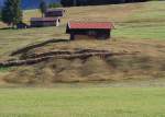
The hummocky meadows near Mittenwald on 11.02.2000.
Erhard Pitzius

Deutschland / Bayern / Oberbayern

825 1000x716 Px, 27.03.2013

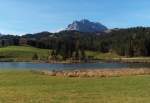
The Schmalensee near Mittenwald on 24.10.2005 with a view of the Wetterstein Mountains.
Erhard Pitzius

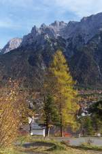
View over Mittenwald to the Karwendel in the golden October 2005. (26.10.2005)
Erhard Pitzius

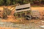
Hunting stand in the Franconian Forest that could not withstand the forces of nature. 25.03.2013.
Markus K.

Deutschland / Bayern / Frankenwald

569 1024x682 Px, 25.03.2013

Hier noch einmal der Blick zur sächsichen Saale in Schwazenbach. Fotografiert am 24.03.13.
L.K.

Deutschland / Bayern / Oberfranken

663 1024x768 Px, 24.03.2013

Here is the view of the Saxon Saale as well as the Hellersinsel in Schwarzenbach on the Saale. 24.03.13.
L.K.

Deutschland / Bayern / Oberfranken

665 1024x768 Px, 24.03.2013

Hier fährt ein Regionalexpress gerade an der sächsischen Saale entlang, um in wenigen Minuten Hof zu erreichen. 03.03.13.
L.K.

Deutschland / Bayern / Oberfranken

676 1024x768 Px, 23.03.2013

Hier zu sehen ist ein ALEX-Zug, welcher an der sächsischen Saale entlang in Richtung Hof fährt. 03.03.13.
L.K.

Deutschland / Bayern / Oberfranken

766 1024x768 Px, 23.03.2013

Zu sehen ist die Saale in Oberkotzau, der Kappelsteg und der Radweg. 03.03.13.
L.K.

Deutschland / Bayern / Oberfranken

657 1024x768 Px, 23.03.2013

Hier nocheinmal die Saale, im Hintergrund ist diesesmal ein Regionalexpress zu sehen.
03.03.13.
Hier nocheinmal die Saale, im Hintergrund ist diesesmal ein Regionalexpress zu sehen. 03.03.13.
L.K.

Deutschland / Bayern / Oberfranken

615 1024x768 Px, 23.03.2013

The Saxon Saale in Oberkotzau, visible is an approximately 5-meter-high dam as well as railway tracks in the background, leading towards Hof and Bayreuth.  
Photographed on 03.03.13.
The Saxon Saale in Oberkotzau, visible is an approximately 5-meter-high dam as well as railway tracks in the background, leading towards Hof and Bayreuth. Photographed on 03.03.13.
L.K.

Deutschland / Bayern / Oberfranken

689 1024x768 Px, 23.03.2013

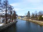
View towards the Saxon Saale in Oberkotzau. Railway tracks can be seen in the background.  
Taken on 03.03.13.

The Saxon Saale springs from an old mining tunnel. On the wall built from rough granite blocks, there is a syenite plaque with the inscription:  Source of the Saale, enclosed by the towns of Münchberg, Schwarzenbach, Hof, Weißenfels, Halle 1869.  The initiative for the first source enclosure came from the town of Münchberg, and the towns mentioned on the plaque contributed to the costs. The entire area is a protected natural monument. The source is the starting point of the 427 km long  Saale Cycle Path. 

Source:  Das Fichtelgebirge
View towards the Saxon Saale in Oberkotzau. Railway tracks can be seen in the background. Taken on 03.03.13. The Saxon Saale springs from an old mining tunnel. On the wall built from rough granite blocks, there is a syenite plaque with the inscription: "Source of the Saale, enclosed by the towns of Münchberg, Schwarzenbach, Hof, Weißenfels, Halle 1869." The initiative for the first source enclosure came from the town of Münchberg, and the towns mentioned on the plaque contributed to the costs. The entire area is a protected natural monument. The source is the starting point of the 427 km long "Saale Cycle Path." Source: "Das Fichtelgebirge"
L.K.

Deutschland / Bayern / Oberfranken

728 1024x768 Px, 23.03.2013

Sky and  Hell  - after a heavy snow shower, the dark clouds cleared away again on February 7, 2013...
Sky and "Hell" - after a heavy snow shower, the dark clouds cleared away again on February 7, 2013...
Marcus Haffner

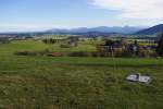
Allgäu near Oy-Mittelberg, Oberallgäu district (06.11.2011)
Peter Reiser

Deutschland / Bayern / Oberallg䵀

809 1024x682 Px, 29.01.2013

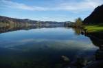
Great Alpsee near Immenstadt (01.11.2011)
Peter Reiser

Deutschland / Bayern / Oberallg䵀

846  1 1024x680 Px, 29.01.2013

High fireworks display after the triathlon in Roth on July 8, 2012.
Marcus Haffner