landschaftsfotos.eu Linie landschaftsfotos.eu
Hello guest, you are not logged in. Log in | Create account 
Forum   Contact   Legal notice
German English 
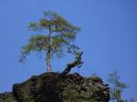
Hunting stand in the Franconian Forest that could not withstand the forces of nature. 25.03.2013.
Markus K.

Deutschland / Bayern / Frankenwald

563 1024x682 Px, 25.03.2013

Hier noch einmal der Blick zur sächsichen Saale in Schwazenbach. Fotografiert am 24.03.13.
L.K.

Deutschland / Bayern / Oberfranken

659 1024x768 Px, 24.03.2013

Here is the view of the Saxon Saale as well as the Hellersinsel in Schwarzenbach on the Saale. 24.03.13.
L.K.

Deutschland / Bayern / Oberfranken

663 1024x768 Px, 24.03.2013

Hier fährt ein Regionalexpress gerade an der sächsischen Saale entlang, um in wenigen Minuten Hof zu erreichen. 03.03.13.
L.K.

Deutschland / Bayern / Oberfranken

673 1024x768 Px, 23.03.2013

Hier zu sehen ist ein ALEX-Zug, welcher an der sächsischen Saale entlang in Richtung Hof fährt. 03.03.13.
L.K.

Deutschland / Bayern / Oberfranken

763 1024x768 Px, 23.03.2013

Zu sehen ist die Saale in Oberkotzau, der Kappelsteg und der Radweg. 03.03.13.
L.K.

Deutschland / Bayern / Oberfranken

653 1024x768 Px, 23.03.2013

Hier nocheinmal die Saale, im Hintergrund ist diesesmal ein Regionalexpress zu sehen.
03.03.13.
Hier nocheinmal die Saale, im Hintergrund ist diesesmal ein Regionalexpress zu sehen. 03.03.13.
L.K.

Deutschland / Bayern / Oberfranken

613 1024x768 Px, 23.03.2013

The Saxon Saale in Oberkotzau, visible is an approximately 5-meter-high dam as well as railway tracks in the background, leading towards Hof and Bayreuth.  
Photographed on 03.03.13.
The Saxon Saale in Oberkotzau, visible is an approximately 5-meter-high dam as well as railway tracks in the background, leading towards Hof and Bayreuth. Photographed on 03.03.13.
L.K.

Deutschland / Bayern / Oberfranken

689 1024x768 Px, 23.03.2013

View towards the Saxon Saale in Oberkotzau. Railway tracks can be seen in the background.  
Taken on 03.03.13.

The Saxon Saale springs from an old mining tunnel. On the wall built from rough granite blocks, there is a syenite plaque with the inscription:  Source of the Saale, enclosed by the towns of Münchberg, Schwarzenbach, Hof, Weißenfels, Halle 1869.  The initiative for the first source enclosure came from the town of Münchberg, and the towns mentioned on the plaque contributed to the costs. The entire area is a protected natural monument. The source is the starting point of the 427 km long  Saale Cycle Path. 

Source:  Das Fichtelgebirge
View towards the Saxon Saale in Oberkotzau. Railway tracks can be seen in the background. Taken on 03.03.13. The Saxon Saale springs from an old mining tunnel. On the wall built from rough granite blocks, there is a syenite plaque with the inscription: "Source of the Saale, enclosed by the towns of Münchberg, Schwarzenbach, Hof, Weißenfels, Halle 1869." The initiative for the first source enclosure came from the town of Münchberg, and the towns mentioned on the plaque contributed to the costs. The entire area is a protected natural monument. The source is the starting point of the 427 km long "Saale Cycle Path." Source: "Das Fichtelgebirge"
L.K.

Deutschland / Bayern / Oberfranken

727 1024x768 Px, 23.03.2013

Midsummer in the Saale Valley. This view was not always accessible. For over 30 years, this area was a restricted zone, and the Saale was a border river between the GDR on the far side and the FRG on the left side of the Saale. Thankfully, today the Saale only forms the small border between Thuringia and Bavaria. View from the  watch hill  in Pottiga towards Blankenberg. 01.08.2012
Midsummer in the Saale Valley. This view was not always accessible. For over 30 years, this area was a restricted zone, and the Saale was a border river between the GDR on the far side and the FRG on the left side of the Saale. Thankfully, today the Saale only forms the small border between Thuringia and Bavaria. View from the "watch hill" in Pottiga towards Blankenberg. 01.08.2012
Erhard Pitzius

The small town of Rudolphstein on the Saale River (Bavaria) as seen from the former inner-German border area of Pottiga (Thuringia). 01.08.2012
Erhard Pitzius

Deutschland / Bayern / Oberfranken

738 1024x680 Px, 11.12.2012

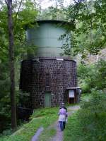
Hydroelectric Power Plant Höllental/Upper Franconia - Water Tower. To harness the hydropower of the Selbitz River in the Franconian Höllental, a strong gradient is needed. The valley of the small river does not provide this. Therefore, almost 2 kilometers upstream from the power plant, the water is dammed at a weir and channeled through pipelines to the power plant. There, it is temporarily stored in a water tower and then fed to the turbine from a height of just over 30 meters. 13.08.2012
Ivonne Pitzius

Deutschland / Bayern / Oberfranken

1391 768x1024 Px, 08.12.2012

To harness the hydropower of the Selbitz in the Franconian Höllental, a steep gradient is required. The valley of the small river does not provide this. Therefore, almost 2 kilometers before the power plant, the water is dammed at a weir and channeled through pipes to the power plant. There it is temporarily stored in a water tower and then fed to the turbine from a height of just over 30 meters.

Behind the building at the weir runs the route of the former Höllental railway.
13.08.2012
To harness the hydropower of the Selbitz in the Franconian Höllental, a steep gradient is required. The valley of the small river does not provide this. Therefore, almost 2 kilometers before the power plant, the water is dammed at a weir and channeled through pipes to the power plant. There it is temporarily stored in a water tower and then fed to the turbine from a height of just over 30 meters. Behind the building at the weir runs the route of the former Höllental railway. 13.08.2012
Ivonne Pitzius

Deutschland / Bayern / Oberfranken

745 1024x768 Px, 07.12.2012

The Hirschsprung is not only found in the Black Forest in the Höllental but also in the  Franconian  Höllental. The Höllental in Upper Franconia stretches from the village of Hölle to Blechschmidtenhammer (Lichtenberg) in the valley of the Selbitz.

The actual landmark of the Höllental is the Hirschsprung, the wooden carved depiction of a jumping stag. The life-sized sculpture is located on a rock ledge 80 meters above the valley floor.

The  Franconian Höllentalbahn  once ran through the valley from Marxgrün to Blankenstein (Thuringia).
13.08.2012
The Hirschsprung is not only found in the Black Forest in the Höllental but also in the "Franconian" Höllental. The Höllental in Upper Franconia stretches from the village of Hölle to Blechschmidtenhammer (Lichtenberg) in the valley of the Selbitz. The actual landmark of the Höllental is the Hirschsprung, the wooden carved depiction of a jumping stag. The life-sized sculpture is located on a rock ledge 80 meters above the valley floor. The "Franconian Höllentalbahn" once ran through the valley from Marxgrün to Blankenstein (Thuringia). 13.08.2012
Ivonne Pitzius

Deutschland / Bayern / Oberfranken

1233 1024x768 Px, 07.12.2012

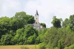
Church on the Staffelberg on 07.06.2012.
Markus K.

Deutschland / Bayern / Oberfranken

651 1024x682 Px, 08.06.2012

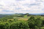
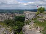
View from Staffelberg on 07.06.2012.
Markus K.

Deutschland / Bayern / Oberfranken

693 1024x682 Px, 07.06.2012

View of the Staffelberg. Kurpark Bad Staffelstein on 06.06.2012.
Markus K.

Deutschland / Bayern / Oberfranken

641 1024x727 Px, 06.06.2012

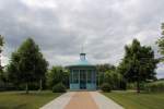
Pavilion with fountain in the spa park Bad Staffelstein on 06.06.2012.
Markus K.

Deutschland / Bayern / Oberfranken

630 1024x682 Px, 06.06.2012

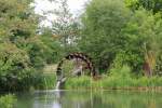
Waterwheel in the spa park Bad Staffelstein on 06.06.2012.
Markus K.

Deutschland / Bayern / Oberfranken

1287 1024x682 Px, 06.06.2012

View to the northwest from Staffelberg (540 m), the local mountain of Bad Staffelstein; 12.05.2012
Volkmar Döring

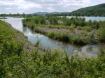
Biotope at Schönbrunner Lake (between Schönbrunn and Reundorf), with the Eierberge hills in the background; 12.05.2012
Volkmar Döring

Biotope at Schönbrunner Lake (between Schönbrunn and Reundorf), Kloster Banz in the background; 12.05.2012
Volkmar Döring

Franconian water wheel in the spa park Bad Staffelstein; 11.05.2012
Volkmar Döring

View over the Riedsee / Mittelsee; Bad Staffelstein, 11.05.2012
Volkmar Döring