landschaftsfotos.eu Linie landschaftsfotos.eu
Hello guest, you are not logged in. Log in | Create account 
Forum   Contact   Legal notice
German English 
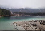
Even under a gray cloud cover, the Eibsee has something mystical. The flow of visitors had subsided by early evening, allowing for a peaceful walk around the lake. The image shows the starting point for most day visitors at the parking lot and the valley station of the cable car.

🕓 15.4.2023 | 7:13 PM
Even under a gray cloud cover, the Eibsee has something mystical. The flow of visitors had subsided by early evening, allowing for a peaceful walk around the lake. The image shows the starting point for most day visitors at the parking lot and the valley station of the cable car. 🕓 15.4.2023 | 7:13 PM
Clemens Kral

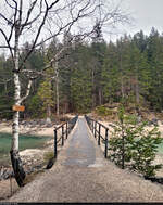
Bridge between the Eibsee and its Untersee on a calm, dull Saturday evening.

🕓 15.4.2023 | 7:12 PM
Bridge between the Eibsee and its Untersee on a calm, dull Saturday evening. 🕓 15.4.2023 | 7:12 PM
Clemens Kral

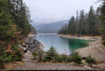
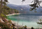
The circular trail around the Eibsee offers varied photographic subjects, although it had become quite overcast during the day and visibility was limited.

🕓 15.4.2023 | 18:58 hrs
The circular trail around the Eibsee offers varied photographic subjects, although it had become quite overcast during the day and visibility was limited. 🕓 15.4.2023 | 18:58 hrs
Clemens Kral

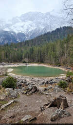
Directly adjacent to the Eibsee is the much smaller Frillensee in the Wetterstein Mountains, offering a view towards the Zugspitze. However, the visibility was better at noon on this Saturday.

🕓 15.4.2023 | 17:32 hrs
Directly adjacent to the Eibsee is the much smaller Frillensee in the Wetterstein Mountains, offering a view towards the Zugspitze. However, the visibility was better at noon on this Saturday. 🕓 15.4.2023 | 17:32 hrs
Clemens Kral

A touch of Scandinavia: the Eibsee near Grainau, photographed on a dull spring afternoon.

🕓 15.4.2023 | 17:27 hrs
A touch of Scandinavia: the Eibsee near Grainau, photographed on a dull spring afternoon. 🕓 15.4.2023 | 17:27 hrs
Clemens Kral

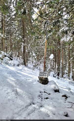
In the middle of the forest: the German-Austrian border between the municipalities of Grainau and Ehrwald. The border post still indicates the opening hours from that time.

🕓 15.4.2023 | 13:58 Uhr
In the middle of the forest: the German-Austrian border between the municipalities of Grainau and Ehrwald. The border post still indicates the opening hours from that time. 🕓 15.4.2023 | 13:58 Uhr
Clemens Kral

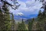
Gloomy weather is brewing in the mountains around the Eibsee near Grainau. Photographed from a viewpoint with a stamp station.

🕓 15.4.2023 | 13:35 Uhr
Gloomy weather is brewing in the mountains around the Eibsee near Grainau. Photographed from a viewpoint with a stamp station. 🕓 15.4.2023 | 13:35 Uhr
Clemens Kral

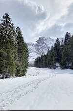
With a view of Lake Eibsee – on a hike through fresh snow to the Hochthörlehütte.

🕓 15.4.2023 | 13:33 hrs
With a view of Lake Eibsee – on a hike through fresh snow to the Hochthörlehütte. 🕓 15.4.2023 | 13:33 hrs
Clemens Kral

Deutschland / Bayern / Wettersteingebirge

196 563x1013 Px, 10.07.2023

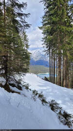
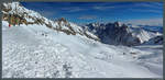
A little visual cooling off in the currently hot temperatures? In mid-April, there was still plenty of snow between Eibsee and Zugspitze, which could be hiked through.

🕓 15.4.2023 | 1:30 PM
A little visual cooling off in the currently hot temperatures? In mid-April, there was still plenty of snow between Eibsee and Zugspitze, which could be hiked through. 🕓 15.4.2023 | 1:30 PM
Clemens Kral

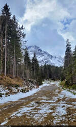
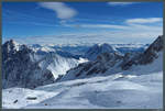
Hike from Eibsee near Grainau to the Hochthörlehütte in Austria. Along the way, there was a view towards the Zugspitze.

🕓 15.4.2023 | 12:42 PM
Hike from Eibsee near Grainau to the Hochthörlehütte in Austria. Along the way, there was a view towards the Zugspitze. 🕓 15.4.2023 | 12:42 PM
Clemens Kral

Deutschland / Bayern / Wettersteingebirge

183 610x1012 Px, 10.07.2023

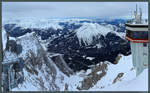
Approaching clouds lie just above the 2875 m high Schneefernerkopf, which, like the Zugspitze, is located on the German-Austrian border. (03.03.2018)
Christopher Pätz

Deutschland / Bayern / Wettersteingebirge

425 1200x809 Px, 18.03.2018

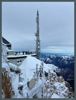
Visitor platform on the Zugspitze with a view of the Wetterstein Mountains. (03.03.2018)
Christopher Pätz

Deutschland / Bayern / Wettersteingebirge

388 1200x810 Px, 12.03.2018

View from the Zugspitze over the Ehrwald Basin with the towns of Ehrwald and Lermoos as well as the Ammergau Alps. (03.03.2018)
Christopher Pätz

Deutschland / Bayern / Wettersteingebirge

373 1200x746 Px, 12.03.2018

View from the German side of the Zugspitze towards the Austrian visitor platform and the Ammergau Alps. (03.03.2018)
Christopher Pätz

Deutschland / Bayern / Wettersteingebirge

342 683x900 Px, 12.03.2018

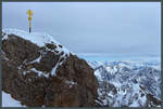
A gilded summit cross crowns the Zugspitze as Germany's highest mountain peak. (03.03.2018)
Christopher Pätz

Deutschland / Bayern / Wettersteingebirge

338 1200x809 Px, 12.03.2018

View from the Zugspitzplatt looking south towards Wetterwandeck, Plattspitze, and Gatterlkopf. (03.03.2018)
Christopher Pätz

The nearly cloudless sky on 03.03.2018 allows for a wide view of the Austrian Alps from the Zugspitzplatt. In the valley at the center of the image is the city of Innsbruck, to the right of it the Hohe Munde (2662 m). On the left, the Wetterstein Mountains can be seen.
Christopher Pätz

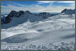
View from the Zugspitzplatt to the Hochblassen and the Wetterstein Mountains in beautiful winter weather. In the foreground, the Sonnenkar chairlift can be seen, which leads down into the Brunntal. (03.03.2018)
Christopher Pätz

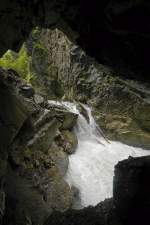
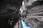
Hammersbach in Höllentalklamm. Shot: July 2008.
Hans Christian Davidsen

Deutschland / Bayern / Oberbayern

502 680x1024 Px, 28.12.2015

The Partnach Gorge is a 702-meter-long gorge carved by the wild Partnach stream, with depths of over 80 meters in places, located in the Reintal near Garmisch-Partenkirchen. Photo taken: July 2008.
Hans Christian Davidsen

Deutschland / Bayern / Oberbayern

551 1200x797 Px, 26.12.2015

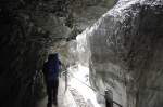
The Partnach Gorge near Garmisch-Partenkirchen originates in the Reintalanger and is the natural outflow of the Schneeferner, the remnant of an ice age glacier on the Zugspitzplatt. Photo: 2008.
Hans Christian Davidsen

Deutschland / Bayern / Oberbayern

589 1200x797 Px, 26.12.2015

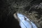
Partnach Gorge near Garmisch-Partenkirchen. In 1912, the Partnach Gorge was declared a natural monument and has since been accessible. The path always runs along the right side of the stream. Photo: July 2008.
Hans Christian Davidsen

Deutschland / Bayern / Oberbayern

523 1200x797 Px, 26.12.2015

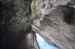
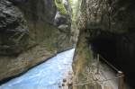
Partnach Gorge near Garmisch-Partenkirchen. The gorge can be visited year-round. However, during the spring snowmelt, the gorge may be temporarily closed for a short period. Photo: July 2008.
Hans Christian Davidsen

Deutschland / Bayern / Oberbayern

554 1200x797 Px, 26.12.2015

Partnach Gorge south of Garmisch-Partenkirchen.  The gorge is a major tourist attraction. It cuts through a rock barrier of Alpine Muschelkalk. Photo taken: July 2008.
Hans Christian Davidsen

Deutschland / Bayern / Oberbayern

818 1200x797 Px, 26.12.2015