
landschaftsfotos.eu Linie landschaftsfotos.eu
Hello guest, you are not logged in. Log in | Create account 
Forum   Contact   Legal notice
German English 

Baden-Württemberg Landschaftsfotos (Landschaften, Natur und Ausblicke)
2186 Photos
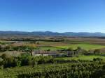
Telephoto view from the Tuniberg near Opfingen over the Rhine Plain to the 1414m high Belchen in the Black Forest, May 2014
rainer ullrich

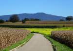
View from the southern tip of the Tuniberg over the Rhine Plain to the Black Forest, in the center of the image the 1414m high Belchen, Oct. 2014
rainer ullrich

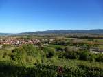
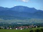
View from the southern tip of the Tuniberg over the Rhine plain to the Black Forest, with the town of Munzingen in the foreground on the left, and behind it on the horizon a part of Freiburg, Oct. 2014
rainer ullrich

Germany / Baden-Württemberg / Rhine Plain

626 1200x900 Px, 14.12.2014

Prechtal - City of Elzach. Oberprechtal has around 1070 inhabitants. Since the beginning of the 10th century, almost the entire Elz valley belonged to the Waldkirch monastery, a foundation of the Alemannic Duke Burchard II. In a protective letter issued by Pope Alexander III in 1178 for the St. Margarethen monastery in Waldkirch, the Prechtal is mentioned for the first time as the Meiertum  Bregen .

In other medieval documents, the place also appears under the names Gebrech, Brech, Brecht, and Precht. The name cannot be precisely explained, but it probably comes from the fact that the Elz, which initially flows northward in today's Oberprechtal, is clearly broken and the river then continues in a southwesterly direction. 22.11.2014
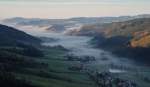
Prechtal - City of Elzach. Oberprechtal has around 1070 inhabitants. Since the beginning of the 10th century, almost the entire Elz valley belonged to the Waldkirch monastery, a foundation of the Alemannic Duke Burchard II. In a protective letter issued by Pope Alexander III in 1178 for the St. Margarethen monastery in Waldkirch, the Prechtal is mentioned for the first time as the Meiertum "Bregen". In other medieval documents, the place also appears under the names Gebrech, Brech, Brecht, and Precht. The name cannot be precisely explained, but it probably comes from the fact that the Elz, which initially flows northward in today's Oberprechtal, is clearly broken and the river then continues in a southwesterly direction. 22.11.2014
Valerij Rein

Germany / Baden-Württemberg / Black Forest

751 1200x699 Px, 02.12.2014

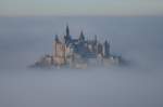
On November 29, 2014, we once again had a weather situation on the Swabian Jura that made the  fairy tale castle  – Hohenzollern – emerge from the fog. The photo was taken from the Zeller Horn.
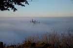
On November 29, 2014, we once again had a weather situation on the Swabian Jura that made the "fairy tale castle" – Hohenzollern – emerge from the fog. The photo was taken from the Zeller Horn.
Friederich Rieber

Germany / Baden-Württemberg / Swabian Jura

688 1000x662 Px, 29.11.2014

On November 29, 2014, we once again had a weather situation on the Swabian Jura that made the  fairy tale castle  - Hohenzollern - emerge from the fog. The photo was taken from the Zeller Horn.
On November 29, 2014, we once again had a weather situation on the Swabian Jura that made the "fairy tale castle" - Hohenzollern - emerge from the fog. The photo was taken from the Zeller Horn.
Friederich Rieber

Germany / Baden-Württemberg / Swabian Jura

1224  5 1000x662 Px, 29.11.2014

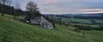
Surroundings of St. Peter. 25.10.2014
Valerij Rein

Germany / Baden-Württemberg / Black Forest

559 1200x502 Px, 25.11.2014

Surroundings of Sankt Märgen. 12.07.2014
Valerij Rein

Germany / Baden-Württemberg / Black Forest

586 1200x798 Px, 21.11.2014

Surroundings of St. Peter. 25.10.2014
Valerij Rein

Germany / Baden-Württemberg / Black Forest

576 1200x700 Px, 18.11.2014

Elzach - Yach - Direction Siebenfelsen - Black Forest. 08.11.2014
Valerij Rein

Germany / Baden-Württemberg / Black Forest

661 1200x796 Px, 18.11.2014

Autumnal view of Minneburg near Neckargerach Sunday, 16.11.2014
Andreas Strobel

Germany / Baden-Württemberg / Neckar-Odenwald District

559 1200x797 Px, 17.11.2014

The View of St. Peter (High Black Forest) 06.09.2014
Valerij Rein

Germany / Baden-Württemberg / Black Forest

569 1200x797 Px, 17.11.2014

Elzach - Yach - Towards Siebenfelsen - Black Forest. Yach is a district of the town of Elzach in the Emmendingen district of Baden-Württemberg. 08.11.2014
Valerij Rein

Germany / Baden-Württemberg / Black Forest

829 1200x796 Px, 12.11.2014

 the last rose,  on the Tuniberg in November
"the last rose," on the Tuniberg in November
rainer ullrich

The View of St. Peter (High Black Forest) 25.10.2014
Valerij Rein

Germany / Baden-Württemberg / Black Forest

558 1200x656 Px, 05.11.2014

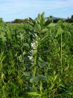
Broad bean, the herbaceous plant up to 1m high is often grown as green manure in the Rhine plain, Oct. 2014
rainer ullrich

View into the Glottertal/Black Forest at sunset, Oct. 2014
rainer ullrich

Low water in the old Rhine near Grißheim, Oct. 2014
rainer ullrich

Germany / Baden-Württemberg / Rhine Plain

642 1200x900 Px, 30.10.2014

The Schluchsee is a reservoir in the municipality of Schluchsee near St. Blasien in the district of Breisgau-Hochschwarzwald in Baden-Württemberg. It is located southeast of the Titisee and is the largest lake in the Black Forest.03.09.2014.
Valerij Rein

Germany / Baden-Württemberg / Black Forest

703 1200x695 Px, 28.10.2014

View from the Rhine Plain near Bötzingen towards the Kaiserstuhl with the 557m high Totenkopf, Oct. 2014
rainer ullrich

Germany / Baden-Württemberg / Kaiserstuhl

691 1200x900 Px, 24.10.2014

Autumn morning at March Hill in the Rhine Plain, Oct. 2014
rainer ullrich

autumnal landscape at March Hill in the Rhine Plain, Oct. 2014
rainer ullrich

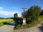
Wayside cross on March Hill in the Rhine Plain, Oct. 2014
rainer ullrich

View from the Rhine Plain near Neuershausen to the 1241m high Kandel in the central Black Forest, Oct. 2014
rainer ullrich