




Suðurland photos
8 Photos
Island / Regionen / S�nd - Suand
910 780x513 Px, 28.12.2008
Island / Regionen / S�nd - Suand
1259 782x516 Px, 03.08.2008
Island / Regionen / S�nd - Suand
1061 800x541 Px, 24.02.2007
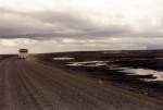
Ring Road through the Skeidararsandur in June 1997, there were often signs at the roadside warning that leaving the road was life-threatening due to sinking in the mud. The Polish bus was an "old acquaintance" from the ferry.
Günther Glauz†
Günther Glauz†
Island / Regionen / S�nd - Suand
847 800x544 Px, 23.02.2007
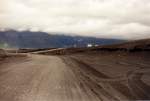
Access ramp to the destroyed part of the Sandur Bridge in July 1997, showing the junction of the temporary track, which was simply laid 30 km across the flat Skeidararsandur. The old road had been relocated onto a dam, which was no longer visible.
Günther Glauz†
Günther Glauz†
Island / Regionen / S�nd - Suand
855 800x539 Px, 23.02.2007
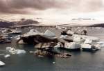
Jökulsarlon (glacial river lagoon) in Breidamerkursamdur on the south coast in June 1997, the icebergs calve directly from the Breidamerkurjokull glacier into the lake and can be up to 15 m high, the lake is up to 150 m deep, between the sea and the lake there is a land bridge only 50 m wide, over which the Ring Road runs.
Günther Glauz†
Günther Glauz†
Island / Regionen / S�nd - Suand
962 800x551 Px, 20.02.2007
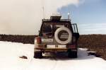
For the glacier ride, air was let out of the tires next to the Berghotel Jöklasel, and the jeep has a compressor at the front for reinflating. In addition to jeeps, there are also guided snowmobile tours. Vatnajökull is the second largest glacier in Europe with 8,100 km² and has a maximum ice thickness of 1,000 m.
Günther Glauz†
Günther Glauz†
Island / Regionen / S�nd - Suand
982 800x532 Px, 19.02.2007
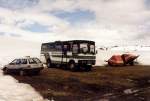
Geländegängiger Bus mit viel Bodenfreiheit neben dem Berghotel Jöhlasel im Juni 1997, von der Ringstrasse zweigt eine 16 km lange Stichstrasse ab, die letzten 6 km dürfen nur Geländewagen und dieser Bus fahren, der PKW hat eigentlich hier nichts zu suchen.
Günther Glauz†
Günther Glauz†
Island / Regionen / S�nd - Suand
1149 800x541 Px, 19.02.2007